Mountain
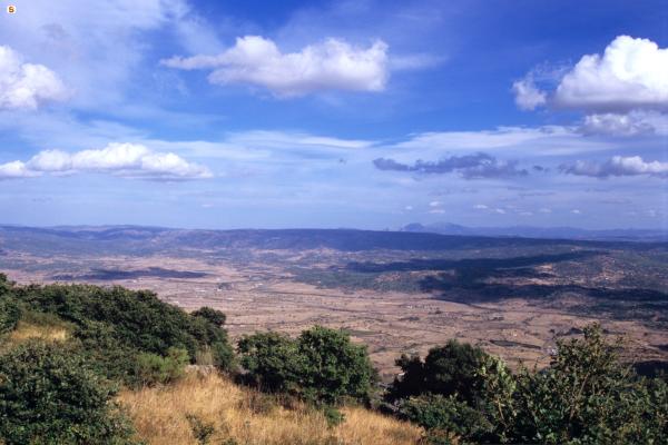
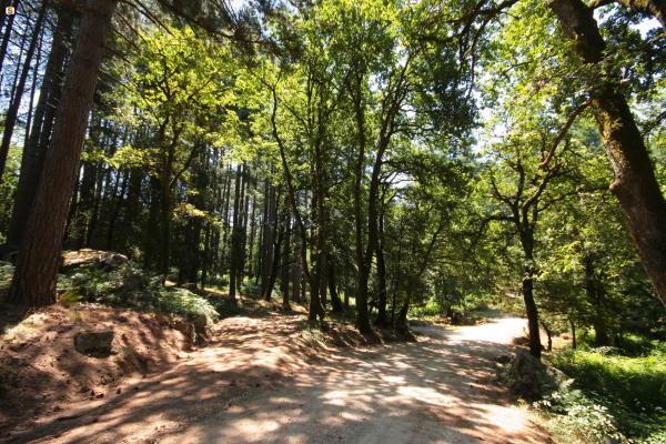
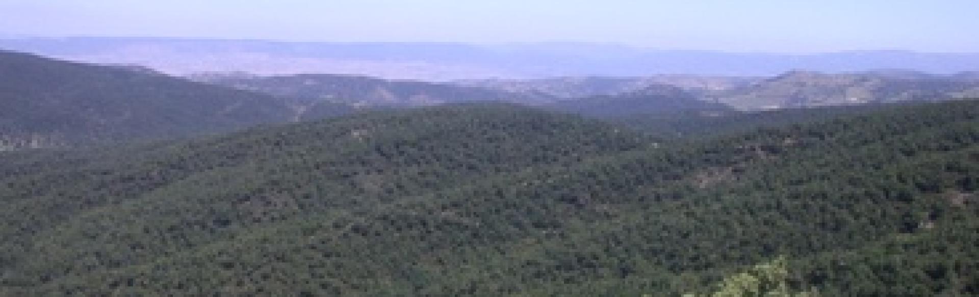
The mountain ranges of Sardinia, like those of nearby Corsica, are not the continuation of the Italian ones, unlike the French Maritime Alps. In reality, however, Sardinia doesn't possess real mountain chains and also those that seem as such are in effect alignments of ancient pits. Among these are the chain of the Marghine and that of the Goceano, that are positioned in succession as a single west to east alignment in the central-northern area of the island. The mountains of the Goceano are an ideal continuation of those of the Marghine and they fall within the municipal areas of Anela, Benetutti, Bono, Bottida, Bultei, Burgos, Esporlatu, Illorai and Nule. The Goceano reaches its maximum height at Monte Rasu (1259 ms), that dominates a variegated landscape of woods, Mediterranean brush and cultivated areas of olives and vineyards. The chain of the Goceano is rich in environmental peculiarity, that is at the base of its strong tourist attraction in the whole area and particularly in the state owned forests. In the forest of Monte Pisanu (in the municipal areas of Bono and Bottida), founded in distant 1886, the plant landscape is dominated by the oak wood. at Pedra Rujas there is a monumental cork oak. But it is in the area of Sos Nibberos where perhaps the forest’s most singular characteristic is found: a biotope of millennial yews, declared a Natural Monument, with specimens close to a metre in diameter and rising to over 10 in height. The Anela Forest falls within the municipalities of Anela, Bono and Bultei, yet another forest founded in 1886 by royal decree and enlarged over the years. Maximum height is reached at the Punta Masiedda (1158 m), but most of its territory is found at around 1000 m covering a large plateau, from which waters flow into the principal tributaries of the rivers Coghinas and Tirso. The whole area is covered by a rather dense holm oak wood. At Masiemmera there are huge Atlas cedars, standing in the middle of large meadow expanses that are covered in flowers of a thousand colours in springtime. In the territory of Bultei is found the third State Forest of the area, Fiorentini, also founded in 1886. Average altitude is around 900 m, while the highest peak is that of Monte Paidorzu (1002 m). There are scores of landscape and naturalistic places of interest, such as Sa Fraigada or Sa Pruna (where a tomb of giants can be visited), while at Sas Prisones some huge specimens of oak and holm oak can be found. At Su Tassu are found some specimens of larch pines that reach over 30 m in height, among the highest trees in Sardinia. But there are also a number of other peculiarities to be found outside the protected areas. At Illorai, in the locality of Sa Cariasa stands a centuries-old stately Downey oak, almost 30 m in height and 10m in circumference, while at Sa Melabrina there is claimed to be the oldest Downey oak in Europe. Moreover, in the town park of Jscuvudè, still in the municipality of Illorai, one can easily admire an unusual natural cross between a holm oak and a Downey oak.