

Masainas
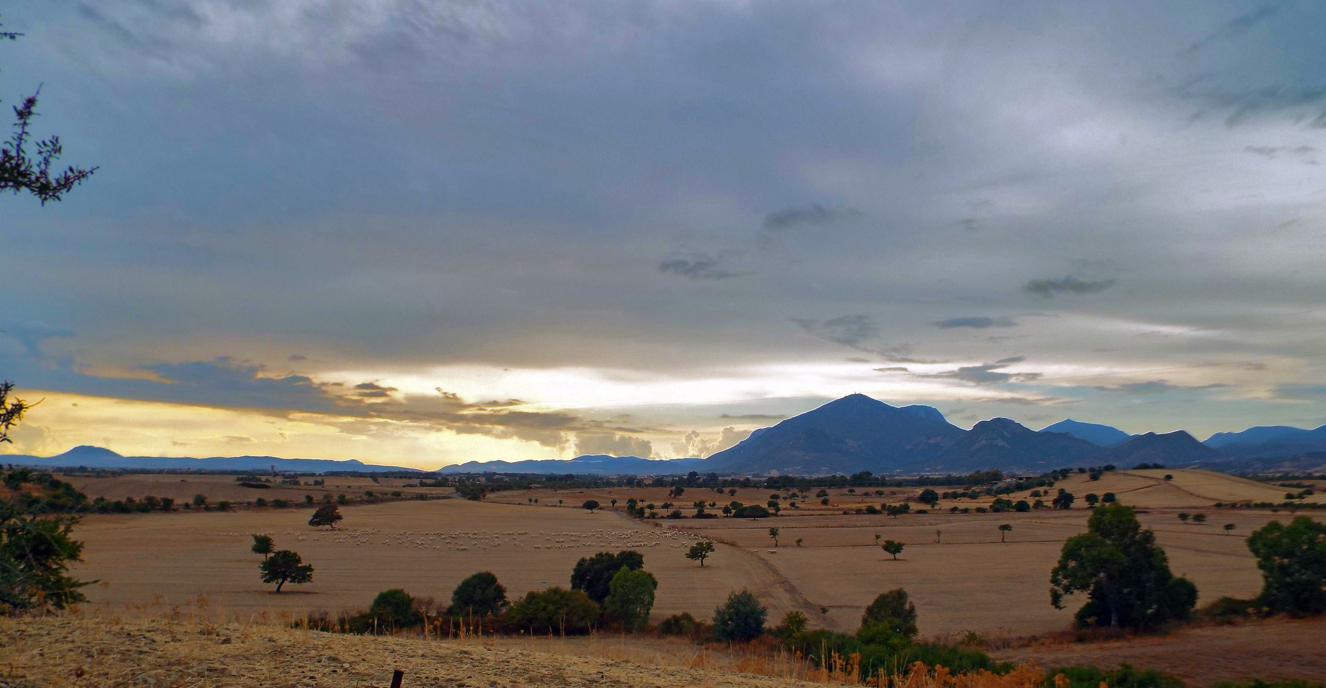
Set on a plain nestled among the marshlands alongside the Gulf of Palmas and the south-western edge of Mt Sulcis, cloaked in aromatic Mediterranean vegetation. The modern-day town of Masainas counts 1,300 inhabitants and arose in the late XVIII century, first as a medau (a single farm) and then as a boddeu (a grouping of farmhouses) around the late IX century Gothic-Aragonese church of San Giovanni Battista. The church may have been built over an older, XI century construction when the Benedictines began their proselytization in the area. In the early 1800s, Masainas was a flourishing rural town with 1,800 inhabitants, the largest of its area. Proof of its vocation for farming and shepherding lies in the many furriadroxius, small sheep folds, to be found in the outskirts. In 1975 it became an autonomous town and farming remains the town’s mainstay. The surrounding area is dotted with pastures, vineyards (in particular Carignano grapes) and fields of artichokes. The Artichoke Festival, featuring a variety of local delicacies, is held every year in late March. In early October there is a festival in honour of the patron saint, the Madonna della Salute, one of the most heartfelt in the Sulcis area.
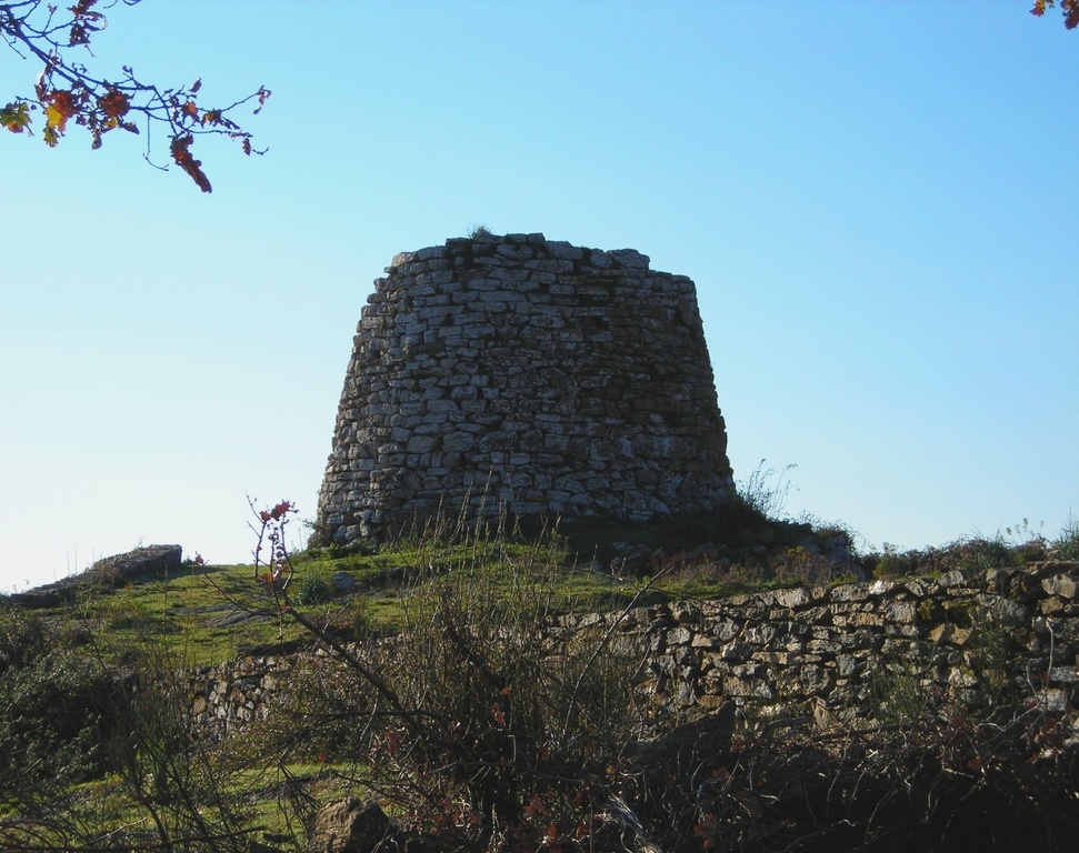
The hills that lead up to the slopes of the mountains change colour and contour according to the season, including the typically Mediterranean vegetation: yellow, red and brown euphorbia (devil’s milk), the deep green of the myrtle bush and lighter shade of the olive trees, the yellow bloom of Spanish Broom in springtime, the grey brown hues of the rockrose. The higher altitudes are home to oak stands, arbutus trees and heather. As you hike up the trails to the summits, you’ll enjoy views of the sea and the Sulcis archipelago. Here eagles, kestrels and buzzards fly. The Sardinian partridge nests here. Not far out of town are the Baiocca and Porto Botte marshes, habitat of herons, black-winged stilts, pink flamingos, cormorants, rare march falcons and swamp hens, all of whom take turns is adding colour to the still waters. High dunes separate the lagoons from the two kilometres of coastland (one with sandy beaches, the other rocky) and are home to a population of wild rabbits, the prey of foxes, hare and the rarer marten and weasels. The stretch of fine white sand scented by juniper bushes and Aleppo pines is where you will find the is Solinas beach. Neolithic settlements were uncovered not far from this sandy shore. Ten nuraghe bear witness to the Bronze Age here, the most interesting being the is Fais nuraghe, four towers laid out like a cross. It eventually came first under Punic rule, followed by the Romans. The remains of a terracotta utensil factory and two Roman sarcophagi were uncovered here. Presumable evidence of a Roman site at is Manigas came in the form of coins, while two tombs hewn into the rock were found at Serra lepuris.

Sa Jara Manna - Giara di Gesturi
An island within the Island, a magical place with unique characteristics. The Giara is a basalt plateau on the border between the Marmilla and Sarcidano regions: it rises abruptly to an altitude of 550 metres, dominating the surrounding flat landscape, rippled only by ‘gentle’, fertile hills. On the top, there is a twelve-kilometre long and slightly sloping ecosystem where rare animals and plants are preserved. To differentiate it from the nearby ‘smaller’ Giara plateaus of Serri and Siddi, it is called Jara manna (large), or Giara di Gesturi, a Municipality containing approximately half of its entire area (45 square kilometres). The other half is divided between Genoni (1600 hectares), Tuili (450) and Setzu (250). Its area also involves Albagiara, Assolo, Genuri, Gonnosnò, Nuragus, Senis and Sini. Each one has nature, archaeological and artistic sites and ethnographic museums, covered by a network of itineraries that can be enjoyed on foot, by bike or on horseback.
‘Giara’ may have evolved from glarea, or ‘ghiaia’ in Italian (meaning gravel), indicating the stoniness of the ground. Its origin comes from lava flows during eruptions that took place 2.7 million years ago on a sandy bedrock from two craters that are now extinct: Zepparedda, summit of the plateau (609 metres), and Zeppara Manna, the most scenic point. It was not the plateau that rose up but the surrounding lands that were lowered, as they were not protected by effusive rock and were eroded by water and wind. Sa Roja lies between the two volcanic cones and is a fault that runs across the plateau with a step of 30 metres. The steep sides have been ‘affected’ by landslides generated by torrents that arise at the springs of the plateau and descend along the edges. This is the origin of is scalas, access routes to the plateau, of which you will discover the geological history in the Geo-paleosite of Duidduru, and in the Paleo Archaeo Centre di Genoni. The isolated location has maintained a plant and wildlife heritage that has disappeared elsewhere, thanks to which Giara has been a site of European Community interest since 1995. It is covered in lush woods, centuries-old species of cork oak, often ‘forced’ to grow slanted by the northwesterly ‘maestrale’ wind. Then there are holm oaks, downy oaks, strawberry trees, lentisk trees and myrtle. In spring, the plateau is filled with colours and scents: there are helichrysum, asphodels and cysts are in bloom, as well as expanses of cyclamen and orchids and a yellow cloak of morisia, an endemic plant that gives its name to the botanical garden in the park. The most spectacular places are is paulis, depressions where rainwater stagnates. There are dozens of them, mostly modest and of short duration. In some cases, they are quite big and they last throughout the year, as with the two named pauli maiori. In springtime, the ponds are covered with a white cloak of buttercups, while in summer they dry up and look like ‘lunar’ expanses. The autumn rains colour them with the dark red of the tamarisk trees and a thin layer of ice often covers them in winter. They are the habitat of a rich microfauna, including two tiny crustaceans, ‘living fossils’ unchanged for millions of years. They are also the home of the western marsh harrier, the black-winged stilt and the mallard. The plateau is famous for its small horses, a unique case of a wild horse colony in Europe. Is cuaddedus gallop in small groups between the bushes, take shelter in the shade of the cork oak woods, drink in the pauli and are greedy for buttercups. Their origin is lost somewhere between legend and history. In the Middle Ages, entire herds populated the island and gradually disappeared. Today, about 700 of them graze in the wild on the Giara plateau: they have a thick mane, a long tail and a slender build, giving them surprising grace despite their size and wild nature. Completing the wildlife, there are wild boar, weasels, hares, martens, foxes and 60 species of bird, including various birds of prey.
The Giara is an unassailable natural fortress, with escarpment walls similar to bastions. A long bulwark against invaders, today it contains traces of a very distant past. A system of nuraghi presided over is scalas: there are 24 of them on the summit, mostly of the single tower type; the double ones and those with two or more towers were lined up at the foot and on the slopes. On the southeastern edge stands the Bruncu Madugui, the most impressive Sardinian protonuraghe with the remains of huts grouped in blocks. Some complexes were also frequented during the Punic-Roman era: Pranu Omus in Genoni, Santa Luisa in Tuili and San Lussorio in Albagiara; others arise next to springs: such as the nuraghe Scab’i Ois, near the spring of the park of Cracchera. The Giara is crossed by the longest stretch of paved Roman road on the Island: seven kilometres! In the Middle Ages only shepherds were already frequenting the plateau: evidence of this is le pinnettas, shelters similar to Nuragic huts.
Musei
Its water-rich territory extends in the valley of the Cixerri River and is irrigated by the river’s many tributaries which are in turn fed by the springs of the nearby Mount Domosnovas. Musei is a town of over 1500 inhabitants easily reached from SS130, which links Iglesias and Cagliari. The origins of its curious name are shrouded in mystery. Listed as Musej in Pisan income records (1323) and as Musey in the Codex Diplomaticus Sardiniae (a few years later). Later, from the Medieval period up to the 17th century, it was called Villa di Prato. During this period, it first belonged to the Giudicato of Calari and then to the Pisan Della Gherardesca family. The family were once the masters of the Acquafredda Castle, which stands in Siliqua, in the centre of the valley. With the arrival of the Jesuits, the name changed once more. The new name may have originated from the name Iesum read backwards, or the corruption of moisè, a Jewish settlement found here, or from the Semitic word mosià (task). In fact, it was the Society of Jesus to inherit the town in 1607 from feudatory (and protector of the Jesuits) Monserrato, the son of Elena Nicolau and a well-known humanitarian and judge of the Royal Audience. They played a crucial role in the development of the new town, overseeing the construction of a late-baroque church supplied with fine implements, including a silver-laminated processional cross, and the Convent of Sant’Ignazio di Loyola, patron saint of the Society of Jesus, whose feast is at the end of June. Residential buildings were constructed in the surrounding area. In addition to apostolate and cultural activities, the Jesuits gave a new impulse to agriculture, especially the planting of wheat and grapevines, as well as to livestock farming, for which the town became known throughout the island in the 18th century. This is the source of the strong agro-pastural traditions of present day Musei.
Fertile land has always drawn people to this area. Evidence of human presence in the area in ancient times includes nuraghes as well as Punic and Roman relics, especially a site near the extremely of village of Arruinalis, where the foundations of antient buildings have been excavated.

Sinnai
It lies on the hills that delimit the southern part of Campidano: from its location, the landscape reaches as far as the Golfo degli Angeli to the south and to the oasis of Sette Fratelli to the northeast. Sinnai is a town with 17 thousand inhabitants in the metropolitan area of Cagliari, historically founded on agricultural and pastoral activities and today on industry and on the tertiary sector. The olive-growing and wine-making and honey production are all still alive. The artisan tradition is focused on weaving reeds to make baskets and also on processing gold filigree, resulting in is prendas, splendid jewels. Women's dresses in precious fabrics are artistic: women’s mastery made them into works of art.
The vast and varied territory of Sinnai extends to the sea, from a portion of the splendid Torre delle Stelle to the tourist village of Solanas, more than thirty kilometres from the town, along the scenic road that leads to Villasimius. In Solanas, a long, wide beach of soft, golden sand is washed by waters reflecting every shade of green and blue.
The hinterland also offers evocative natural landscapes. Since the beginning of the 20th century, the Sinnai pine forest has represented a 'green lung' of conifers and a place for walks and recreation. The Park of Sette Fratelli-Mount Genis is spectacular, with its peaks of Sa Ceraxa and Serpeddì, which exceed one thousand metres in height. In the forests of Mont'e Paulis, Minniminni and near the lake of Corongiu, there are holm oaks, cork oaks, wild olive trees, phillyrea, juniper and mastics. Following well-marked out trekking and mountain bike itineraries, you may encounter fawns and weasels and see the flight of the golden eagle and the peregrine falcon. In the park, you will be able to visit the museum of the Sardinian deer in Campuomu.
The old town centre features narrow lanes, Campidano houses and prestigious buildings, featuring the Palazzo Civico (1860) and the ancient barracks of the Cavalleggeri cavalry, where the Sinnai Museum is currently located. Inside it, there is the art gallery with pictorial works from the 16th century to the contemporary age and the archaeological section, which 'tells' the story of the events that took place from the Neolithic era to the Middle Ages. You will discover artefacts from the Nuraghe di Santa Itroxia, from the little Nuragic temple of Bruncu Mogumu and evidence of the Phoenician-Punic period, among which the little statue of the god, Bes. The churches represent a precious architectural heritage. In the town and the surrounding area, the former parish church of Santa Vittoria, mentioned in a document dated 1141, and the current parish church of Santa Barbara Vergine in Gothic-Aragonese style. Inside it, there is a real museum of art, including altars and baptismal fonts made of marble, paintings, wooden statues and silver artefacts. In the districts, you will find the Romanesque church of Santa Barbara di Solanas and that of San Gregorio.
Narcao
It is famous for the mining village of Rosas, an example of industrial archaeology becoming a tourist attraction, and for the Narcao Blues festival, one of the main Sardinian musical events. Narcao is a village in the Lower Sulcis region with over three thousand inhabitants. Its undulating territory stretches between mountains shaped like 'jars' covered in Mediterranean scrub, oak trees, pinewoods and eucalyptus woods. A visit to the cave of su Bacculu is a must, where you can admire evocative flowstones and stalactites. These caverns were the stage of the first settlements in the territory, dating back to the Neolithic period: the relics found in the cave of su Maiu are now kept at the national archaeological museum in Cagliari. The landscape is dotted with the ruins of prehistoric residential building, dolmens and menhirs, as well as pieces of obsidian.
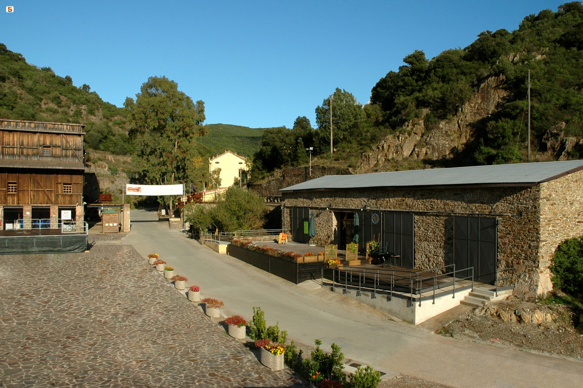
The large protonuraghe Atzei, which has a 'corridor' structure, dates back to the Early Bronze Age. In the Terraseo district, you will notice the ruins of a Punic temple dedicated to Demetra and Kore: small statues depicting the goddess were found in an altar. Roman tombs were found at Ollastra Frogheri. Benedictine monks were the first to occupy the fertile countryside of Narcao around the year 1000: they built the bell tower of the parish church of San Nicolò, patron saint celebrated in mid-August. The village flourished until the 14th century, after which it became depopulated. At the end of the 17th century, rural workers and shepherds settled there: symbolising the comparison with these settlements is the medau or furriadroxiu (small rural agglomerate) of Is Meddas, a hamlet of the village, which conserves its original structure - a central courtyard overlooked by low-rising farmhouses and a little landowner's edifice. The rustic dwellings continued to increase until the present-day village was formed, featuring houses made of unbaked bricks and decorated with murals representing scenes of life in the mines. Unsurprisingly, Narcao was the protagonist of the mining activities in the Sulcis region: the territory is dotted with abandoned mines, among which Rosas, surrounded by the Terrubia mountains and included in the Geomineral park of Sardinia: between 1851 and 1978, lead, copper and zinc were extracted here. Buildings and structures were renovated and transformed into an 'open air' museum-park, set in an unspoilt landscape with trails for trekking, mountain bike and horseback riding. In the square used as the washing area, the heart of the village, you can admire the former post office and headquarters (now a restaurant), the bakery and storage depots, the forge (now a bar), guest quarters and miners' dwellings, which were transformed into a holiday-house. As a whole, the Rosas park is an engineering and anthropological exhibition: it includes tunnels, 'shafts' and mills (still functioning) used for processing the minerals, documenting the technological development that took place. The multimedia rooms with illustrative panels and tools trace back the mining period and the miners' voices tell the story of the work and life conditions of the workers and their families. The village is also famous on an artistic level: since 1991, Narcao Blues, a very popular national music festival has been taking place at the end of July, with the participation of world-famous performers.

Sa Corona Arrubia
The ‘Corona Rossa’ (Red Crown) is a basalt plateau, in the countryside of Collinas and Lunamatrona, covered in red lichens, highlighted by the sunset. Here, there is a singular museum, which is both a scientific hub and a cultural centre, able to welcome hundreds of thousands of visitors since its creation, with permanent exhibitions, organised in three pavilions - wildlife, botanical and anthropic - and international-level temporary exhibitions, among which ‘Dinosaurs’', ‘The Great Spanish Painters’, ‘Leonardo da Vinci’ and ‘Ancient Egypt’.
In the wildlife section, you can admire the largest and most complete display of dioramas in Sardinia: eight life-size three-dimensional reconstructions of local spaces populated by local plant and wildlife. You will see the ecosystems of the ‘giare’, holm oak woods, riparian environments and arid pastures. The botanical section is in turn divided into a fungarium, a xylotheque and an herbarium: you can enjoy a 360-degree exploration of the plant world. The showcases emanate a particular charm with a description of the use of medicinal plants over the centuries and panels with accurate descriptions of the mushrooms.
The anthropic pavilion contains an archaeological and an anthropological section. At the entrance, you will see the life-size reconstruction of a pre-Nuragic hut. Continuing with the visit, you can admire stone reconstructions of Nuragic monuments: polylobed fortresses, Tombs of Giants and sacred wells. During the excursus you will be aided by a comparative table of time, which compares the general prehistoric and protohistoric eras to the Sardinian eras, with evidence of the main events. The ‘anthropological’ rooms, on the other hand, show a ‘cross-section’ of rural life in Marmilla in the first half of the 20th century, through the eyes of the inhabitants of that period.
Owned by sa Corona Arrubia, currently organised in a travelling exhibition, there is also a collection of 200 traditional hand-made toys. The museum also periodically hosts conferences on scientific and cultural topics, presentations, art exhibitions and musical events. Outside, you can follow educational paths in the geobotanical park, where Mediterranean plant species are grown.
In addition to indicating the plateau on which the museum stands, Sa Corona Arrubia also gives a name to the consortium of 18 Municipalities of Marmilla, formed to promote the enhancement of local cultural heritage. The organisation is dedicated to Giovanni Pusceddu, historic mayor of Villanovaforru, one of the main promoters of the initiative.
As well as seeing the full-scale Nuragic replicas in the museum, in its surroundings you can also admire ‘authentic’ archaeological evidence: in Lunamatrona, there is su Cuaddu de Nixias, the most ancient Tomb of Giants discovered, and the protonuraghe Trobas; in Villanovaforru, there is the nuraghe Genna Maria and the Civic Archaeological Museum; in Collinas, there is the nuraghe Concali and the tomb of sa Sedda de sa Caudela.
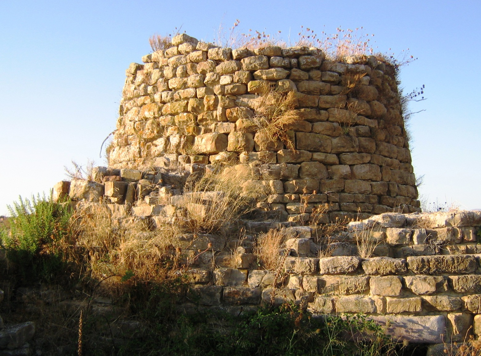
Nuraghe Piscu
The name is said to derive from su piscu, the bishop of the diocese of Barbaria, who received numerous donations from the judges of Cagliari, including the land where the archaeological park stands. The Piscu Nuraghe stands imposingly on a hill, along the SS 128 road to Senorbì and Mandas, just a short distance from Suelli, which was the bishop's seat in the Middle Ages and has always been a centre of veneration for Saint George the bishop.
Mentioned in various medieval documents and known locally as sa domu de s orcu, the Piscu is the most monumental and best preserved of the 200 nuraghi surveyed in Trexenta, archaeologically 'investigated' and restored in the 1980s. The majestic complex architecture arose between the Middle and Recent Bronze Age (15th-11th centuries BC), built of marl blocks, hewn and arranged in regular rows, and consisting of a main tower, the oldest of the structure, and four corner towers, joined by thick walls, which were built at a later stage. Inside the bastion, almost a square with sides of about thirty metres in length, is a courtyard. Around it, a low bulwark of large boulders 'embraces' five projecting towers and encloses a village of numerous circular and quadrangular huts.
The main tower, nine metres high and eleven metres in diameter, is accessed through an architraved entrance with a relieving space above. The corridor has two opposing niches and leads into the large tholos (a false dome) chamber, built with hewn blocks of limestone. The technique is 'overhanging': the rings decrease in diameter as you ascend. Originally it must have consisted of two floors accessible by a staircase or through external terraces. The corridor then leads into the courtyard, with entrances to the four secondary towers of different sizes. Two of them are contiguous, so the unusual plan appears to be that of a trilobate rather than a quadrilobate structure. The four towers have niches and slits, the largest being similar in size to the keep, with a circular chamber and a T-shaped room. On the inside of the wall, a well has been unearthed, which served as a cistern for collecting rainwater. Various types of vessels were found at the bottom, some small with handles and diagonally cut upper openings (possibly glasses). The first excavations date back to 1860: in the keep, a large jar embedded in the ground and covered with a plaque, oyster shells, boar tusks and animal bones were found; in a chamber and in the hallway, a bronze bowl, potsherds, pieces of millstones, a piece of marble, perhaps used for tanning hides and charred grain.
The Piscu is the most iconic building in an area with many pre-historic finds, guarding the surrounding fertile valleys. From the small hill on which it stands, you can see other nuraghi, some 15 of them, including Planu Senis, as well as pre-nuragic sites, such as the necropolis of Pranu Siara and Santu Perdu.

Guamaggiore
Its undulating territory extends from the fertile hills of the Trexenta subregion to the slopes of the Saturno and San Giovanni mountains. Guamaggiore is a village with 1,000 inhabitants, where focus has always been on the production of grain. This has resulted in excellent durum wheat flour, from which fresh artisan pasta is made. One of the typical products is fava beans, protagonists of many a local dish. The gastronomic tradition is expressed in the particular preparation of snails, rabbit a su chittu and sweets (amarettus, gateau and pardulas).
Human presence in the territory of Gomaiori (in the local dialect) is documented from the pre-Nuragic era, with the settlements of the nearby Monte San Mauro dating back to the middle of the 4th millennium. Remains of no less than 25 Nuragic structures, often positioned to defend the territory, attest to the dense population in the Bronze Age. The Nuragic stones were reused for the construction of ancient Christian buildings of worship. In particular, the Chiesetta di Santa Maria Maddalena, a medieval parish church built as of 1219 on the ruins (and using the materials) of the Nuraghe located on a hill southwest of the town, once the fulcrum, that is today the entrance of the village. The interior has a single nave with wooden trusses. The exterior is characterised by the portico and bell gable. In front of the square before the church, which hosts the celebrations honouring of its patron saint at the end of July, stands the Church of San Pietro Apostolo, a Romanesque sanctuary built at the end of the 13th century atop a set of stairs. The rectangular structure bears a single nave with three niches in the presbytery. The tiled roof is based on a wooden plank. The face of a puto (cherub) is sculpted in an imposing holy water font that dates back to 1675. In the front is a portal with a pointed arch surmounted by a bell gable.
Subsequently, the town developed around the new parish church of San Sebastiano Martire, built in the second half of the 17th century. The choice of the foundation’s placement is linked to a plague epidemic. The surviving inhabitants of Gueymajori settled near San Pietro where they built it as an offering to the martyr. This became the ‘new’ heart of the town, around which beautiful rural houses rise today in Ladiri (clay bricks). Of a rectangular layout, the parish church is enriched by the presbytery and the five side chapels with polychrome marbles and wooden statues. Many valuable furnishings date back to the initial layout, such as the basin of the sacristy (1678). An ancient pipe organ is preserved in the choir. On the façade is a bell tower with a square design. In honour of the saint, two celebrations are held each year - on 20th January with the lighting of a bonfire, and at the beginning of May with a characteristic festival, Is Carrus a Monti.
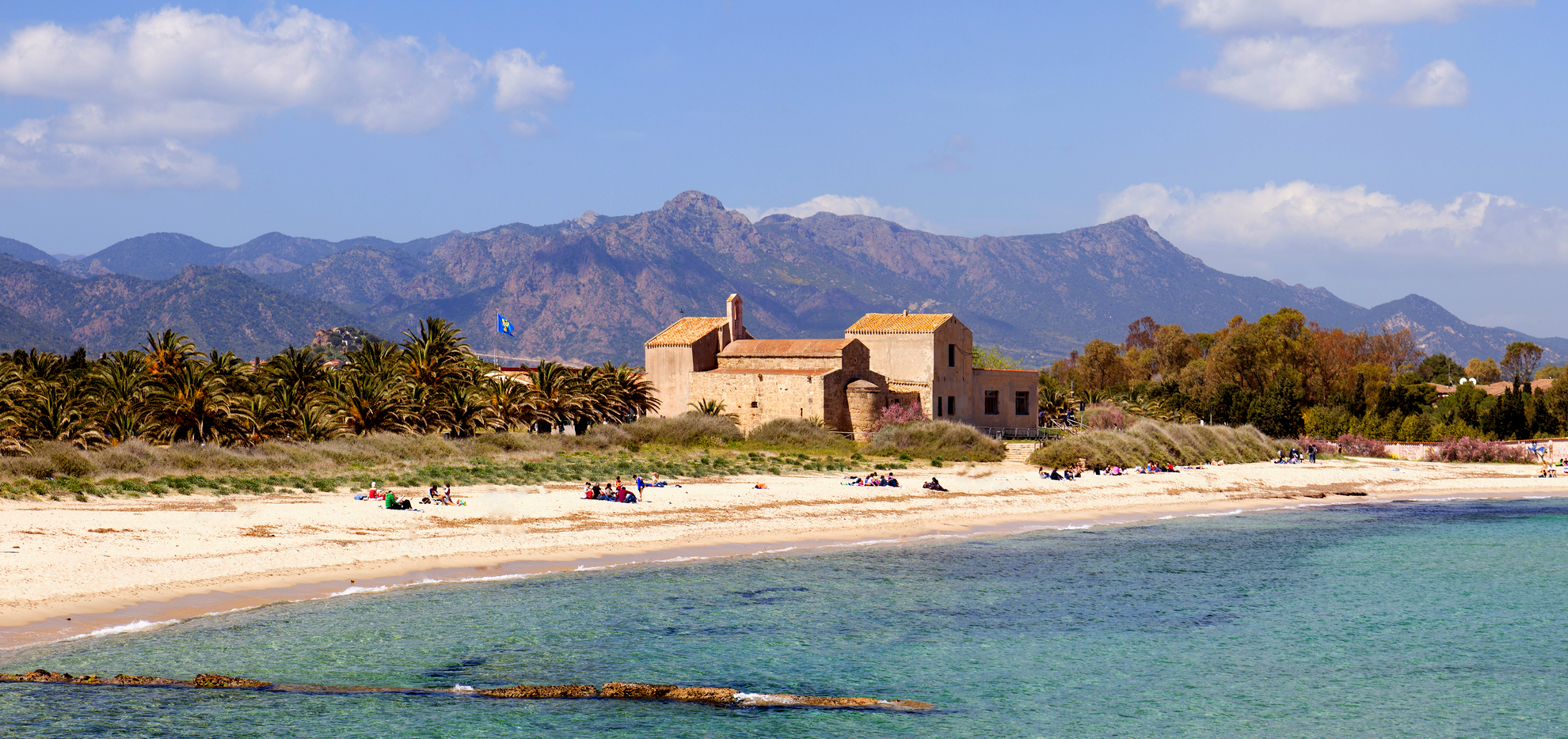
Sant'Efisio di Nora
It all began in 303 CE when the Romans executed the death sentence of Efisio, a common soldier guilty of having converted to and professed Christianity. In the high Middle Ages, a sanctuary was built on the exact spot of his martyrdom. Thus the legend began, with the history of the church of Sant'Efisio later taking on more meaning in the late 11th century when it is donated - together with a variety of other places of worship - to the order of the Victorine monks of Marseilles, who rebuilt the sanctuary in the Romanesque style in vogue at the time, reusing sandstone and limestone ashlars from the ruins of the nearby ancient city of Nora.
The church stands next to the lovely Nora beach some 4 km from Pula and owes part of its allure to its position and vicinity to the beach. The interior of the church exudes an evocative and mystical atmosphere thanks to the dim rays of light that filter in from the oculus above the apse and to the long crypt dug under the presbytery, where there is a domed structure which, according to legend, corresponds to exact place the saint was killed and buried.
The church features three barrel-vaulted naves with soffits, divided by arches set on sturdy pillars. On the external wall of the south side, you will notice the inclusion of a Phoenician-Punic funerary stele. The portico and atrium on the façade were added in the 17th-18th century, probably to shelter the growing numbers of pilgrims from the sun. The original façade stood at the bell tower.
Worship of St. Efisio links this little church to Cagliari, to the medieval Stampace district where there is another church dedicated to the martyr and, following tradition, it too built on a symbolic place. The crypt below seems to have been where the saint was imprisoned before being taken to Nora for execution. From there, starting in the middle of the 17th century, every year without fail, the inhabitants of the capital make good on a vow they made to Sant'Efisio following the end of an epidemic of plague. Over the centuries, the pilgrimage has become one of the most majestic processions in Italy when thousands of faithful flocks from all over Sardinia to accompany a chariot bearing the simulacrum of the saint. It all starts on May 1st and arrives in Nora the following day. On 3 May the celebratory rites take place on the beach and the following day, late in the evening, Sant'Efisio, escorted by the immense procession, is brought back to Stampace.
A few dozen metres away you can continue your cultural tour at the Nora archaeological area. It was originally a Phoenician port and market, of which only the tophet remains, then an important Punic town, evident from the necropolis, and, finally, a flourishing urbs romana. Of the later you can still see some remains of the thermal baths and amphitheatre, the piazza of the forum and the “house with the tetrastyle atrium” decorated with lovely mosaics.
Su Nuraxi 'e Pauli
It has always been surrounded by an air of legend, while its position, structure and closeness to similar fortresses suggest that it was a ‘lookout nuraghe’, part of a territorial control system. Su Nuraxi ‘e Pauli gets its name from the area in the Seulo territory in which it is located, just over two kilometres from the town. It is a single-tower nuraghe, built by the laying of uneven rows of schist blocks. It has a diameter of just over ten metres, while the tower has a residual height of around seven metres. You will be surprised by the considerable wall thickness of over two metres. From the entrance, you enter a passageway with an ogival roof. On the left, a staircase opens up and its steps lead to the top of the tower; while you will notice a niche on the right. The passageway ends in the main chamber, with a circular layout, where you will notice two other niches.
The nuraghe stands on the top of a rocky elevation, from which you can admire a captivating view over the Rio Medau, dotted with oak woods, with Mount Perdedu in the background. The other name of the nuraghe is Mannu, to distinguish it from another tower that stands two hundred metres to the south-east: this is su Nuraxeddu, ‘the small nuraghe’. The tower has partially collapsed but a few rows have been preserved and are the same in every respect to those used for su Nuraxi ‘e Pauli. Su Nuraxeddu also shares the thickness of its walls and the presence of niches in the main chamber with its ‘larger neighbour’. According to a popular legend in Seulo, the two towers are connected by an underground tunnel dug into the schist rock and impenetrable to attackers. The position of the second nuraghe is, in any case, strategic: in addition to the visual contact with the main tower, from the top of the hill on which it stands - around 700 metres above sea level - it dominates the valley of the Rio Medau more closely, beyond which it maintains visual contact with the Nuragic settlement of the nearby Taccu ‘e Ticci plateau. Here, you can see traces of a village with around thirty buildings, a Giants’ Tomb and the remains of a third nuraghe. Unlike the other two, the Taccu ‘e Ticci was probably a complex type of nuraghe, as traces of at least three secondary towers seem to be have been identified around the keep. Not far away, to the south-east, you will see the Giants’ Tomb: a rectangular body has been detected with the burial chamber inside, while the exedra is of the row type.
The Seulo territory is not only famous for its archaeological heritage, but also for its scenic treasures, linked above all to water: on the border of the Sadali territory you can admire the spectacular waterfall of su Stampu de su Turrunu: the water has carved a ponor into the rock face that has, in turn, generated a cave, from which the waterfall plunges into a crystal clear pond. Another unmissable waterfall is located on the border of Gadoni, namely sa Stiddiosa: here, the water dribbles like light rain, falling into a natural emerald green pool.