
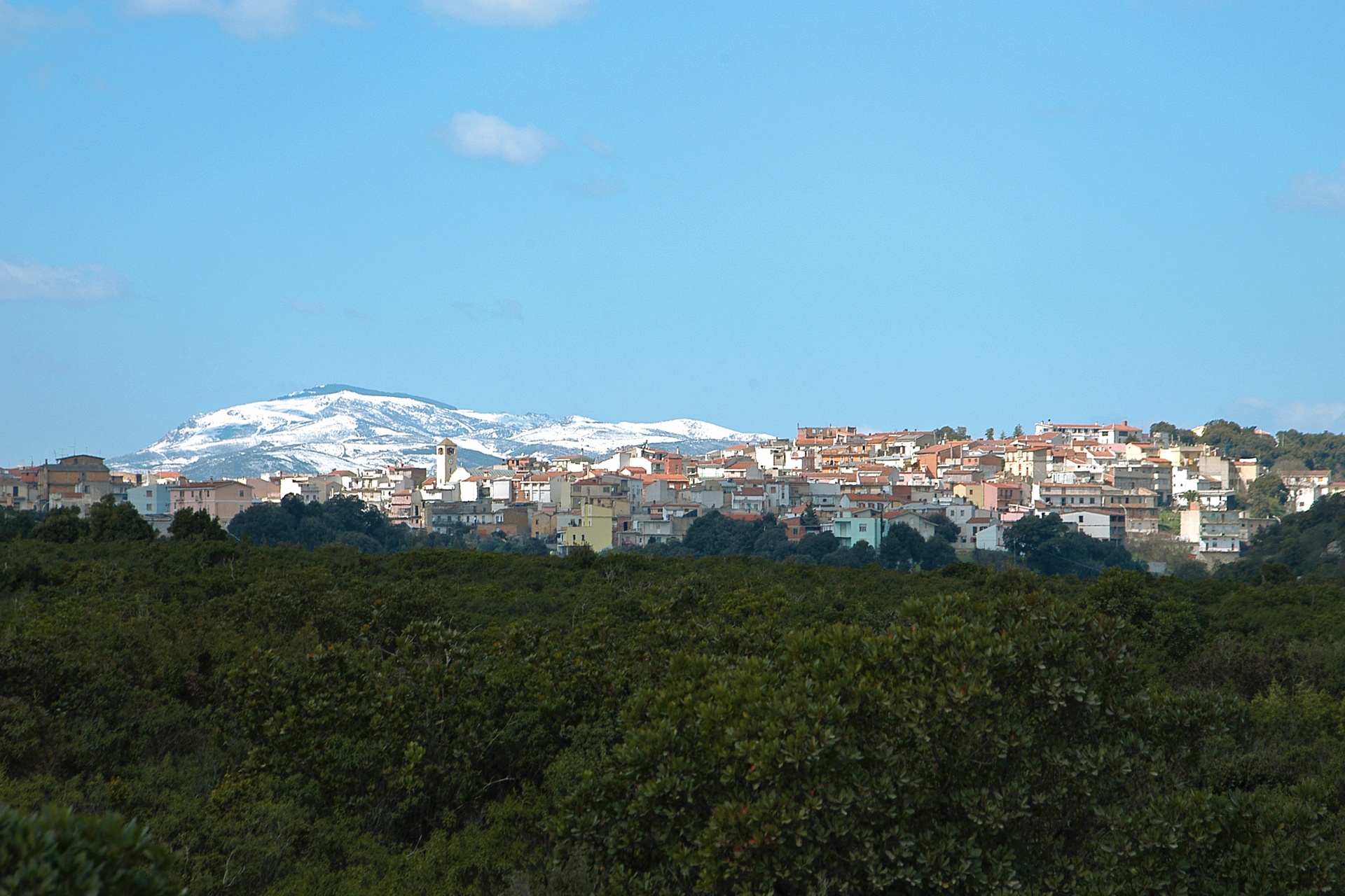
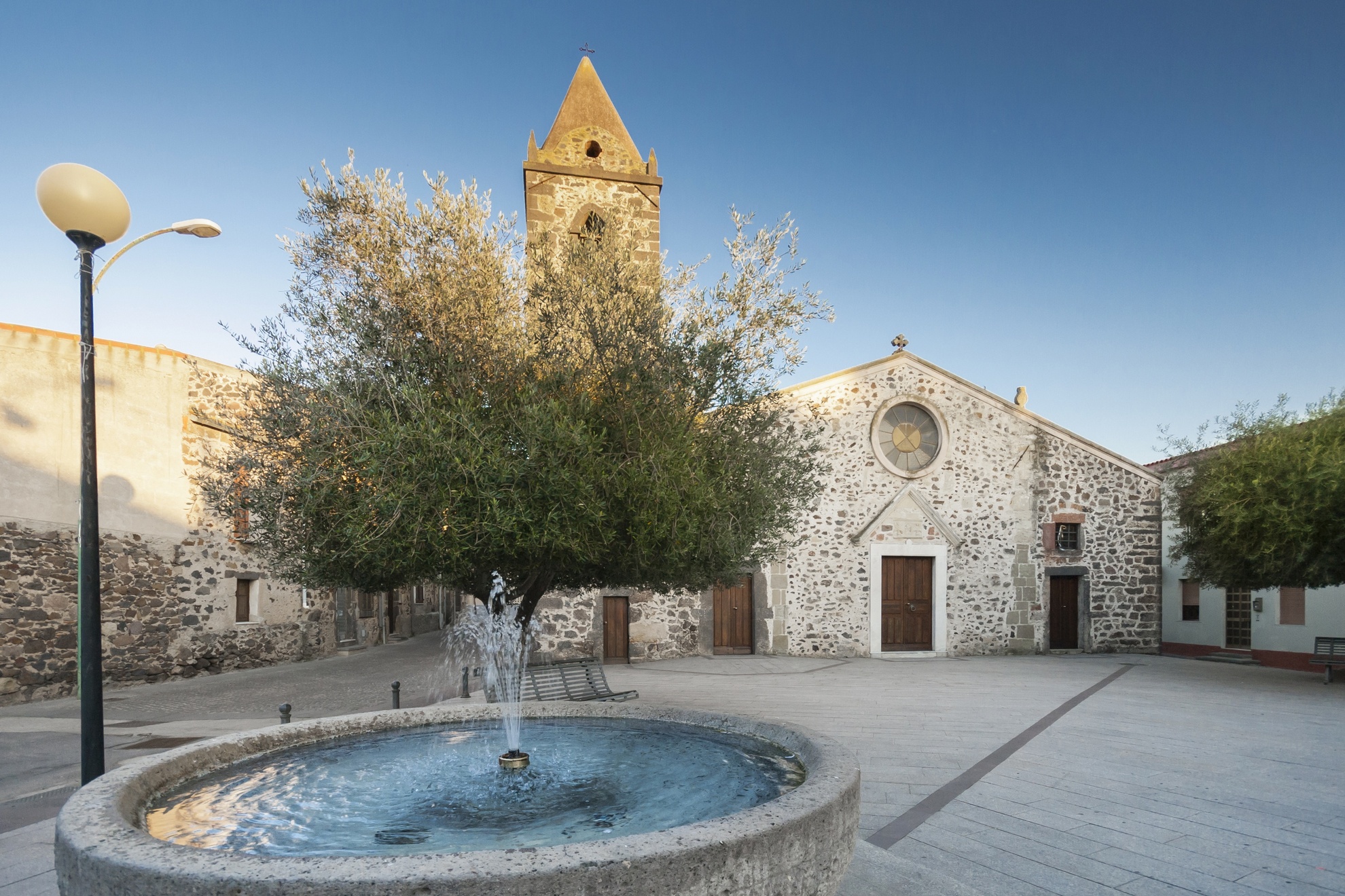
Perdasdefogu
It is part of the Ogliastra Blue Zone, one of five areas in the world with the highest life expectancies among the inhabitants. Hence, it does not come as a surprise that the most long-lived family in the world in 2014 was from Perdasdefogu: eight siblings for a total of 828 years (the two older sisters were 107 and 101). The place name means ‘fire rocks’, a reference to the limestones which were transformed into lime in furnaces. Its two thousand inhabitants (foghesini) typically call their town Foghesu, i.e. ‘furnace’. It is a Medieval mountain town to the south of Ogliastra. According to legend, the first houses in Perdas were constructed by refugees from Turu, a village destroyed by the Mores. Today, the isolated town climbs to an altitude of 600 metres on the edge of uniquely-shaped limestone tacchi formations.
The town’s fabric is composed of 19th century buildings and stone homes centred around the Classical-style Parish of San Pietro Apostolo. It was built at the end of the 19th century and now houses 17th century silverware and 18th century statues. In the upper section of the town stands the 11th century Proto-Romanesque Church of San Sebastiano. The saint’s Feast Day is celebrated on January 20 with the lighting of a bonfire. Two more churches stand in the countryside: the Church of Santa Barbara, with a feast in late March marked by a procession in traditional dress, and the Church of San Salvatore, who is celebrated with a fascinating, ancient festival. The locals are very attached to their religious traditions, especially to those of the Holy Week, which sees the preparation of su nenniri, a basket of wheat sprouts used to decorate altars, and perform a fertility rite for good fortune.
The economy is driven by shepherding and the cultivation of cereals, fruit and grapes. Since mid-20th century, the town’s outskirts have been the site of the Military Firing Range of Quirra, a military and scientific research centre that has become part of town life. Adjacent to the centre, there is Bruncu Santoru Park with holly oak and Mediterranean shrub forests populated by Corsican red deer. In the heart of the mountain, within the park, the earth suddenly ‘opens’ (joint): this feature, called Sa Brecca de is Tapparas, is a sort of canyon or open-air cave through which a narrow trail runs for 300 metres between (40-metre tall) sheer walls, illuminated by light that filters between trees and rocks. The Caves of Is Angurtidorgius are also a must-visit. From the mountain trails, you will be able to admire the solitary panoramas of Salto di Quirra and the ‘tacchi’ of Jerzu. Hidden between the oaks, you will encounter the Waterfalls of Luesu with the 70-meter tall Su Strumpu waterfall. At the centre of environmental education, you can visit an exhibit of local animals, minerals and fossils: Perdasdefogu is part of the Geo-minerology Park of Sardinia, thanks to an anthracite deposit mined until mid-20th century that is now an industrial archaeology site. Prehistoric sites in the area include Giant’s Tombs, the sacred spring of Peddi de Cani and nuraghes Arras, Florentina, Perdixeddu, Prediargiu and Trutturis.
Gairo Sant'Elena
The town itself climbs upwards along a deep gulley with 700 and 800 high walls that came about after landslides caused by torrential flooding in 1951. This forced Gairo Vecchia to be evacuated, and the remains are now a fascinating ghost town. Some of the inhabitants went to live on the coast and founded Cardedu, others went to Gairo Sant’Elena (or new Gairo), now with a population of 1,500. Eight kilometres further on is the suburb Gairo Taquisara, which has a Trenino Verde stop along the Mandas-Arbatax line. It was once the a stop along the shortest stretch of Sardinian railroad that took off from Gairo and followed the river Pardu to Jerzu, the end point and today a museum known as the Stazione dell’Arte (in the town of Ulassai).
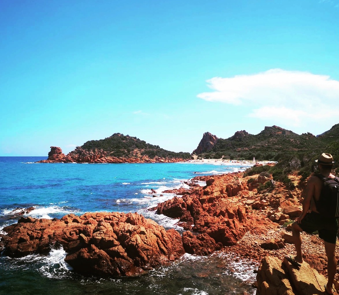
The Gairo area goes from Gennargentu to the sea. You will enjoy stunning landscapes: the protected Perda ‘e Liana natural monument stands out majestically in the distance. At 1300 m it is the highest of the Ogliastra tacchi, or outcrops, and is populated by mountain goats and surveyed from above by the lammergeyer. It’s unusual shape is one of Sardinia’s morphological attractions: on a conical trunk rises an impressive tower whose walls climb upwards for 50 metres and a diameter of 100. As you go up, the vegetation thins until it just about disappears along the base. Another natural attraction is the Taquisara grotto, accessible over a route laid out for visitors. Above the grotto is Mount Ferru, graced with natural pools fed by the su Accu ‘e axina river. Enjoy a dip in the water! Mt Ferru and Mt Cartucceddu embellish the coastline with deep purple rocks, while juniper trees fill the air with their heady fragrance. This is the lovely scenario of Marina di Gairo, a quiet, charming seaside resort. Its gems include Coccorrocci and su Sirboni (the boar). The former is a four-kilometre stretch of soft, round, coloured pebbles that are a perfect match to the shades of blue and green of the sea. A nice long hike will take you along the promontory that separates it south of Marina di Tertenia. The latter is blessed with all the beauty of pristine nature and is known as su Sirboni, (or Cala Francese). The fine white sand on the beach stretches far into the shallow green hues of the Mediterranean Sea. The surrounding area is dotted with pre-Nuragic and Nuragic era monuments, remains like is Tostoinus and Perdu Isu and the Giant tomb at rocky fortress that is Taquisara. Nearby, are other landmarks well worth exploring: the famous Serbissi nuraghe, for example, in the Osini area. The region’s most heartfelt celebrations take place in early August in honour of the Madonna della Neve and the Pentecost, all of which includes the enjoyment of such delightful sweets as piricchittus and amaretti, not to mention other treats and renown wines.
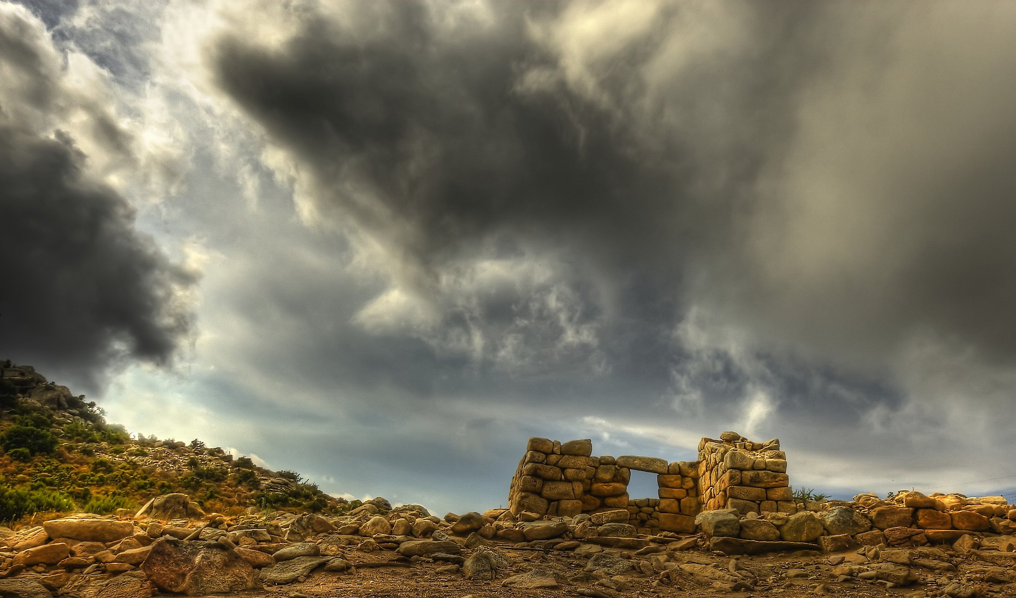
Serbissi
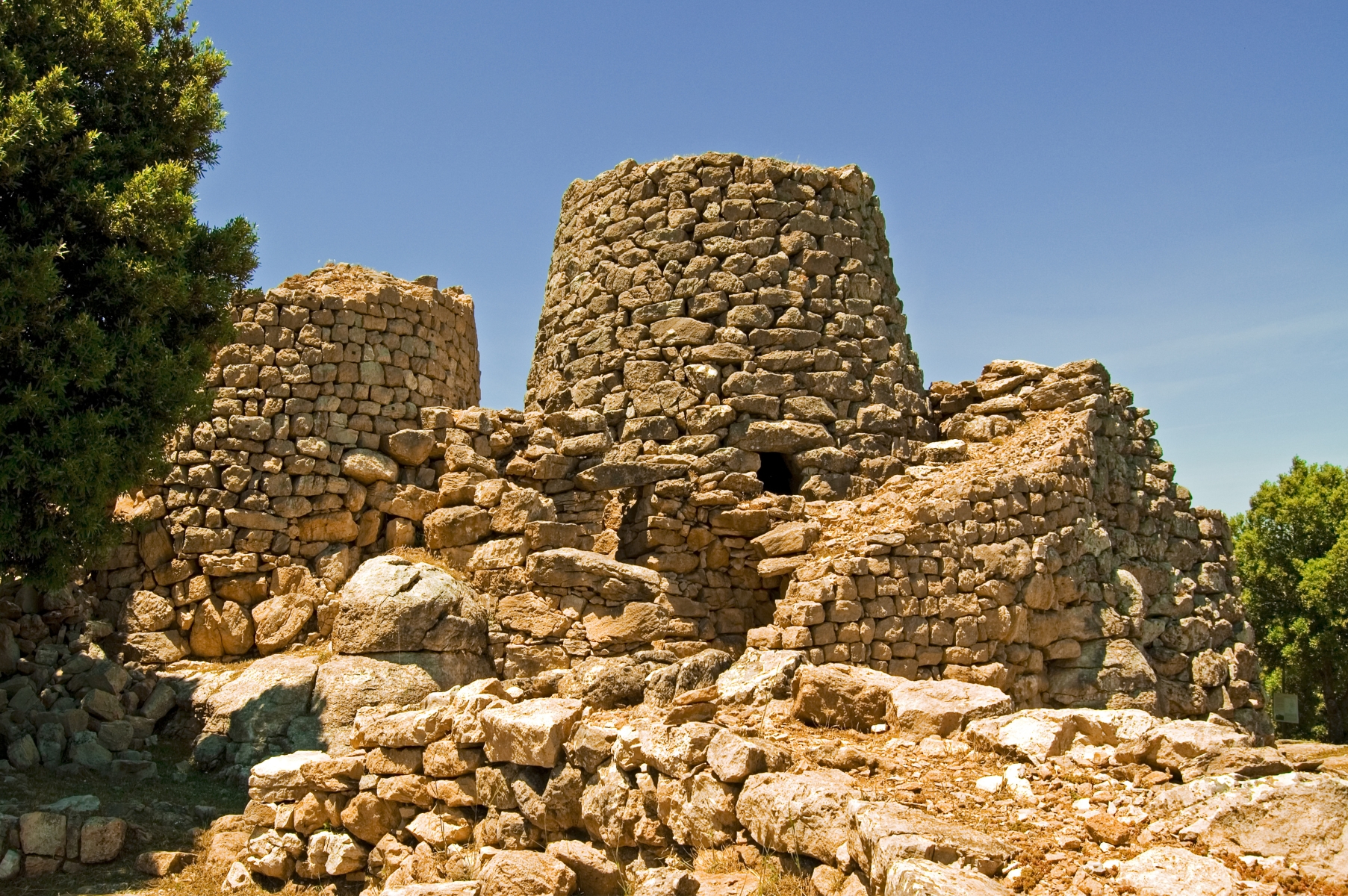
You will travel back in time, through gorges, precipices and cliffs covered in Mediterranean scrub, passing by the Scala di San Giorgio and arriving at the top of the Taccu di Osini, a plateau at an altitude of almost one thousand metres, that overlooks the village - which is eight kilometres away - and dominates the Ogliastra region. Up here, after a short stretch on foot, at about one thousand metres of altitude, you will find the Serbissi nuraghe, inhabited between the Ancient and the Recent Bronze Ages (17th-10th centuries BC). It is a place in which thousands of years of history and natural beauty combine perfectly. The architectures, a rare example of a Nuragic complex at high altitude, tower over a rocky limestone landscape with sheer rock faces, on which they rest, using an unusual technique to adapt to the terraces. The structure, which is in excellent condition, consists of a nuraghe with four towers, a village, a cave, two tombs of giants and, nearby, another two single-tower nuraghi.
From a distance, you will be struck by the slender outline of the central fortified tower, created with even rows of blocks and today over six metres high. Instead, from close up, you will be intrigued by the well-finished weave of the masonry. The room on the ground floor is integral and has a tholos (false dome) roof, while the upper floor, which is oval-shaped, has a floor made of stone slabs. A town boundary wall connects the fortified tower to the other three towers. Here, you will also find spaces that are still intact: the northeast tower has a lower tholos-type room and an upper room with a fireplace, while in the tower to the east you will find a room with six embrasures. The entrances to the towers overlook a courtyard-corridor with a cobbled floor. Around the nuraghe you will see eight circular-shaped huts made of stone and clay and a cobbled floor: here, you can stop and imagine everyday life and the mysterious rituals of the Nuragic populations. Alongside it, you will notice a karst cave with two entrances, which may have been used as a storage space for foodstuffs. Above, on the Troculu floor, you will find two tombs of giants, one with arched rows of steles, and the single-tower nuraghi of Sanu and Orruttu, perhaps included in a village at one time.
On your archaeological tour you will notice the splendour of the Taccu di Osini. Legend has it that, during a journey through the villages of the diocese, St George, a bishop, reached the foot of the plateau, to either go around or climb. He recited a prayer and opened up a narrow passage between the limestone and dolomitic walls: this is where the name of the natural monument comes from, the evocative Scala (or gorge) of San Giorgio, to whom a rural church is also dedicated. Don't miss out on a visit to 'Osini storica', a ghost town that was abandoned after the floods in 1951 and re-established one kilometre further north.
Ispinigoli
A kaleidoscope of forms and colours from a mysterious past, within the bowels of the earth. A visit to Ispinigoli, in the Supramonte di Dorgali area, a few kilometres from the village, is an exciting and evocative descent taking you underground, to a room that is 80 metres in diameter and will strike you for its natural beauty and historical value. Inside the cave, which has been open to the public since 1974, you will walk along a well-equipped trail: the constant cool temperature - always 15 degrees - will accompany to you along the 280 steps of the descent. After going through the entrance, from the natural terrace, you will be captivated by a 38-metre high column, among the most impressive in Europe, a majestic limestone concretion that joins the vault to the base of the cave. It is the beginning of a beautiful sight that will captivate you.
An exceptional environment in every detail: from the enormous concretions that stand out from the walls to the small and tiny stalagmites and the undulose formations. It is a game of colours and contrasts, getting gradually more intense as you go deeper down via the steps, brushing against the yellowish limestone with various forms and undertones, until you reach the base of the huge column.
Furthermore, in the 'Abyss of the Virgins', only expert speleologists can continue on. It is a narrow canal that is 60 metres deep, stretching for about 12 kilometres and connecting to the cave of San Giovanni Su Anzu. Basically, Ispinigoli is the part that can be visited of the entrance to an enormous karst system, with underground offshoots and streams. The chasm is of exceptional historical-archaeological interest: Nuragic, Punic and Roman findings have come to light, demonstrating its long use as a burial place and one of worship. Human remains have been found, as well as rings, necklaces and sun symbols, bringing to mind a Phoenician sacrificial well: human sacrifices may have taken place here. During the world wars, Ispinigoli was place of refuge and, until the middle of the 20th century, it was used by shepherd as a shelter for their flocks. Close to the cave, there is a hot water spring in which you can bathe and a well-known restaurant, where you can taste typical Sardinian cuisine.
The Supramonte area is one of the most remote treasure chests on the Island, dotted with towers, valleys springs and other deep caves. In order to complete the 'underground' tour, a boat trip in Dorgali, from the Grotte del Bue Marino, is a must, while in the adjacent territory of Oliena, you cannot miss out on a visit to Sa Oche and Su Bentu, one of the largest karst systems in Europe, and the Grotta Corbeddu cave, in the majestic valley of Lanaittu, that gets its name from a famous bandit who had his hideout here.
Tempio di Janna 'e Pruna e su Notante
Clinging to a mountainous ridge, they have characterised the area for thousands of years and have consecrated it to the worship of the waters: a temple, a sacred font and other mysterious buildings in which the Nuragic people performed their mysterious rituals and affirmed their territorial dominion. The temple of Janna ‘e Pruna and the nearby sacred well of su Notante stand on the granite peak of mount Senes, in the territory of Irgoli, exactly in the pass that gave its name to the temple and that was already a strategic point of passage from the coast to the hinterland in prehistoric times, connecting the valleys of riu Siniscola and Cedrino. The landscape here, at an altitude of almost 600 metres above sea level, is enchanting: to the south-west the view dominates the valley of the stream of Remulis in southern Baronia until you see the Supramonte and Gennargentu.
The first site you will encounter upon entering the sacred area is the temple of Janna ‘e Pruna, built in well-worked granite blocks positioned in even rows. It consists of a rectangular atrium, equipped with a counter-seat on the left wall, and a circular cell - it may have originally been equipped with a tholos roof -, with a central fireplace and a stone bench here too, leaning against the wall. The temple was surrounded by a temenos, the sacred enclosure, with a trapezoid floor plan and an oval courtyard in front, where votive offerings were placed. Outside the enclosure, you will see traces of another circular building surrounded by a walled enclosure. All the buildings are then enclosed by another large rectangular curtain wall. The materials found during the excavations allow us to date the monument to a period between the Late Bronze Age and the beginning of the Iron Age (12th-9th century BC).
Continuing south-west, about 150 metres from the temple, you will encounter two other buildings, the function of which is still a mystery. The first has a circular plan and an architraved niche inside, while the other is rectangular, with three rows of steps on the east side. Further downstream, close to the course of the Remulis, alongside which there is a row of black alders, you can admire the su Notante font, built using the isodomic technique with square blocks of basalt, a stone that cannot be found on site, so it was necessary to transport the raw material here to build the well. The western part of the façade and the catchment well of the spring from which the water still flows are still standing. The sacred well has a trapezoidal opening and a rectangular basin and it is covered by a flat arch. You will also notice a stretch of wall with granite terracing. After the visit, you can observe the artefacts from the sanctuary in the Municipal Antiquarium of Irgoli. The museum itinerary, divided over two floors, tells the story of the town and its territory from the Recent Neolithic period to the Middle Ages.
Lanusei
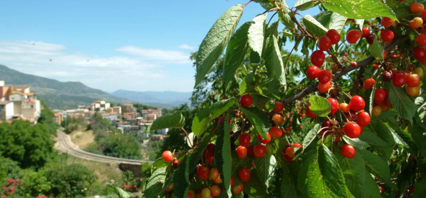
It is one of the Città delle Ciliegie (cities of cherries), with a festival not to be missed at the end of June, and it has a station along the Mandas-Arbatax Trenino Verde tourist railway line. Lanusei is an ancient village with 5400 inhabitants, dating back to the 12th century and located on the southeastern ribs of the Gennargentu Park, an episcopal see of the diocese of Ogliastra and of the first 'house of the Salesians' in Sardinia (1902), or the ‘temple of San Giovanni Bosco', patron saint of the village, celebrated at the beginning of June. Casa Mameli brings further lustre to the town. This was the birthplace of Goffredo Mameli, composer of the Italian national anthem. It is one of the nineteenth-century buildings embellishing the old town centre, among which there is also Palazzo Piroddi, a neoclassical work by the famous architect Gaetano Cima. In the centre of the village, there is the seventeenth-century cathedral of Santa Maria Maddalena, in which there are frescoes by the painter Mario Delitala, dedicated to the life of Mary Magdalene and to the life of Christ. Another important religious building is the sanctuary of the Madonna d'Ogliastra, abode of the Franciscan friars, located in the upper part of the village. Outside the village, there are the churches of Maria Ausiliatrice, in a forest to the northwest, and the rural church of San Cosma and San Damiano, celebrated at the end of August and at the end of September. On mount Armidda you will be able to visit the Caliumi Astronomical Observatory, one of the largest public ones in Italy.
Lanusei boasts a type of cuisine based on agricultural and pastoral tradition, including delicacies like culurgiones and coccois prenas. A typical mountain village that also has an outlet into the crystal clear Ogliastra sea: the little pebble beaches of Porto Santoru, surrounded by Mediterranean scrub, where there is a pier and abandoned buildings that were once used for loading minerals. Its territory was already inhabited in prehistoric times. There are numerous traces of the Neolithic age and even more of the Nuragic age, especially within the granite plateau of Selene, on which there is a magnificent forest of holm oaks and chestnut trees and it is dotted with water sources, famous for their beneficial qualities. Inside the Selene archaeological park, consisting of the foundations of a Nuraghe and several village huts, as well as two Tombs of Giants, positioned 80 metres from each other, dating back to somewhere between the Middle Bronze Age and the Late Bronze Age (15th-12th century BC). Of the burial sites, you will be able to admire the integral apsidal body, a covered corridor and an architectural front with a semi-circular opening (exedra). Tomb I also has a counter-seat, while, during the excavations, a block shaped like a truncated pyramid with three holes in it was found in Tomb II: it was the top of the exedra, where the votive baetylus stones were inserted.
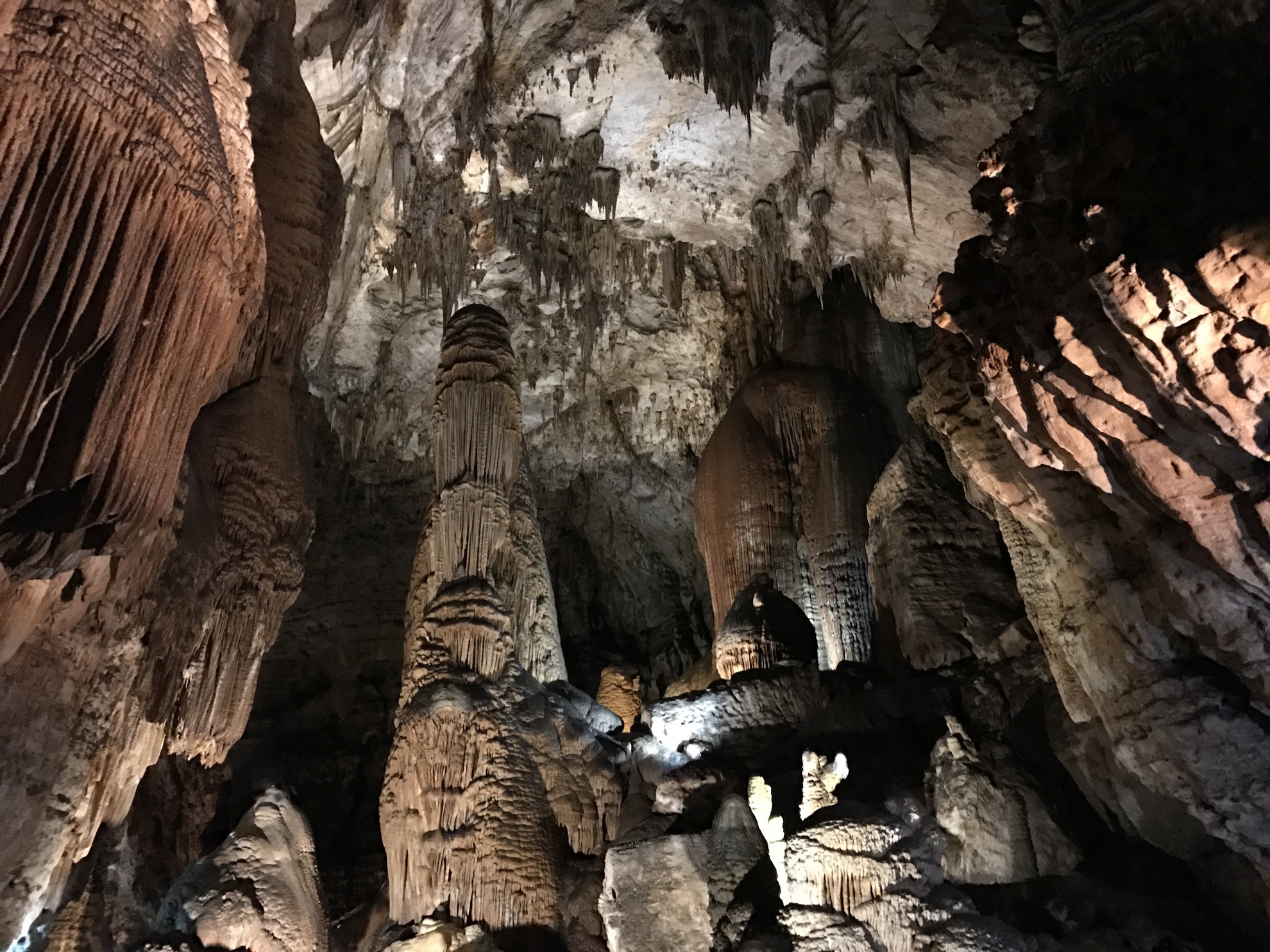
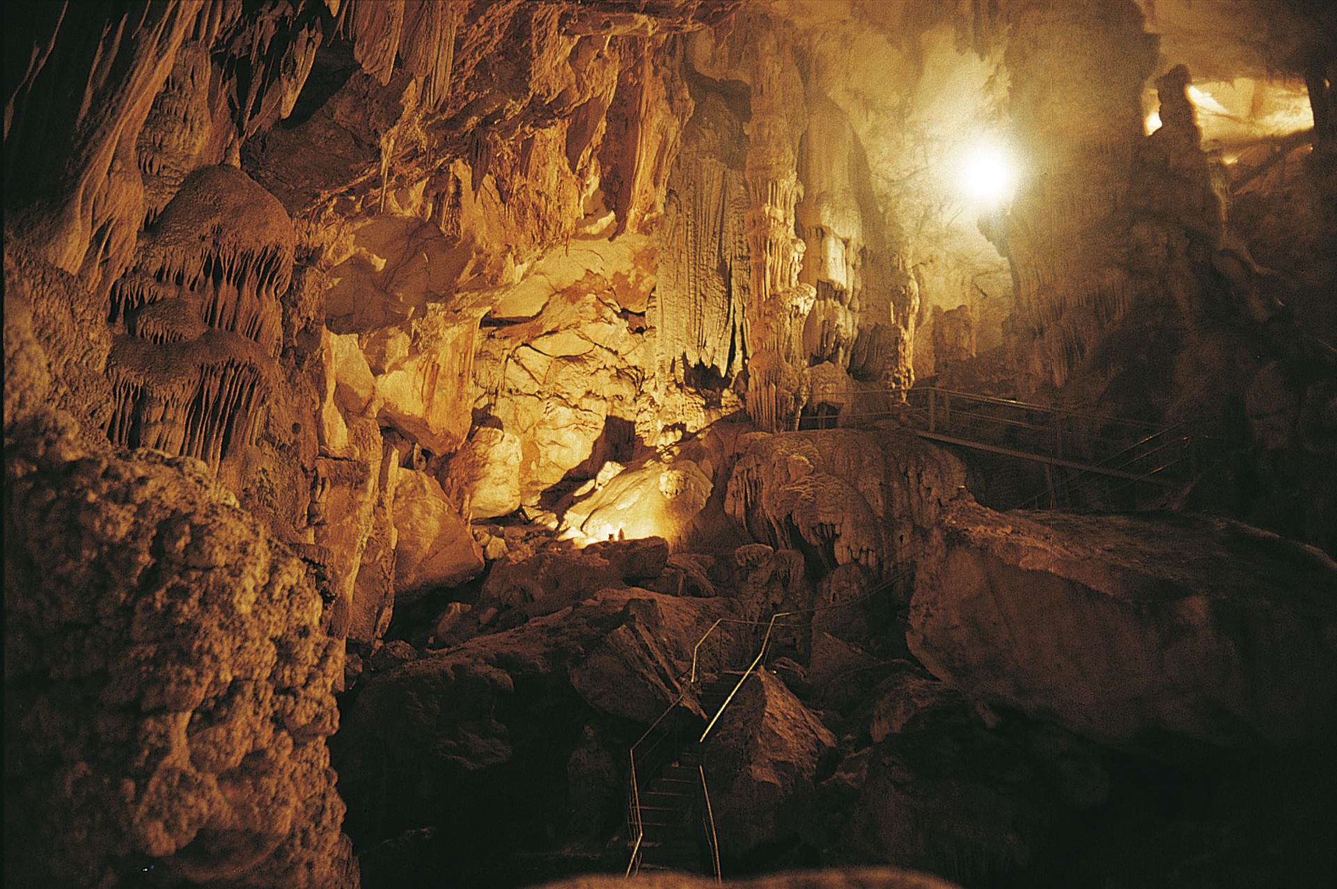
Su Marmuri
The beauty of the stalagmites and festoons hanging from the walls is amazing, as is majesty of its spaces: it opens up at an altitude of 880 metres and extends over 850 metres, all of which can be visited. The Cave of Su Marmuri - meaning 'the marble' because of the unusual appearance of the limestone rock - is found one kilometre from Ulassai, a reference point for climbing and trekking enthusiasts. To get to it, you need to take a road situated between rocky outcrops and deep gorges. The immense cavity, formed 150 million years ago by the force of the water, extends along the rocky outcrop known as the Tacco di Ulassai, a massif that overlooks the village.
The entrance opens out onto a steep escarpment practicable thanks to a flight of steps and open to the public since the 1950s. Leaving behind the effort of having climbed hundreds of steps, you can start to enjoy a leisurely stroll on flat ground along the magnificent concretions, which are still being formed, and you can visually 'climb' breathtaking heights. In some areas, the walls are 70 metres high: it is the most impressive cave in Europe.
The one-hour visit takes place along an easy trail that passes through a series of extremely high ‘rooms’ and basins, two small lakes fed by the incessant trickling of water, a series of stalactites, stalagmites, pisolites and splashes, globular shapes formed as a result of dripping water. The atmospheric temperature is constantly around ten degrees C. Of the numerous spaces to see, it is worth stopping off at the Grande Sala (Large Room), which is 72 metres long and 30 metres wide, the Organ Room, with its concretions that look like organ pipes, the Cactus Room, featuring two twenty-metre high stalagmites, similar to cactus plants, and the Room of the Bats, the Gallery of the Basins and the Terminal Gallery. The view is captivating, wherever you look.
Su Marmuri is one of the most famous natural monuments of Sardinia, and not unique in Ulassai, which boasts an incomparable 'waterscape' created by the imposing waterfalls of Lequarci and Lecorci, which descend whirling from vertical limestone walls just half a kilometre from the town. The waters of Lecorci flow just below the famous cave and journey on to join those of Lequarci.
On the nature trail, don't miss the chance to dip into the great cultural tradition of Ulassai, a real museum-town that was the birthplace of famous artist Maria Lai, whose works are dedicated to the Art Station.
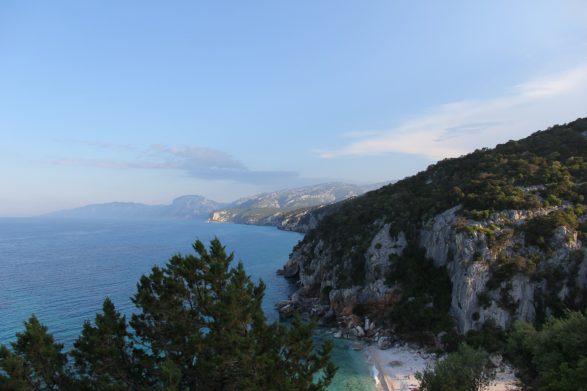
Park of the gulf of Orosei and Gennargentu
Immense landscapes, which are wonderful and never the same, like an enormous mosaic: inaccessible peaks, green pastures, plateaus, canyons, centuries-old forests, sheer cliffs overlooking crystal clear waters, caves and beaches. From the mountain to the sea: the National Park of the Gulf of Orosei and Gennargentu is one of the most spectacular destinations in Sardinia, with itineraries ideal for trekking and mountain bike excursions. The protected area, established in 1998, includes 74 thousand hectares in the territories of 27 towns and villages in Barbagie, Mandrolisai and Ogliastra.
In the Gennargentu mountain range, Punta Lamarmora (1834 metres) and Bruncu Spina (1829) stand out and are peaks from which you will have a 360 degree view of the entire Island. The massif is linked to limestone and dolomite rock plateaus, the supramontes of Orgosolo and Oliena, with the valley of Lanaittu and Monte Corrasi. Up to a height of 1200 metres, the holm oak is predominant, while higher up there are downy oaks and oaks. Very tall holly trees also grow on the slopes. Don’t miss the forests of Uatzo, Montarbu and Montes, where there is the centuries-old holm oak forest of Sas Baddes. All around, there are expanses of Mediterranean scrub: strawberry trees, junipers and mastics, accompanied by the fragrance of helichrysum, rosemary and aromatic shrubs. Amphibians, insects and rare reptiles live here: the salamander (in the caves) and the papilio hospiton butterfly. The most impervious zones are the habitat of the mouflon, next to which, the deer and the fallow deer have 'returned'. Wild boars can be found everywhere, accompanied by the weasel, the wild cat, the dormouse, the hare, the marten and the fox. The golden eagle and the peregrine falcon fly over the higher crests, while the Eleonora's falcon flies around the sheer cliffs overlooking the sea. The goshawk, the spotted woodpecker, the buzzard and the Eurasian sparrowhawk are common here.
Other places to add to the list of wonders to be visited include the karst spring of Su Gologone, the canyon of Su Gorropu, with rock faces up to 450 metres high, the huge sinkhole of Su Suercone, a ponor in which there are centuries-old yew trees, the caves of Su Bentu and Sa Oche, Perda 'e Liana, Perda Longa, Su Sterru, Su Texile and the Nuragic village of Tiscali.
The elevations slope down to the sea on one of the most enchanting stretches of coast in the Mediterranean: 40 kilometres from Cala Gonone (Dorgali) to Santa Maria Navarrese (Baunei) with spectacular sheer rock faces in which caves open up, like that of Bue Marino, codule gleaming with oleanders and charming little coves: Fuili, Luna, Sisine, Biriola, Mariolu and Goloritzè. Whales and dolphins swim in the gulf, which was once the kingdom of the Mediterranean monk seal.
Bauladu
The village is situation on the foothills of the basalt plateau of Abbasanta, bordered to the north by the spurs of Montiferru and to the south by the plains of Alto Campidano, a particularly fertile area with numerous springs. Bauladu is a small village with a population of around 700, 18 kilometres from Oristano, and which regained independence in 1946 after being united with Milis in 1927. The local economy is mainly based on a flourishing agriculture in the flatter areas, while the hilly territory is used as pasture. The name means ‘wide ford’, with reference to the ford of the River Cispiri, which crosses the territory and after joining the riu Mare Foghe, feeds into the Stagno di Cabras. There is a large nature reserve in this area, home to rare reptiles including the Aesculapian and Sardinian snakes.
Tradition points to Santa Barbara de Turre as the oldest settlement in Bauladu, abandoned following an epidemic. The surviving inhabitants moved under the protection of the Camaldolesi, who founded the Church of San Lorenzo and the Church of San Gregorio. The village became an important monastic villa under the Giudicato d’Arborea. Its development mainly took place thanks to the large Abbey of Santa Maria di Bonarcado. The two medieval churches are still the villages main churches today, as well as being the oldest. The parish church of San Gregorio Magno is in the village centre: its earliest Romanesque foundations date back to the 13th century, along with the stone facade. It was renovated in the 18th century and a chapel preserves a wooden sculpture of the Madonna with Child, in gold and multicolours, attributed to a carver from the Neapolitan school in 1600. The Church of San Lorenzo, built before the parish church, is set in a garden. Religious festivals include the celebrations of Santa Vittoria (mid-May), when a large bonfire is lit, and San Giovanni Battista (late June). The procession held in honour of the Saint is joined by men and women in traditional costumes (red for the women) and knights, who later take part in jousts and challenges. The lunch is based on boiled mutton and local wine. The festival is held at the same time as the sheep and cheese festival, bearing witness to the area's agricultural and pastoral tradition.
Settlements in the area are documented back to Nuragic times with the Giants' tombs at Muraguada, built using blocks of basalt, with a rectangular entrance, and the Crabia Nuraghe, in excellent state of conservation, with an intact tholos (false domed cover) on the ground floor and a stairway leading from the entrance to the upper floor.

Siniscola
The impressive Montalbo dominates the landscape: this 'Sardinian dolomite', with its white rocks, looks out onto 25 kilometres of coastline, half of which are of fine, light sand. Siniscola is a small town with twelve thousand inhabitants, the most highly-populated in the Baronie area, second in the province of Nuoro and 50 kilometres from Olbia. In the Roman period it was Portus Lugudonis, a station along the coast leading to Karalis. Around it, the scenery is varied: limestone elevations, gorges and cliffs, hills and plains, pastures and vineyards, lagoons and beaches, perfect places for trekking, horse-riding, speleology, free climbing and surfing. Along the silver ridge of Mount Albo, you can enjoy evocative itineraries, once trails for coal merchants and shepherds, with archaeological sites and pinnettos, holm oak forests and Mediterranean scrub, populated by the mouflon, the golden eagle and the red-billed chough.
The peak is 'lunar', with doline valleys, chasms, underground rivers and caves, which were inhabited in prehistoric times: Bona Fraule, where iron weapons were found, Gane 'e Gortoe, rich in limestone concretions, Sa Conca 'e Locoli, eroded by the fierceness of the water, and Sa Prejone 'e 'Orcu, a Nuragic cave-sanctuary. In all, there are thirty Nuragic settlements, among which the villages of Luthuthai and Rempellos, the Nuraghe Conca Umosa and the Tombs of Giants Sas Kolovranas, Su Itichinzu and Su Piccante. The first traces of human presence date back to the 6th millennium BC, in the grotto of Elène Portiche and, from a later period, there is Cuccuru 'e Janas, 'hill of the fairies', a grotto with radially-positioned burial chambers.
From the mountain, the trails lead all the way down to the beaches, interrupted by low cliffs and framed by transparent, turquoise waters. The first stop is La Caletta, a seaside district and tourist port with five kilometres of golden beach, delimited by the pond of Su Graneri and a pine forest. Moving south, you will find Santa Lucia, a fishing village, where Sapori di Mare (Flavours of the Sea) takes place in June, with tastings of seafood, and in September you can enjoy the shows taking place during the Festival Internazionale (International Festival). Next is the enchanting S'Ena e Sa Chitta, the 'beach of sugared almonds': white sand and smooth rocks. A little further south, there are the huge dunes and centuries-old junipers of Capo Comino, which looks like a film setting. Behind it, there are the ponds of Salina Manna and Salinedda. Moving further south, you will reach Bèrchida, a gem along the eastern coast, with its dazzling splendour that comes from the white sand, emerald green waters and golden sand dunes.
During the Spanish period, the coastline was protected by watchtowers, reminding us of Saracen incursions. One of these still exists in Santa Lucia and there is another, dated 1608, which dominates the medieval town centre, along with the eighteenth-century parish church of San Giovanni Battista. Nostra Signora della Salute is worth visiting and was built near the spring of Luittu, with its 'healing' waters, one of the many springs dotted around the territory. The events taking place are endless: Fires of Sant'Antonio Abate, Carnival, Holy Week, a stage of Spring in Baronia. In mid-October, the most heartfelt (and centuries-old) celebration takes place in honour of Nostra Signora delle Grazie (Our Lady of Graces). The religiousness can also be seen in the various festivals taking place, during which you can feel the authenticity of the community and taste Cannonau wine and pecorino cheese, menus based on suppa thiniscolesa and roasted meats. The symbol of Siniscola is Sa Pompia, a large citrus fruit that is a cross between a citron and a lemon. It is used in the laborious preparation of exquisite pastries: pompìa intrea and s'aranzata. This fruit is also used in cosmetics and herbal preparations.