
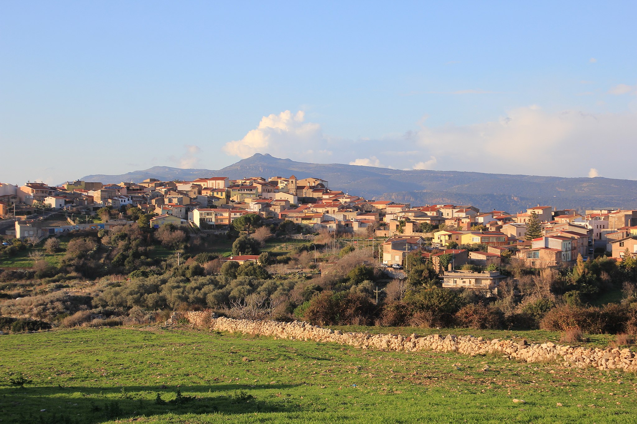
Siamanna
It was founded in the Roman Era in the upper section of the modern town, in Funtana e Susu, along the road from Usellus to Forum Traiani (Fordongianus), which is marked as Is Romanaius to this day. Siamanna is a small town of about 800 inhabitants, 15 kilometres from Oristano. It sits at the foot of Mount Grighine, which gave its name to the territory extending from the northern borders of Campidano and the historical territories of Barigadu and Upper Marmilla. The town’s name derives from s’ia, meaning ‘the road’, in reference to the Roman road. It was combined with the adjective manna (big), to differentiate it from the nearby, smaller town of Siapiccia, meaning ‘small road’. The two towns were part of the same municipality from 1947 to 1975.
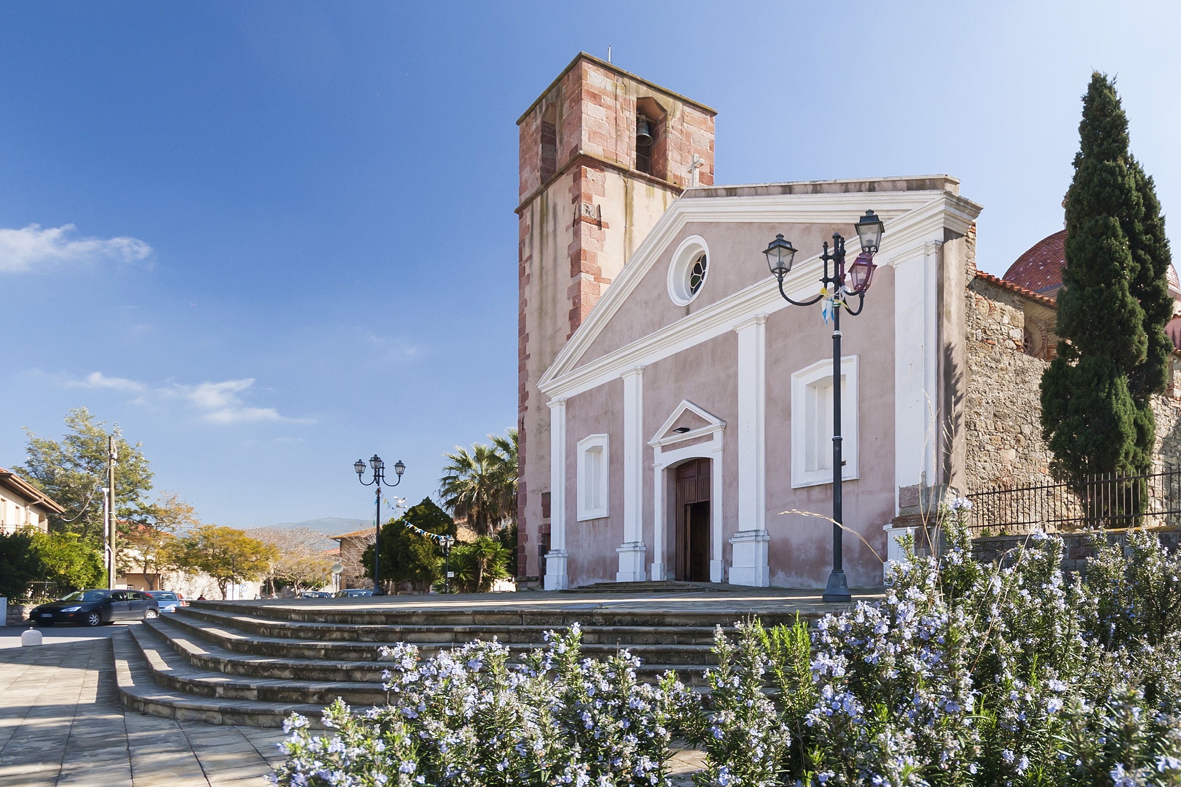
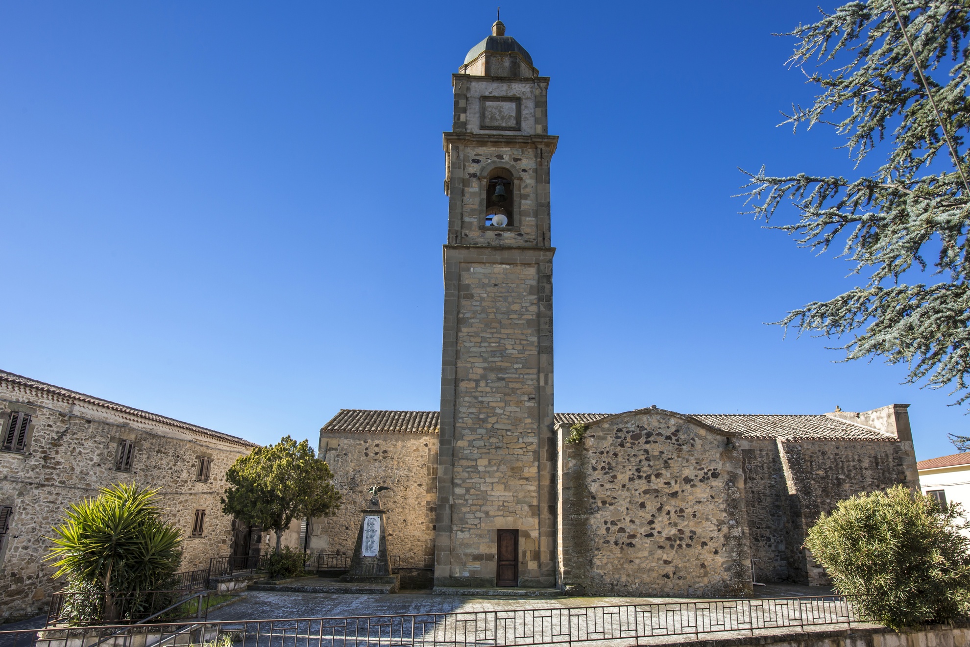
Its well-maintained historic centre has characteristic rural Campidanese structure: low houses with large courtyards and narrow roads. The 1512 Parish of Santa Lucia, whose original Pisan Romanesque layout consists of a nave and two lateral aisles, catches the eye in the city centre. In the first half of the 20th century, it fell into ruin and was torn down to be replaced by a new church. Only the 1745 bell tower dating to the Marquisate of Arcais remained standing. Its patron saint is celebrated on August 21 and 22 with two very popular events, the Festival of Su Pannu, brocade or damask cloth once given as a prize at festival race, and the Festival of Typical Products. The festival’s protagonists are Siamannese bread, grapes, cheeses and ricotta, typical of a town of shepherds and farmers cultivating cereals, fruit, olives and grapes. During the festival, the farmers cook ravioli according to traditional recipes for visitors. Religious celebrations are repeated on December 12 and 13 with a bonfire and a procession. On a hill about two kilometres from the town stands the Church of San Giovanni, a must-see. Possibly constructed in the 16th century and restored several times. Its patron saint is celebrated in late June with a dinner, music and traditional dancing. Adjacent to the church stands a nuraghe of the same name, the most important of nine surrounding the town, which predate by several centuries the Punic period and the extensive ‘Romanisation’. The other nuraghes are Auredda, Concu, Crogana, Curreli, Monte Qua Sigu, Paba de Soli, Pajolu, Pitzu Cau and Santa Vittoria.
Mount Grighine is over 700 metres in height and dominates the fertile lands around Siamanna, cut by valleys and crossed by the Mannu River. The mountain is a Palaeozoic island formed 500 million years ago. Its slopes contain outcrops of basaltic and granitic rocks eroded by the wind, alternating with, at times impenetrable, Mediterranean shrubs and ‘flashes’ of century-old holm and cork oaks, at Sa Cora e Is Ottus and Su Sruesciu Nieddu, for example. A refuge for bandits in the past, today, the mountain hosts an imposing wind farm.
Castello di Monte Acuto
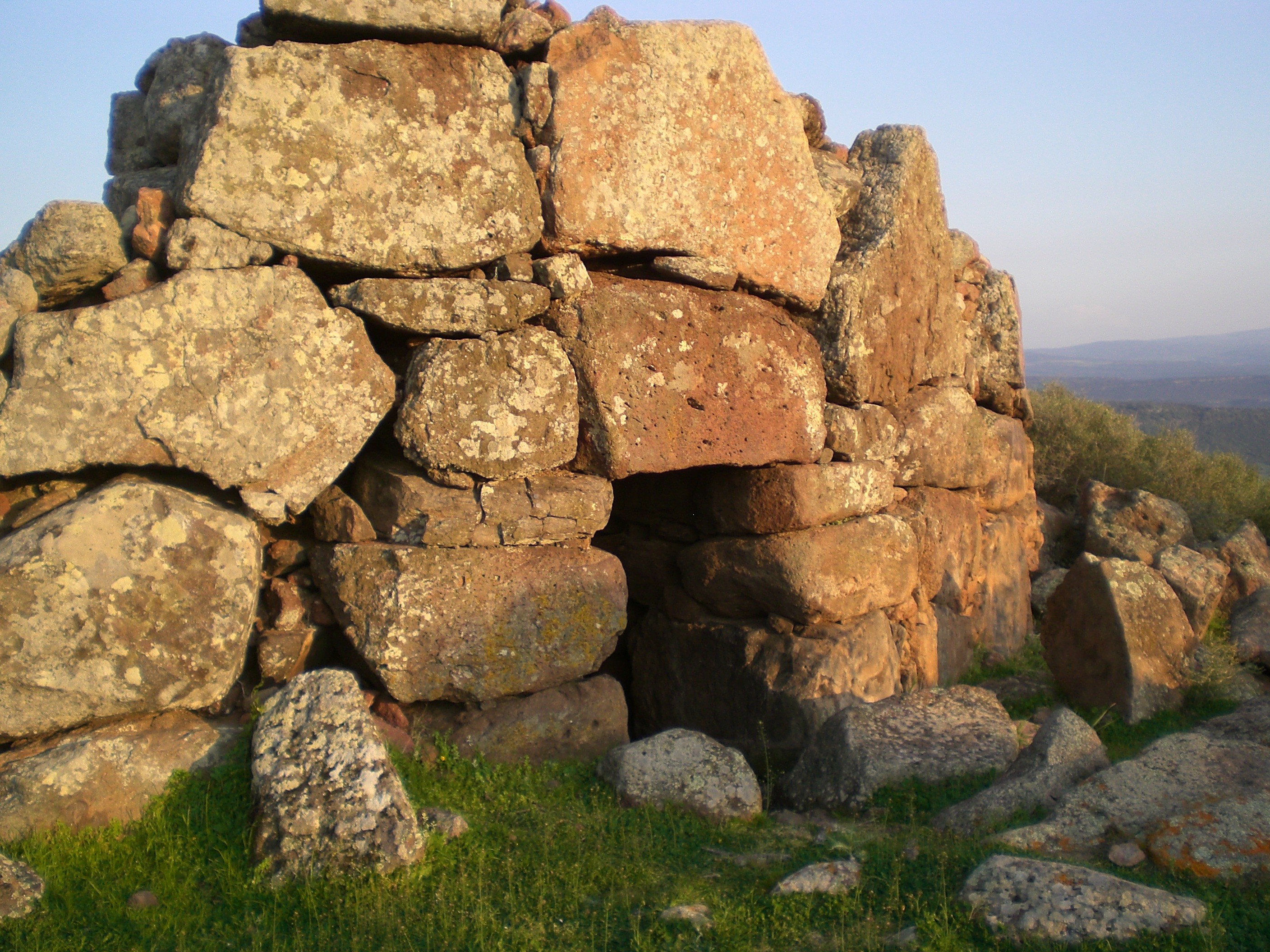
The high plains of Monte Acuto, on the southern slopes of the Limbara range, are home to the remains of defensive fortresses and strategic outposts from early medieval times. Wounded during fierce battles and marked by the passage of time, Monte Acuto Castle sits at 500 metres in the Berchidda region and is a fine example. First documented after the XIII century, it enjoyed its most flourishing period when it was the seat of Giudicessa Adelasia di Torres and of archbishops, prelates and a variety of dignitaries. The castle was vied for first among the guidicati, and then fought over by Pisa and Genoa. It remained a vital structure until the Catalan-Aragonese conquest, after which it began to fall into disuse and declined to its current state. Perched on high, it watched over the roads travelled by convoys along the Mannu river valley, where merchandise was carried towards Terranova Port, modern-day Olbia, and connected with the Upper Gallura.
In order to get an idea of life at the castle you have to get through thick vegetation amongst which you’ll find a variety of pre-Nuragic and Nuragic sites: dolmen and menhir, huts and megalithic walls bear witness to the prehistoric remains you’ll come across along the trails. As you continue your ascent, you’ll see a sort of outpost, a guard tower, round, located a short distance from the fort. The castle’s main body, which seems to have had an elongated oval shape, is home to the remains of the walls. Tiles and bits of ceramic vases were found here too. At the top you’ll find the remains of a square room, the base of the tower (now gone), and next to that a partially interred cistern. From up here you can see the other systems of elevated outposts, each one visible to the other. You will go back to the life at the castle, imagining the chain of coded light signals created using metal items or mirrors that passed from one outpost to the other, or with bonfires when needed during the night.
After your trip to the castle, go and explore the many attractions in Berchidda, a lovely city with houses and neo-Classic palazzi set along narrow streets surrounded by a granite landscape shaped by the passage of time, dotted with oak and cork woods and Lake Coghinas. At Berchidda you can enjoy traditional cuisine, like the suppa cuatta, fine cheeses, sweets made with almonds and Vermentino wine. In mid-August they have the world famous Time in Jazz festival. In the town centre you can visit the church of San Sebastiano and the XVI century church of the Rosario and the wine museum at the feet of Sant’Alvara hill. In the surrounding countryside are prehistoric and Roman remains, like the bridge over the Silvani river.
Nostra Signora di Castro
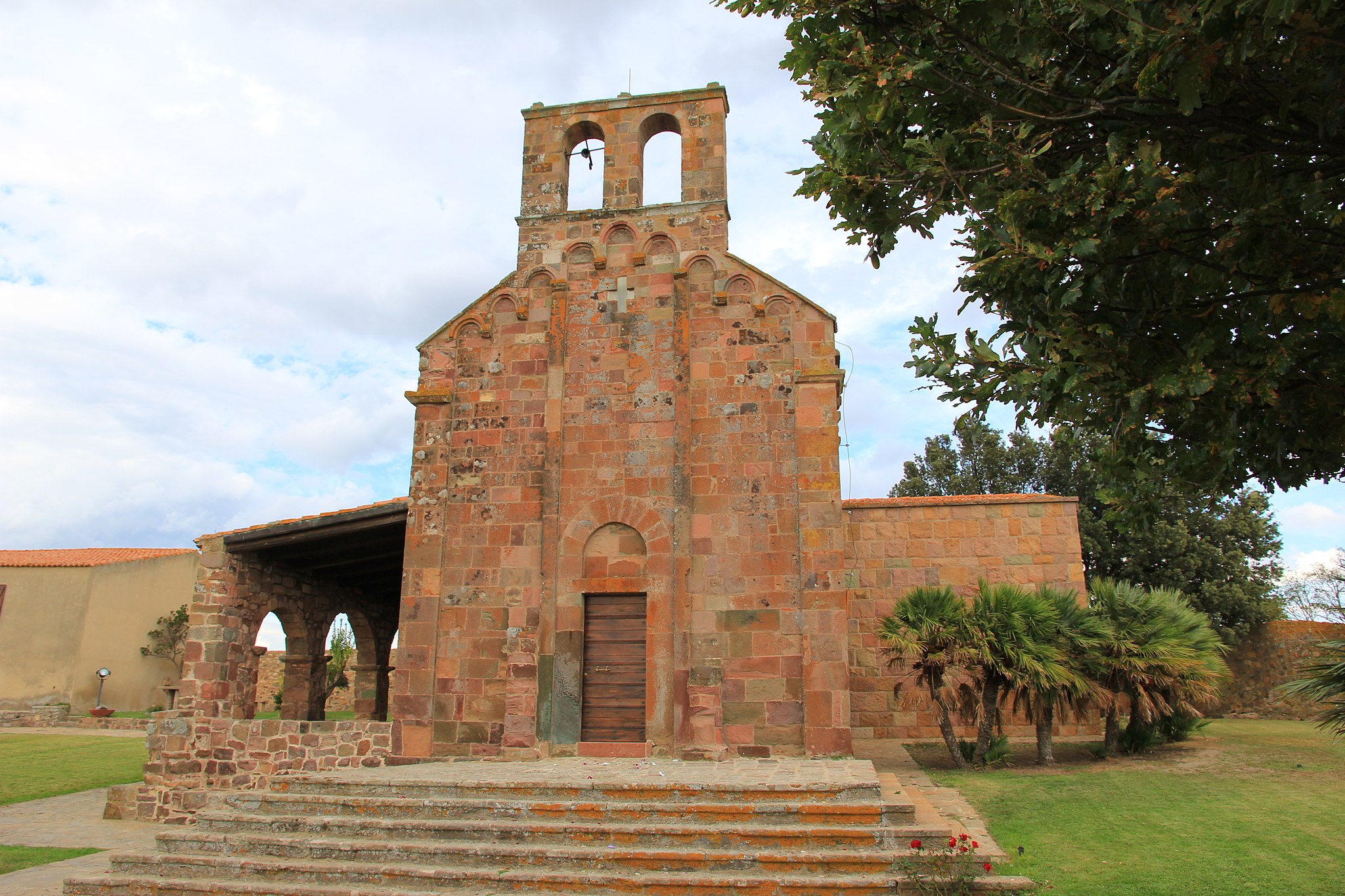
On a high plain on Monte Acuto, one of the most “Romanised” areas in Sardinia, a Roman-Byzantine castrum (castle) and medieval ruins dominate the plain below, home to the Coghinas river and lake. This is the setting around Nostra Signora di Castro, just five kilometres from Oschiri. Going up the hill of the small Romanesque church you will relive the history of the XI and XII century, when it was built between the banks of the lake, the castrum of Luguido, the village and the Castra castle, which lend their name to the temple. It was once the cathedral of the Castro diocese, which was done away with four centuries later, in 1508. No one knows the exact date of construction. The Liber judicum turritanorum claims it was founded by Mariano I di Torres in the XI century, at the same time as the Nostra Signora del Regno in Ardara, whose Romanesque-Lombardian style bears close similarities. Others think it’s consecration was linked to the cathedral of sant’Antioco di Bisarcio in 1164 or 1174.
The area around it has lodging for pilgrims, cumbessias, and a two storey building now used for exhibitions about the history of the sanctuary and the archaeological site. The church attracts many pilgrims, the courtyard comes to life on the Sunday after Easter for the Madonna di Castro celebrations. Once up the five stairs you will enjoy the light reflected by the blocks of trachyte used to make the building. They are graced with gradations of hues of intense pink to dark purple. Two pilasters face the door and divide the façade into three mirrors, each featuring three arches set on decorated bases. Inside is a single 11 metre long and 5 metre wide nave. The semicircular apse has a trussed wooden ceiling. To the left is a great door that was added at a later date. A parchment has survived from the Romanesque altar, now housed in the parish of Oschiri. It features St Restituta, an African martyr whose cult on the island dates to the High Middle Ages. Some graves in the surrounding area date to the same period.
In Oschiri, a town in eastern Logudoro at the feet of the Limbara and in the middle of a valley graced with Mediterranean shrubbery, oak and cork trees, are other religious buildings of the same period as the former cathedral. In the old town, near the parish church of the Immacolata is the Church of San Demetrio, in the countryside are the sanctuaries of San Giorgio, San Pietro, Santo Stefano and Nostra Signora di Othi. Low houses and narrow cobblestone streets are what characterise this rural village, where fine cheese, Vermentino wine and panadas are made. The surrounding area is home to Roman and Byzantine ruins, but also prehistoric remains like the 70 domus de Janas at the necropolis, the mysterious complex of Santo Stefano and 60 Nuragic settlements. The relics are on display at the MuseOs.

Biru 'e Concas
Right in the middle of the island is a place that exudes spirituality and provides food for thought. You will notice it when you visit the most extraordinary grouping of menhir in all of the Mediterranean basin. It is the archaeological park of Biru ‘e Concas, which literally means ‘trail of the heads’, commonly referred to as the Sardinian Stonehenge. Located a few kilometers from Sorgono, the town is nestled in the woods of the Mandrolisai region, the westernmost point of the Barbagia. Inside you will see two hundred huge sculpted boulders that have been worn down to an oval shape. The oldest, proto-anthropomorphic, date to the late Neolithic (3500-2800 BC), while the more elaborate stylized ones, anthropomorphic, date to the Eneolithic (2700-1700 BC). In essence, the megalithic monuments are elongated sacred rocks that were once embedded (perdas fittas) and served as phallic symbols for fertility to evoke the Mother Goddess, a primordial Nuragic divinity that somehow echoes the mythical and heroic figures of the forefathers.
Nestled among pine, chestnut and hazelnut trees and still spread about as they were in origin, you will see some of these forms of prehistoric cultural art alone or in pairs, trios, other times set in circles or rows of twenty. Thirty of them are lined up in double rows, like warriors defending an area of worship, another 170 are flat on the ground pointing west, towards the sunset, broken up, the result perhaps of the holy war against the idolatry of the Barbagians declared by Pope Gregory in the VI century during the Christianisation of inner Sardinia. The two hundred menhir discovered in the late XX century were remarkably important for Barbagia, who had only counted some fifty before the big find. And they are all concentrated within an area of five hectares, very near the famous Sanctuary of San Mauro, a complex erected by Benedictine monks as though they were attempting to exorcise the holy, phallic granite statues all lined up along the transhumance routes towards the plains. Who were the makers of the great stones? Is there some connection to Celtic or Breton megalithic tradition, or where they autochthonous, original? And why such a vast concentration of menhir near Sorgono? These are questions still being asked and the object of debate among Sardinian archaeologists.
Not far from the menhir is a hidden spring that could indicate a well for the worship of water, the confirmation of an intertwining of styles and architecture between the Neolithic and Bronze Ages. All around are remains of round huts, perhaps a Nuragic village, while further on are two nuraghe, one with a corridor, the majestic Talei, the remains of a Giant tomb and a dolmen.

Villa Piercy
An estate dating to the late XIX century has, over the decades, morphed from being a farming estate to a nature oasis with a verdant garden featuring a wide variety of plant species. Set over four hectares among the hills of Marghine and the Campeda high plain, it is the legacy left by a Welsh engineer who came to Sardinia in 1863 to help design the (Cagliari-Olbia and Chilivani-Porto Torres) railroad line that was being built by the Italian-English company known as the Royal Sardinian Railroad Company. The celebrated figure was Benjamin Piercy, a rich and powerful man who fell in love with Sardinia, where fortune smiled on him until he collapsed during a banquet and died in 1888. In exchange for the work on the largest public works done (until then) in Sardinia he received several terrains in the Bolotana area. There he invested more than a million lire, a vast fortune in those days, to construct a modern company that was defined a “monument to agriculture.”
On the premises of the Badde Salighes estate (the Valley of the Willows) he built a majestic English style villa, his residence, where he lived in luxury and lavishly entertained fellow Brits and Italian friends. They say that Umberto of Savoy, the soon to be King of Italy, was a frequent guest. The rural three storey, square residence was built between 1879 and 1882. The building was topped with four towers covered with metal domes topped with an iron pinnacle. Inside the residence you will see paintings embellishing the ground floor rooms. After a 2010 renovation it was opened to the public along with the gardens, something of a botanical garden that reflected Piercy’s love of nature. Strolling among maples, holly, chestnut trees, holm oaks and downy oaks, you will also admire exotic species, the legacy of the British engineer's travels to various parts of the world. In the garden there is a libocedro, Himalayan tuja, Spanish fir, Balearic box, Lawson cypress and other rare plants. The park is also in English style, with a swimming pool surrounded by trees just a short distance from the villa.
Piercy’s legacy was left to his son and then expropriated in the mid-XX century. It included the lovely villa, the garden and even a small town, Chilivani (part of Ozieri), an important stop along the railroad. The Mediterranean’s largest animal husbandry concern was begun on the thousand hectares of his estate. Many workers worked and lived with their families in the Badde Salighes and Padru Mannu, where a dairy equipped with modern technology was built. It stands to good reason that Piercy’s name is closely linked to the nascent intensive agriculture and animal husbandry of Bolotana, a town surrounded by fertile fields and steeped in rural traditions, including the art of carpet weaving.
The Monte Baranta Megalithic Complex
Huge boulders create an impenetrable 100 metre long and 3 metre high wall. It’s the great wall of the fortress built by pre-Nuragic settlers to defend their wide fertile valley, and it is one of the most remarkable and massive settlements from the III millennium BC in all of the Mediterranean basin. It sits on the slopes of Mount Baranta just 3 kilometres from Olmedo, an important industrial/agricultural town in the heart of the Nurra region. Also known as su Casteddu, the fortress dates to the Copper Age (2500-2000 BC) and was constructed with massive megalithic structures following the natural contours of the terrain. Protected by walls, the fortress is comprised of a wall-tower and a group of rectangular huts. Everything here is imposing, built with large rocks and boulders: even the horse-shoe shaped tower is huge, six and a half meters thick and nine metres high. It sits perched on an outcrop of trachyte over the valley below.
At the far end of the wall is a sacred area with a megalithic circle where worship and sacrifices were carried out. It is made up of 80 standing straight up in a 10 metre wide circle. Between the rocks are characteristic menhir, one split into two pieces, another whole lying on a rocky raise, perfectly polished. East of the wall you will also find the remains of a small village. Seven large, rectangular, multi-room dwellings have so far been identified.
The Monte Baranta megalithic complex was a busy place, bustling with the military, religious and civic activities of the pre-Nuragic people who lived there. You can feel a touch of insecurity in the air, a fear of attack from the outside that urged the settlers of the Monte Claro culture to seek protection inside an impenetrable construction.
Just after its construction, Su Casteddu was lived in for a relatively short period of time, as shown by the paucity of period relics found during digs and the fact that the area of worship remains unfinished. The site was repopulated during the Early Bronze Age and then, more sporadically, during Nuragic and Roman times. Proof of the vitality and density of the population can also be seen in the surrounding area, in the Olmedo region that counts some twenty nuraghe, including those of Mount Ortolu (a corridor construction), Masala (tholos) and sa Femina, remarkable for the fact that is was built in town.
Monserrato
Monserrato lies in the southernmost part of the Campidano province, near the Molentargius-Saline Regional Park, within the metropolitan city of Cagliari. Monserrato is a city with 20,000 inhabitants, whose inhabited area, through the municipality of Pirri, is seamlessly joined with that of the capital, from which it became independent via a referendum in 1991. In Sardinian, it is known as Pauli (swamp), already the name in medieval times. It then became Paùli Pirri. In 1881, the name changed to Paùli Monserrato. Just seven years later, via royal decree, this became Monserrato, deriving from the Madonna of Montserrat.
The old town is characterised by narrow streets overlooked by typical Campidanese houses in Ladiri (mud-brick), with Spanish loggias and wooden portals. The winemaking tradition lives on, as is testified by Sagra della vendemmia (Grape Harvest Festival) at the end of September. Its communal winery is the oldest in Sardinia (1924), with nuragus, monica, moscato and nasco wines produced here. From the end of the 20th century, construction was remarkable, with new and modern neighbourhoods being built. Along the road to Sestu, the Cittadella Universitaria was built, being a vast complex connected to the city by the Ponte Strallato (bridge) on the state road 554, the only one on the island. Inside the citadel is the Museo Sardo di Antropologia ed Etnografia (Sardinian museum of anthropology and ethnography). The other main exhibition is the Museo delle Ferrovie della Sardegna, dedicated to the construction and operation of historic stations and railway lines, with an area in which old-time steam locomotives and vintage carriages are kept. There is also the Trenino Verde, a tourist service that departs from Monserrato and heads to Mandas and Isili.
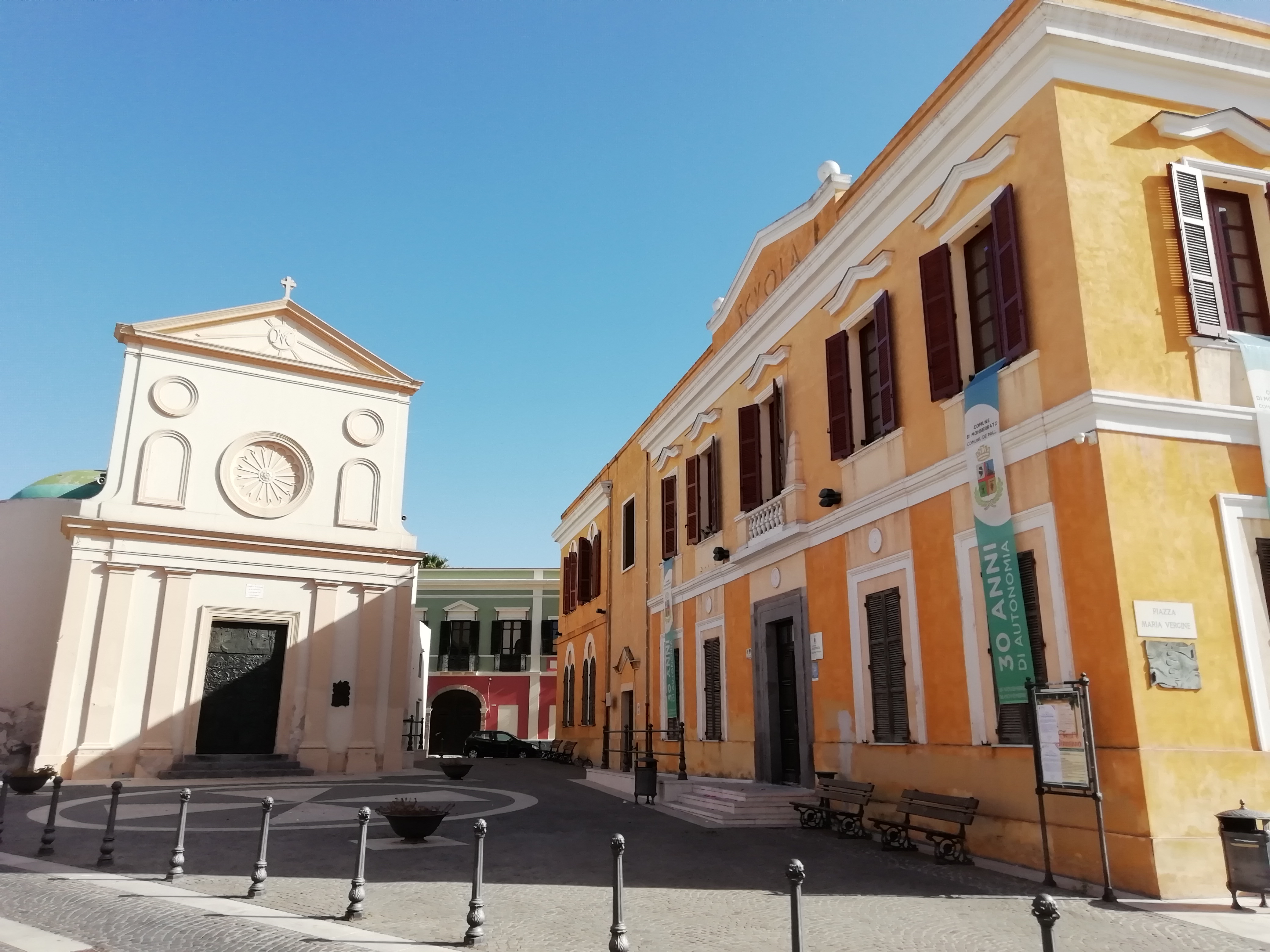
To be admired in the heart of the city is the parish church of Sant’Ambrogio (whose patron saint is celebrated on 7th December), in late Gothic-Catalan architecture, built between the late-15th and early-16th centuries. Whilst there was originally one nave, today the interior has three, with the central one being wide and tall, composed of pillars that unite in ogival arches. The side aisles are barrel-covered with six chapels on each side. On the high altar in gilded wood and polychrome marble (1705), scenes of peasant life and Christian symbols are carved in bas relief. The baptismal font is the work of Catalan craftsmen of the 15th century. Particular and unique in Sardinia is the conformation of the diagonal buttresses of the façade. The earliest information on the Church of Santa Maria de Pauli dates back to the 12th century. Its Greek cross layout is surmounted by a 19th-century dome. It is only open in September to celebrate the Virgin of Montserrat, just prior to the harvest rituals. Within are housed works by artist Gianni Argiolas, including the ‘Painting of the Procession’. Another illustrious local is painter Cesare Cabras (1886-1968), whose works are on display inside the town hall. A stand-out amongst the Monserrato traditions is the luxurious traditional women’s clothing.
Gonnosnò
It is located at about 200 metres above sea level at the food of the Giara plateau, within a naturalistic context of great environmental value. In the upper Marmilla, today it boasts around 800 inhabitants. As the toponym (gonnos, high ground) indicates, Gonnosnò, is at the centre of a hilly area that also includes the fraction of Figu, so called presumably due to the abundance of fig trees. In 1947, the municipality was named Figu-Gonnosnò, assuming its current name as of 1964. The town and township are mentioned in the books of Sardinian history due to being the first to have established a Monte Granatico (1678). It is not by chance that the economy is agricultural-pastoral, even if craft plays an important role.
Amongst the artistic excellences of the village is the parish church of Sant’Elena Imperatrice, with a bell tower dating back to 1645, topped with a small dome. Until the 1970s, it was also covered with 800 coloured tiles (since removed). Inside are two chapels dating back to 1690: the Madonna del Rosario and San Basilio, in which there is a wooden altar embellished with carvings and gildings. The baptismal font is from the 17th century whilst the main altar is from the 19th century, with a polychrome marble antependium from the 1700s. The patron saint is celebrated in mid-August. Perched at the top of a hill since 1624, the Chiesa di Figu is dedicated to the Nativity of the Virgin Mary. The main door is adorned with a contoured and decorated architrave. The interior has a single nave with a wooden roof. It houses three very ancient statues: the Resurrection, Virgin of the Rosary and Sant’Antonio Abate, in whose honour bonfires are lit in mid-January. The other celebrations are held for San Sebastiano (20th January), San Salvatore (the first Tuesday after Easter), San Bernardino da Siena and San Priamo (mid- and late-May) and San Vitalia (early October).
The territory of Gonnosnò is rich in Nuragic remains: the temple-well of San Salvatore, constructed in worked stone blocks at about 300 metres from the spring, the four Tombs of Giants of Is Lapideddas and a dozen single-tower Nuragic structures scattered throughout the territory. The most interesting is the Nuraghe Nieddiu on a protruding spur of the Giara, perhaps an imposing defensive structure, made of roughly-shaped basal blocks that have been carefully positioned. The tower has a diameter of 11 metres and is currently three metres high.
Magomadas
Magomadas is one of the Borghi Autentici d’Italia (authentic villages of Italy) and is included amongst the Città del Vino (cities of wine), which is not surprising given that it is part of the ‘Strada della Malvasia di Bosa’ (Malvasia di Bosa road). Magomadas is a small town with less than 700 inhabitants of Planargia sub region that unfurls along the top of a hill with a panoramic view of the Modolo valley on one side, and the sea with kilometres of evocative coastline on the other. The picturesque village is characterised by ancient houses and surrounded by the warm colours of the vineyards that extend along the fertile countryside that has always marked the agricultural-pastoral traditions and economy of the community. As proof of this, in a 16th-century building in the historical town centre, there is the Museo del Vino (wine museum), providing a historical excursus on winemaking in Planargia, and a wine shop with wine tastings paired with typical dishes. Also in the town is the parish church of San Giovanni Battista, built in the early-17th century in late Gothic-Catalan style (subsequently restored). The single nave is interrupted by a triumphal pointed arch in red trachyte that leads into the presbytery. Of particular value therein are three 18th-century altars. Also worth a visit is the Chiesa di Santa Croce, dating back to late-14th/early-15th century, housing a beautiful wooden Christ with outstretched arms, the protagonist of the Rito de s’Iscravamentu during Holy Week.
Amongst its attractions, the small town also boasts a stretch of coast with beautiful white beaches, rugged cliffs and pristine waters of deep blue. In the hamlet of Santa Maria del Mare, three kilometres from the village, is the church of the same name that dates back to 1635. Once known as s’Stella, two celebrations take place here in the third week of May and in August - a procession and concerts in the piazza - being the most adored by the Magomadese community and with many visitors in attendance thanks to the Sagra della Malvisia (malvasia festival) also taking place.
The territory has been inhabited since the Nuraghic age, as evidenced by the remains of a sacred well in the locality of Puttu and various Nuraghic structures, with the Nuraghe Sebe on the outskirts of the town ‘strategically’ dominating the surrounding valley. The original settlement was built during the Punic period, as can be determined by the toponym magom adasht or, ‘new city’. The ancient Carthaginian settlement near the sea transferred to a hill near the current ruins of the Chiesa di San Nicola for means of defending the people against Saracen raids in the 14th century. Around 1388, the village was the heart of the island, where the peace treaty between Eleonora d’Arborea and the King of Aragon was stipulated.
Mogorella
It rises at the base of the evocative Mount Grighine in a luxuriant area dominated by the Monte Arci park and covered with Maquis shrubland (cistus, strawberry trees, holm oaks, lentisk, myrtle), downy oaks and cork oaks, being the habitat of numerous animal species. Mogorella is a very small town of about 450 inhabitants in the upper Marmilla region, in the province of Oristano. Its toponym, officially certified in 1546, indicates a ‘small hill’. The patron saint of the village is San Lorenzo, celebrated twice a year. Firstly comes a procession on 20th May accompanied by folk groups and knights, in conjunction with the Sagra della Pecora (sheep festival), with the traditional dishes enjoyed together with local wine; and then in mid-August there are religious rituals and civic events.
Its territory has been inhabited since prehistoric times, as can be proven by seven Nuragic remnants, the great attraction of the area. Of particular importance is the Protonuraghe Friarosu, which stands on a 400-metre-high limestone plateau near the entrance to the village. It has a ‘corridor’ structure, of which seven stone rows remain, with a height of five metres. This represents, especially in the architectural context of the two internal sub-elliptical spaces, the ‘connecting link’ between the archaic Nuragic typology and the more evolved tholos (false dome) variety. It dates back to between ancient and middle Bronze period, as confirmed by the numerous ceramic finds discovered, including plates, pots, bowls with rims, hemispherical and streamlined bowls, narrow-mouthed ollas, all materials from the Bonnanaro culture, used both in Proto-nuragic and in the Nuraghe a Tholos. Another important prehistoric remnant is the Nuraghe Mannu, being the best preserved of all. Neighbouring these are the Nuraghi Bau Tentu, consisting of two circular structures joined by corridors, and the Luas, originally consisting of three overlapping rooms connected by a staircase. Of the Nuraghe Cuccuru, one kilometre from the inhabited town centre, there remains a tract of the perimeter walls. The Aresti, Pastoris and Ruina Tassa are of single-tower type, just like the Nuraghe Fenugu, around which a large village presumably stood. The discovery of a precious and rare bronze sculpture, the Gladiator of Mogorella, today displayed in the National Archaeological Museum of Cagliari, proves that the area was occupied in Roman times. At almost eight centimetres, the statuette depicts a secutor, who was opposed to the Reziario and had to dodge fearful weapons. The head is covered by a helmet, whilst the raised right hand holds a sword (of which remains the hilt), and the left one a shield, now lost.