
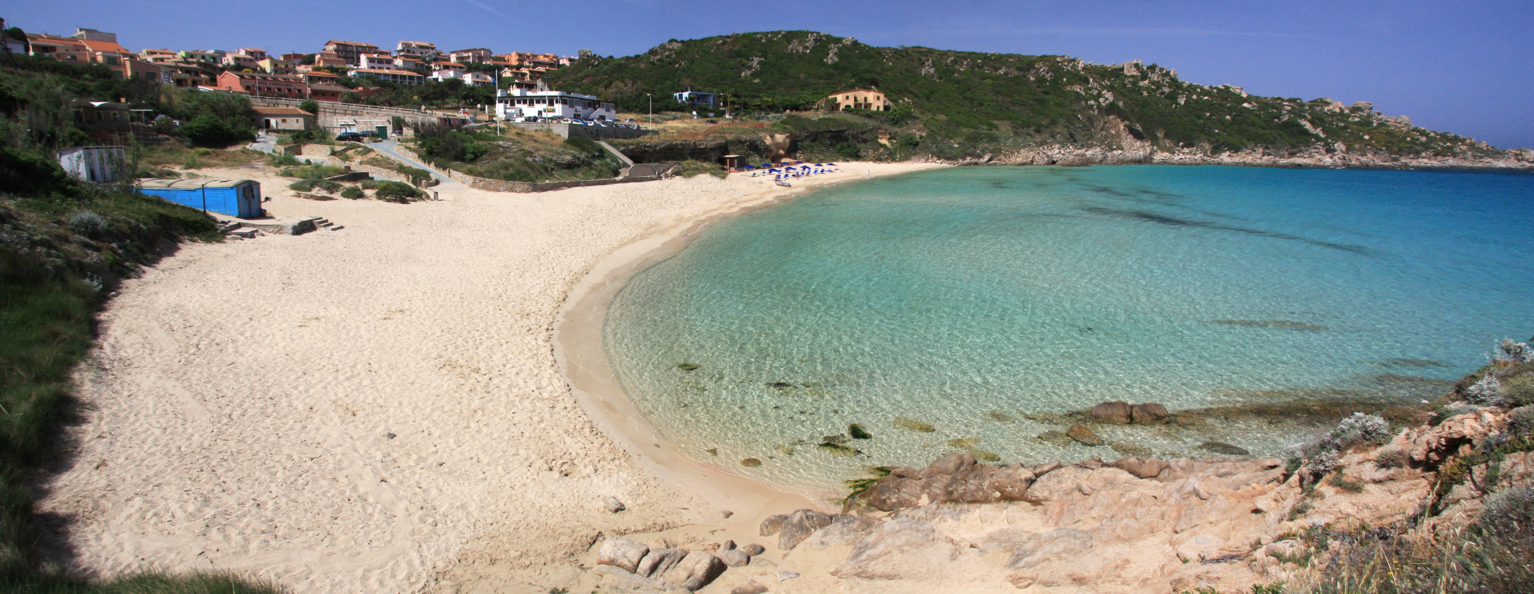
Rena Bianca
A paradise with bright colours and clear waters only a short walk from the town centre. The Rena Bianca is the city beach of Santa Teresa Gallura, a cove 700 metres long, with shallow waters and thin, soft, white (as its name states) sand that has pink reflections on the shoreline, thanks to minuscule coral fragments. You can see it from the top of a hill where the main piazza of this seaside town opens up, and you will be excited to get down there, at the bottom of a 300-m descent and a set of stairs, which you will climb down all at once.
The beach is framed by cliffs and perfumed by the Mediterranean scrub. The Municca peninsula and the Municchedda islet protect it from the western wind, while the promontory where the 16th-century Torre di Longonsardo stands protects it from the eastern wind. The fresh, silver waters awe visitors with their thousand hues from blue to turquoise and green, and are always incredibly clear. The Rena Bianca has been awarded the Blue Flag by the Foundation for Environmental Education due to the quality of its waters, immaculate coasts and services that provide tourists with comfort and safety. Beloved by divers and children, the beach is accessible to disabled people and is rich with services, wide parking area and restaurants. Beach resources rent beach equipment, sunbathing chairs and underwater exploration.
There are other gems to be explored in the Santa Teresa territory: to the east of the town, in the northernmost tip of the island, there are picturesque Cala Sanbuco, beautiful Cala Balcaccia and La Marmorata, wide and well equipped. Towards Palau, the natural granitic pools of Valle dell’Erica, the very long Porto Liscia-Sciumara, home of windsurf, and the enchanting peace of Conca Verde. To the west, there is Capo Testa, a peninsula-promontory connected to the mainland by a strip of sand that creates two beaches, Rena di Ponente (or Taltana) and Rena di Levante. In the same promontory, enjoy the spectacular Valle della Luna and Cala Grande. Near the rocky coves of Santa Reparata and, along the coastal road to Castelsardo, lovely Lu Pultiddolu, from which you can get to the dune of Rena Majore, in the Aglientu territory.

Olbia
The ancient Greeks called it olbìa, ‘happiness’. It is the gateway to the island and the driving force behind the economy of the Gallura area. Vestiges of the past dot the city. Many of the relics archaeologists have brought to light, like the 900 gold coins, are now safeguarded at the Archaeological Museum on the islet of Peddone. The Punic-Roman, and later Christian, necropolis includes 450 tombs and comprises the museo della necropoli, located at the feet of the altar of the beautiful Basilica di San Simplicio. Built between the late XI and early XII centuries, it is this region’s most important church, as well as being the oldest vestige of Christian presence on the island. The patron saint is celebrated in mid-May with the heartfelt Festa di San Simplicio, when the faithful, in costume, take part in a procession. The celebrations include the palio della Stella joust. You will also be struck by the Baroque architecture of the Church of San Pablo, with its brilliant ceramic dome. Traces of man’s presence here date to 4000-3500 BCE in the form of dolems, menhirs and circular mageliths. Some 50 Nuragic settlements date to the Bronze Age, including the Tomb of the Giant of su Monte de s’Aba, the riu Mulinu nuraghe, the village of Belveghile and the sa Testa sacred well. The Phoenicians came here in the VII century BCE, followed by the Greeks. The first stable settlement was Punic (V-IV century BCE). The Carthaginians surrounded the settlement with walls and towers, remains of which you can still see on Via Torino. The town became the east coast’s largest city when the Romans took over. Under them, Olbia got paved roads, thermal baths, and a forum, traces of which remain near the palazzo comunale, as well as an aqueduct in Tilibbas (I-II century CE). Then there are the remains of the s’Imbalconadu villa (1st century CE). In 1999 twenty-four shipwrecks came to light, some of which had been sunk by the marauding Vandals.
The city looks out over a spectacular gulf that encompasses the Tavolara Marina Area. It is the access point to the exclusive Emerald Coast. The seemingly endless Olbian coastline is home to a myriad of turquoise inlets from which to choose, among them are the four beautiful bays of Porto Istana, within the confines of the protected area, the Lido di Pittulongu, especially La Playa, a local favourite. Next to it, one after the other, are the beaches of Squalo, Pelicano and, further north, Mare, Rocce and Bados, which borders on the Golfo Aranci. Another long stretch of shoreline follows, offering visitors sandy or pebbly white beaches and crystalline water at Porto Rotondo, Marina di Cugnana and Portisco, in particular, sa Rena Bianca. Southwards, headed towards San Teodoro, are the yellow-ochre sandy shores of Lido del Sole, Le Saline, Bunthe, Li Cuncheddi and Punta Corallina. To this fascinating array of sea and archaeology add fine food in the form of Olbian clams, to be paired, of course, with a glass of vermentino.
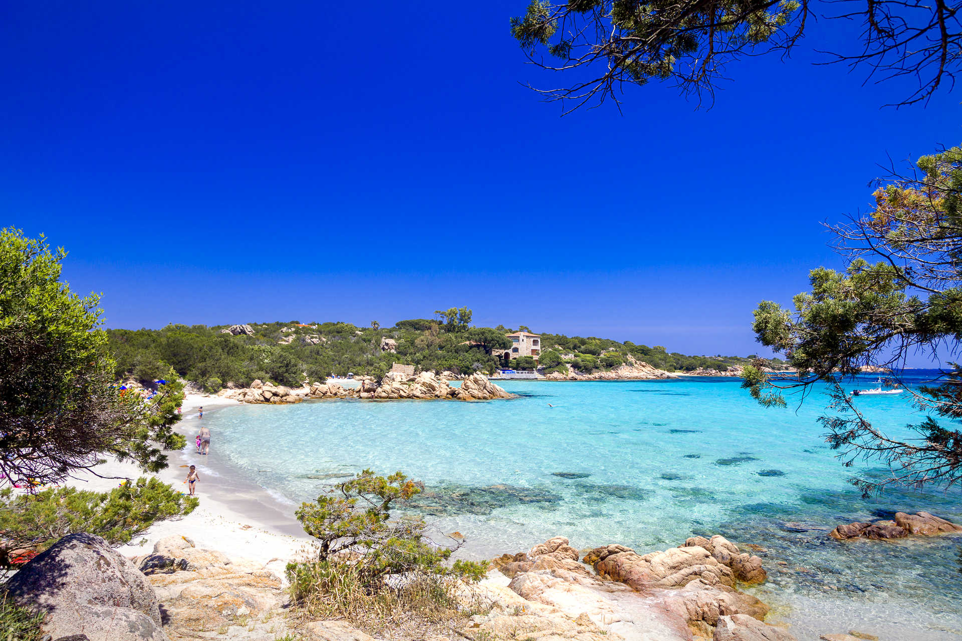
Arzachena
Breathtaking landscapes, beaches of incomparable beauty, hills covered with vineyards and archaeological treasures. A vast and unique territory characterizes Arzachena, a small town in the Gallura region, 25 km from Olbia, with a population of 14 thousand residents in the wintertime. There are the same number of beds at the hotels in a locality in constant demographic and economic growth and famous for the Costa Smeralda, a symbol of elite tourism that emerged in the 1960s. Things that contribute to its marine prosperity are granite mining, a distinctive feature of the architecture in the old town centre, and famous wineries producing Gallura’s Vermentino wine. Until the 17th century, the little residential area of Arzachena was just a small group of little houses located around the church of Santa Maria. Today, it is a triumph of colours: little squares and facades of pink granite and white stone, flower-filled views and green spaces dotted with boutiques, delights and artisan products. Around the little town, there are the typical stazzi, rural settlements converted into B&Bs and agritourism facilities, as well as numerous districts in a ‘young’ Municipality established in 1922. The largest ones are Abbiadori, Baja Sardinia, Cannigione, once a fishing village and now a tourist village, and Poltu Quatu, a modern marina in a ‘fiord-like’ cove. Then there is Porto Cervo, an architectural 'gem' that blends with the landscape and the most exclusive holiday location in Sardinia, brimming with yachts and celebrities in the summer, as well as aperitifs and elegant evenings, scintillating nightlife, luxury hotels and villas, glamorous restaurants and clubs, sailing and golfing events.
All around, there is wild scenery, like Capo Ferro, and countless Costa Smeralda beaches. Cala Granu stands out, as does the ‘crescent-shaped’ expanse of soft white sand of Grande Pevero. Behind it, there are the well-kept greens of the Pevero Golf Club and opposite, there are the islands of Li Nibani. A destination very popular with celebrities is the Piccolo Pevero, the long half of its ‘big brother’. Then there are the delightful coves of the Romazzino bay. Poltu di li Cogghj was the Aga Khan’s favourite beach: it is known as the Prince’s Beach and is a stretch of fine sand divided by pink rocks. On the opposite side of the Costa Smeralda promontory you will be entranced by La Celvia, with fragments of shells and quartz powder, overlooking Cala di Volpe, a little harbour where scenes from ‘Agent 007- the spy who loved me’ were filmed. Further South, behold the spectacle of the most beautiful Costa Smeralda beach, Cala Capriccioli. The landscape is enriched by the little islands in the Arcipelago di La Maddalena National Park: Soffi, Camere and Mortorio. In the distance, you will see the shoreline of Liscia Ruja: coves lit by the white brushstrokes of sails. The largest beach is the scene, during the 15 August Ferragosto holiday, of a great celebration. Closing the coast, is the, evocative and secluded La Suareddha. Other masterpieces scattered throughout the 90 km of the Arzachena coast, include the ‘silky’ stretches of Tanca Manna and the splendid Ea Bianca (or Cove of the Junipers). Near La Sciumara there is Padula Saloni, a pond populated by herons, black-winged stilts and western marsh harriers and a bird watching destination.
Arzachena is not just sea and high society, but it has a fascinating past that made a permanent mark. In the old town centre there is the monti incappiddhatu (mountain with a hat), a rock known as the Mushroom, shaped over time in an original way and used since the Recent Neolithic Age. A walk in the countryside you will allow you to discover a vast archaeological park. The oldest and most famous site is the Li Muri necropolis (late 4th millennium BC), known as ‘grave circles’. Among the evidence of the Bronze Age, the nuraghe Albucciu, a ‘corridor-type’ building, hidden in a wild olive thicket. The remains of the village are around the nuraghe and 80 metres away there is the tomba Moru, the result of the transformation of an allée couverte into a Tomb of Giants. Nearby, you will find the little temple of Malchittu, the ‘theatre’ of ritual ceremonies. Not to be missed is La Prisgiona in the valley of Capichera, consisting of trilobed nuraghe and a village of approximately one hundred huts. To conclude the archaeological tour, there are two Tombs of Giants built in multiple phases between the Early and the Intermediate Bronze Age: the tomb of Coddu vecchiu with a four-metre high stele, and the famous tomb of Li Lolghi, made entirely from granite, with a long burial chamber and a long exedra, respectively 27 and 26 metres in length.
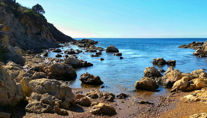
Cala Greca
Located in the easternmost part of Capo Figari, in the territory of Golfo Aranci, Cala Greca is a small beach of pink stones and rocks, facing east and hidden by limestone cliffs overlooking the sea. The bay is located inside a nature reserve and can be reached on foot from the nearby Cala Moresca, an enchanting beach where the road ends.
Cala Greca has shallow waters and a pebbly seabed and is surrounded by dense Mediterranean scrub. Nearby, you’ll find the unusual rock of ‘Mamma Chiatta’, named that way because it resembles an overweight, elderly lady. The beach is cosy and without services and it is frequented by diving enthusiasts because of its rich seabed. There is a centre that provides the necessary equipment for lovers of water sports.
Behind Cala Greca, there is a small valley that can be reached via land. It slopes towards the sea and conceals a small cemetery known as the ‘cemetery of the English’. Inside it, there are thirteen tombs but, despite the name, only one English sailor from the ship named Vulcan is buried there, while on the northern side, there is a marble plaque, placed there in 1891 by the crews of the Navigazione Generale Italiana, an Italian shipping company, in memory of the sailors who died in the shipwreck of the Ligurian sailing ship Generoso II and were buried in 1887. The other tombs are of sailors from Golfo Aranci, whose names have been lost and who are celebrated every year.
Cala Greca is part of a nature reserve, namely the promontory of Capo Figari, which is dominated by an ancient lighthouse 350 metres above sea level, a unique Mediterranean habitat, to be discovered on trekking itineraries. You will reach the top after visiting other splendid coves of Golfo Aranci, Moresca and del Sonno. You can also dive down to the seabed full of life and the mysterious caves of Punta Filasca.
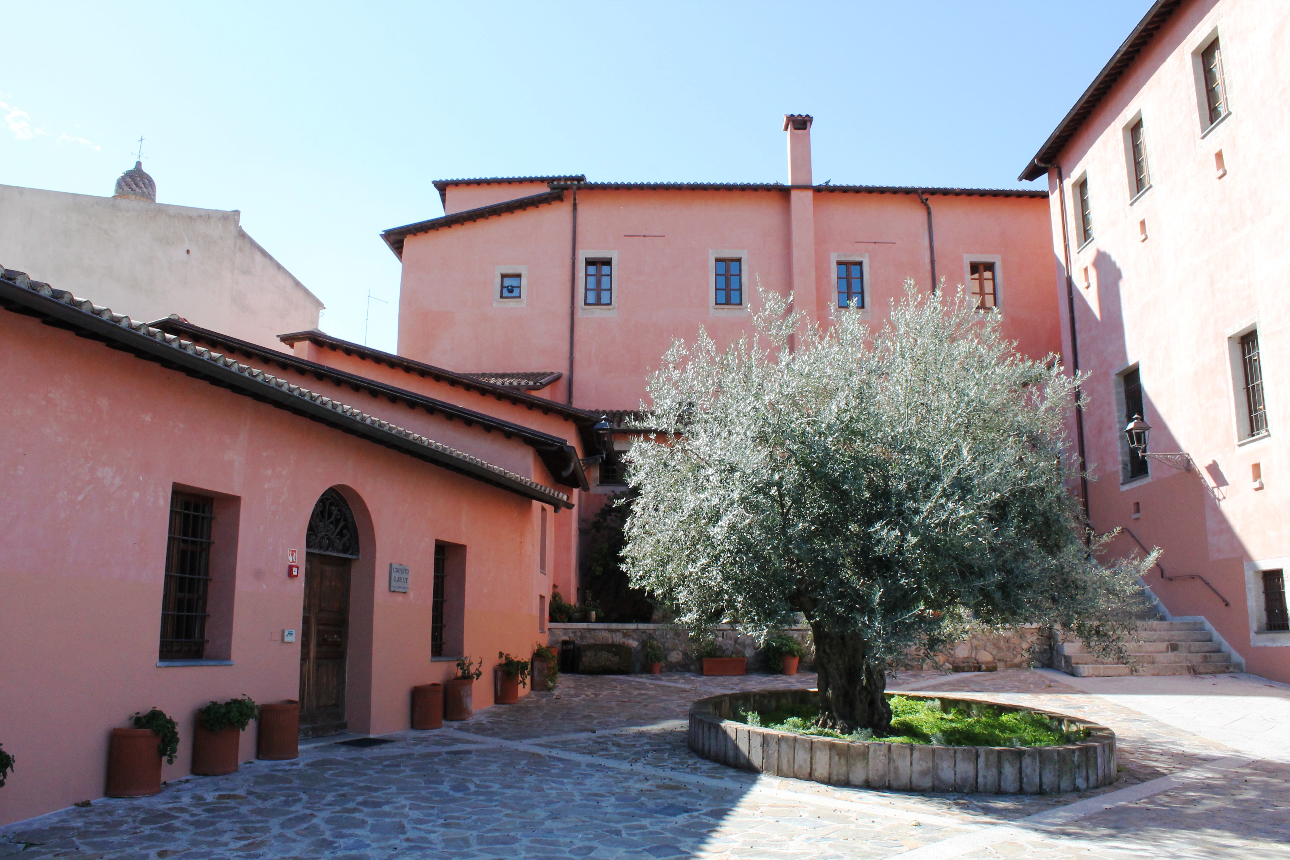
Civic Archaeological Museum of Ozieri
It contains finds discovered in a place that is fundamental for Sardinian prehistory. Furthermore, in its ‘treasure’, there is also one of the main collections of ancient coins of Sardinia. The Civic Archaeological Museum of Ozieri is located in the historic centre and is also known as the ‘Museum of the Poor Clares’ or ‘Convent of the Poor Clares’ because, for almost a century and a half, from the mid-18th to the late 19th century, the building hosted a community of Poor Clare nuns from Orosei. It is dedicated to the archaeology of the Ozieri territory, with objects dating back to the Palaeolithic era, covering a period of time that reaches the modern age. In particular, you can admire the finds from the Cave of San Michele that was important to the point of giving its name to the first prehistoric cultural facies, of which there are widespread traces throughout Sardinia.
Among the various ceramics dating back to the San Michele culture, corresponding to the recent Neolithic Age (3500-2900 BC), a piece that stands out is the famous Pyx, a pot decorated with engravings in the shape of bull horns, very similar to those found in several Domus de Janas in the territory. You will find it in Room 1, dedicated to prehistory. In Room 2, you will find artefacts dating back to the Nuragic age: ceramics, bronzes, stone utensils and votive objects, such as swords and incense boats. Moving on to Room 3, you will find the historical era, where you can see artefacts from the Punic and Roman ages, while Room 4 contains jewels, ceramics and lithic elements from the Byzantine and medieval periods. The numismatic collection can be found on the second floor, divided into another four rooms, where around six thousand coins are on display. Here too, a chronological criterion has been adopted: the various rooms contain, in order, Greek, Punic and Republican coins; Imperial coins; late Roman and barbarian coins; lastly, medieval, Spanish and Savoy coins. On this floor, there is also an ethnographic section and the conference room. The museum organises events, temporary exhibitions, educational workshops and training activities.
Once the visit is over, you can go to the site from which the artefacts of the San Michele culture originate. The cave of the same name is located south of the town and about sixty metres of it can be visited. You will see stalactites and calcite alabaster duricrusts and you’ll be able to imagine the ancient inhabitants of five thousand years ago, who frequented the cave for their cults or to bury their deceased.
Another monument not to be missed in the Oziero area is the Basilica of Sant’Antioco di Bisarcio. To reach it, you’ll need to travel about 15 kilometres and take a leap in time of four thousand years compared to the cave, admiring one of the most captivating medieval churches on the island.
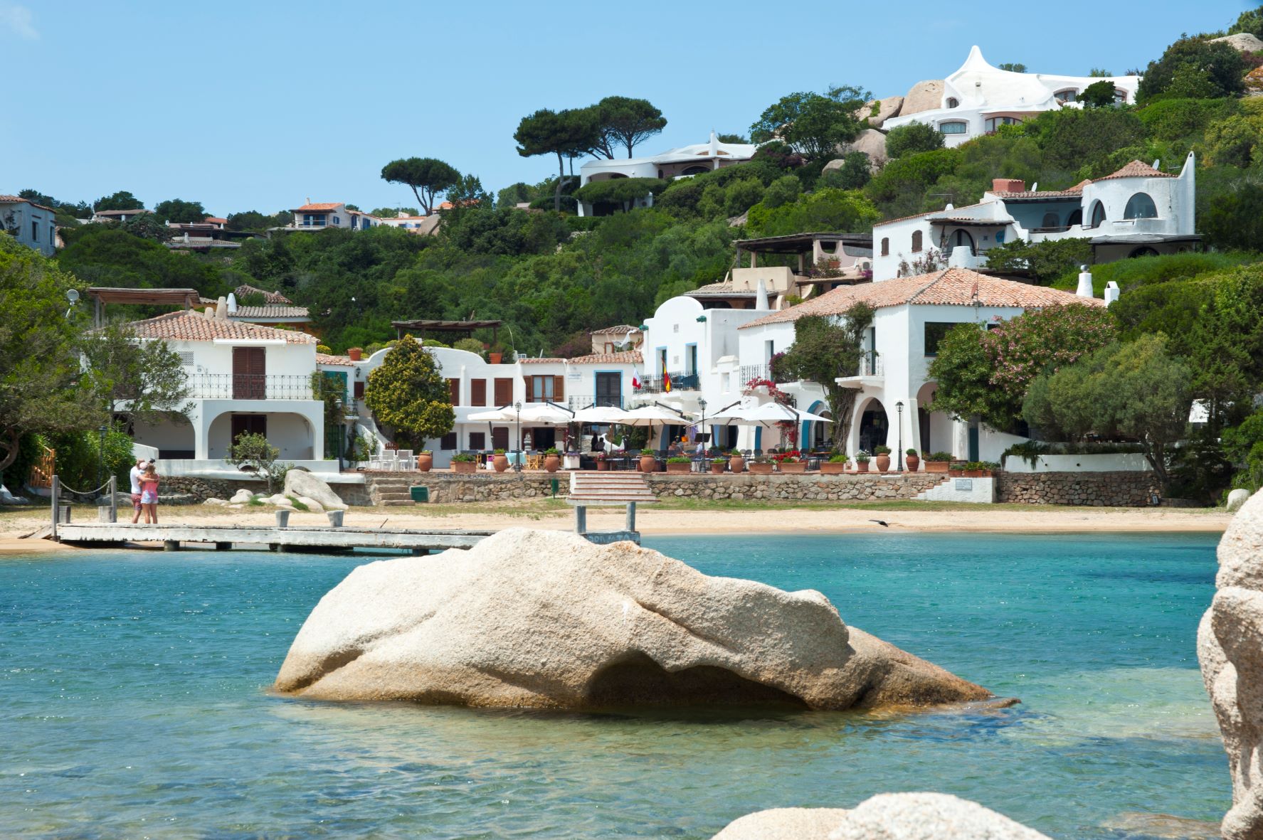
Porto Rafael
A small tourist settlement faces the La Maddalena Archipelago National Park. In Porto Rafael, the predominant colours are the blue of the sea contrasted with the white of the houses within the villages positioned along the extreme northern tip of the Isola, in the territory of Palau, just a few kilometres away, and Porto Cervo, the heart of the Costa Smeralda.
Founded in the 1960s by the Spanish Count Rafael Neville de Berlanga del Duero, the tourist hub is characterised by a quaint piazza overlooking Cala Inglese, also known as the 'Porto Rafael pool', and by the white houses bounded by colourful gardens. It is a popular destination for summer holidays, frequented by personalities from the world of entertainment, yet is also suited to families and lovers of relaxation and a bustling social life. The centre is equipped with all services, whilst also being home to renowned international sailing events during the summer. Not to be missed is 11th August, when a special event is held in the piazza whereby all participants, dressed in a white tunic, dance in honour of the Count who founded the town.
The small marina of Porto Rafael is an ideal point of arrival for small and large boats, as well as for setting out on excursions to the enchanting islands of the archipelago. Just a stone's throw from the village, along the coast of Palau, you will find small beaches of coarse-grained pink sand with small pebbles, all forming authentic natural pools.
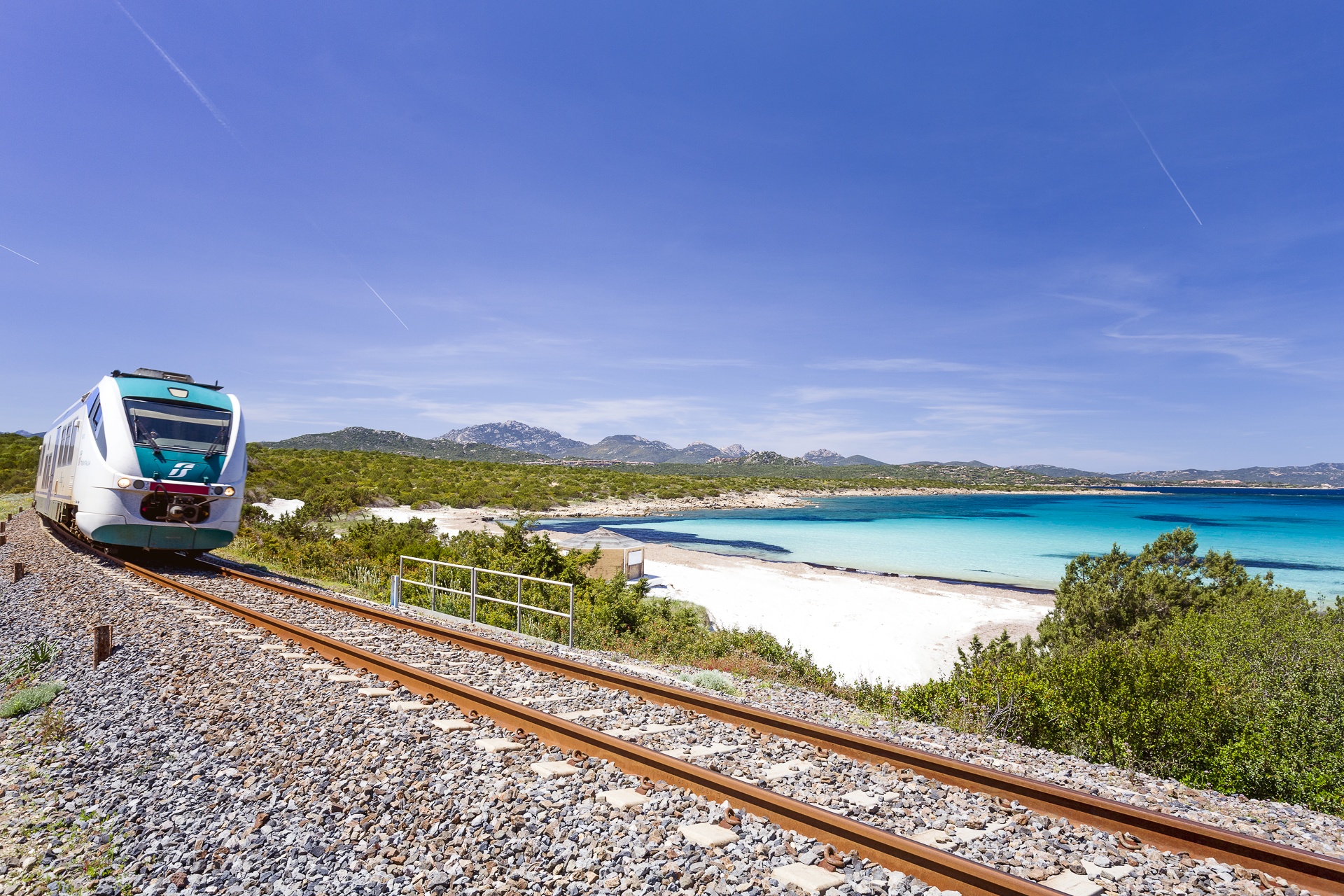
Cala Sabina - Golfo Aranci
Aboard a train, on a small railway line that runs from Golfo Aranci along the northern coast of the promontory of Capo Figari, you will get to one of the most beautiful and distinctive beaches of the Gallura coast. A large beach with about 300 metres of fine white sand, surrounded by junipers and Mediterranean scrub: this is Cala Sabina, a few kilometres from the residential area of Golfo Aranci, the territory it falls within, and about twenty kilometres from Olbia. Its name has an unusual story and is the result of botanical confusion: the Phoenician juniper, which thrives around here, was mistaken for the Savin type. Another characterising element is the railway line, which was built in the 1960s, specifically to connect the residential area with the seaside resort that, until that moment, could only be reached by sea.
Protected by two small promontories overlooking the sea, the bay is well-sheltered and has shallow, emerald green waters, suitable for families, alternating with stones and rocks. The beach has a free part and a partially-equipped part with bathing and food services, thanks to bars, restaurants and tourist services for excursions. You can set off to explore the marine protected area of Tavolara – Capo Coda Cavallo.
In the reefs on the sides of the beach, you can enjoy underwater ‘explorations’, while there are small coves on the easternmost side, from which you can embark upon nature trails. Don’t miss the chance to visit the promontory of Capo Figari, also famous for Guglielmo Marconi’s technological experiments, and reach another pearl of Golfo Aranci, that of Cala Moresca.

Badesi
Set between Anglona and Gallura, on the far eastern rim of the Asinara Gulf, this is a coastal town whose origins are relatively recent. The area it occupies began to be settled in the XVIII century, perhaps by a family of shepherds, and it gradually became a village that is now nestled around the Sacro Cuore church built there in the early 1900s. The town’s patron saint is celebrated in early June. Four suburbs later came into being on the plains surrounding Badesi.
The beaches of Badesi Mare are of uncommon beauty. Li Mindi is a wide beach of white sand graced with marvellous colours that stretches for kilometres on end, and over which the Coghinas delta passes, one of Sardinia’s most important rivers. The fine sand dunes are home to juniper trees, the island of Asinara lies on the horizon and the view spans from Castelsardo to the isola Rossa. Towards Valledoria you’ll find the famous and bustling Baia delle Mimose, a stretch of white sand bathed by the blue water of the sea, blessed with a shallow sandy bottom, framed by dunes covered in coastal vegetation.
Thanks to its exposure to mistral winds, the shore is the ideal place for windsurfing all year long. The coast has been declared an EU Place of Interest for its thick vegetation and unusual fauna, in particular marsh and migratory birds that nest among the reeds along the Coghinas river and on its islands. All around are gently rolling hills and sloping fields that are home to vineyards whose grapes are used to make the prestigious vermentino di Gallura wine.
With the arrival of summer, the area attracts a myriad of visitors to the Estate Badesana, a series of events that includes the famous summer carnival (on the night of 13 August) and a food festival (8 August) featuring local cuisine and traditional delicacies. In May there is the trofeo Magrini, an international surfcasting competition along the shoreline.
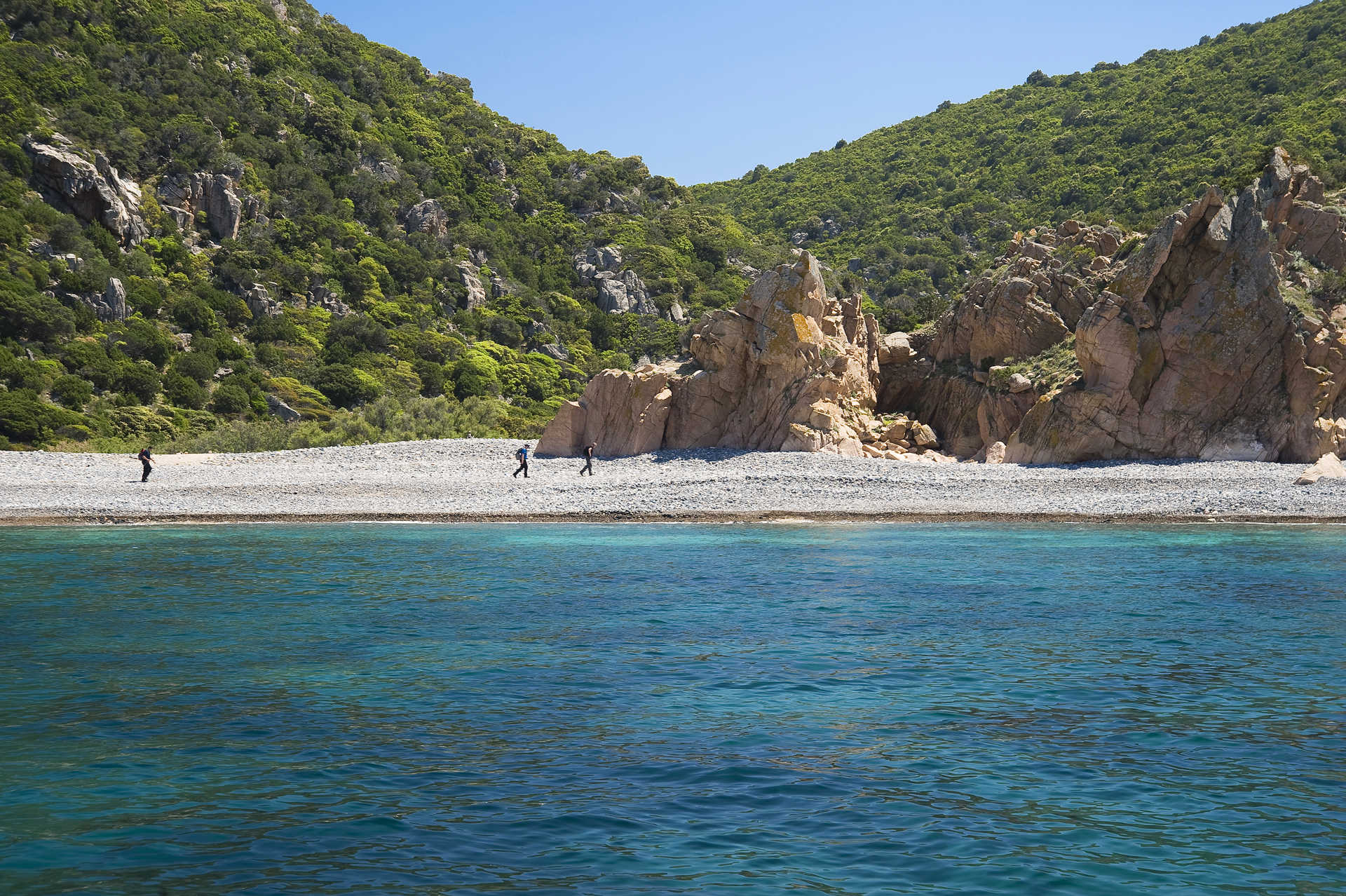
Trinità d'Agultu e Vignola
A long and charming stretch of coastline with soft, white beaches and a beautiful hinterland, which contains the flora and fauna reserve of the Zincu Denti forest. The two residential areas of Trinità d' Agultu and Vignola form a single Municipality with two thousand inhabitants, in the northwestern part of the Gallura region. Formed in the second part of the nineteenth century by families from nearby residential areas and stazzi, Trinità d'Agultu, the municipal 'capital', towers over the shoreline from an altitude of 350 metres. In the centre, the eighteenth-century church of the Santissima Trinità stands out and contains the statues of St. Barbara and St. Orsola, deriving from the ruins of two little medieval churches. There are solitary sanctuaries scattered around the countryside: those of Sant'Antonio, San Pietro Martire, San Giovanni, San Giuseppe, San Michele Arcangelo on a panoramic hill, and that of Santa Maria di Vignola, near the coast, in the centre of the second municipal urban area. The vineyards produce excellent Vermentino wine, ideal as an accompaniment to fish recipes: zimino (fish soup), linguine pasta with sea urchins, grilled fish. From the land, a special dish: zuppa gallurese (Gallura soup), a dish with bread, Pecorino cheese and sheep meat broth.
Vignola includes the district of Lu Colbu and the marine district of Costa Paradiso, a granite landscape covered in Mediterranean scrub and punctuated with little coves. The colours of the sea range from green to blue and light blue. Li Cossi is a masterpiece of nature: fine, golden sand set amidst the pink rocks. Other beautiful places include Cala Sarraina, which has always been a natural harbour, the little coves of Porto Leccio and the romantic bay of Li Tinnari, shaped like a double arch, made of crumbled shells, grains of granite and round pebbles. Isola Rossa is a seaside village located six kilometres from Trinità and it got its name from the little island in front of it. Its modern harbour is dominated by a Spanish tower that dates back to the end of the 16th centre. It is an ideal place for snorkelling and diving. Around it there are countless little coves: La Marinedda, one of the most beautiful beaches in northern Sardinia, will strike you with the contrast between the blue sea, the white sand, the red rocks and the green vegetation. Its continuation is the beach of Spiaggia Longa. Other breathtaking inlets are Cala Rossa, with its light sand, pink rock and transparent sea, Cala Canneddi, with its combination of multi-coloured little stones and the secluded Li Feruli, with its cream-coloured sand.
The most ancient traces of human presence in the territory are from the Mesolithic period, in the shelter under the rocks at Porto Leccio. Dating back to the Neolithic period, there is the Conca di Li Fati, a grotto dug out of the granite rock and a very rare case of a Domus de Janas in Gallura. The most important evidence of the Bronze Age is the Nuraghe Bastianazzu, to the west of Isola Rossa: it is a complex building made of granite rocks and its purpose was to control the coast.
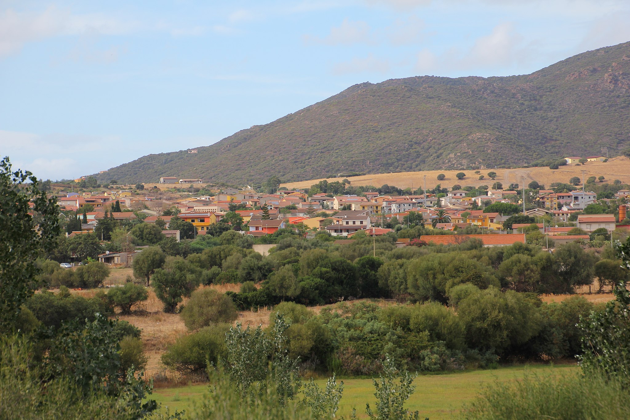
Viddalba
Extending along the edge of the fertile plain of the lower Coghinas, Viddalba is a town with 1,700 inhabitants where the Gallura language and traditions are kept alive. In western Gallura bordering the Anglona, just south of Badesi and a short distance from the beautiful beaches of the Gulf of Asinara, it is the perfect destination all year round for sailing, windsurfing and kitesurfing. The village was built in the Middle Ages, rising up in the area called Vidda Ecchja. Its name appears for the first time as Villa Alba (‘white town’), in the condaghes of San Pietro di Silki and San Michele di Salvennor (11th-13th century). According to folklore, the hamlets around the main town were the raided by the ‘Muto di Gallura’, a deaf-mute bandit in the late-19th century who marked local history. Originally, the area relied on animal farming. Today, the local economy is based on tourism, agriculture and particularly the cultivation of watermelons, potatoes, tomatoes and - above all – ‘spiny’ artichokes, flanked by handicrafts, especially processing fabrics, wrought iron and stone.
Trekking and horse-riding enthusiasts can travel through the scents of the Mediterranean, along fascinating rural roads in the stazzi and on the heights that delimit the territory to the east. The paths lead to the peak of Monti Ruiu, crossing intensely-red rocks, and to Monte San Gavino, where twenty ‘studded streets’ form the playground for lovers of paragliding and climbing. At the summit (at 800 metres) stands the Church of San Gavino a Monte, where celebrations are held on 1st May. The Viddalbese section of the Coghinas river flows between pine and eucalyptus woods, rich in eels, carp, bass, tench, and populated by herons, coots and common moorhens. It is home to sport fishing and a destination for kayaking and bird watching. On the bank of a river just a short distance from the village, there is the Terme di Casteldoria, with salt-bromine-iodine waters with healing properties, already exploited by Roman, Doria and Aragonese populations, flowing at over 70° Celsius. The river continues downstream to join up with the bays of Mount San Giovanni, where there is a park, panoramic platforms and the Romanesque church of San Giovanni Evangelista, dating back to the 12th century only to then be rebuilt from ex novo. The simulacrum of the saint is kept in the Chiesa di San Leonardo. Festivals and food fairs are accompanied by traditional rhythms and costumes, occasions to taste Zuppa Gallurese, meats, cheeses and wines. Amongst the events, one stand-out is the Matrimonio Gallurese (‘Gallurese Wedding’) stands out, with poetic competitions, parades on horseback, songs and dances.
The Viddalba plain has been frequented since the Neolithic period, as is shown by the Domus de Janas, inhabited assiduously since the ancient Bronze Age (18th century BC). Near the Sanctuary of San Leonardo, the ruins of a Nuragic village can be seen, amidst which the vast Necropolis of San Leonardo rose up between the end of the 3rd and 4th centuries AD, from which precious funerary objects and dozens of decorated funerary stelae have come to light, which were the ‘markers’ of incineration tombs, now kept in the civic archaeological museum, one of the main exhibitions in the province of Sassari. It is dedicated to testimonies of the entire lower valley of the Coghinas: from ceramic finds from the Neolithic, Lithic and Eneolithic period through to the Punic, Roman and Renaissance coins.