
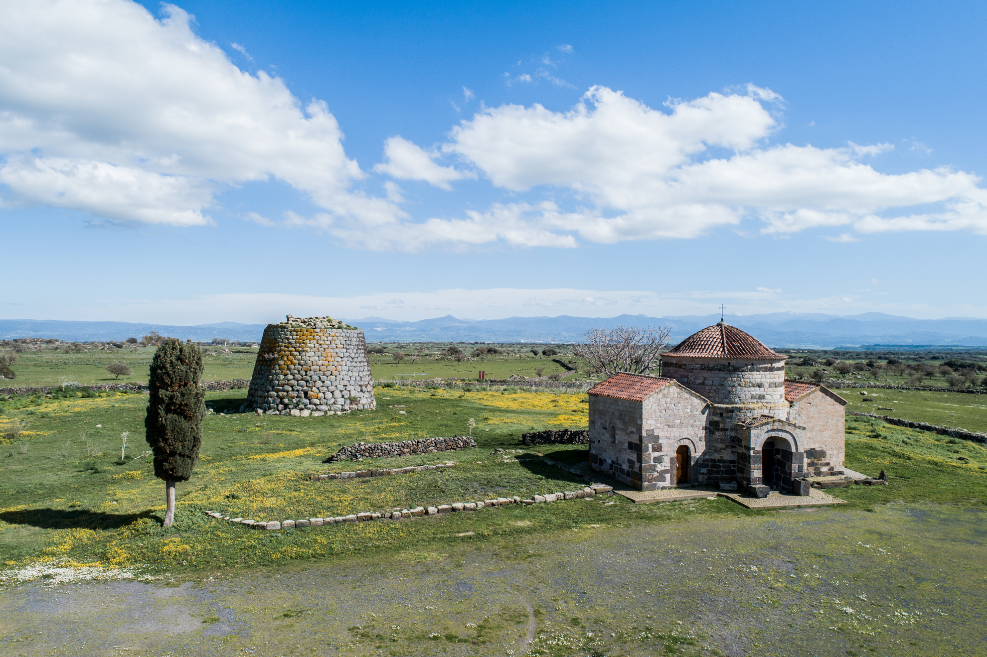
Silanus
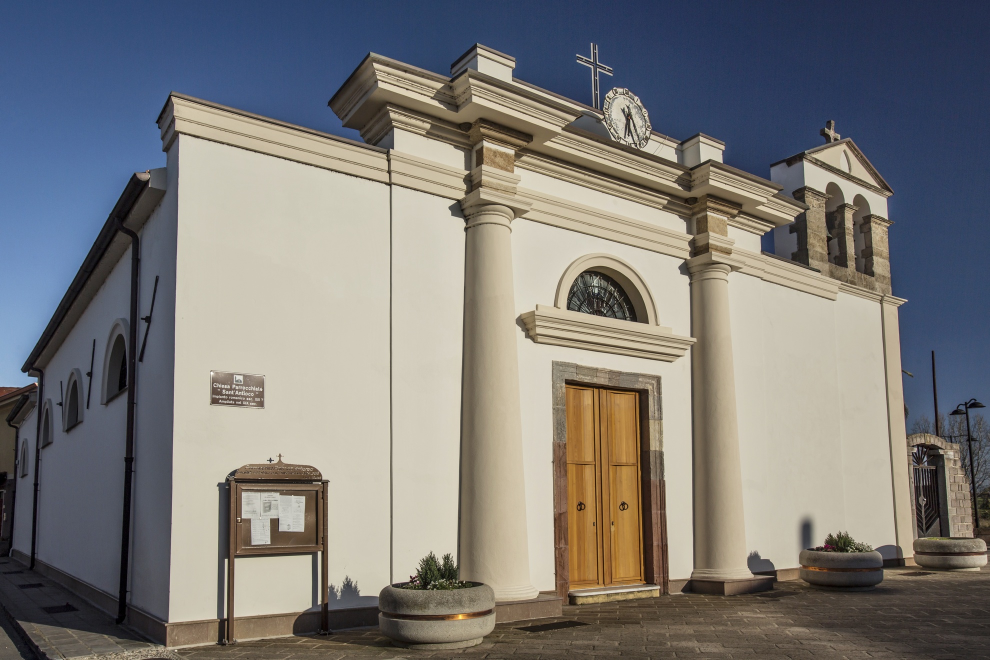
The town is perched at almost 500 metres above sea level in the middle of the Marghine mountain range, a fertile region blessed with fields of grain, olive groves and orchards. Some 2,000 people live there and it boasts the world record for longevity – there were seven inhabitants aged over 100 at the turn of this century! Silanus is a member of Italy’s Most Authentic Towns thanks to the nature, traditions and historical monuments. The economy is based on farming and herding, on the lovely rugs they make and on it baked goods, which you can try during the bread and traditional baked goods fair that takes place in May and June. They also make a wide assortment of cheeses: pecorino, ricotta and casizzolu. In the first half of May they hold the su ischidu festival in celebration of the traditional recipes and to award prizes to the best dairy product. The event is held at the Santa Sabina complex, which includes a single tower nuraghe encircled by a village (1600-1000 BC), the Pedra Pinta Giant Tomb, a sacred well with a domed cover and the church of Santa Sabina, built in the XI century over the remains of an earlier Byzantine building that is still today a destination for pilgrims. It is one the most important examples of medieval architecture in Sardinia and documents the continued sacredness of the place. A famous novena is celebrated there in late September, featuring gosos (liturgical chanting), not dissimilar to another novena that takes place earlier in the month at San Bartolomeo (santu Portolu). The church of San Lorenzo was built in 1150 in what was then Sjlano (now the outskirts of town), as part of a Benedictine abbey. The interior is graced with XIV century frescoes. San Lorenzo is celebrated in early August with a hooded procession and bearing of the bandelas (standards), shows and a poetry competition. Behind the church you’ll see some of the betili (relics) found in the sa Pedra Longa Giant tomb and the majestic (and well-preserved) Corbos nuraghe. Other worthwhile Nuragic legacies include the Madrone and s’Ulivera nuraghe, and the Pedras Doladas, Zanchia and Murartu tombs. There is a lime quarry next to San Lorenzo that remains an important local resource. An ancient Roman city may have once flourished here. The Gothic-Catalan church of sa Maddalena, who is celebrated late July, was built in 1582. There are also two remarkable churches from the XVII century: Nostra Signora d’Itria – home to a multi-coloured wooden statue of the Virgin (XVI century) and of various saints - and the Santa Croce. The parish is dedicated to Sant’Antonio Abate, who is celebrated mid-January with bonfires, processions and plenty of food. The event marks the start of the wonderful carnival celebrations in the area, on par with Holy Week. The church also hosts a polyphonic singing event at Christmas. Every two years is the Tenores singing event, a week of popular culture featuring traditional choirs from all over Sardinia. The Funtana Elighe journalism award is also worth a mention, as is the Nois event, which will let you explore the town by way of photography exhibits.
Morgongiori
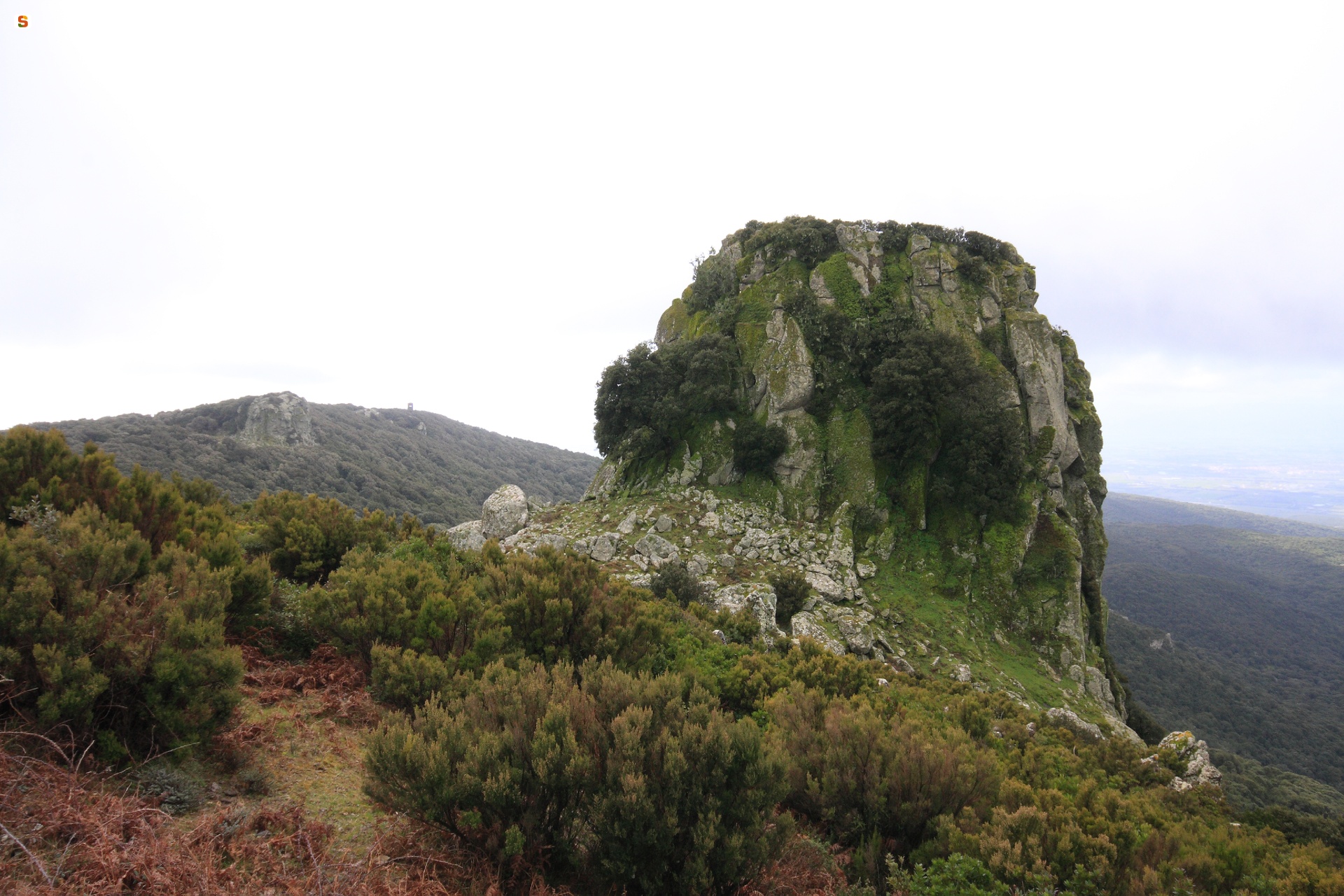
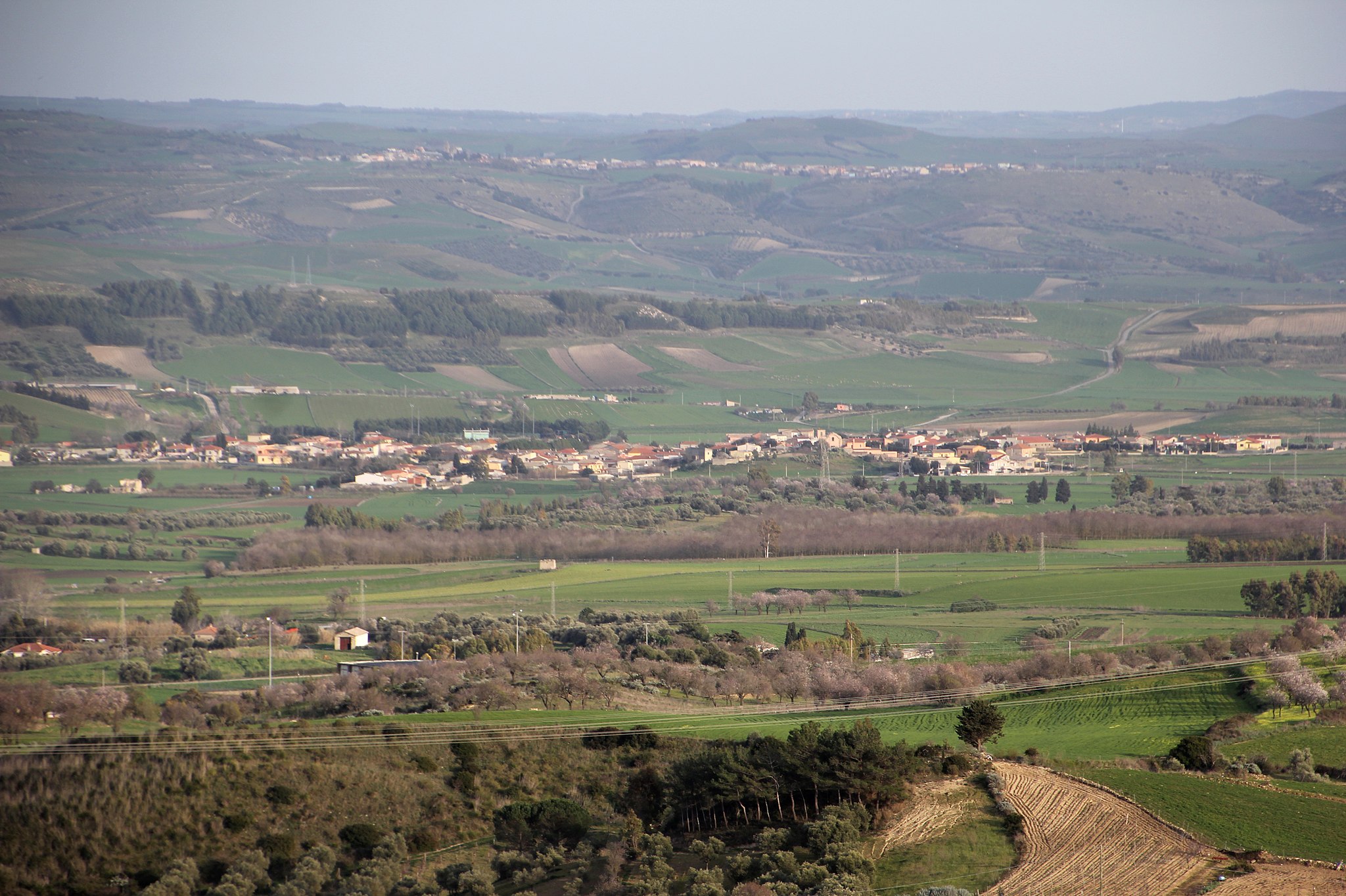
Morgongiori lies on the southern slope of the Monte Arci park, a naturalistic ‘jewel’ that falls partially within its territory. The town of Morgongiori is in the upper Marmilla region and has approximately 800 inhabitants. It is surrounded by hills covered with oaks and holm oaks, crossed by a myriad of streams and surrounded by harsh rocky cliffs shaped by time, including the Conca Mraxi (‘head of the warrior’). It is the ‘city of stones’, with houses in trachyte and basalt, adorned with arched portals, whilst courtyards and loggias characterise the historic centre. All is gathered around the parish church of Santa Maria Maddalena (1673). The church houses a documentary archive of the village. Along the Arci pathways is the Church of Santa Sofia. In the surrounds arose a medieval village that was abandoned due to Saracen raids. Santa Suia is celebrated in mid-October, whilst the farmers’ festival is held in mid-May. For the procession, horses and oxen are decorated with gutturadas, being fabric collars. Morgongiori is known for its textile craftsmanship. On ancient horizontal looms, a wealth of carpets, tapestries and saddlebags has been preserved in the Museo Vivente dell’Arte Tessile (MUVAT - the living museum of textile art), where women from the village give live demonstrations. In August, there is a tapestry and carpet exhibition. The exclusive local gastronomic specialty is lorighittas, a fresh pasta in the shape of a ring (loriga), to which an eagerly-awaited festival is dedicated at the beginning of August.
At the peak of Monte Arci is sa Trebina Longa (at 812 metres), one of the necks (volcanic fossil ducts) that stand out on top of the enchanting massif. Walking along the park’s pathways (or riding along them on mountain bikes), the is Benas pinewood, springs, waterfalls, caves and rock faces suitable for clean climbing can be admired. It is an oasis populated by wild horses, weasels and martens, with buzzards and hawks flying overhead. Green is alternated with the colours of basalt, trachyte and obsidian, the ‘black gold’ of the island’s prehistory, a mineral processed and marketed throughout the Mediterranean. In the village, there is the environmental documentation centre, which illustrates the geological and cultural riches of the park. The fecundity of the land has always favoured agricultural activity and, together with the presence of obsidian, has attracted people here since prehistoric times, as tens of archaeological sites can demonstrate. To be admired in Prabanta is the menhir su Furconi and two Domus de Janas, sa Sala and su Forru, Neolithic monuments (3200-2800 BC) linked to Luxia Arrabiosa, a character in the popular imagination. On the way to is Benas, in addition to Roman tombs, one can spy s’Omu ‘e s’Orcu, one of the most well-known Nuraghe of the area together with Trunku de is Pillonis, which is associated with a Tomb of Giants. Near the village, there is sa Domu ‘e is Caombus, a vast cleft in the rock from which a basalt staircase commences, immersed in darkness - perhaps once leading to a hypogeic Nuragic temple.

Nuraminis
It extends on a plain dotted with moderate, isolated limestone hills inhabited since prehistoric times. Nuraminis is a town of 2600 inhabitants in southern Sardinia with a tradition of cereal farming, which is reaffirmed by Cereal Festivals in mid-June and by hand sowing in December. Its territory is characterised by rare geological features, destinations for climbing enthusiasts, which can be reached via mountain bike or horse trails. The most notable of these are the lava domes of Mount Leonaxi, the fossils of Genna Siustas and Mount Murroni and the limestone cuesta of Coa Marfine, known as the limestones of Villa Greca. A natural monument that stands out from the surrounding landscape is a kilometre-long rocky ridge, the remains of an ancient coral reef. These geological features also contain archaeological sites. From the top of Matta Murroni, you can admire megalithic walls and by cuesta peak, the ruins of Sa Corona, a proto-nuraghe dating to 3000 BC, a unique example of prehistoric architecture. At the foot of Leonaxi, there is a multi-layered site (‘courtyard’ nuraghe or fortified complex), with walls constructed using a series of different techniques. Santa Maria is another such ‘multi-layered’ site. Inhabited from 3000 BC to the Early Middle Ages, it consists of the ruins of a village, a burial ground, a holy well and a church. In Genna Siutas, stands Funtana ‘e Siutas composed of four large slabs with a hole for drawing water, and a staircase for accessing the pool. Just 500 metres away, there is the Serra Cannigas complex. A corridor nuraghe associated with a tholos and a fortified structure that takes advantage of the rockface on which it is set to form an artificial terrace. On the eastern slope, traces of sheds can be seen. Artefacts found here show that the area has been inhabited for thousands of years. Small vases, fusaroles and copper ornaments now on display at the National Archaeological Museum in Cagliari were found inside two shaft tombs located in the same hill. On another hill there is a Nuragic complex called Nuraxi and an adjacent village. Sa Grutta is a Neolithic site. It is a large cave that opens onto smaller chambers resembling a Domus de Janas.
The Parish of San Pietro Apostolo has great architectural value. It was built in the Catalan Gothic style that was later altered, with the bell tower (thirty metres high) and the starred vaulted ceiling in the apse remaining unaltered. The niches and Byzantine age marble fragments have historical interest. The chancel and the lateral chapels hold wooden and marble altars, statues and paintings, including an altarpiece depicting the Mysteries of the Rosary (17th century). The Church of San Vito Martire, in Villagreca, is just as charming. Built in the 9th century, it is a rare example of Byzantine architecture on the island. It was reconstructed in the 18th century in the Catalan style. It houses the 16th century “sorrowful crucifix” from Flanders and two 18th century altars, one wooden and one marble. In the countryside, there is a small Romanesque Church of San Lussorio Martire that may have been built in the 12th century by Vittorini monks.
Ollastra
From 1928 to 1946, it was a hamlet of the nearby town of Simaxis and shared its name. It was not until 1991 that Ollastra Simaxis became the present day Ollastra. It is a small farming town of 1200 inhabitants on the border between the Campidano plain of Oristano, from which it is 16 kilometres away, and the hills of the inland. During the Roman era it was crossed by Via Maxima. The town name derives from ollastu, i.e. wild olive, a tree that covers this particularly fertile land crossed by Tirso, the largest river of the island. Vineyards, citrus fruit orchards and fields of artichokes and other vegetables cover the flatlands near the town thanks in part to the Santa Vittoria dam. Some lands are set aside for the cultivation of cereals. To the north-west, the wild olives have been replaced by domestic olive trees, from the fruit of which excellent olive oils are obtained. To the south-west, rice is being cultivated in the reclaimed ancient swamp of Arcais. Consequently, the town’s economy relies heavily on farming, although a small contribution is also made by shepherding and artisanal production of carpets and baskets. The vernaccia, an almond and cheese sweet is a local specialty of note.
The town, which has a historical centre of unfired mud brick (ladiri) houses, is surrounded by hills. The tallest of these, Mount Ollastra (380 metres high), shares its name with the town. The hill is perforated by two caves, S’Arutta e ‘Conca e’ Mesu and S’Arutta e’ Margini Figu. The San Martino area is dominated by Mediterranean shrubs. The most important churches are far from the town centre. The Church of San Marco is on a small hill in the outskirts. It was constructed in the 13th century on land given to the Cameldolese monks and expanded in the 16th century with the addition of two lateral naves. The thatched, gabled roof is supported by wood beams (s’urriu) following an ancient technique. San Marco’s Feast Day is celebrated on April 25 with a livestock exhibition held since 1839. The su pannu race with riders participating from all over Sardinia is also held in the saint’s honour. The Church of San Costantino is set on a small hill close to the town. It was constructed using materials from the nearby ruins of the Church of Santa Vittoria. The Church of San Sebastiano dates to the 17th century. On January 20, a large bonfire is lit in the square where all the inhabitants gather to celebrate San Sebastiano’s feast day. The oldest church in the area is the Church of Santa Severa, built in the second half of the 15th century.
Because of its fertility, the territory has been populated since prehistoric times. Around 550 BC, when the Nuragic civilization was in decline, the town was at the heart of a territory surrounded by the ruins of numerous nuraghes, including Accas, S’Orco and San Perdu, and by small settlements of mud and straw sheds.
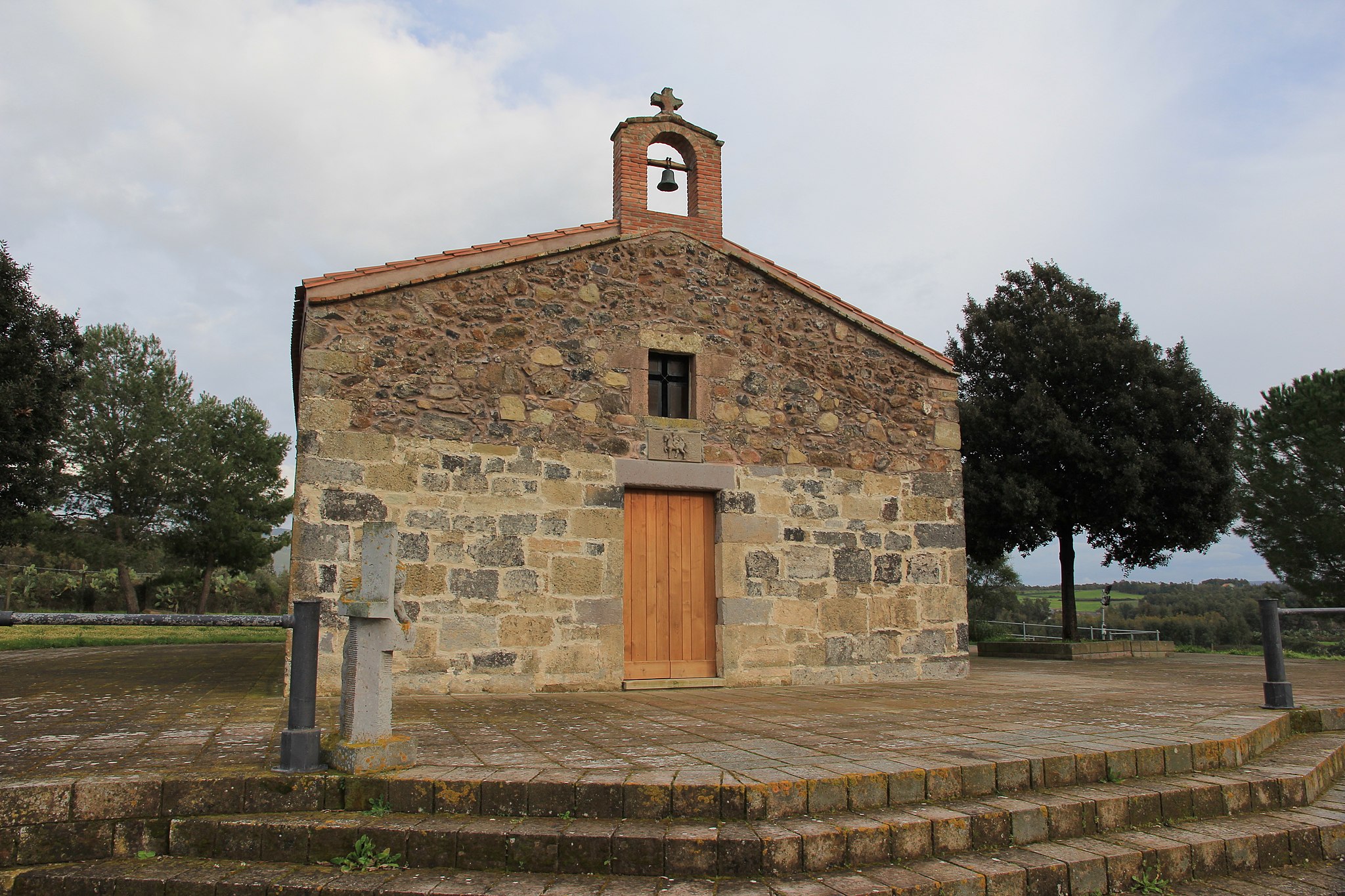
Pabillonis
Situated in the central-south of Campidano, near the confluence of Flumini Mannu and Flumini Bellu, on lands rich in clay, which has defined its history and economy. Pabillonis is a town of almost 3000 inhabitants, with close ties to its farming and crafting traditions, particularly to the production of baskets and modelling of terracotta to produce tiles, bricks, pans and sciveddas (smoothed and glazed bowls). It has been known as bidda de is pingiadas, the town of pans, for centuries: an exceptional quality of the products is assured by the skill of master ceramicists and high quality of the raw materials available in the surrounding swampy land. The town extends around the Romanesque Church of San Giovanni Battista, the oldest of the town’s churches (12th century). The birth of the saint is celebrated in late June, and his death, in late August with traditional carrus de s’àlinu (decorated floats).
The church, housing the most artwork of value is the Parish of Beata Vergine della Neve (16th century): it houses frescos, a 16th century wooden tabernacle, a part of an 18th century wooden altar and a 19th century organ, in addition to valuable statues and holy objects. The Patron Saint’s Feast Day is celebrated in early August. Local festivals begin in mid-January with the Fires of Sant’Antonio Abate and conclude on December 31 with Su Trigu Cotu (cooked wheat) when cooked wheat and sapa (dehydrated grape juice) diluted in honey is distributed from door to door as a good luck charm for the new year.
In the peace treaty between the Crown of Aragon and the Giudicato of Arborea (1388), the town is sited as Paviglionis and Panigionis, from the Latin pavilion (pabillone in Sardinian), i.e. military encampments for defending the borders of the Giudicato, of which the village was part. Originally, the town stood in San Lussorio, where the ruins of this former village, destroyed by Saracen raids, and a small church dating to the 1960’s can be seen. Buried below the church are the ruins of the Nuragic complex of Santu Sciori, composed of a polylobed bastion, of which the bulwark towers can still be seen, and used in the Medieval period as a burial place. It, along with Su Ponti da Sa Baronessa, a Roman bridge that is still standing, is evidence of the towns antique origins. The Nuragic period left other traces in the area as well: the ruins of nuraghes Surbiu and Domu ‘e Campu, and above all, Nuraxi Fenu, three kilometres from town. Excavations have uncovered fragments of vases, lanterns and Roman coins, which testify to human presence in the area up to the age of Imperial Rome. Today, the artefacts are housed at the Archaeological Museum of Sardara. This nuraghe complex dating to the Bronze Age (1600-1300 BC) and called by the historian Vittorio Angius (19th century) as “one of the most colossal on the island”, extends over two thousand square meters.
Palmas Arborea
Gently descending towards the plain, it is dominated to the east by the Monte Arci volcanic massif and flanked to the west by Pauli Majori pond, just a few minutes from the enchanting beaches of the Sinis Peninsula. Palmas Arborea is a town of almost 1500 inhabitants in the Campidano plain of the Province of Oristano, located about 10 kilometres away. The town’s main income comes from shepherding and the cultivation of artichokes, citrus fruit and grapes. The town has Medieval origins: around the year 1000, three small villages stood here, Palmas Majori and Palmas de Ponti were abandoned by the 15th century, while Villa de Palmas, which stood where the present-day town lies, survived. Originally, it was called just Palmas, due to the large number of palm groves surrounding it. In the 20th century, Arborea was added to differentiate it from another Palmas (of San Giovanni Suergiu). In the historical centre, you will see houses made with unfired mud bricks set around the Parish of Sant’Antioco, who has several feasts during the year. One of the festivals held in April is Pariglie Palmaresi, which includes a procession on horseback accompanied by folk groups, and the Is Tre Aneddus during which riders try to thread rings and perform acrobatic tricks. In July, there is a Sardinian Dance Exhibition among other celebrations. In November, the death of the martyr is commemorated, and a must-visit Mushroom Fair is held with a show and mushroom tasting.
The scenery around the town is multi-faceted and multi-coloured, granting unforgettable views. The calm waters of the Pauli Majori, a paradise for birdwatching enthusiasts, is home to the swamphen, purple heron and the white-headed duck. The flora, on the other hand, is characterized by splendid orchids. It is one of Italy’s most important wetlands. In the Park of Monte Archi, the Island’s largest deposit of obsidian, you can travel back in time eight thousand years (during which various Mediterranean peoples settled in Sardinia, leaving traces behind) in search of this mineral – the ‘black gold’ of the Neolithic – abundant on the mountain’s slopes and used to make prehistoric weapons and tools. Archaeological sites range from recent Neolithic to Nuragic stone circles. The massif is covered with basaltic lava flows, while its interior is composed of trachyte. Volcanic conduits come together in three peaks (the highest is Trebina Longa at 812 metres), giving the mountain the appearance of a tripod. A green carpet of holm oaks and Mediterranean shrubs, with occasional cork and downy oaks, covers the mountain. The 150-hectare Forest of Sa Dispensa, populated by weasels, martens and birds of prey (goshawks, kestrels, buzzards and sparrowhawks), is within the territory of Palmas Arborea.
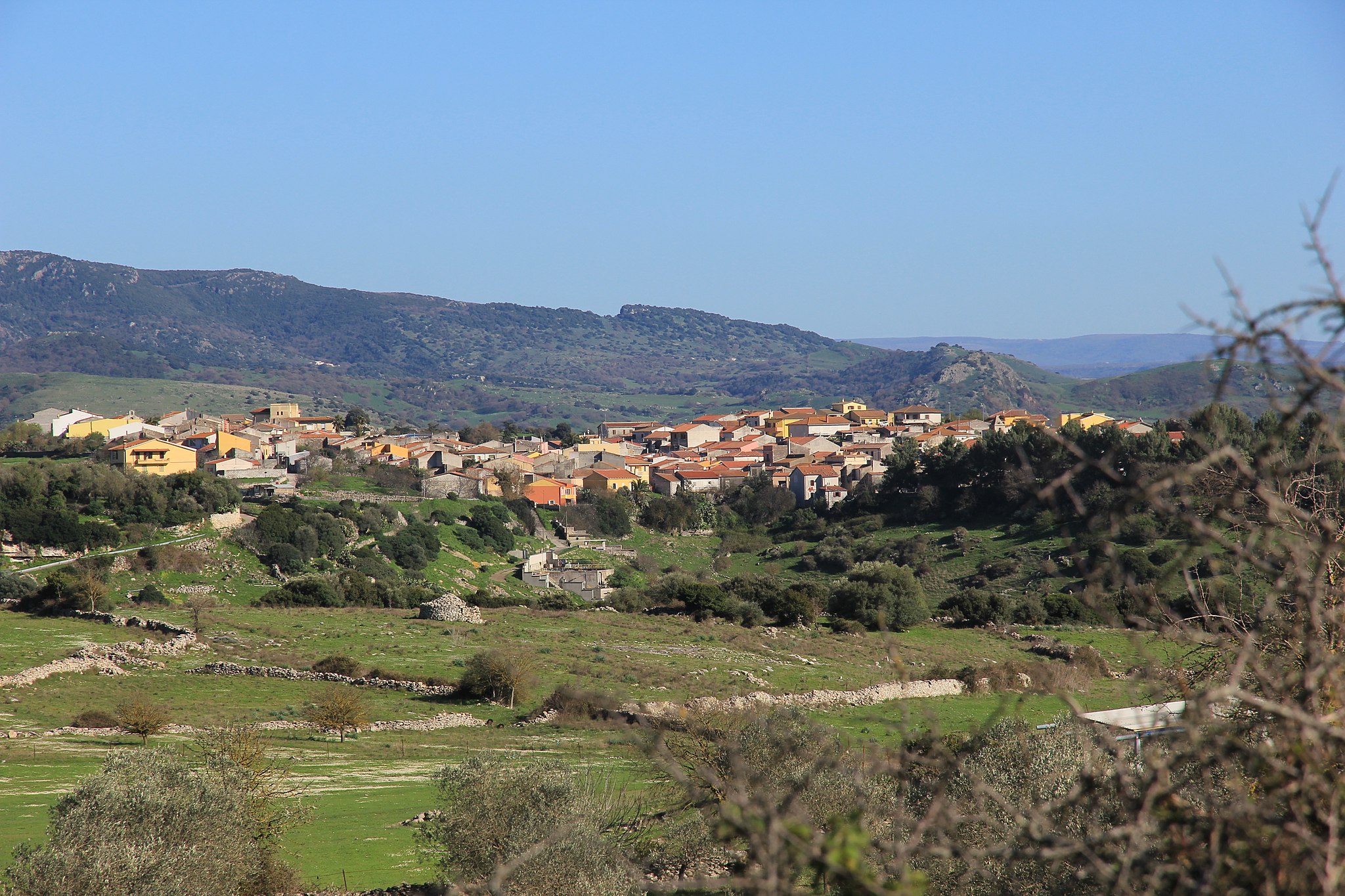
Pauli Arbarei
Located on a flat area in the centre of Marmilla, by the western edge of a bog, drained at the end of the 19th century. Pauli Arbarei is a town of 600 inhabitants with agro-pastoral traditions, which relied on cereal farming in the past and today boasts quality food and wine products. The area is exalted by a dozen or so Nuragic sites, some of which are yet to be studied; particularly, the three-lobed Nuraghe of Bruncu Mannu. Its fertile countryside is dotted with archaeological sites, with new sites still being discovered: worked stones, half-buried sections of nuraghes and even a triangular well temple hidden among the ruins.
The centre of the town hosts the Parish of San Vincenzo Diacono, built in the 17th century in Renaissance style. The town’s patron saint’s Feast Day is celebrated in late January. In mid-May, the Feast of Sant’Isidoro, protector of farmers, is marked by a procession of yoked bulls, horses, farming carts and tractors festively decorated. In late August, the town’s most important celebration is held, in honour of Saint Gostino, to whom a three-nave church with a wood roof and round arches is dedicated.
The Ethnographic Museum, equipped with multimedia tools, tells the story of the town through the testimony of women, who talk about the town’s traditional activities: from working the looms in the home to working the fields, from baking bread to worship. The objects are easily reached, can be touched and manipulated, to make this brief visit back in time even more realistic. Old, poignant photographs serve as a backdrop. A second ethnographic exposition, Sa Tellaia, was inaugurated in 2002 in parallel with the Sheep Festival. It was set up in a private home suitable for housing a museum. It contains objects typical of a farming culture and of ancient Sardinian cuisine.
Romana
It sits at an altitude of less than 300 metres on a spacious plateau of volcanic and calcareous rocks in a largely flat area rich in prehistoric sites. Romana is a town of about 500 inhabitants in the Meilogu-Logudoro region, surrounded by karst formations, such as the Cave of Inghiltidolzu in the nearby valley of Santu Giagu, and crossed by the Temo River, which flows into an artificial lake near Monteleone Rocca Doria. The territory is rich in water sources. Statues unearthed in the town’s surroundings are believed by scholars to be offerings from people healed by the beneficial properties of the waters of the ancient Abbarghente spring, which has been used from Nuragic age to the Punic-Roman era.
Two churches are inside the town: the Parish of Madonna degli Angeli, with the patron’s Feast Day celebrated in early August, and the small Romanesque Church of Santa Croce. The surrounding countryside contains two sites of interest: the cave Sanctuary of San Lussorio, with a late July feast day; and the Church of Santa Maria de s’Ispidale, dedicated to the Madonna of Health. Other important celebrations include the feast of San Giovanni Nepomuceno in mid-May and of Saint Anthony of Padua in mid-September.
The territory is rich in Nuragic sites, including the nuraghes of Montigu, Chiechrios, Pabirra and Santu Giagu.
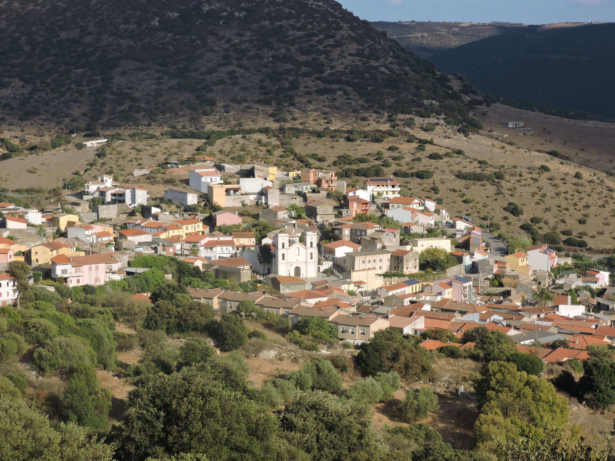
San Nicolò Gerrei
San Nicolò Gerrei reaches 370 metres in altitude, in an area rich in plateaus, south of the river Flumendosa. Populated by 800 inhabitants, San Nicolò Gerrei is the main town in the territory from which derives its name, inhabited since the Neolithic period and with traces of well-established settlements in Carthaginian and Roman times. Farming and mining are the main sources of income, along with the cultivation of grains and vines. The name of the village also comes from the patron saint, Nicola, celebrated twice a year, in mid-May and early December. The existence of the current inhabited area is attested by documentary sources from the 13th century, it being referred to as Padule (or Pauli), names which remained in use until 1863. It derives from the Latin palus, with the inhabited area arising in a basin subject to stagnation and containing numerous springs.
Until the mid-16th century, Gerrei was covered with forests and called Galilla, in the ancient site of the Galillenses who in 69 AD - as evidenced by the large bronze inscription Esterzili tablet - were forced to withdraw from these territories. Considered to have descended from the pre-Nuragic and Nuragic peoples, from which derive the megalithic circle of Mnt’Ixi, the Nuragic Monti Taccu and Su Nuraxi, the great sacred hut of Forreddus and three sacred springs, including the well-preserved Su Musuleu. Noted 19th-century archaeologists speak of Su Putzu de Santu Lacci, a well temple about four kilometres from the town. Behind it gushed a spring of water collected in a well, perhaps once a sanctuary facing towards the ‘healing’ divinity. In 1861, a relic was discovered in its ruins that bought fame to San Nicolò - a bronze column base with trilingual inscription (Latin, Greek and Punic) from mid-2nd century BC. Originally, it was perhaps a crowned cylindrical altar. The three texts are a votive dedication - by a certain Cleon rendered thanks to the god Eshmun (correspondent to the Greek Asclepius and Latin Esculapio) for restored health. The presence of ruins and fragments of ceramics at Santu Iacci ranging from the Nuragic to the Roman age and Punic coins proves that the spring was in continuous use. Today, there are no traces of the temple. Whilst other important artefacts remain from the Roman era, including a treasure of almost 400 coins minted from between 117 and 251 AD, many Roman finds were brought to the Peninsula by the Savoy in the 19th century. One example is an ornately-sculpted Pentelic marble sarcophagus - Apollo the Citharist is represented, accompanied by Athena and surrounded by the nine Muses - amongst the most beautiful to have ever been found in Sardinia. It was first brought to Genoa, then, at the request of Carlo Felice, transferred to a castle in Piedmont. In 1915, the canonical Francesco Lecca made mention of another sarcophagus. The necropolis from which they came would have been discovered in 1932 in Bingia Manna.

Santa Maria Coghinas
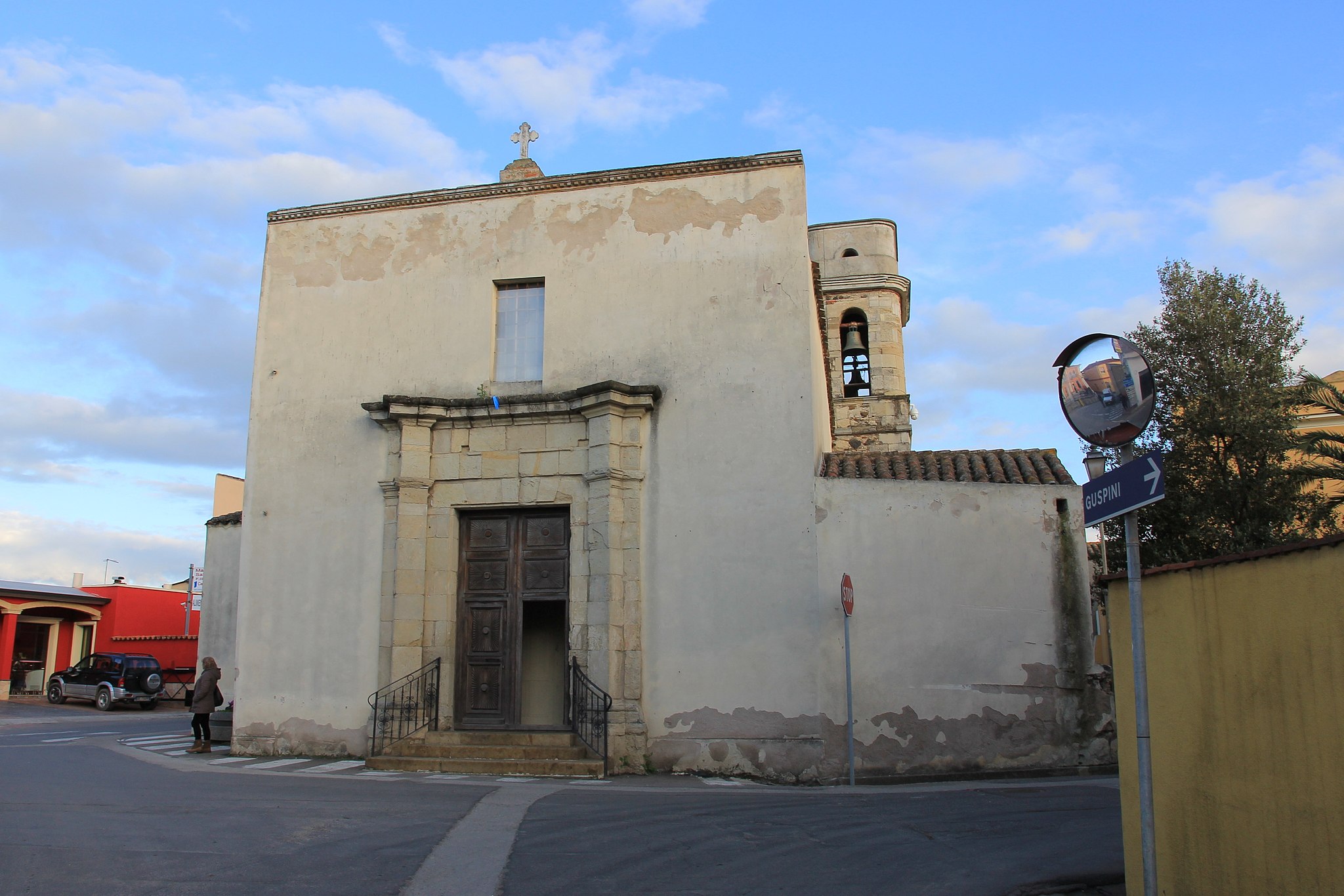
Santa Maria Coghinas lies on a bank of the Coghinas river, adorned with hills that surround a fertile alluvial valley, where vineyards and artichokes are highly cultivated as its main resource. The town has 1,400 inhabitants is and located just short distance from the Gulf of Asinara, a fraction of Sedini until 1960 and then of Valledoria until 1983, when it became an independent Municipality. The present inhabited area was repopulated in the 19th century by families of Gallura shepherds, after the medieval village was abandoned in the 15th century. This is why the language, customs and traditions of Gallura live on, despite the town being part of the Anglona. The name of the village derives from the river and the church of Santa Maria delle Grazie, in Romanesque style with a Gothic façade, coeval with the medieval nucleus of the village. To be admired within is the statue of the Virgin Mary, carried in a procession during the festivities held on 1st May. The quaint Romanesque church of San Giovanni is also well preserved.
A thick blanket of Mediterranean scrub and cork covers the landscape around Coghinas. Herein live herons, osprey, partridges and aquatic turtles. A short distance from the village, where the river loops back at the foot of a granite hill, the Casteldoria thermal baths emerge, famed since Roman times for their therapeutic qualities and today a renowned spa. The temperature of salso-bromo-iodic waters varies between 40 and 70 degrees Celsius. On the same hill, called Monti Di Lu Casteddu, framed by bright red rocks, emerge the ruins of Castedoria, a fortress built in the 12th century by the Doria, who had strong interests in the area, especially in Castelsardo. From the peak, you can spy the Anglona region and the coast, an area of intense traffic since ancient times. The castle was the protagonist of intricate events that involved the republics of Genoa and Pisa, the Giudicato of Arborea and of Torres and Crown of Aragon. The first written testimonies date back to the late-13th and early-14th centuries, then belonging to Brancaleone Doria, husband of Eleonora d’Arborea, and restored by Pietro d’Aragona (1354). It passed through many masters, until the slow decline in the 15th-16th century and the demolition by the Piedmonts at the end of the 18th century. Today, the well-preserved Torre dei Doria can be clearly seen from a distance, with a pentagonal layout and over twenty metres in height, with some parts of the walls, the remains of a chapel and a cistern for water supply. The ruins of the ancient village are still standing, perhaps built together with the fortress, around which myths and legends abound, many linked to the last reigning prince, possibly being Andrea Doria. In a story penned in 1894, Grazia Deledda wrote of a secret underground passage, excavated between the castle and the Cappella di San Giovanni di Viddalba, used to reach the church. The Nobel Prize also refers to the Conca di la Muneta, a basin in which the Doria are said to have pounded coins. The tale tells of an explorer who discovered a room full of gold and another closed by an iron door that was to have contained the treasures of the Genoese family.