
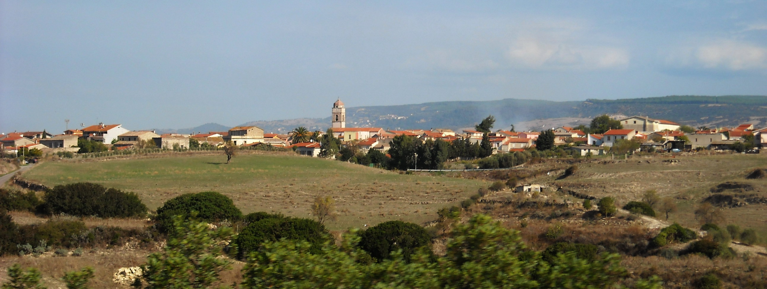
Escolca
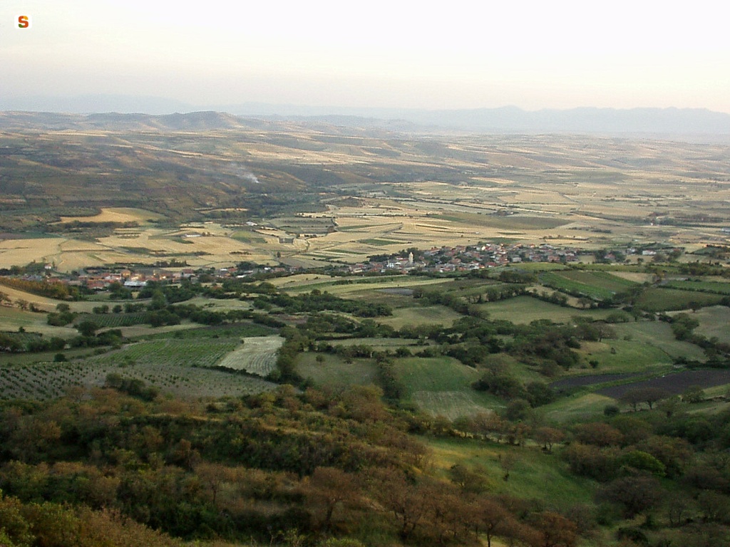
Escolca stands at the foot of the Giara di Serri, in the historical territory of Sarcidano, bordering Trexenta. A small agricultural village with 600 inhabitants, it is replete with olive trees, grains and grape vines cultivated throughout the land. Characterising the local craftsmanship are historic frames for embroidering fabrics and woven baskets. The town is spread out around the parish church of Santa Cecilia, in late Gothic style. The village first arose in the 11th century as the Villa di Escolca of the Curatoria di Siurgus, in the Giudicato of Cagliari. There are several legends regarding the origins, with talk of a scolka, as in a group of small villages, or as a guardhouse to watch over the fields. What is certain is that the territory was inhabited since the Nuraghic period, as is evidenced by the nuraghe Mogurus, a monotower constructed with basaltic rocks. There are also remarkable findings that date back to the Roman period.
The small ancient village of San Simone holds a historic and mysterious charm, consisting in just approximately fifty houses, constructed in straw and mud and built around the church dedicated to the saint, from whose foundations emerge the remains of Su Nuraxi Mannu. The fraction of Escolca, now a ‘ghost’ village, borders four other towns (Gergei, Gesico, Mandas and Villanovafranca). Inhabited in Antiquity, a terrible plague decimated its population. Survivors found refuge only in Escolca, to whom they donated the lands of the village. The inhabitants of the nearby town of Mandas were opposed to the donation, yet the two towns came to an agreement after various disputes, with a decision being made to place the statue of San Simone on a yoke, with the fraction then going to the village towards which it spontaneously directed itself. The oxen chose Escolca. It was decided that, by way of recompense, during the celebrations in honour of the saint, the procession would also pass by Mandas. This tradition has continued unchanged each year, with the feast of San Simone held in the uninhabited village, usually during the weekend following Pentecost.
Quartucciu
It stretches across the deepest part of the Campidano plain, six kilometres from Cagliari. It was once a district of Cagliari, between 1028 and 1983, and is situated close to two of the most evocative natural attractions in Sardinia, the Molentargius Nature Park and the Park of the Sette Fratelli. Quartucciu is a little town with thirteen thousand inhabitants, located where Quarto Suso or Quartutxo was once situated (from which it gets its name). At the beginning of the 14th century, other villages named Quarto, which indicated the distance from Carales (four miles), merged with the village of Cepola, forming the current and adjacent Quartu Sant'Elena. Quartucciu's economy is largely based on the tertiary sector, particularly services and commerce, but its artisan tradition is still alive and well, especially its textile products, weaving and the production of breads and pastries.
In the centre, there are numerous religious buildings well worth visiting: the parish church of San Giorgio Martire, built by the Aragonese in the 14th century on a Pisan structure. Inside it, there are works of art, including the retable of Castagnetta (16th century) and the crucifix 'of the rain', one of the nine 18th-century crucifixes kept inside the church. Then there are the churches of Sant'Antonio (late 19th century), celebrated in January, of San Biagio Vescovo di Sebaste (17th century), celebrated in February, and, above all, that of Sant'Efisio, a 13th-century Romanesque work of art, today incorporated in the cemetery.
There are two very important archaeological monuments. Dating back to the Punic-Roman era, in the locality of Pill'e Matta (industrial area), there is a necropolis with 200 tombs, almost all intact, from which more than two thousand artefacts have been recovered and a part of these are on display at the Angioni house-museum. Today covered by glass to preserve it and make it available to see, it was frequented from the 4th century BC to the 5th century AD. The other site, in the locality of San Pietro Paradiso, is the Tomb of Giants with a 'stylised bull-protome' of Is Concias (14th-13th century BC), one of the most well- preserved on the island, used for burials and religious rituals. From the same period (13th-9th century BC), there is the Nuraghe Nanni Arrù, in the district of Sant'Isidoro. The megalithic tomb is located inside the Park of Sette Fratelli, one of the greenest and most captivating in Sardinia: ten thousand hectares of forest extending across a mountain range with seven peaks about a thousand metres high. The oasis is a triumph of nature, with rocks shaped over time by the weather, torrents running through canyons and gorges, and mammals, among which deer and mouflons, as well as rare birds of prey like eagles and falcons. The other nearby natural attraction is Molentargius- Saline: 1600 hectares with freshwater and saltwater ponds, separated by a plain. A wetland area of international acclaim and a site where various aquatic birds stop and nest, primarily the greater flamingo. The most suitable way of touring the park is by bike.
S'Ortu Mannu
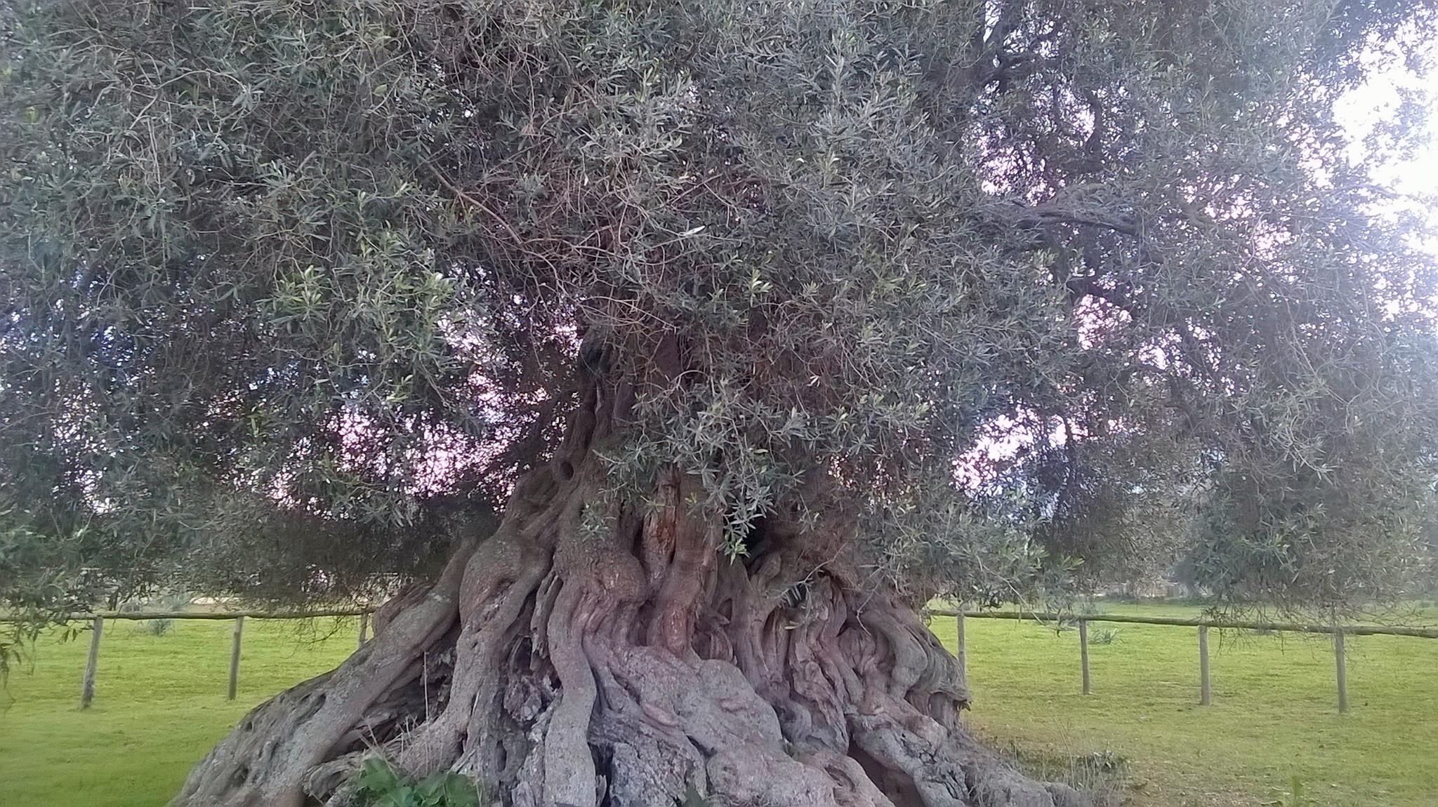
A woods of olive trees planted between the 14th and 17th centuries, trees with majestic, twisting, gnarly trunks protected by a lush green canopy of leaves. S’Ortu mannu means ‘great orchard’ and is a nature oasis covering some 13 hectares (originally it measured 500 hectares). It lies at the feet of mount Exi, at the top of which are the remains of the Gioiosa Guardia castle, built between the 12th and 13th centuries at the behest of the Della Gherardesca counts, and lies circa 3 km from the town of Villamassargia. The park, so designated in 2001, is home to 700 centuries-old monumental olive trees that were planted in the Middle Ages, when Benedictine monks first put the roots of the first grove into the ground. Legend has it that the Pisans encouraged the locals to graft more trees, which they, the locals, would then own. Whether this is true or not, the grove counts many trees which, until recently, were the property of individual citizens. When the town took over s’Ortu mannu, each of these trees was entrusted to the family of the original owner. Almost every family in Villamassargia tends to a tree in this oasis, proof of the strong ties the population has with its land, important ties handed down through the generations.
At the centre of the park, encircled by a fence, stands the majestic, solemn matriarch of s’Ortu, the queen of the grove, sa Reina (the queen), as she is called. This natural monument is about 900 years old and is enormous, perhaps the largest in all of the Mediterranean, boasting a circumference of 16 metres. Its bark is a masterpiece crafted by Mother nature, a work of art made of woody knots and woven twists. When you stand next to her, you can feel the life force that runs between the tangled roots and trunk. As you walk through the ancient grove – perhaps during the yearly Walk among the Olive Trees event – you’ll admire naturally sculpted art in a place that has weathered thousands of years.
The park is the perfect place to enjoy the magnificence of nature and hosts a variety of cultural and gastronomic events. In summer there are plays and concerts, in late October is the Olive Festival, a great time to sample the fine extra virgin oil produced by the olive presses of Villamassargia. Aside from the tradition of oil production, Iglesiente’s centre also boasts other gastronomic specialities – cheese, bread, sweets – as well as the tradition of textile manufacturing: several artisanal workshops in town still produce carpets, arras and household linens. The town benefitted from the mining boom in Sulcis. One example of industrial archaeology is the Orbai mine, mined since Roman times when they extracted lead and zinc. Don’t miss a visit to the parish church of the Madonna della Neve in the historical centre of town. It was originally built in the 12th century and was then redone with Gothic-Catalan elements. The church of Nostra Signora del Pilar, built in 1318, has a Romanesque façade and is also worth a visit.
Nurri
It is located at an altitude of 600 metres, on the crest of an extinct volcano, surrounded by hills, some with crop cultivations and others covered in Mediterranean scrub, holm oaks, downy oaks and cork oaks, sloping down to the banks of two artificial basins, Lake Flumendosa and Lake Mulargia. Nurri is an agricultural and pastoral municipality with just over two thousand inhabitants, in the Sarcidano area, an enchanting 'land of lakes' on the border of southern Sardinia, Barbagia and Ogliastra. In the northern outskirts of the village, there is a station of the Trenino Verde tourist railway that leads from Mandas to the Rocce Rosse (Red Rocks) of Tortolì-Arbatax. As well as the evocative tour, travelling in the ancient carriages, from which you will discover hidden corners of Sardinia that have inspired various scholars, you can also take a 'Mississippi-style' boat trip (or canoe) on the lakes. Endless itineraries will take you to the heart of these waters, between lush hills that sink down into the depths of the basins, the habitat of various bird species (heron, duck, mallard and kingfisher) and freshwater fish (carp, perch and rainbow trout) that attract recreational fishing enthusiasts.
The fertile soils have facilitated the cultivation of cereals, wine grapes and olives. Breeding is also an important part of the village's economy: top-quality cheeses are made in Nurri. The cuisine is linked to agricultural and pastoral activities: you will find tradition and simplicity in the tasty first course dishes (fregula, malloreddus and ravioli). Among the artisan products, wooden, iron and stone objects are made: famous examples are the mole sarde, which are traditional Sardinian millstones, and jack-knives. The most important building is the sixteenth-century parish church of San Michele Arcangelo, built in Gothic-Catalan style with a Greek cross layout (later renovated in the 18th century). Elements that stand out are the parvis and the bell tower, which is isolated with respect to the church and adorned with a terracotta portal. Also in the centre, there is the church of Santa Rosa da Viterbo (mid-17th century), annexed to the Capuchin convent. Its façade is made of trachyte blocks of different shades. The saint is celebrated at the beginning of September.
The original nucleus of Nurri emerged around the Nuraghe Sardajara, the ruins of which can still be seen. It is one of the numerous pieces of prehistoric evidence, along with Domus de Janas and other Nuraghi, among which the Corongiu 'e Maria, the Santu Perdu and Su Pitti de is Cangialis, one of the very rare Nuraghi with five towers. The most important evidence of the Roman era is the ancient town of Biora, built to hold back the incursions of the populations of Barbagia. When the water level in Lake Mulargia is low, you will see the remains of a bridge, a connection to Barbagia.

Castiadas
Tropical beaches and sea, natural oases and high-quality agri-food products. Castiadas is a young Municipality in the Sarrabus area, autonomous since 1986 and occupying a vast, rich territory, inhabited since the pre-Nuragic period and frequented until Roman times. Today, it is made up of hamlets that emerged after the Second World War, with a limited concentration of residents - just one thousand six hundred - but densely populated and lively in the hottest months. The first traces of the village date back to the 14th century. In the nineteenth century, the territory was reclaimed to build an agricultural penal colony, closed in the mid-20th century and now converted into a museum. This is the origin of the population and utilisation of a very fertile area, which produces renowned vegetables and citrus fruits.
The 13 kilometres of Castiadas coastline are one of the most beautiful stretches in Sardinia, with scenery made up of a succession of scenarios featuring white sands and dazzling colours, perfect places, not only for summer but also for a spring or autumn break, thanks to the beautiful clear, sunny days. Moving along the coast, starting from the border of Villasimius and the marine area of Capo Carbonara, you will come across a jewel of absolute value, Cala Pira, a corner of paradise protected by a promontory on which there is a tower of the same name: soft sand dunes are surrounded by granite rocks and perfumed by centuries-old junipers and Mediterranean scrub. Further north there is another pearl, Cala Sinzias, with two kilometres of soft, pure white sand, a clear seabed and waters reflecting various shades of blue. There is dense vegetation behind it: lentisks, pines and eucalyptus trees. For lovers of on the road travel, the bay is ideal and has areas equipped for camper vans and campsites behind the beach. Then there are the beaches of Cannisoni and San Pietro (or Cala Marina), large and beautiful with its golden hues. Beyond it, Costa Rei begins, with its ten kilometres of fine, golden sandy beaches that slope towards a sky-blue sea. In sequence, you will encounter the beaches of Monte Turno, Sant’Elmo and Santa Giusta, until you get to the ‘Scoglio di Peppino’ (Peppino’s Rock), the boundary between the territories of Castiadas and Muravera.
In the background, there is the mountainous outline of the Oasis of Sette Fratelli, an important nature park, the ideal place for relaxing walks, dotted with archaeological sites. A triumph of nature, made of elevations with rocks shaped by the weather and woods inhabited by rare animal species, such as deer and mouflons. In the itineraries inside the park, you will encounter canyons, gorges, towers and valleys crossed by rivers. Among the various natural monuments, one that stands out is the Arco dell’Angelo, a pink granite arch from which you can admire the entire valley of Castiadas.
Nuragus
Until mid-20th century, most of its fields were covered with nuragus vines, a grape that takes its name from the town and is used to make a prized white wine. During the Roman period, the same countryside was home to Valentia, an important military and trading stop along the road from Karalis and Ulbia, as documented by the historian Pliny the Elder and geographer Ptolomy. Traditionally, it is said that Nuragus, a small town located to the north of the Giara plateau, in Part’e Alenza territory, on the border between Marmilla and Sarcidano, was founded by the survivors of the Roman castrum (fortified military camp), destroyed in the 8th century by the Vandals. Materials salvaged from the military camp, of which only a necropolis and wall traces remain, were used to construct a series of villae, which later united. This hypothesis is supported by ruins found around the town such as Ruinas, on top of which the oldest church still standing was built, the Romanesque-Pisan Church of Sant’Elia Profeta (10th-11th century). The church remained the centre of religious activity in the area until the 19th century: a large three-day market was held in the small loggias surrounding it. In early July, the most popular celebration is held in honour of the saint’s Feast Day. Today, the town, with a population of less than 1000, has held fast to its agro-pastoral traditions and hosts a Sarda Sheep Show-market in late April. May is time for a show of food and wine: ‘Nuragus a Nuragus’ is a festival of is tallarinus, a pasta and sour cheese dish. In November, it’s the turn of the typical sweet with the Festival of Turroni de Cixiri (chickpea nougat). In the town centre, the Parish of Santa Maria Maddalena, constructed over a Romanesque church, catches the eye. It houses wooden Baroque altars and 18th century liturgical instruments. The saint’s Feast Day is celebrated in late July.
The area was permanently settled in the Bronze Age, as seen from thirty nuraghes. On the same plateau occupied by the Roman castrum, stands the five-lobed Alenza nuraghe. Nuraghe Santu Millanu, composed of a central tower and a bastion with four corner towers, is the most famous for its size and completeness. Named after the Church of San Gemiliano, its keep, constructed using limestone blocks set in regular rows, is over six metres high. Traces of a village with superimposed Roman structures surrounds the fortress. On the same hill but 300 metres lower, rises the small, elegantly constructed Well Temple of Coni. Its architecture is classical: a stairway preceded by a short hall and an underground chamber where the spring was located. Here, the praying matriarch, a bronze statuette of a woman in prayer wearing a long skirt and mantle, was uncovered. At Serra Ilixi, evidence of contact with western Mediterranean was found in the form of a kiln with copper ingots inscribed with Aegean letters dating to as early as 2000 BC. These unique pieces of Sardinian prehistory are housed in the National Archaeological Museum in Cagliari. On the border between Nuragus and Nurallao, there is another must-see site: the Giant’s Tomb of Aiodda.

Sant'Andrea Frius
Positioned 300 metres above sea level, Sant’Andrea Frius is set in an uneven and rugged landscape, comprised of hills, valleys and short plains, bathed by the Coxinas and Cirras streams, partly covered by ‘low’ Mediterranean scrub and moderately cultivated with orchards, almond groves, olive groves and vineyards. Sant’Andrea Frius is a town of 1,800 inhabitants in the historic subregion of Trexenta, the ancient ‘granary of Rome’, whose territory reaches right to the border of Gerrei. Its main resources are farming and agriculture, with the production of grains, fruit and vegetables, plus wine production. Its roots extend back to the Punic-Roman era, it having long been a strategic outpost when heading towards the centre of the island. Inside the inhabited area, the rich funerary equipment of a ‘cassone’ tomb were found. The Punic period is represented by the site of the Linna Pertunta close to the town, which has revealed numerous ex voto in terracotta conserved in the National Archaeological Museum of Cagliari. Remains of rustic villas date back to the Roman era.
In the Middle Ages, under the Giudicato of Cagliari, it was simply Frius. Uninhabited under the Spanish rule, the town was repopulated at the end of the 17th century by peoples from the neighbouring towns, to whom we owe the current urban configuration, consisting in a network of streets and low stone houses around the small and barrel-vaulted and single-nave parish church of Sant’Andrea - from which derived the new toponym - dating back to the 17th century. The façade has been enriched by a polychromed mosaic, depicting Saint Andrew fishing.
The know-how and flavours of the village are expressed in the festivals. The patron saint is celebrated at the end of May with the Sa Manna festival and at the end of November with an event in which the creation of artistic candles by ‘wax masters’ can be seen and typical dishes of Campidanese cuisine can be savoured. Within the same period, Sant’Isidoro is also celebrated as the protector of farmers and shepherds, with a procession accompanied by knights and traccas (decorated carts). A church close to the parish church is dedicated to him, whilst the ruins of Nostra Signora di Bonaria, built in 1963, lye in the outskirts. The Virgin Mary is celebrated at the beginning of September. A ‘Palio’ is held during the local Carnival, on the day of the Pentolaccia. Throughout this ‘Corsa del Drago’, the Knights ‘di San Giorgio’ wear traditional costumes and perform acrobatics on horseback. At the beginning of August there is the Sagra del Mandorlo. During this almond festival, you can taste the variety of almond-based desserts, with the highlight being the competition for the best Gatteau, a sweet of sugar and almonds. The territory is rich in springs, of which two were used as early as the Nuragic age, in the highlands of Sa Corte Casassias. The most numerous and obvious remains hark back to the Bronze Age - eleven Nuragic structure, including seven complexes: the Mannu, the most archaic, Guntroxiu, Monte Uda, Montroxiu and Perda Niedda. There are also traces of settlements in Tuerra and Niu Caborra.

Serrenti
Its residential area has an elongate shape, almost parallel to SS131, the island’s main transport artery. Serrenti is a town of almost 5000 inhabitants sitting on a gentle slope along the western edge of the south-central Campidano plain, skirted by Riu Cardaxiu. It is the area where the fertile Campidano plain gives way to mildly rolling hills: the landscape starts to mutate and Mediterranean shrubs take over for cereal-cultivated fields and vineyards. The area is rich in sites of naturalistic, artistic and archeologic interest. The most notable of these are the Nuragic Nuraxi Oliri and Bruncu su Nuraxi sites and the well temple in Cuccui. The latter is surrounded by a flourishing cork oak forest that is extremely rare in Medio Campidano.
Prehistoric findings of great interest were unearthed at Sa Tellura. Two large outcrops near SS131, known as Perda Longa are unique. They are topped by the scenic park of Monti Mannu. Recently reforested, it offers views of the golfs of Cagliari to the south and Oristano to the west. On April 25, at the summit of the park’s mountain, visitors can participate in the ecologic walks, tastings, music shows and athletic competitions of the Vivere Serrenti event.
The town draws its income primarily from farming, with durum wheat, tomatoes, artichokes and even asparagus being cultivated. A relatively new crop to the area, asparagus is at the centre of a popular May festival. Farming is rounded out by different crafts, most importantly, stone carving. Near Serrenti, there are mines of excellent quality trachyte, used in the construction of important sites, such as the courthouse in the capital city.
The centre of Serrenti is occupied by the 17th century Parish of Maria Immacolata. The patron saint’s Feast Day is celebrated on December 8 with a solemn procession accompanied by folk groups, traditional music and poetry competitions. The town has two other churches dedicated to Saint Giacomo, with a feast day in late July, and to Saint Vitalia, who was martyred in the Amphitheatre of Cagliari during the rule of Emperor Adriano. Her Feast Day is celebrated in early October and is most revered by the local community. Other important cultural sites in the town include the Municipal Theatre, inaugurated in 2006, the adjacent Casa Corda and the former slaughterhouse, which now host the library, events and festivals.
Selargius
With almost thirty thousand inhabitants, it is the eighth most populated town in Sardinia. Selargius is part of the metropolitan area of Cagliari, practically joined to the capital city. Perhaps of Roman origin, in the Early Middle Ages it was Kellarios, from the Latin cellarium (agricultural depot). Work in the fields, the town’s historical activity, lives again in the agri-food products: wine, particularly Monica and Nasco, homemade bread and pasta, local almond pastries (macaroons, gueffus, pistoccus), Is pardulas and the very famous Selargius capers.
In the Aragonese period, the municipality was a huge fortified 'barricade' defending Carali: a square with sides 200 metres long and a moat corresponding to the bed of a torrent. The old town centre preserves its memory, consisting of Campidano houses, built with ladiri, raw bricks, and featuring large portals, courtyards and covered loggias, Is Lollas. The most beautiful and well-kept ones are in Via Roma, where you can also visit the seventeenth century prison of the marquises of Quirra.
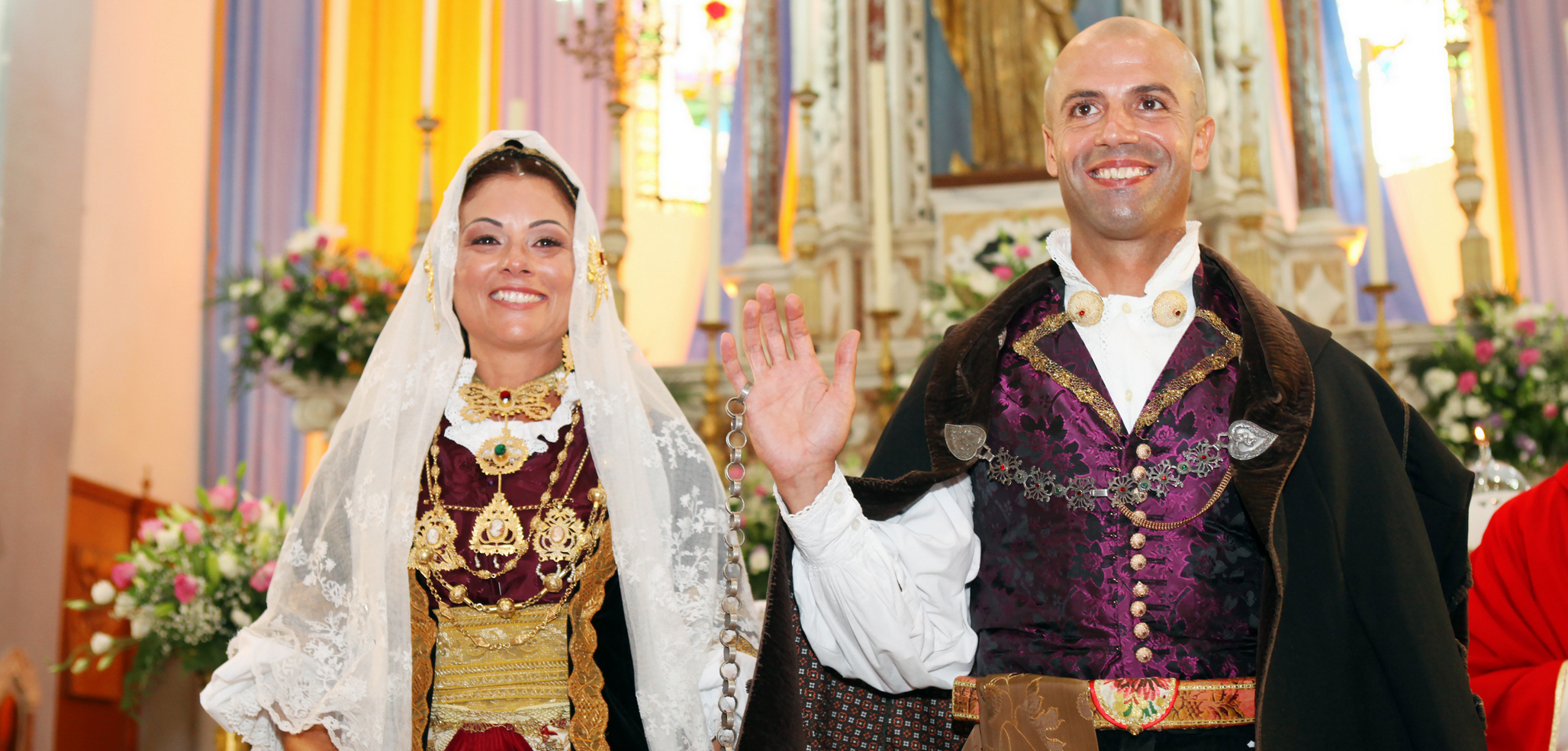
The ancient religious buildings are the little church of San Lussorio, a gem of Romanesque architecture dating back to the 13th century, far from the old town centre, on the border of Monserrato, and the church of San Giuliano, dating back to the 12th century. The sanctuary has Romanesque forms, particularly the façade, which is preceded by a portico and a central nave with a wooden roof, and an unusual charm: it is located in an evocative corner of the town centre and appears to be standing still in time. Next to the spectacular red brick tower-chimney of the former distillery of Si 'e Boi, now a cultural park, stands the current parish church of the Beata Vergine Assunta, dating back to the 15th century and remodelled in the 17th century. It features a neoclassical façade, a tall bell tower and a large dome. Inside it, there are various works of art, among which the main altar made of multi-coloured marble. The patron saint is celebrated on 15 August, Ferragosto, while St Lussorio is celebrated at the end of August. Another historical church is named after St Salvatore. The churches and the old town centre are the setting, on the second Sunday in September, of the Ancient Selargius Wedding, known as the Antico Sposalizio Selargino (Sa Coja Antiga), the most famous and heartfelt event. A wedding procession with groups wearing the traditional dress of villages from all over the Island and launeddas players accompany the bride and groom, joined by the Sa Cadena, according to an ancient ritual.
In the Selargius territory, there is also nature and archaeology. You can enjoy itineraries on foot or by bike in the Molentargius-Saline Park, one of the most beautiful natural oases on the Island and the habitat of the greater flamingo, and you will discover the origins of the village in the areas of Su Coddu, of Staineddu and on the hill of Cuccuru Matt'e Masonis, where Neolithic artefacts were found, while the sacred well of Santa Rosa dates back to the Nuragic era.

Mulargia
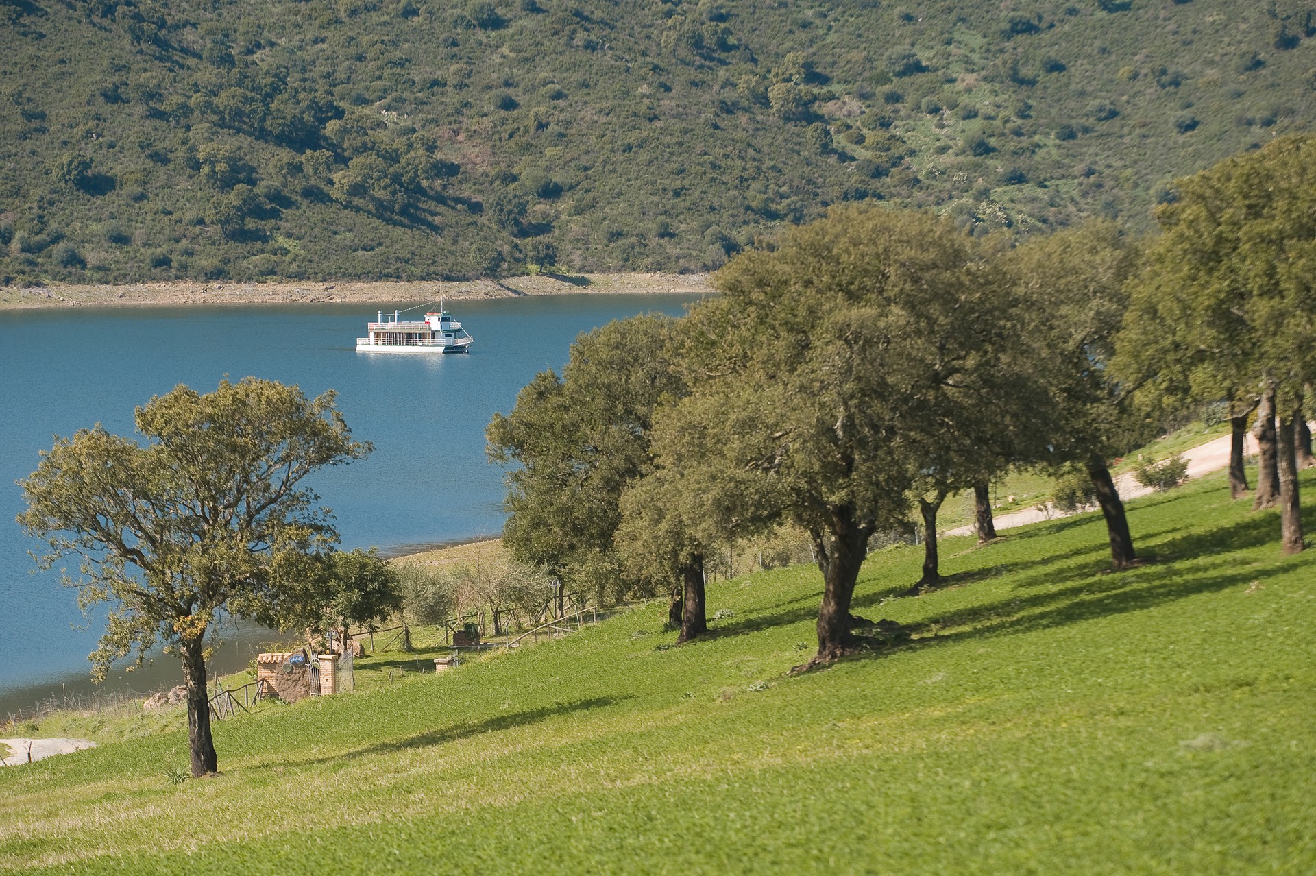
Endless trails, all to be explored, will lead you into the heart of Mulargia, a lake set between the mountains of Su Rei and Moretta, in the part of Sardinia where the historical territories of Gerrei, Trexenta and Sarcidano meet. You will travel through the luxuriant hills that slope down towards the shores, where you will notice a 'Mississippi style' boat cutting through the water, while its paddle wheels leave a long and striking white wake behind it. In the healthy air of the lake, the attractions are endless: sport, excursions and a plunge into the ruins from times gone by. During the trips, on a boat or in a canoe, you will see the dense vegetation coming down from the mountains to the shore and sink into the depths of up to 80 metres. The path along the lake is broken by the one hundred metre high walls of the great dam that creates the basin. Created between 1951 and 1958, in the territories of Orroli, Goni, Nurri and Siurgus Donigala, to feed the aqueducts of thirty Municipalities in the province of Cagliari, the great basin contains 320 million cubic metres of water that, with its characteristic blue tinges creates a quiet oasis of peace.
Inside the lake ecosystem, you will come into contact with several species of wildlife: birds, like herons, ducks, mallards and kingfishers are the protagonists, along with turtles and freshwater fish, like the perch, the chub, the carp and the rainbow trout, attracting numerous recreational fishing enthusiasts. All around the lake, an enchanting world opens up. You can travel deeply into the area and experience the visit in an alternative way, for example by climbing aboard the Trenino Verde tourist train that, along its long itinerary through the heart of the Island, passes by the Mulargia. The mountains also have interesting surprises at store: the Moretta area contains rare tree species. An aura of mystery surrounds the 'Red Giant', the Nuraghe Arrubiu complex, located a short walk from the lake, in the territory of Orroli: it is one of the most majestic and surprising expressions of the Nuragic civilization.