
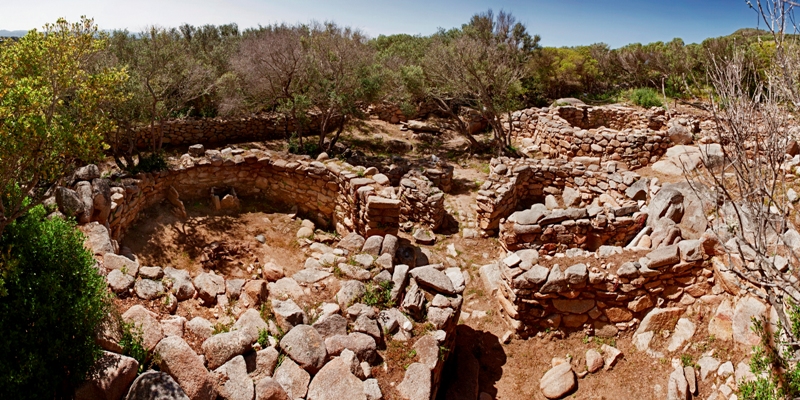
Lu Brandali
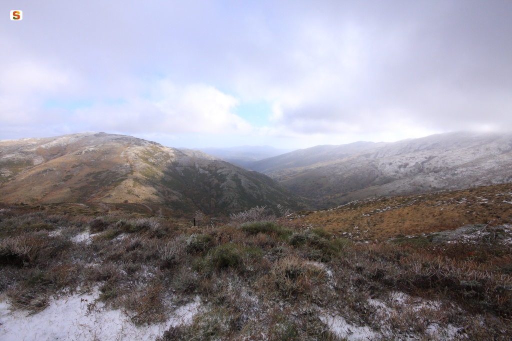
A short distance from the sea, on a granite promontory in Santa Teresa Gallura, the Nuragic civilisation has left some of its most fascinating traces, revealing its intimate daily and spiritual aspects. In the archaeological complex of di Lu Brandali you will travel through time, amidst the houses, ‘workshops’, defensive and funeral buildings of a past that dates back to between the 14th and 10th century BC. The evidence of a distant past stretches along the slopes of the promontory, surrounded by lush Mediterranean scrub. On the top, stretching over staggered levels to take advantage of the rocky formation, stands a nuraghe featuring mixed architectural elements, both ‘corridor-type’ and ‘ tholos-type’: it has a keep surrounded by a secondary defence wall with two towers, one of which was used as a furnace in the centuries that followed.
Close to the fortified area, along the slope and on the plain south-east of the nuraghe, you will visit the remains of the village. The huts, generally with a curvilinear layout, also took advantage of the landform. The walls were made of blocks positioned using the row technique and connected by mud mortar, while the floors were made of rammed earth and, in some cases, there were also rock benches. You will notice the traces of different superimposed walls: the rooms were subjected to restructuring and reorganisation of the spaces, with the addition of rooms used as artisan ‘workshops’. The huts, often built in small clusters and separated by narrow corridors, were not the only type of housing solution: to the west you will, in fact, come to the area of the tafoni, which contribute to the charm of Lu Brandali. A passage between the rocks leads to a group of granite caves, used by the villagers both as shelters and for burials.
A few dozen metres from the site, in the portion of the complex further downstream, there is a Tomb of Giants: you can guess how majestic it must have once been from the size of the still visible foundations. The tomb corridor is more than six metres long and ends in an apse shape, the flooring is made of flat slabs in front of the entrance to the exedra and in cobblestone in the remaining space, while two jambs, on which an architrave originally rested, delimit the entrance. Here, thousands of years ago, occult and mysterious ceremonies took place, in which worshippers and priests ate ritual meals and smashed ceramic containers on the ground, as shown by the numerous finds unearthed during the excavations.
After a visit to the daily life of the past, the magnificent sea of Santa Teresa awaits you: moving towards the promontory-peninsula of Capo Testa you will come across the splendid beaches of Rena di Ponente and Rena di Levante; in the western part of the cape, you cannot miss the charm of Cala Grande-Valle della Luna. A short distance from the main village square is the bay of Rena Bianca, a city beach with soft, very white sand, with the imposing Tower of Longonsardo watching over it from above. The tower was built in the 16th century by order of King Philip II and protected against pirate raids. Today it is a symbol of the town and a captivating location where you can admire the spectacular sunsets.

Sos Molinos
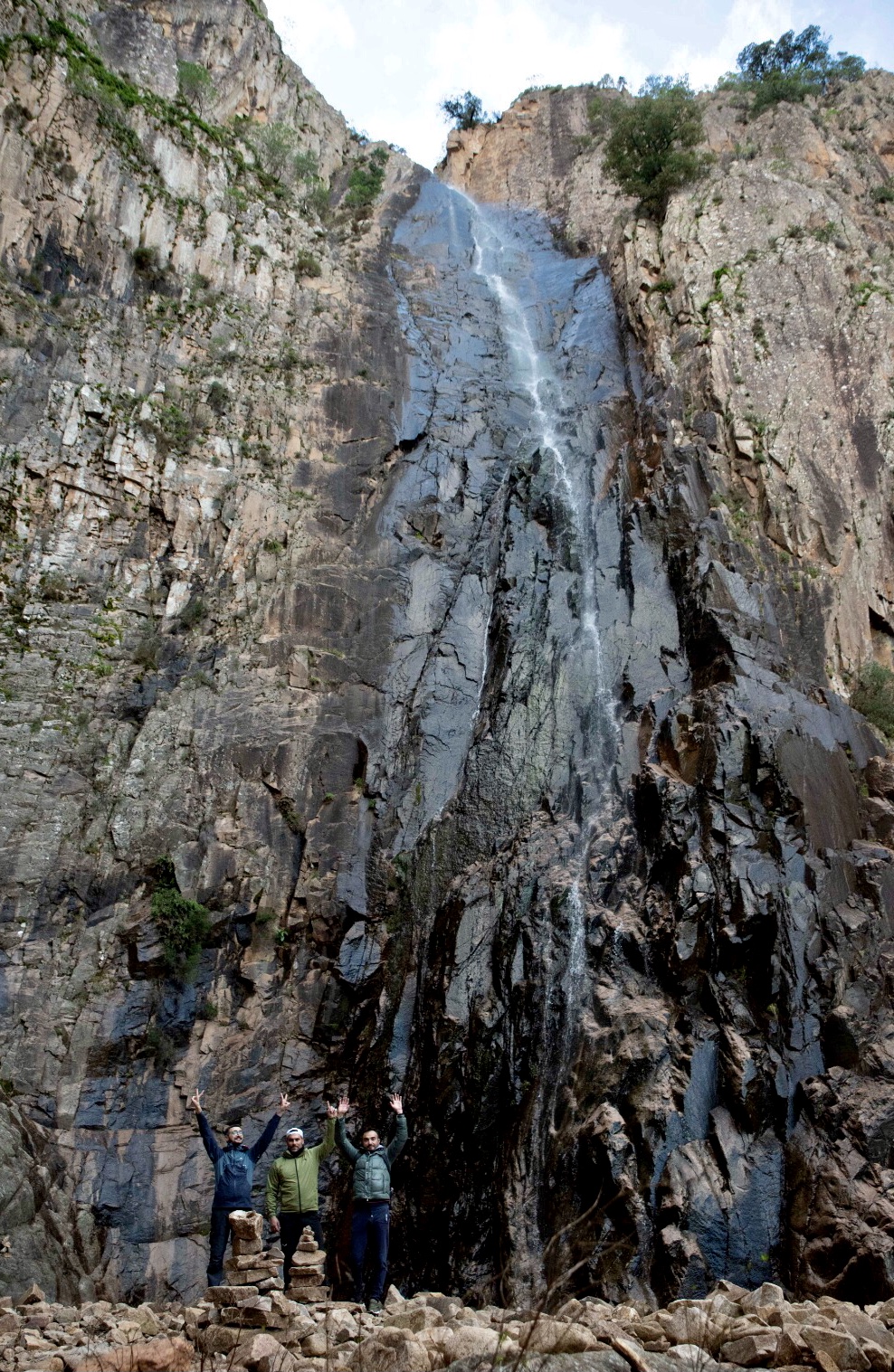
A masterpiece carefully guarded by nature. On the border between the territories of Bonarcado and Santu Lussurgiu, along Provincial Road 15, which connects the two picturesque villages of Montiferru, lies an enchanting landscape, which you will discover little by little. You'll start to hear the quiet roar of the water from the clearing by the roadside, the starting point of the path that will lead you to the valley and the waterfall of sos Molinos. This downhill mule track, with the occasional remnant of a paving stone, is lined with holm oaks, downy oaks and alders, which will accompany you on your walk. Along with the trees, you'll see countless laurel bushes, so lush that the valley has been declared a special area of conservation. Besides the green of the Mediterranean vegetation, you will be struck by the variety of flowers around the pond formed below the waterfall: cyclamens, daisies and orchids add pops of colour to the magical scenery of the water cascading over 30 metres, jumping from rock to rock. The stream that forms this waterfall flows from a height of 440 metres along the eastern slope of the basalt plateau of Montiferru, where the waters have carved a lush valley for thousands of years. There are five 'jumps', the largest - and most spectacular - being the last one, 15 metres long.
The name of this place (‘molino’ means ‘mill’ in Italian) originates from its function in the pre-industrial age: the steep watercourse, its high flow rate and the many drops meant that the water could be used as a means to power the many mills and stone fulling mills that followed one another along the stream. One of them is still there, right next to the main waterfall, and adds to the fairytale setting. Its structure and the materials once used to build it are in perfect harmony with the surrounding nature.
Santu Lussurgiu, a characteristic town with picturesque views and craft shops, is a veritable 'temple of water'. Further north, one of its hamlets in the middle of the san Leonardo forest, whose origins dating back to the 12th century are shrouded in mystery, is famous for seven springs that once flowed here, known as Siete Fuentes. Documents attest to some buildings in the villa - two monasteries and a hospital - but no traces remain. The oldest surviving structure is the church of San Leonardo. Bonarcado, on the other hand, is four kilometers from sos Molinos, and is famous for two masterpieces of Romanesque architecture: the sanctuary and the basilica of Nostra Signora di Bonaccatu, home to the oldest Marian devotion on the island.
Muru Mannu
The monte Linas massif provides for endless exploration of ever-changing natural environments: high peaks, deep gorges, woods, Mediterranean brush, streams and waterfalls. One of these, the Muru Mannu cascade in the Gonnosfanadiga area, is surrounded by imposing walls of granite, and you will be amazed at its final vertiginous drop of over 70 metres. Together with the river that feeds it, it owes its name to the rocky crest from which it flows. Near the end of its course – which begins at about 1000 metres – the river encounters a sudden drop in height, first with a few small jumps, and then the final magnificent leap that makes Muru Mannu the tallest waterfall in all of Sardinia. At the bottom, the water plunges into a small lake surrounded by oak and holly trees, and then heads into the valley with a series of smaller falls before it merges with the Linas river to create the larger Cannisoni river.
On the trail that leads to this wonder of nature, you’ll walk through shaded woods and sunny clearings, through narrow ravines dotted with oak and eucalyptus trees, while holly and strawberry trees line the path along two streams that become the Linas river. Here and there you’ll find traces of man’s presence: charcoal pits, abandoned huts and sheepfolds, all of which make the hike all the more interesting. You’ll feel like you’re some sort of fairy tale or fantasy figure as, now and again, you cross streams where, as they join, reveal little waterfalls and ponds. Finally, as you follow the course of the Muru Mannu in the direction opposite to its flow, you’ll find the big waterfall to your left.
Along the way there is a deviation that leads to the Piscina Irgas waterfall. This trail is also surrounded by lush green and ends at the feet of a 45 metre drop of water that pours into an emerald pond. On the side that leads to Villacedro, still at the feet of the Linas, is the gorgeous scenery of sa Spendula, run through with easy trails and a park with a picnic area that lead to the vista of a 30 metre tall waterfall. In his youth, the author D’Annunzio so loved this place he wrote a sonnet dedicated to it.
The natural ‘gems’ of Gonnosfanadiga and Villacidro are part of the Monti Mannu forest complex, some 4,600 hectares of dense woods, granite walls, prehistoric and industrial archaeological remains, not to mention the wildlife, that includes Sardinian deer and mouflons, as well as, for the birdwatchers, Pellegrine Falcons and Royal Eagles.

San Lussorio - Selargius
It guards fascinating mysteries and is probably one of the oldest Christian places of worship in Sardinia, perhaps contemporary with the Basilica of San Saturnino in Cagliari: its original layout could date back to the 5th or even the 4th century AD. The country church of San Lussorio is located in Serriana, on the outskirts of Selargius, a town in the Cagliari hinterland. A site that has always been frequented, as shown by the adjacent archaeological area of su Coddu: when discovering the sanctuary you can combine a visit to a pre-Nuragic village and observe the traces of numerous wells and holes where the support poles of the wooden huts were inserted.
The dating of the ancient heart of the church is not the only source of uncertainty. In fact, the magnificent sarcophagus kept inside it, also used as an altar in the past, led to the belief that this was the place of martyrdom of the saint it is named after. The name sa cresia de is santus, ‘the church of the saints’, already documented in the 17th century, leaves experts with contrasting opinions: some believe that the church was also dedicated to the child martyrs Cesello and Camerino and, in this case, it would be the only religious building dedicated to the three saints. Others, however, believe that the site on which the church stands was the place of martyrdom of numerous converts.
Outside, you’ll notice a large, elegant arch not far from the façade, the only evidence of the pronaos added by Archbishop Francesco de Esquivel. When you enter, you’ll see a building that was first rebuilt in the 12th century, while the last renovation took place after the bombings in the Second World War. A further mystery is linked to the number of naves: did the original layout include one, two or three? There’s only one today, but it has been suggested that it initially had three naves and that, following collapses that occurred in the 17th century - involving the nave on the right and the apse - it was rebuilt to its current structure on the orders of Archbishop de Esquivel himself. However, the right nave may never have existed, in which case the church would have been created with a double nave layout, similar to other medieval religious buildings on the island.
The sarcophagus of San Lussorio, dating back to the 4th century, is on the left side of the nave. According to legend, it contains the martyr’s remains, but the aedicules on its front façade show symbols of war, suggesting that it belonged to a person with a military rank. Perhaps a venator, a person in ancient Rome whose task was capturing and looking after wild animals for the games at the amphitheatre. The lid has been lost and what happened to numerous other precious furnishings adorning the sanctuary is also a mystery, including a wooden pulpit originally positioned to the right of the altar and a holy water font carved in stone. Still remaining are the three statues of the saints Lussorio, Cesello and Camerino, an oil-painted altarpiece above the altar and a Via Crucis, works by the Selargius-born artist Claudio Pulli.
Once the visit is over, you can also stop to admire the former house of Soro, an early 20th-century Art Nouveau villa joined to the church, where a monastery belonging to the monks of Saint Victor of Marseilles once stood.

Monte Ferru natural pools
Masterpieces between the sea and the mountains. A few steps away from the coastal ‘jewels’ of Gairo Sant’Elena and from the Marina di Cardedu, proceeding towards the eastern side of Monte Ferru, the highest ‘coastal’ peak in Sardinia, you will find yourself surrounded by spectacular nature. From the source on Accu ‘e s’Axina, crystal clear waters are channelled towards the valley, creating a series of little waterfalls, with water drops of a few metres, ‘resting’ in red porphyry basins of various widths and depths. Their name is Monte Ferru, but they are also known as the natural pools of Coccorrocci. The scenery is enchanting. The pools will appear in front of you at the end of a intertwining of holm oaks, junipers and oleanders. The pure, clear, very cool waters are ideal for a revitalising dip, especially in the summer heat: you’ll undoubtedly feel lulled by the gentle sound of the little waterfalls.
To get to the pools, you can follow a path marked by various indications - on signposts and painted on several rocks -, alongside the bed of a torrent up to a sort of natural stone staircase, from which you can enter the first pool and, one after the other, to the others
further 'upstream'. During the journey, you can stop off at the convenient picnic areas. The area is classified as a site of community importance: it isn’t hard to understand why. You may spot golden eagles, peregrine falcons and Eleonora’s falcons flying over the lush woods.
You can also continue up to the top of Monte Ferru, where, at an altitude of 875 metres, the view extends over the whole of the Ogliastra hinterland and coast, to the north over the plain of Tortolì, as far as the Supramonte di Baunei area and Perda Liana and, to the south, all the way to the coast of Quirra. The massif’s almost two thousand hectares of territory offer opportunities for trekking, horseback riding or mountain bike excursions. Then, a few kilometres away, there are dreamy beaches: the Marina di Cardedu, with light sand mixed with pebbles, divided into the large beaches of Museddu and Perd'e Pera; and the Marina di Gairo, with the wild charm of su Sirboni, with its soft, fine sand and red-tinted rocks, as well as the thousand colours of Coccorocci, the red background of Monte Ferru, the green junipers, the pebbles of countless colours making up the beach and the blue sea, perfect for snorkelling.
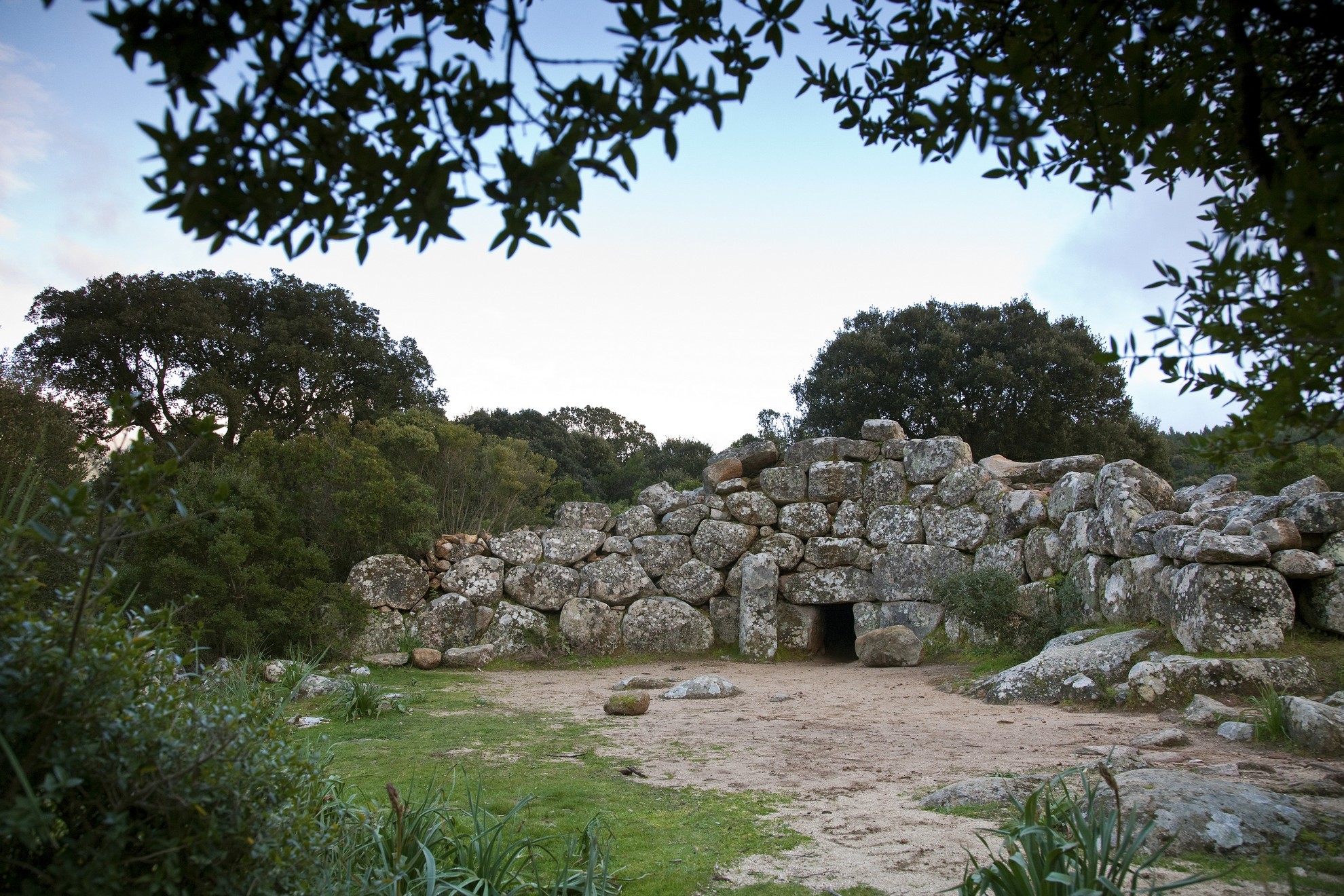
Tomb of Giants Is Concias
It is also known as sa domu ‘e s’orku, ‘the house of the ogre, the monster’, a name common to numerous Nuragic funereal monuments arising from the idea that large, evil monstrous beings dwell there. The majestic and well-preserved is Concias Giants’ tomb is the archaeological symbol of Quartucciu, a town in the hinterland of Cagliari. It sits at an altitude of 350 metres in an area called San Pietro Paradiso, not far from a little country church named after him, along the road that leads to the top of Mont’e Cresia inside the large and beautiful Sette Fratelli Park. The atmosphere around the burial spot exudes something mystical and esoteric, a legacy of the archaic cult of ancestors and prehistoric rites that thousands of years ago Nuragic priests and their followers practiced in the area in front of the exedra, made up of sacred blocks of stone.
The monument has been dated to the Middle and Recent Bronze Age and has the typical rectangular shape with an ample half-circle exedra made of rows of granite stones that decrease their size from the sides to the centre. At the entranceway you'll notice two doorjambs under an architrave and a granite bethel, a symbol of fertility that was found during the excavations. The internal chamber is about eight meters long. It has projecting rows and the height diminishes towards the base of the apse, down to about 1.7 metres. Near the massive stone door slab you will see a rectangular counter, likely used to place offerings. The floor is flattened rock. As you explore the area around the tomb you will see three cavities dug into the bedrock and encircled with stones: they are hearths or small votive wells for offerings during funeral rites.
The site sits on the western slope of the Sette Fratelli mountain range inside a 60,000-hectare park. It is a veritable green lung with some 10,000 hectares of it occupied by forests. There are many walking trails and holm oak trees reign here, alongside cork oaks, downy oaks, Spanish broom and an undergrowth of strawberry trees, thyme, heather and lavender bushes. In addition to the deer, the fauna includes wild boar, hares, martens, eagles and peregrine falcons. From the highest peaks, like punta Serpeddì, the view reaches all the way to the Golfo degli Angeli (Gulf of Angels). The park is also home to other archaeological treasures. Just to the east of is Concias is the single towered nuraghe known as sa Fraigada, which encompasses rocky outcrops, while further along is su Fromigosu, a complex nuraghe fenced in by a wall with numerous towers.
Novenary of Santa Cristina
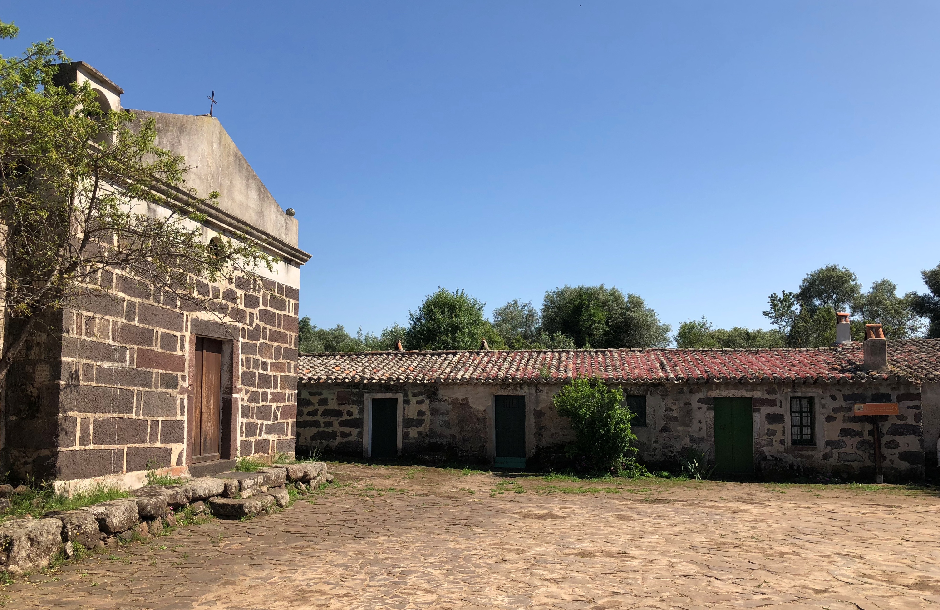
A village in the centre of Sardinia comes alive as worshippers fill it twice a year, in May and October, while during the rest of the year it brings an atmosphere of mysticism and sacredness to a place that is, in itself, magical, where the rituals of the cult of the water were celebrated for thousands of years. The church of Santa Cristina and its picturesque novenario, made up of 36 muristenes (dwellings for pilgrims), are located inside the Archaeological Nature Park of Santa Cristina, in the Paulilatino territory, four kilometres from its residential area. The charm emanating from the sanctuary lies in the union between the evidence of Nuragic, medieval and modern times, in a place that has remained an area of worship and devotion for thousands of years.
The church has undergone numerous renovations, making it impossible to reconstruct its original appearance. It probably originally had Romanesque stylistic features, traces of which remain in the oldest parts along the perimeter walls. The layout includes a single nave, with a small bell gable on the left side of the façade. You will see the façade from a rectangular square in front of it, called su corrale, while around it are the dwellings for the novena pilgrims, little stone houses with a simple and at the same time fascinating structure. The façade of one of them bears an inscription showing the year of construction: 1730. In this scenario, on the last Sunday in October, worshippers celebrate San Raffaele, while the most heartfelt celebration takes place in May, when the muristenes open for nine days, welcoming the pilgrims arriving as a sign of devotion to Santa Cristina. Tradition tells us that the saint was held prisoner and martyred in one of the nearby Nuragic constructions, giving rise to the cult and the pilgrimages of her devotees.
In fact, the church is a link between two centres of important and famous findings dating back to the Nuragic age, leading to the suspicion that the Camaldolese friars of Santa Maria di Bonarcado, who built it between the 12th and 13th centuries, wanted to break the archaic and pagan atmosphere of the Nuragic site. The ultimate sacred area is located in the first centre, surrounded by centuries-old olive trees: it is the best-preserved well temple on the Island and was built with impressive geometric precision. Inside, you can admire a vestibule, a staircase and a room with a tholos vault with concentric rings. At certain times during the year, the eternal water of the well reflects the light of the sun and the moon, creating enchanting plays of light. The temple is surrounded by a sacred enclosure, around the remains of Nuragic huts, including the main one ‘of the meetings’ with a circular seat. In the other centre, there is a single-tower nuraghe dating back to the 15th century BC - older than the well - and the traces of a vast village.
Villanova Strisaili
The name Strisaili appeared in a tax register in Pisa as far back as 1316, while Biddanoa de Strisaili appears in a document dated 1504, when Ferdinando d’Aragona turned the towns the Carroz family had been given as fiefdoms into allodio and made them his own. The history of Villanova Strisaili then darkens, perhaps because of the raids and looting that caused part of its inhabitants to move to a new settlement further east, where in 1579 Villa Manna de Strisaili makes it into the records. In 1813 the two villages officially became one and today the town is a suburb of the larger Villagrande Strisaili. It is with this city that, in 2014, it entered the Guinness Book of World Records as the place with the highest percentage of males over the age of 100. It also belongs to the Blue Zone of Ogliastra, one of five regions in the world that have the highest concentrations of people who have eclipsed the century milestone.
Villanova sits on a plateau on the southern slopes of Gennargentu. The air here is pure and the landscape verdant, surrounded by monumental downy oaks together with luxuriant junipers and holm oaks. Around the village you will find a myriad of must-see attractions, including the Bau Mela natural pools, the Pirincanes gorge and the Rio 'e Forru waterfalls. The town is just a few minutes from the lake of the upper Flumendosa, a regular destination for hikers and mountain bikers, and for the canoeists who ply the waters in search of the most beautiful views of the surrounding landscape. There is a wide variety of archaeological sites too: to the north you’ll find the Nuragic sanctuary of s'Arcu 'e is Forros, where, next to a megaron temple, there is a tri-lobed nuraghe and huts. Then there is the area of sa Carcaredda, with four Giants’ tombs near a rare temple in antis and a village, and, finally, the Troculu complex with two nuraghes, a village and, more importantly, a well-preserved Giants’ tomb.
Traditions here have not changed for centuries. On the third Sunday of June, they celebrate San Basilio Magno and the town fills with thousands of Sardinians pilgrims. Villanova Strisaili is also one of the stops along the Cammino di San Giorgio vescovo, a pilgrimage route that is still in the making to retrace the medieval evangelization journey of the legendary bishop of Barbaria who lived between the 11th and 12th centuries.
Compoltitu
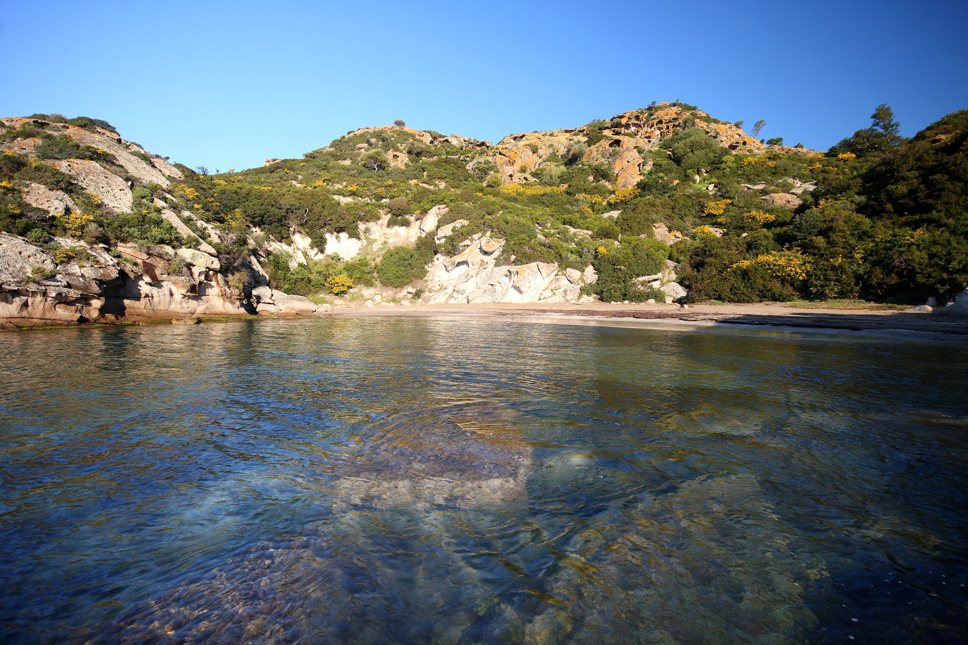
Beautiful rocky promontories embrace and protect its sides as they descend into the transparent sea with its waters reflecting shades of turquoise and blue. Five kilometres north of the medieval village of Bosa, along the scenic road heading to Alghero, you will find the small and beautiful white sandy beach of Compoltitu, in a natural harbour, with its shallow, crystal clear waters, which has earned itself the highest recognition by Legambiente (Italian environmentalist association). You will be struck by the overall scenery of the cove, set between reefs of white limestone rocks smoothed by the sea, allowing you to stretch out in the sun serenely, in a place completely sheltered from the northwesterly wind. Alternatively, you can use them as a trampoline for diving into the water above a sandy seabed. While doing some snorkelling, you can explore the nearby rocky coves.
From the car park, you can walk along a short, bumpy path through the Mediterranean scrub. Once you reach your destination you will find a true pearl of nature before you, in an unspoilt natural setting.
In another splendid inlet, about a kilometre away, before entering the charming town of Bosa, you will find s’Abba Druche, a small easily accessible beach with medium-grain sand, pebbles and shells washed by a green sea. Four kilometres further on, you will enter the historic city most typical of Sardinia, at the mouth of the Temo river, with all its attractions – the Malaspina Castle, ancient tanneries, the historic town centre and the colourful houses of the sa Costa district, unique on the Island.
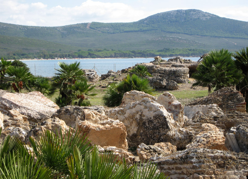
Villaggio di Sant'Imbenia
The ancient geographer Ptolemy defined nymphaeus portus the splendid, peaceful bay of Porto Conte, today the lovely centre of a beautiful park a few kilometres from Alghero. In this natural harbour - the likes of which is rarely seen - stretching between the promontory of Capo Caccia and Punta Giglio a Nuragic settlement developed around the 14th century BC and was destined to undergo an extraordinary evolution. In the space of just a few centuries, that village, known today as Sant’Imbenia, became one of the major commercial ports of the Mediterranean, where the Phoenicians, Greeks and Etruscans exchanged goods and materials with the local people. Thus, those populations that once came from the sea, assimilated new cultural aspects over time, imported from other ‘peoples of the sea’.
Your journey into the past starts at a nuraghe, of which you can observe the central tower and the bases of two secondary towers, and at a series of huts around it. Their structure and placement underwent impressive renovation: rooms were opened up, the layout of the dwellings - which were connected and organised into ‘blocks’ - became more elaborate and, above all, something revolutionary was created considering the period: a large public square, onto which shops and workshops opened up and were equipped with furnaces. You will notice traces of the narrow streets and paved squares that separated the insulae, with community areas, furnished with bench-seats and stone basins. There are also traces of the only circular hut separate from the other buildings, known as the ‘hut of the closets’, which has recovered numerous Phoenician and Greek ceramics, as well as copper ingots and bronze objects.
The village’s commercial evolution took place thanks to its strategic position by the sea, as it was a sheltered and safe landing place even in the event of troubled waters, and also to the mineral wealth of the Nurra, particularly iron, copper and silver. The local people learned new metalworking and ceramic techniques, creating oriental-inspired artefacts. The collaboration probably also included the production of wine, exported to Africa and Spain in amphorae made in the village. The port centre lost its role as a commercial hub between East and West and fell into decline during the 7th century BC: the Phoenicians changed their strategy, concentrating their trade in the colonies in the south-west of the island.
The Nuragic tour continues in the direction of Alghero, about six kilometres from the city of Catalan origin, with a visit to the majestic Nuraghe Palmavera, with a central tower, two towers with a defence wall and a large village. Proceeding towards Capo Caccia, the bay of Porto Conte offers another archaeological area directly on the sea: a leap in time of several centuries taking you to the 1st century BC, as a guest of the villa of a wealthy landowner from the Roman era. The Villa of Sant’Imbenia has three main bodies: a residential part, with rooms decorated with frescoes, stuccoes, mosaics and covered in marble; a probable thermal plant, also with rich decorations; and a ‘rustic’ part with service areas, servants’ quarters and warehouses. It was a real agricultural holding, with plots of land organised into large estates to exploit the fertile soils and fish resources. The products were intended for domestic consumption and trade to overseas markets.