
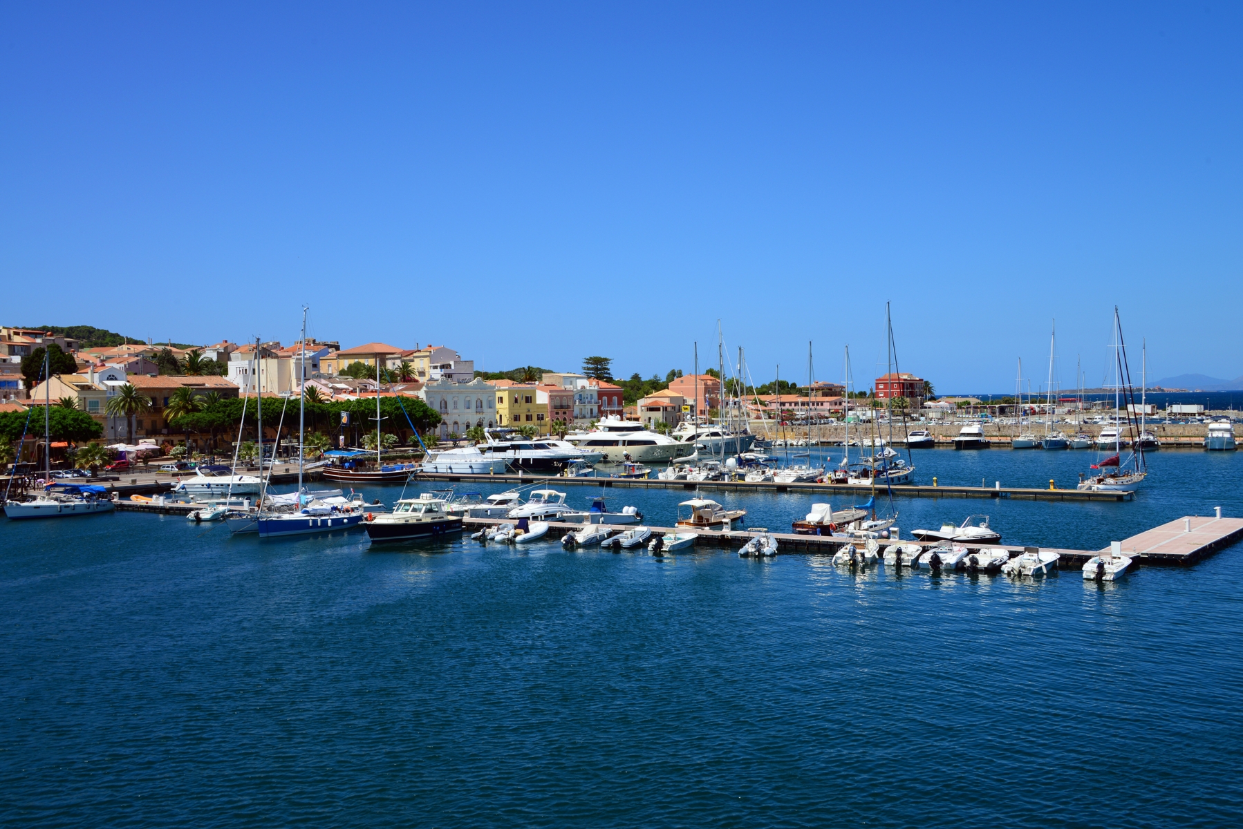
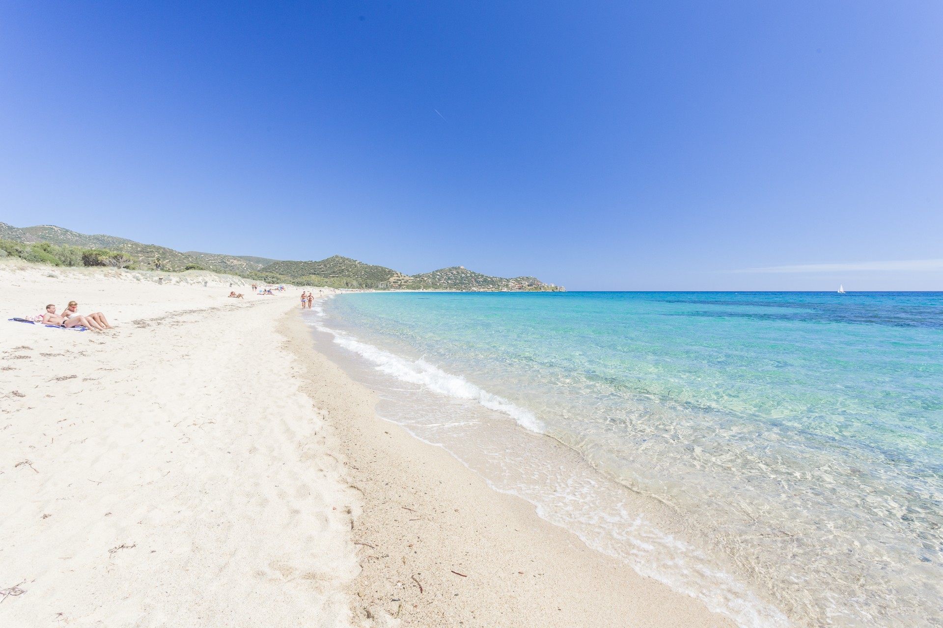
Sea Museum
“King Carlo Emanuele (…) successfully transformed, (…) the inhospitable island into a region of fishing and trade so that it would bring wealth and well-being to the kingdom and abroad”. The inscription stands out on the southern door of the Savoy fortress: it was the first masonry building (1738) of the then-emerging Carloforte, a village built on a natural acropolis. The small fort was built as a guardhouse and meeting site and later became a place of imprisonment. Following its renovation, it currently accommodates the civic museum, known as the Museum of the Sea. Inside it, you will find the story of a Ligurian community that moved from Tabarka (in Tunisia) to the Sulcis island of San Pietro, which can now be reached in 40 minutes by ferry from Calasetta and Portoscuso.
The first of six rooms contains the colonization documents. The second room contains artefacts linked to the fishing, processing and preservation of tuna, an activity that made the island famous all over the world. You can admire the model of a tuna-fishing net, arepresentation of the series of anchors and nets that form the ‘cage’ used for tuna fishing, and a model of the nineteenth-century establishment of Portopaglia. Every year, between the end of May and early June, Carloforte celebrates this tradition with an international culinary event called the Girotonno. The museum continues on with the Malacology room, in which there is a collection of Mediterranean shells. In the Galanzieri room, there are documents about the boatmen who maintained a connection between the island and the mines of Sulcis (in particular in Porto Flavia) for transporting minerals, as well as the tools used in Lateen sailing. The visit ends with the room of rural activities and with one dedicated to the painter, Mario Emanuelli.
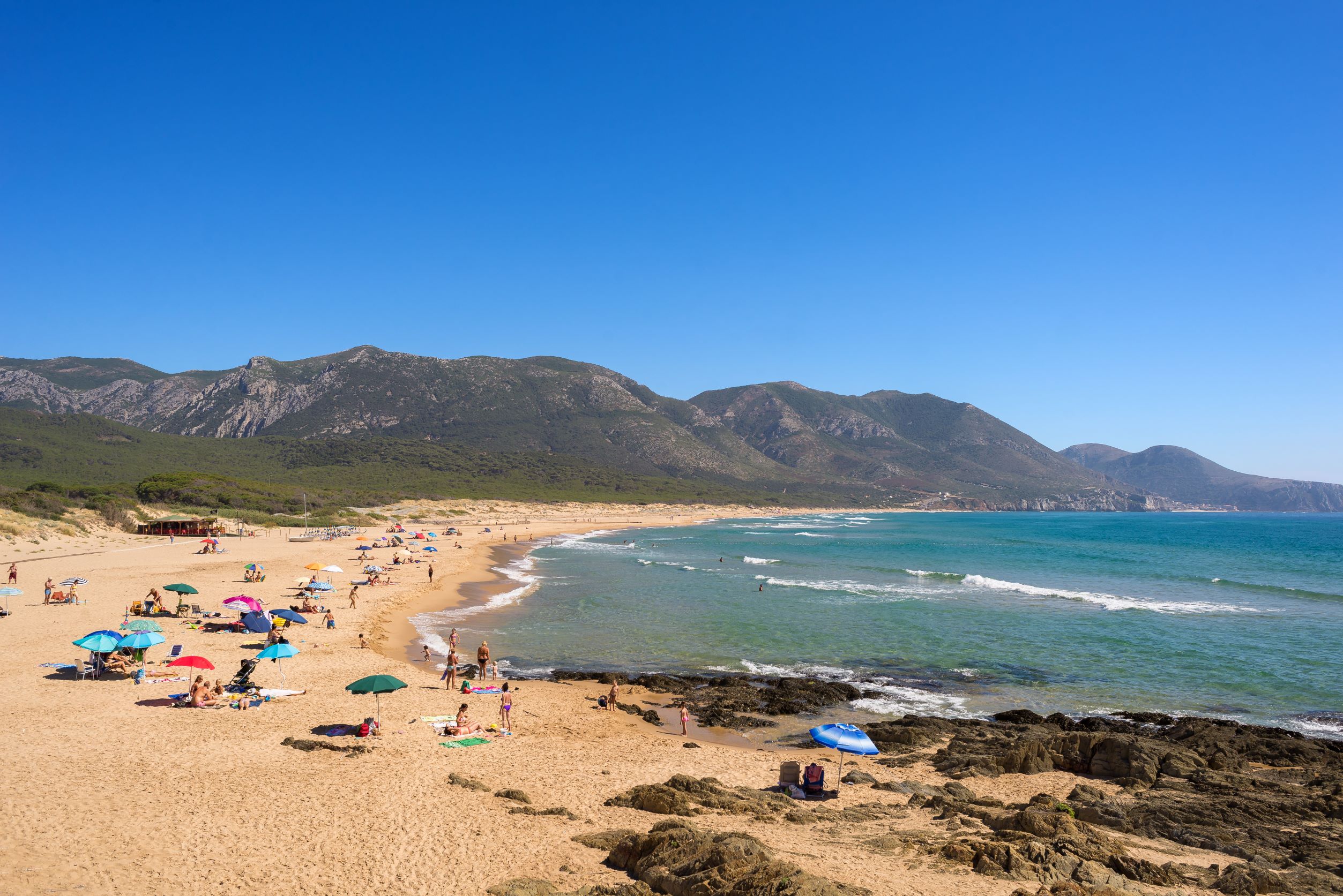
After your visit to the museum, don't miss your chance to explore the jagged coastlines and the wonderful coves of San Pietro. To the north, you will find the romantic CalaVinagra; to the north-west, there is a deep fjord that is closed by the enchanting Cala Fico; to the west there is the impressive promontory of Capo Sandalo, dominated by the nineteenth-century lighthouse. There are no other lighthouses in Italy located further west than this one. To the south, there is La Conca, with its sheer cliffs, and Le Colonne, two sea stacks standing up out of the water and the symbol of Carloforte.
Porto Ottiolu
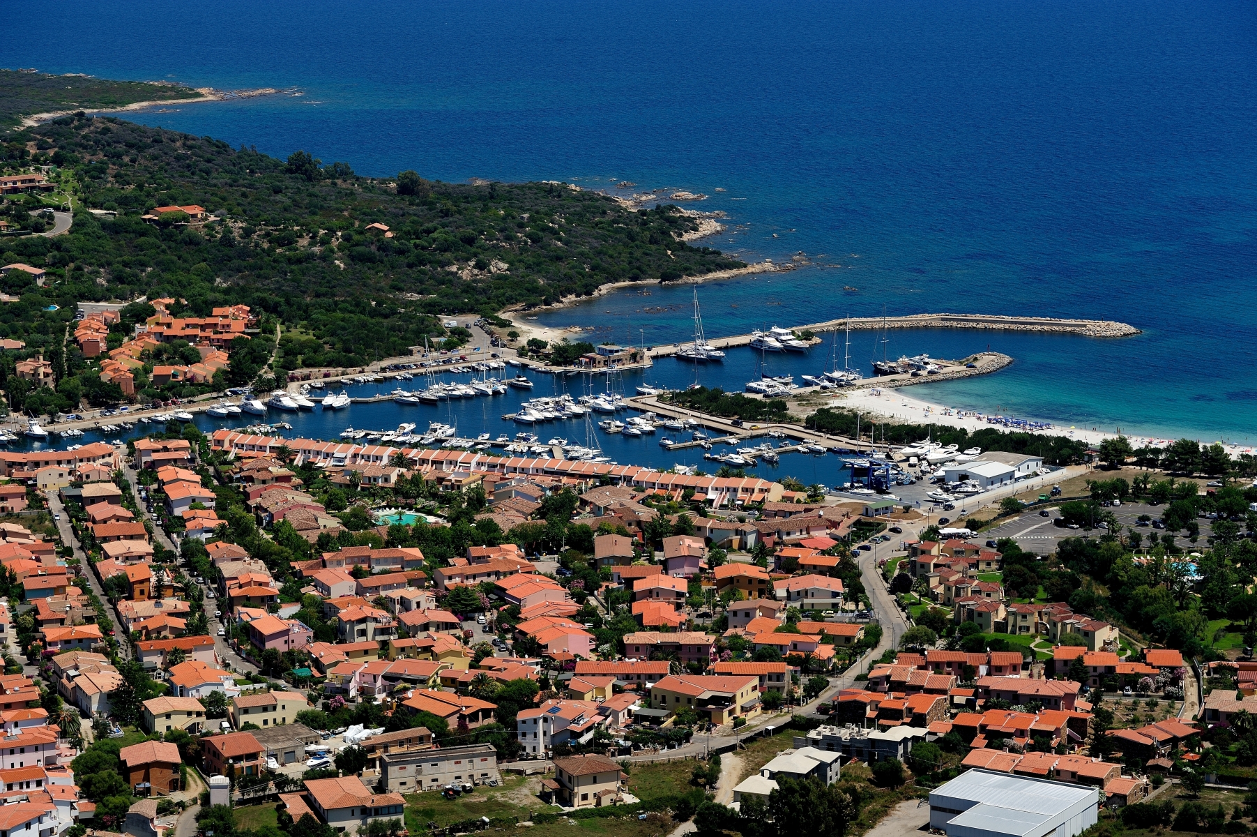
A captivating little village, a white beach, cobalt blue sea and a tourist port among the most well-equipped in Sardinia. Porto Ottiolu is a splendid bay situated halfway between Budoni, of which it is a district, and San Teodoro, on the border between Baronìa and Gallura.
Its beach is perfect for people to enjoy and a must for anyone wanting to experience all the amenities offered by the beach establishments: half a kilometre of fine, light, slightly sparkly sand, forming small dunes covered with low vegetation and a shallow seabed that makes bathing easy for children, in front of the little island namedTo d’ottiolu.
CalaOttiolu is accessible to the disabled, it has ample parking, places for dining/refreshments and it is very popular with windsurf and recreational fishing lovers, as well as by diving and snorkelling enthusiasts. It is possible to rent beach umbrellas, sunbeds and pedalos. Departing from Ottiolu and walking to Punta Li Turchi allowsyou to discover evocative places, like the Spiaggia dei Francesi and Poltu Quadu, in a sheltered and secluded little cove. From here, you can easily get to the other beaches of Budoni and those of San Teodoro.
The port takes up a large part of the bay and its position is sheltered from the winds. With a series of docks that stretch for two kilometres, it can accommodate up to 400 boats and vessels of every category. It is currently one of the most important tourist ports in Sardinia. Behind it, there is the village and residential area of Ottiolu, with its little main square and services, bars, restaurants, commercial premises and offices. From the port, you can set off on a journey to discover the natural beauty of the north-eastern part of the Island. You can choosefrom a large selection of organized tours, particularly in themarine protected area of Tavolara - Capo Coda Cavallo, in the park of the Maddalena archipelago and in the Gulf of Orosei with its unspoilt islands, sheer cliffs, little bays and charming beaches.

Porto Rotondo
One of the most important places for national and international tourism. It is a jewel in the crown, along with Porto Cervo, forthe Gallura area, on the north-eastern coast of Sardinia. Porto Rotondo is a district in Olbia, a few kilometres from GolfoAranci, Palau and Arzachena. In 500 hectares of territory, between the gulfs of Cugnana and Marinella, with a highly-equipped tourist port with 800 moorings for boat, there are about a thousand residents in winter. In the summer, there are sometimes as many as 30 thousand inhabitants in the villas, timeshare homes and residences built around an initial nucleus of the village, dating back to 1964. It was started by the Venetians, Luigi and NicolòDonàdalle Rose, as part of an initiative undertaken by a group of entrepreneurs. This is where its architecture, which decidedly resembles the structure of Venice, comes from and, not surprisingly, the main square is Piazzetta San Marco. Along with the magnificent residences, there are also numerous luxury and extra-luxury hotels.
Poltu Rutundu (in Gallura dialect) is considered one of the most ‘in’ places in Sardinia and the whole of Italy: it is easy to encounter famous personalities, especially in the summer, at nightclubs. Big names from the world of high finance and show business personalities choose it as a summer residence.
It is generally considered a Costa Smeralda locality, even though it is technically not part of it, based on what was established by the Costa Smeralda Consortium. This has led to a certain rivalry between the Porto Rotondo‘rotondini’ and the Porto Cervo‘cervini’, each wanting to be leader of the most renowned locality.
In Porto Rotondo, every year, at the end of August, the Big Game is held. This is a deep-sea fishing sports event, among the most important and spectacular in the Mediterranean. The Porto Rotondo Yacht Club, officially established in 1985, has become one of the most important at national level, maintaining a strong link with the Yacht Club Italiano in Genoa.
San Giovanni di Posada
A location set in the greenery of a pine forest that surrounds a long white beach with a crystal clear sea. San Giovanni is a delightful village just over three kilometres from one of the most important towns in Baronìa, Posada, and near the large and well-equipped tourist port of the renowned La Caletta in Siniscola. It is the ideal place for anyone wishing to spend their holidays in a relaxing environment, a stone's throw from the sea, especially for families.
All the beaches of Posada, San Giovanni, Su Tiriarzu, Iscraios, Due Pini and Orvile, have been receiving the prestigious Cinque Vele Legambiente recognition for many years, thanks to the attention focused on their protection, ensuring that they remain true natural oases. Along the coast, you can enjoy various water sports like sailing, underwater recreational fishing, wind and kite surf, beach sports like beach tennis and beach volley and you can ride along the coastline on a bike or on horseback.
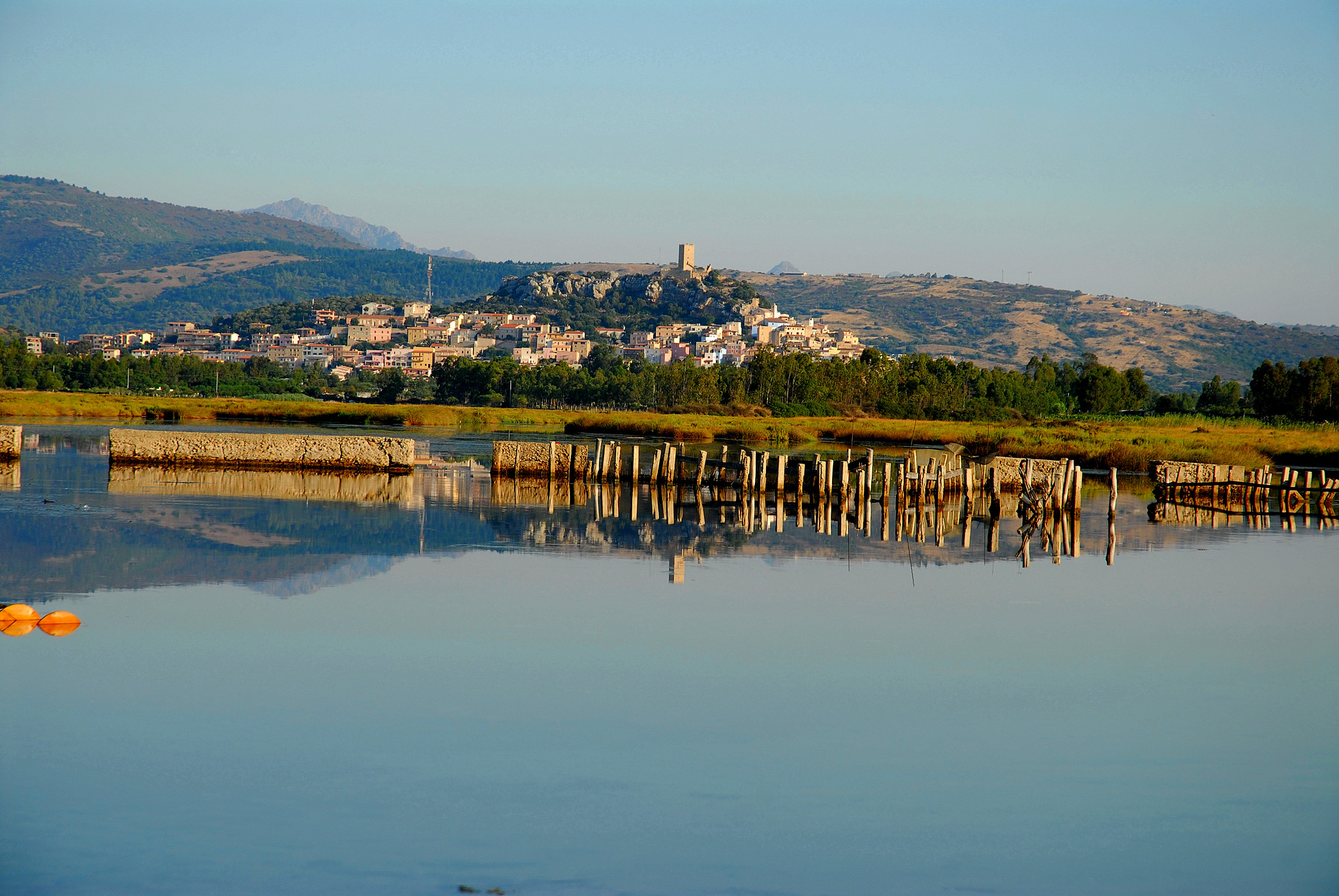
The tourist locations to stay at in Posada are in the old town centre, the outskirts and, of course, the village of San Giovanni, with hotels, residences and numerous bed&breakfasts and holiday homes. The entire Posada valley is an attraction, not only for its sea and beaches, but also for its extremely high environmental-natural value and for its history. Posada is one of the most beautiful medieval villages in Sardinia. It is perched on a hill and has impressive city walls. From above, the landscape is dominated by the Castello della Fava, an ancient stronghold built by the judges of Gallura in the 8th century, which can also be visited on foot. Its valley is perfect for nature-lovers, who can set out to discover the Rio Posada river that crosses the plain and can be travelled down in a canoe, allowing you to admire the pink flamingos that populate it, or the lake of Maccheronis, in the territory of Torpè. It is also the perfect destination for those who want to go on a journey back in time to prehistoric Sardinia, with its Nuraghe and tombs of the giants.
La Caletta
Five kilometres of soft, golden sand, clear blue sea and shallow waters, make it an ideal place for children. La Caletta is a long, wide beach that starts at a little coastal village of the same name, a district of Siniscola and one of the largest centres in the Baronìa area, and it stretches as far as the lagoon of Su Graneri. A pine forest surrounds the ‘spiaggia grande’ (big beach) - so-called to differentiate it from the other beaches of Siniscola - almost adjoining the beach of San Giovanni di Posada: they are interrupted only by the modern tourist port of La Caletta, which is full of services: sailing, surfing and diving schools, equipment rentals and a departure point for boat or dinghy trips.
The shoreline is often windswept and, unsurprisingly, the ‘spiaggia grande’ is equipped for water sports, among which kitesurfing and windsurfing. La Caletta has ample parking is a habitual destination for camper van tourists and campers and there are accommodation facilities in the vicinity, suitable for every type of tourist. In the village, you will find all necessary services, including car and bike rentals, restaurants, pizza restaurants and clubs.
Stretching for thirty kilometres, the Siniscola coastline is a mixture of landscapes with smooth rocks and white beaches. La Caletta takes up almost half of a total of 12 kilometres of fine sand. Moving south, you will come across Santa Lucia, another quaint fishing village, with fishermen originally from the island of Ponza, that was established around a 16th-century Aragonese tower. Then you will encounter the ‘spiaggia dei confetti’ (beach of sugared almonds), S’Ena e Sa Chitta, three kilometres of white sand, closed in by rocks in the area of an old lighthouse, off the shore of which you will find the litttle Isola Rossa (Red Island). A little further south, there are the pure white sand dunes and centuries-old junipers of Capo Comino. Continuing on, you can admire Bèrchida, which many consider tobe the most beautiful beach in the world, after which you will see theOasis of Biderosa, another magical place. It is a coastal forest of over a thousand hectares, the pride of Siniscola, thanks to its variety of flora and fauna, and it overlooks five little coves, among which the charming beach of Biderosa.

Civic Archaeological Museum "Giovanni Marongiu" of Cabras
It contains the Giants of Mont'e Prama, the greatest archaeological discovery of the late 20th century in the Mediterranean. The Civic Archaeological Museum of Cabras, inaugurated in 1997 and named after Giovanni Marongiu, a personality from Cabras, is a journey from prehistoric times to the Middle Ages through traces of the past discovered on the Sinis peninsula.
An aura of legend surrounds the stone statues of the Giants, kept in a room that was opened in 2014. In the burial area of Mont'e Prama, which dates back to the Iron Age (8th century BC), over five thousand fragments were found. Patiently recomposed, they gave new shape to the mighty sculptures, almost two metres high: 18 boxers with shield and glove, six archers with protection, helmet and bow and six warriors. Six statues 'reside' in Cabras, along with four (of a total of 16) models of nuraghe found during the excavations. The others are in the Archaeological Museum of Cagliari. Thanks to a touch screen, you can conduct a virtual exploration of the entire sculpture complex.
The pre-Nuragic Age is documented by the artefacts of Cuccuru is Arrius, a village on the Cabras Lagoon, inhabited uninterruptedly between the 5th and 3rd millennium BC. The ruins of a necropolis date back to the first period, while elaborate and decorated pottery dates back to the more recent period. In the Nuragic Age, a shaft temple was built and became a sanctuary in the Roman period. Two display cases are dedicated to the sa Osa Nuragic site, active from theMiddle Bronze Age (17th-14th centuries BC) to the Iron Age. As well as pottery, some grape seeds were found inside a well, representing the oldest piece of evidence (dating back to three thousand years ago!) of vine growing on the Island.
Tharros takes up another section of the museum. This town was founded by the Phoenicians on top of a previous Nuragic village. It was extended during the Punic era and was an urbs Romana, frequented up until the Middle Ages. Materials on show come from the tofet, a Phoenician-Punic sanctuary, in which funeral urns were placed, containing the ashes of children and small animals, to which stone rods were attached (6th-4th century BC). In another part of the room you will find artefacts from the artisan district of the town, where iron and bronze were processed, along with ceramics. The room dedicated to a great underwater discovery dates back to 2008: the shipwreck of a Roman ship from the 1st century BC, identified one mile from the island of Mal di Ventre. In the remains of the boat, which lies on the seabed at a depth of 30 metres, a cargo of approximately one thousand exceptionally pure lead ingots was found, coming from Spanish mines. A unique example for the ancient world.
Geremeas
A wonderful bay, three kilometres long on the eastern side of the Golfo degli Angeli, featuring three white sandy beaches, surrounded by promontories covered in Mediterranean scrub and by a sea of endless shades of blue. Geremeas is a tourist locality in southern Sardinia, which is part of the municipality of Quartu Sant'Elena and of Maracalagonis, residential areas less than twenty kilometres away. The two territories are separated by a river of the same name, riu Geremeas, the capacity of which increases considerably during the wintertime and flows into the sea, while during the summer it is reduced, creating a small pond close to the shoreline.
The first beach is Kala 'e Moru (Saracen's landing place), in the territory of Quartu: a sandy shore with tiny golden grains of sand washed by a transparent sea of iridescent colours and a sandy seabed. On the hill overlooking the beach, there is a large tourist village, which is separated from the magnificent cove of Mari Pintau by the promontory of Bruncu de Su Monte Moru. Further east, you will come across the other two beaches, which are separated from each other by the river. The first is Marongiu, with its fine, light sand and the other is Baccu Mandara, in the territory of Maracalagonis, with soft, golden, slightly coarser sand, which is steep next to the shore. It is washed by a crystal clear green and turquoise sea, with waters that become deep very close to the shore. Behind it there are sand dunes surrounded by greenery. Continuing along the coastal road, you will come across another famous locality in the Maracalagonis area, Torre delle Stelle.
The beaches of Geremeas can be accessed by disabled people and are equipped with ample parking and services: beach equipment and boats, places for dining and refreshments and accommodation facilities. When the northwesterly mistral wind blows, the bay becomes a destination for kitesurfing and windsurfing enthusiasts. In the evening, you can enjoy the splendid sunsets in comfort, watching the sun slowly set in the distance, 'hiding' itself behind Cagliari. As well as the sea, you can enjoy nature and archaeology in the nearby hinterland: you will find interesting archaeological sites and the Parco dei Sette Fratelli (Park of the Seven Brothers).
Portixeddu
At the foot of the slope, a small cliff opens onto a large, wild expanse of fine, light-coloured sand, more than two kilometres long, embraced by a dense pine forest, where you can enjoy some shade on hot, muggy days. The beach of Portixeddu, also known as rio Mannu because it is cut in half by the mouth of the stream, overlooks a fantastic sea, with a splendid transparent seabed that slopes rapidly and is affected by strong currents that must always be taken into account. The water is crystal clear and, with the complicity of the sun, it creates captivating sky blue colours and wonderful reflections of light.
The length and depth of the beach will always offer you tranquillity and relaxation. When the strong northwesterly wind is blowing, the beach becomes a destination for surfers. From the promontory above it, you can enjoy a spectacular view, especially at sunset. In the evening, you can also go for walks and stop off at the small stone square at the seafront, where numerous outdoor events take place in the summer. You will find restaurants and accommodation nearby, as well as a kiosk-bar on the beach and the possibility to rent beach equipment, canoes and pedaloes.
The small tourist village of Portixeddu (small port), where the beach is located, is found in the territory of Fluminimaggiore, about ten kilometres away, while the nearest town, Buggerru, is six kilometres away. Basically, it is isolated from the rest of the territory, making it even more captivating.
The coast of Fluminimaggiore has other places not to be missed, such as Guardia is Turcus (guard of the Turks) and the two coves of sa Perdixedda (pebble) Manna, the big beach, and sa Perdixedda Pittica, the small beach. Not far from Portixeddu, in the territory of Buggerru, you will find the dunes of San Nicolao, on the coastal stretch of the Golfo del Leone, one of the most picturesque on the west coast of Sardinia.
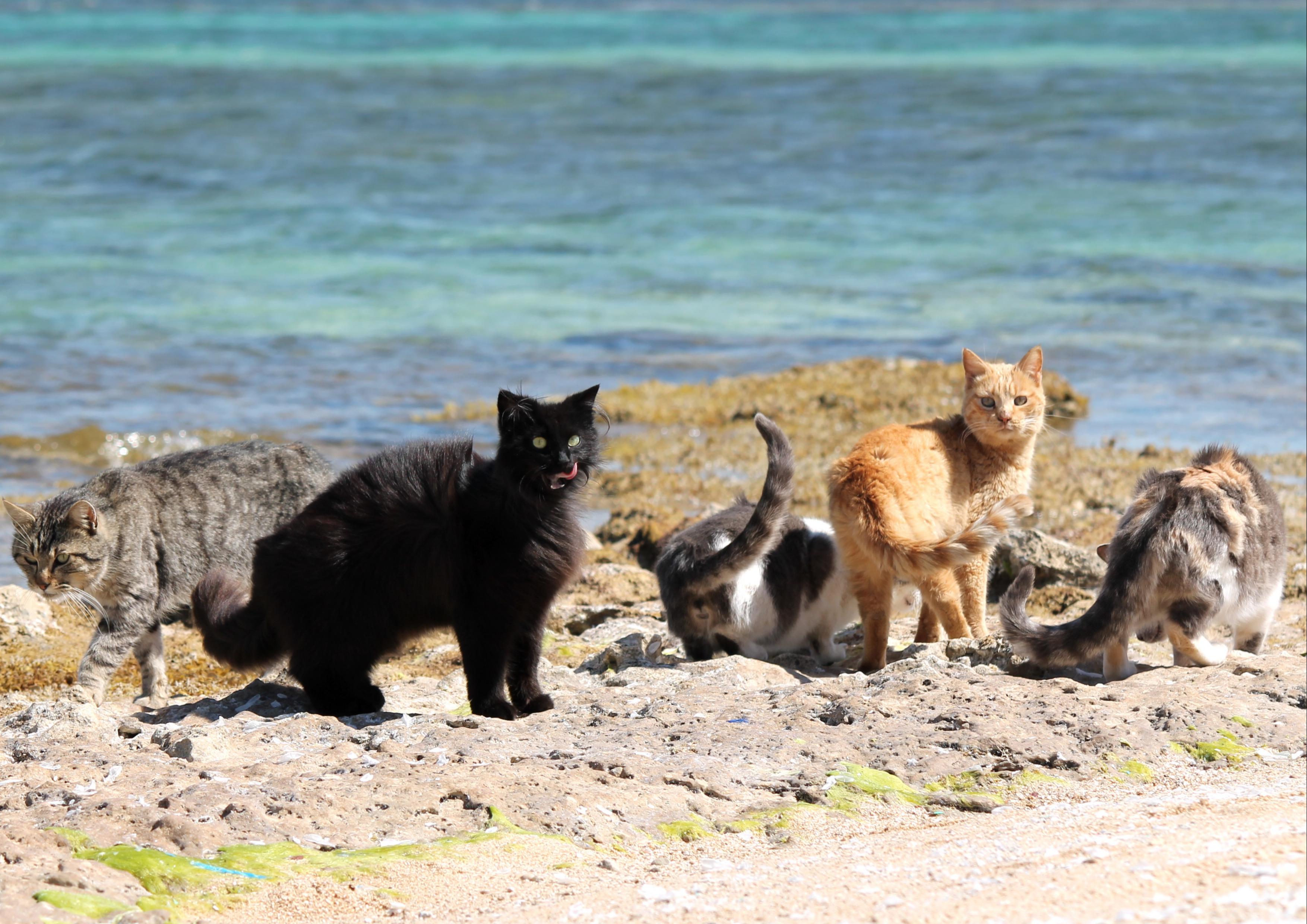
Su Pallosu
In 2016, travellers voted it the fifth most beautiful beach in Sardinia and the first in the province of Oristano. It is largely devoted to cats. Su Pallosu is one of the gems dotted along Capo Mannu, the northernmost part of the Sinis peninsula and of the marina protected area in which it is preserved. It is part of the territory of San Vero Milis, which is twenty kilometres away. It is very well-known because there is a feline colony behind it, where cats live and are taken care of and where guided tours are organised. The felines, whose presence dates back to the 20th century, often venture onto the beach: these cats are not afraid of going for a dip in the sea.
Su Pallosu is a thin strip of land with a seabed of golden and ambre-coloured medium-grain sand mixed with a few pebbles, hidden in a little cove and protected by a high barrier of earth behind it. It is washed by a transparent, crystal clear sea with iridescent green shallow waters and a sandy seabed.
To the left, you can bathe in beautiful natural pools between the rocks. There is a captivating view of the little island of Su Pallosu that dominates the scene and of the tip of Santa Caterina di Pittinuri to the north. In the western part, you can admire beautiful rocks sculpted by the sea over the millennia. To the east, the beach widens slightly. Near the beach, you will find parking, a restaurant and a bar.
It is the sandy shore furthest to the north of Capo Mannu, beyond which there is the beach of Sa Rocca Tunda and the little coves of Scal'e Sali. Further south, you will find the very unusual and sheltered beach of Sa Mesa Longa and at the base of the cape there are the beaches of Mandriola, Putzu Idu and S'Arena Scoada, the other pearls of San Vero Milis.