
Monte Olia
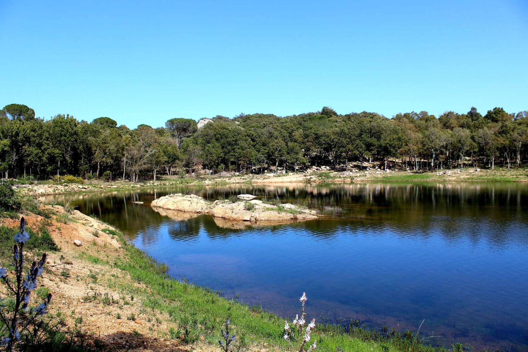
One of the “historical” regional forests has a great picnic area, is ideal for outdoor activity, and boasts fabulous views from its highest reaches. The forest of Mount Olia spreads out over an area of 2,236 hectares located between the Monti and Berchidda territories. The forest sits on a substratum of granite and is home to holm-oak woods interspersed with conifers (domestic, black and Aleppo pines), downy oaks and young cork oaks, especially in the reforested areas. You will also notice many strawberry trees, heather, cistus and lavender bushes.
The altitude here varies from the 350 metres of the valley floor to the 811 metres of its highest point, the lookout post of Mesureris. Once at the top you’ll enjoy spectacular views that span from the Olbia valley in the north-east to the island of Tovalara, then to the Limbara massif in the north-west and to Lake Coghinas in the west. The fauna that lives here is varied: there are roe, deer, wild boar and mouflons, and it is also the refuge of a rare endemic species, the Bedriaga lizard, considered one of the most quick and agile of its kind in Italy. Eagles and red kites fly high above the treetops, while the rivers are home to Sardinian trout and stream trout. In sa Toa there is a natural pond, a picnic and camping area open in the summer, and trailheads that will lead you on hikes to explore the areas around the forest, especially heading towards the s’Eleme river, which marks the border between Mount Olia and the Bolostiu forest. Another great destination is s’Elighe, a natural pool, in Lada Pilosa. It is nestled in dense vegetation, and the surrounding area is dotted with pinnettas (straw shepherd huts) and wooden huts.
Now and again, you’ll hear the throbbing of powerful engines as Mount Olia is sometimes a venue for the Rally Italia Sardegna. Not far away, the territory is home to vermentino grape vineyards, the wine boasting DOCG status. Monti is an important vermentino wine district and there is a famous festival here in its honour in August, when you can sample fine local meals paired with it. The wine museum in Berchidda tells the fascinating story of winemaking in Sardinia. Berchidda lies draped over the southern slopes of Mt. Limbara and is famous as one the Sardinia’s jazz capitals, home of the Time in Jazz festival since 1988.
The sacred well of "Sa Testa"
Uncovered in the 1930s when locals were searching for fresh water springs, it comes to no surprise that the sacred well known as sa Testa had been chosen by the Nuragic Age settlers to honour their water divinities. Today it is a site very popular with archaeology enthusiasts, especially those studying Nuragic culture. The old shrine dates to between XV and XIII centuries BCE and sits just outside of the town of Olbia. It is just under 18 metres long and made of granite, trachyte and schist cut into blocks that were then carefully finished. The external part is reminiscent of a door and symbolizes the gateway that separates the world of the dead from that of the living. The shrine has a circular courtyard, a vestibule, a small hallway between the courtyard and the well, and steps that lead down to the water at the bottom.
You will reach the circular garden area through the northern gateway. It was used to perform collective rituals of water worship. The door opens onto 17 steps that lead to the spring that gushes water from the depths of the earth. The well is reached over a floor paved with slabs of schist with, at the centre, a canal that brings water from the outside towards the steps of the well. The well is partially covered with architraves. The deepest underground part of the shrine, a room with a ceiling some seven metres high where the water gathers is covered with a false dome (tholos style). Important relics were found in the sacred area, like jewellery and a small dagger with bronze hilt, parts of a small statue that may have been set between the stone blocks.
Other traces of Nuragic civilisation in the Olbia area can be found in the Riu Mulinu nuraghe, one of northern Sardinia’s most important prehistoric landmarks, and the huge Giant Tomb of su mont’e s’Aba (or s’Ape).
Olbìa, which means “happy” in Greek, was founded by the Greeks and later became a Roman colony. The Romans built an aqueduct, thermal baths and s’Imbalconadu, a typical farm. Don’t miss out on a visit to the city’s museo Archeologico, on the little island of Peddone and the museo della necropoli underneath the lovely basilica di San Simplicio, the city’s patron saint.
Necropoli di Ludurru
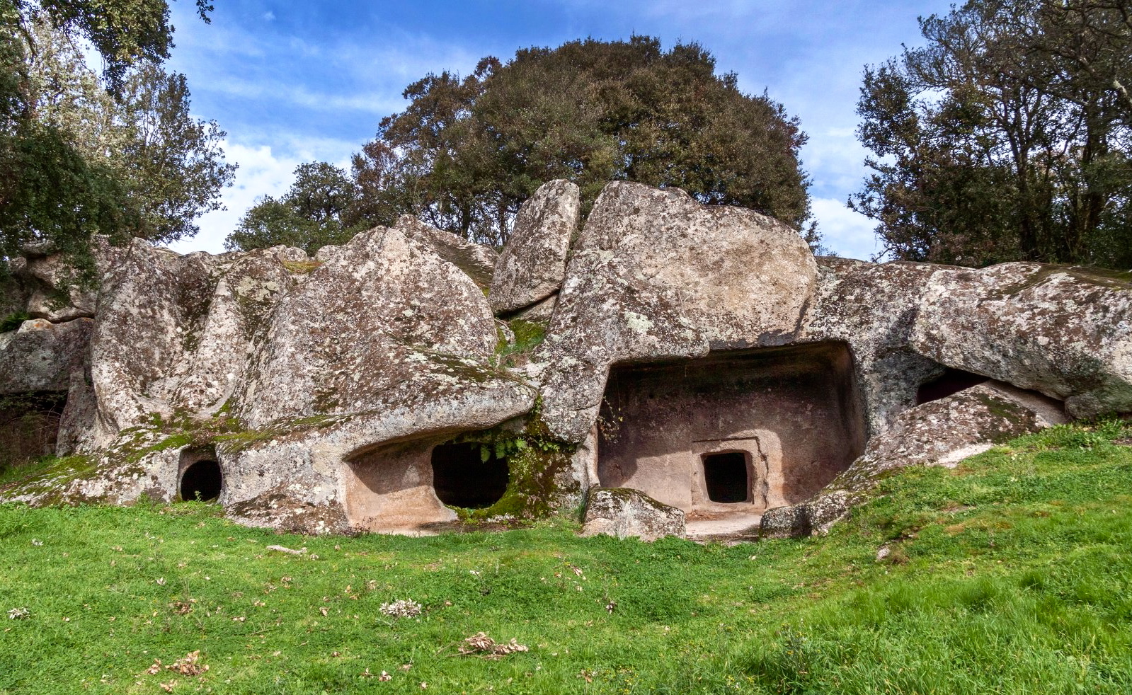
Since the Neolithic period, the people who inhabited the area of Buddusò used one of its most distinctive natural resources, granite. The precious stone was not only present in everyday life. In fact, worship and relative rituals dedicated to deceased loved ones required their remains to be conserved in hypogea dug out of the very hard rock, involving huge efforts. One of these granite benches used for the cult of the dead is in the locality of Ludurru, a few hundred metres from the inhabited area of the ‘granite’ village, which today represents a crossroads between the historical territories of Gallura, Monte Acuto, Goceano, Baronìa and upper Barbagia. Here, surrounded by Phillyrea shrubs and cork oaks, lies a domus de Janas necropolis, consisting of six ‘fairy houses’, hypogea dug during the Final Neolithic period (3200-2800 BC).
The tombs have one or more rooms. Tomb 1 has a pavilion with a hatch that leads into the anteroom, where you will notice, along the perimeter of the floor and ceiling, bands carved in relief that frame the walls and drainage channels on the floor. Two entrances with painted red bands above them lead to the central room, from which two secondary rooms branch off. Tombs 2 and 3 are single-celled and the third hypogeum in particular has a semicircular niche. The fourth domus is divided into three rooms preceded by an anteroom, in which one corner is occupied by a rectangular counter and, in the centre of the floor, a cupule was created for the hearth or in which votive objects would be placed. In the main cell, there is a trace of two semi-columns. Hypogea 5 and 6 are similar, made up of a pavilion that leads into a semicircular space. Outside, you can see a ‘roof’ covering an entrance to the tombs, while on the left of the necropolis, a false door was carved on a boulder covered with lichens, symbolising the entrance to the realm of the afterlife. Lastly, on the top of the granite outcrop, you will notice an almost regular parallelepiped-shaped boulder, with a hollow similar to a channel and a basin: the most probable theory is that it was an altar.
Buddusò contains numerous other prehistoric remains. In all, about 60 domus de Janas have been found, one of which is within the village, while most of them are in the necropolis and in its countryside: in addition to Ludurru, the burial sites of Borucca also stand out. The Bronze Age is documented by 32 nuraghi. The most important is located along the road that leads to Bitti: it is the nuraghe Loelle, hidden in the woods and featuring a ‘mixed’ structure, partly protonuraghe and partly a complex structure. Next to it, there is a village of huts, two Tombs of Giants and a dolmen.
Cala Napoletana
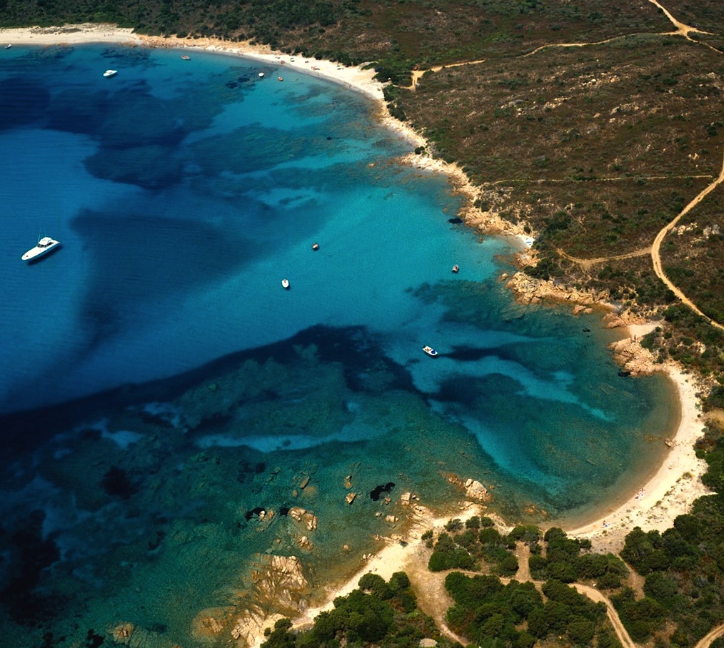
Its sea is so transparent that the boats parked offshore seem to be floating in the air. If it weren't for the numerous, multicoloured fish crowding the seabed, the waters of Cala Napoletana would be identical to those of a swimming pool. The surrounding landscape, on the other hand, makes you think of an earthly paradise: fine, soft, white sand, granite rocks tinged with pink and sinuous shapes, patiently smoothed by the wind and waves, and lush, green bushes in the Mediterranean scrub surrounding the small cove.
In reality, the sandy shore is divided into three beaches, separated by rocks and large granite boulders. The water is shallow and the gently sloping, sandy seabed is perfect for snorkelling, thanks to the extraordinarily transparent water. For those who want to relax and admire the view, the central hours of the day are best, when the sun’s rays highlight the natural colours of the beach with magical plays of light.
The beach occupies the northwestern corner of the island of Caprera – the second largest island of the Maddalena Archipelago Park –, on the stretch of coast south of Punta Galera, which can be reached by sea in private boats and on guided tours of the islands of the archipelago, or along a captivating path. The land route starts from the Arbuticci battery – a late 19th-century fortification that houses the Giuseppe Garibaldi Memorial Museum -, and the first stretch of it runs through the Mediterranean greenery, with heather, myrtle, helichrysum and strawberry trees, and then reaches a dilapidated lookout, at a breathtaking viewpoint. From here, you can admire the Strait of Bonifacio and other islands further north of the archipelago, Budelli, Razzoli and Santa Maria. You can then walk among the granite rocks, until you see the deep blue colour of the sea of Cala Napoletana.
The territory of Caprera is entirely protected by the park and it contains unmissable gems like Cala Coticcio, the ‘Sardinian Tahiti’, which can also be reached by sea or via an internal path. To the south, you will find the beach of Due Mari (Two Seas) and Cala Portese on the sides of an isthmus, both washed by the turquoise sea. Further east, you will find the Spiaggia del Relitto (Beach of the Shipwreck), characterised by the spectacular skeleton of an ancient ship lying on the shore. The island is not only known for its beaches, but also for being Garibaldi’s last dwelling: in the Compendio Garibaldino, one of the most frequently visited museums in Italy, you can retrace the adventurous events in the life of the Hero of Two Worlds.
Razza di Giunco
Its name is linked to the giunchi (meaning rushes) that populate the nearby marshy areas and it is no coincidence that unspoilt nature is the recurring theme along this stretch of coast between Portisco and the inlet of Petra Ruja, in the territory of Olbia. In reality, Cala Razza di Giunco has four beaches, including promontories, islets and fjords, creating a spectacular setting, nestled between the pink granite rocks. The beaches alternate white sand and golden sand, sometimes with pebbles, while the crystal clear sea will strike you with its deep blue and emerald green reflections. The shallow waters make it suitable for children, but it is also a destination for snorkelling enthusiasts and it is populated by numerous species of fish near the shore.
The cove is equipped with numerous services: ample parking, rental of sun loungers and beach umbrellas, windsurfing school and equipment rental and a kiosk bar. In addition, the Razza di Giunco coast is dog-friendly: you can relax and have fun in the vegetation, in the sand or in the water with your four-legged friend.
When looking out to sea, you will see the islands of Soffi and Mortorio in the distance. Then, to the east, the outline of the islet of Portisco stands out and, further on, Porto Rotondo and Punta Volpe. To the west, a spectacular promontory embraces the last and smallest of the cove’s four beaches, known as Razza di Juncu.
Further north-west, you can continue your tour of the Costa Smeralda beaches along provincial road SP 94, in the Arzachena area. You will come across Petra Ruja, which stretches in an arch shape and is characterised by its red rocks that give it its name. Then there is Liscia Ruja, the largest and best-equipped beach of the Costa Smeralda, with 500 metres of sandy shore surrounded by rockroses and strawberry trees, with its sand that turns pink as you get closer to the shoreline. Moving on, there is the bay of Cala di Volpe and, one kilometre to the south-west, the seaside village of Capriccioli, with its coastline set between pink granite rocks, surrounded by junipers and wild olive trees and divided into two main coves, with soft, light sand and shallow waters, as well as a sea reflecting captivating shades of colour ranging from turquoise to emerald green.
Razzoli - La Maddalena
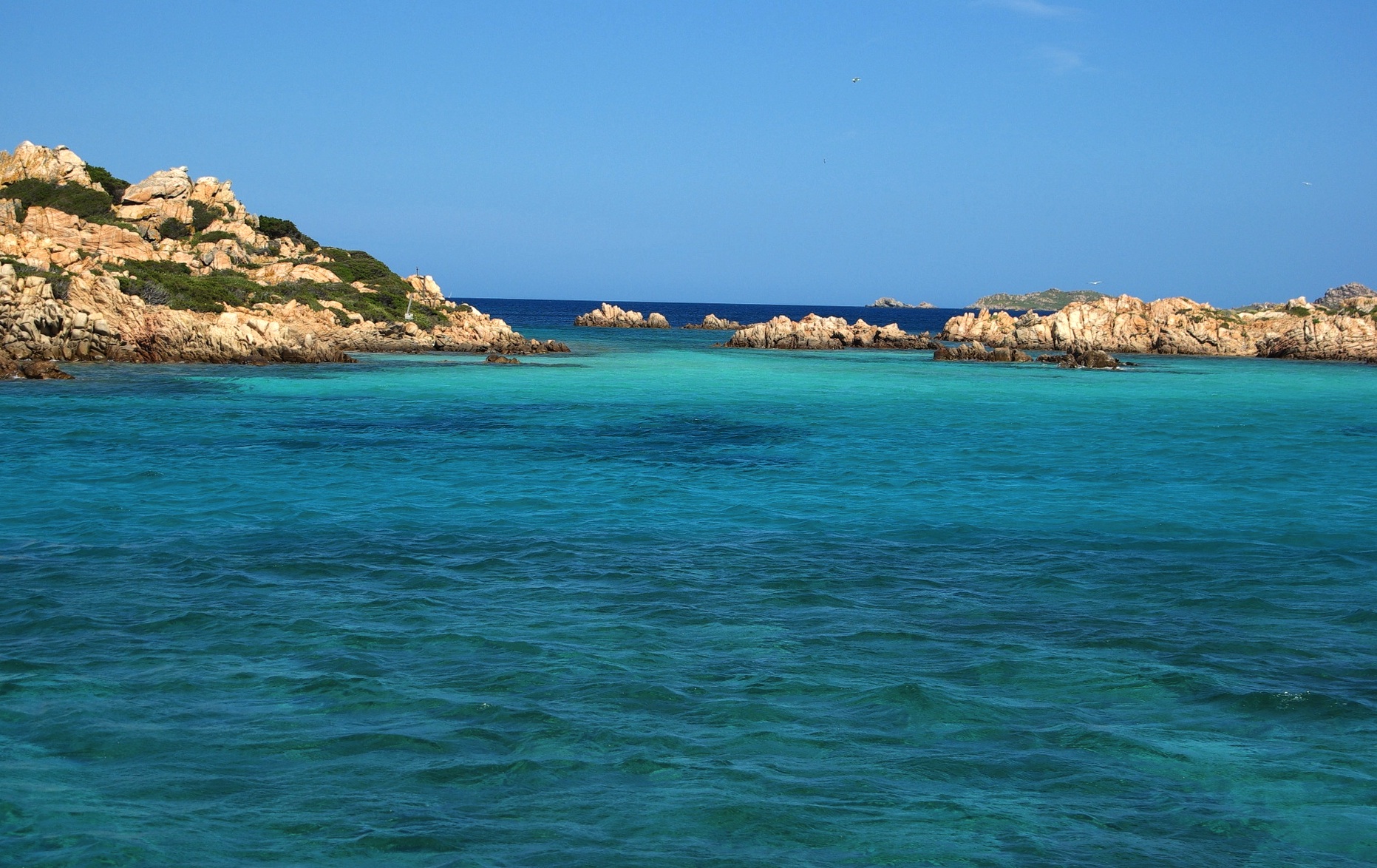
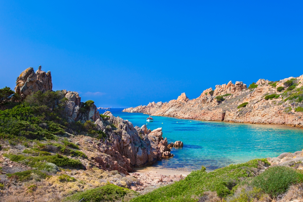
This is the penultimate bulwark of Sardinia on the border with Corsica - further north is only the "twin" island of Santa Maria. The high cliffs of Razzoli dominate from the north the park of the Maddalena archipelago, of which it is the fifth largest island with an area of one and a half square kilometres and a coastline of over twelve kilometres. The larger islands are La Maddalena, from which you will leave to go to Razzoli and the other islands, Caprera, Garibaldi’s "garden", connected to its "older sister" by the Moneta Pass, Spargi and Santo Stefano. Razzoli is the largest of the northern "trio", also composed of Budelli - with its legendary pink beach (Spiaggia Rosa) - and Santa Maria, a few meters away and connected by the Asinelli Pass.
The unmistakable characteristics of Razzoli are the jagged coastline and a mountainous conformation; the highest peak is Monte Cappello, 65 meters high, while what is most fascinating is its history that preserves mysteries that have become increasingly intriguing and evocative over the centuries. The pristine vegetation and marine fauna are the main attraction - not surprisingly, among the 60 islands and islets of the archipelago, it is the one with the wildest appearance. It forms a natural embankment with its high granite cliffs, clashing against the elements of an often rough sea at the northern end of Sardinia. The rocks shaped by sea and wind are authentic natural sculptures. Some sheltered coves are real 'gems': Cala Cappello, Cala Noce, and Cala Lunga, accessible only by sea and composed of pebbles and fine sand, and other small sandy coves like Cala Bove Marino: here in the past, not far from the shoreline, you could see the 'shy' monk seal, last sighted off the cove in 1997. The shades of the sea vary between blue and deep blue, with a seabed rich in marine fauna and flora, perfect for snorkelers.
Inland, among granite rocks and Mediterranean scrub, especially helichrysum and junipers, ancient mule tracks allow you to enter the heart of the island, inhabited mainly by sea birds, until you reach the lighthouse, built in 1974 next to the previous building dating back to 1843. You can visit the imposing structure that rises above the sea and whose great light reaches up to 13 miles from the coast. The building is connected to the beach of Cala Lunga by a mule track characterized by a rail track used by the families who inhabited the island to transport fuel and food supplies. Just before the lighthouse, guarding the tormented Bocche di Bonifacio, you will see a tomb with ancient legends. The story has it that a young woman, the daughter of a lighthouse keeper, was buried here after dying in childbirth, and that on some nights her harrowing lamentations can still be heard. According to others, the tomb preserves the bodies of two French sailors who were shipwrecked in 1855.
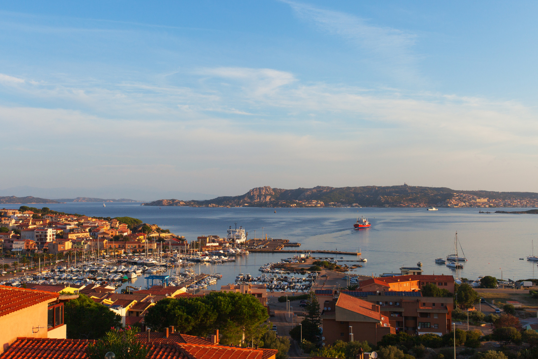
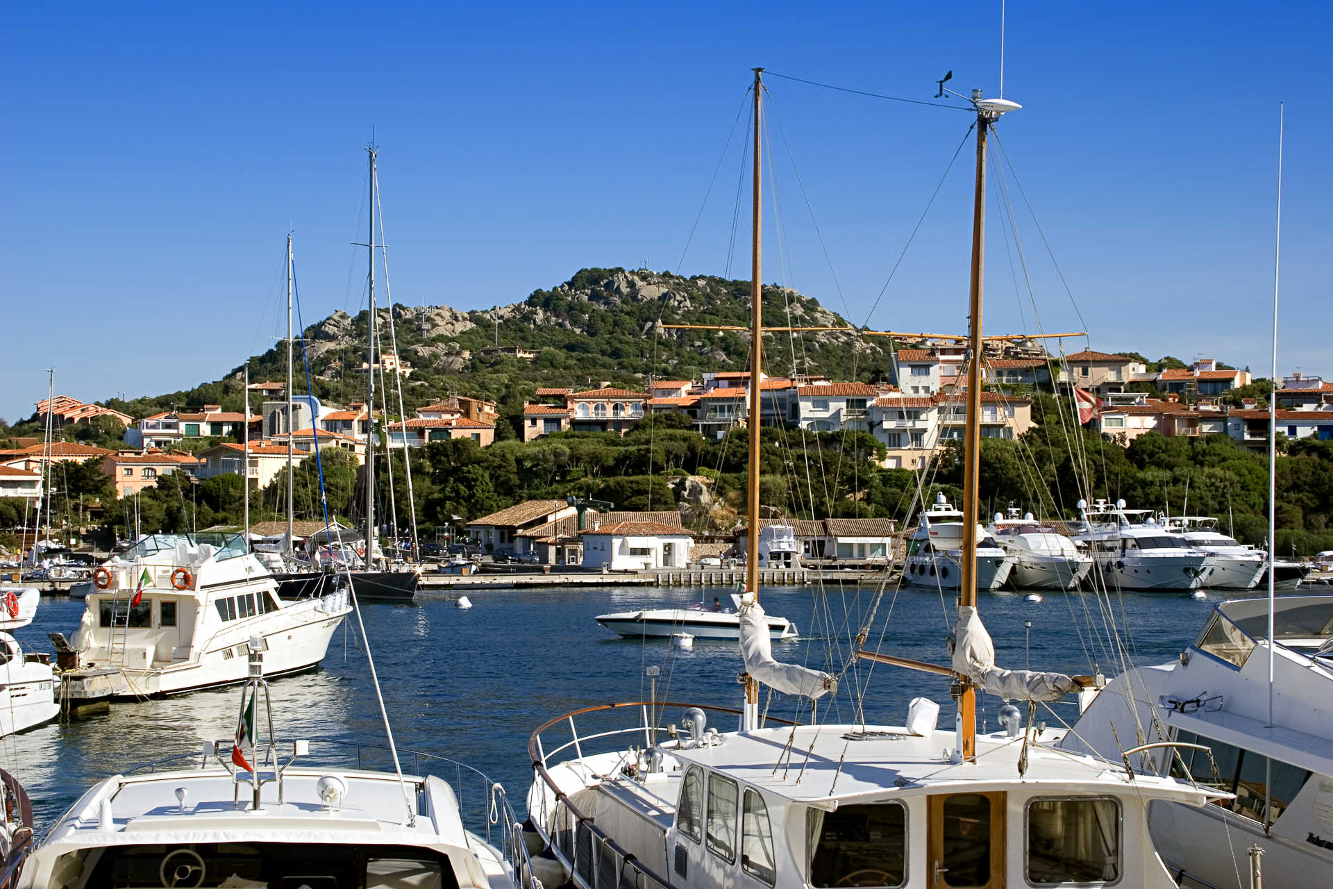
Palau
Clear blue water and boulders sculpted by weather and time. Palau is nestled in an inlet well repaired from the northern winds, adjacent to the exclusive Costa Smeralda and looking out over the beauty of the enchanting Maddalena Archipelago National Park. This tourist resort and harbour town came about in the late XIX century and counts some four thousand residents. Summer evenings bustle with night life and events. The main religious festivity here revolves around Santa Maria delle Grazie in early September, and winter is enlivened by a spectacular Carnival celebration that is reason enough to come for a visit. On a granite promontory chiseled by time just outside of town is a natural sculpture that seems crafted by an artist. It is Orso rock, the symbol of Palau, and looks out to distant horizons over the sea. The II century CE geographer Tolomeo claims that it had already been known since the days of Antiquity, and that even then sailors used it to guide them along their way. The seascape around Capo d’Orso is as beautiful as it is interesting, thanks to the tafone tombs and remains from the Neolithic Era. The sea bed here is resting place of shipwrecks from a variety of periods. Other sites well worth a visit are the Luchìa nuraghe, set as a guardian to the Bonifacio straits, and the Giant Tombs of Li Mizzani and Sajacciu, near the church of San Giorgio. As you head towards Don Diego, stop at the Batteria militare fortress at Talmone. There is another fort on Mt. Altura, a belvedere that looks out over the sea.
As you go from one end of Palau to the other, the shoreline alternates between granite coastline, sandy stretches, like Sciumara beach, and the lovely Porto Faro, with its Nordic atmosphere. Headed west you’ll come across the renowned and exclusive Porto Rafael, with its luxurious villas and a tourist harbour framed by wild olive trees, myrtle and lavender. Then there is the enchanting beauty of Punta Sardinia and the exotic atmosphere of Cala Trana, a little beach of light pink sand protected by dunes and flanked by huge granite boulders. Further towards Santa Teresa Gallura you’ll find the wild natural haven of Isuledda or Isola dei Gabbiani (Seagull Island). It is actually a peninsula held together by an isthmus of sand and surrounded by a turquoise sea. Two beaches fan outwards to the water’s edge: Arenaria and Porto Pollo. There is always a pleasant breeze here making it ideal, along with nearby Barrabisa, for windsurfing, kitesurfing and fun-boarding. International competitions featuring world champions are held here every year. Isuledda is also great for camping and campers. The view from here includes the little island of Cavalli and, further in the distance, Spargi and Budelli.

Chiesa di Stella Maris
An iron cross stands on top of the white bell tower, with a curvilinear outline, pointing up at the sky in front of the bay of Porto Cervo. Its cone-shaped outline dictates the rounded form of the entire structure of the small Church of Stella Maris. The building is a classic example of modern architecture. It was designed by the architect Michele Busiri Vici, in 1966, and was completed three years later. The small church overlooks the sea at the port of the renowned tourist resort: the white colour and soft lines, in perfect ‘neo-Mediterranean’ style, so dear to its creator, can be seen from afar, in the Costa Smeralda landscape, while the bells ring out to mark the passage of visitors arriving from the sea or from the land.
The main entrance is sheltered in the shade of a portico consisting of six stone pillars that hide effigies and portals crafted by the artist Luciano Minguzzi. Just before crossing the threshold, you can admire two sculptures by Pinuccio Sciola on the façade, portraying Saint Joseph and Pope John Paul II. Inside the temple, the granite floor shines in the sunlight coming in through the finely decorated windows. In the years following its construction, the church was further embellished by various donations such as the evocative Mater Dolorosa, a sixteenth-century painting by El Greco (Domenico Theotocopulos). The small church also contains a Neapolitan pipe organ built by the De Martino organ makers (17th-18th century) and the bronze doors depicting the Annunciation and Christian symbols, also the work of Minguzzi. Two crucifixes made by the German school, dated late 17th and 18th centuries, complete the interior of a small architectural jewel, immersed in sacredness.
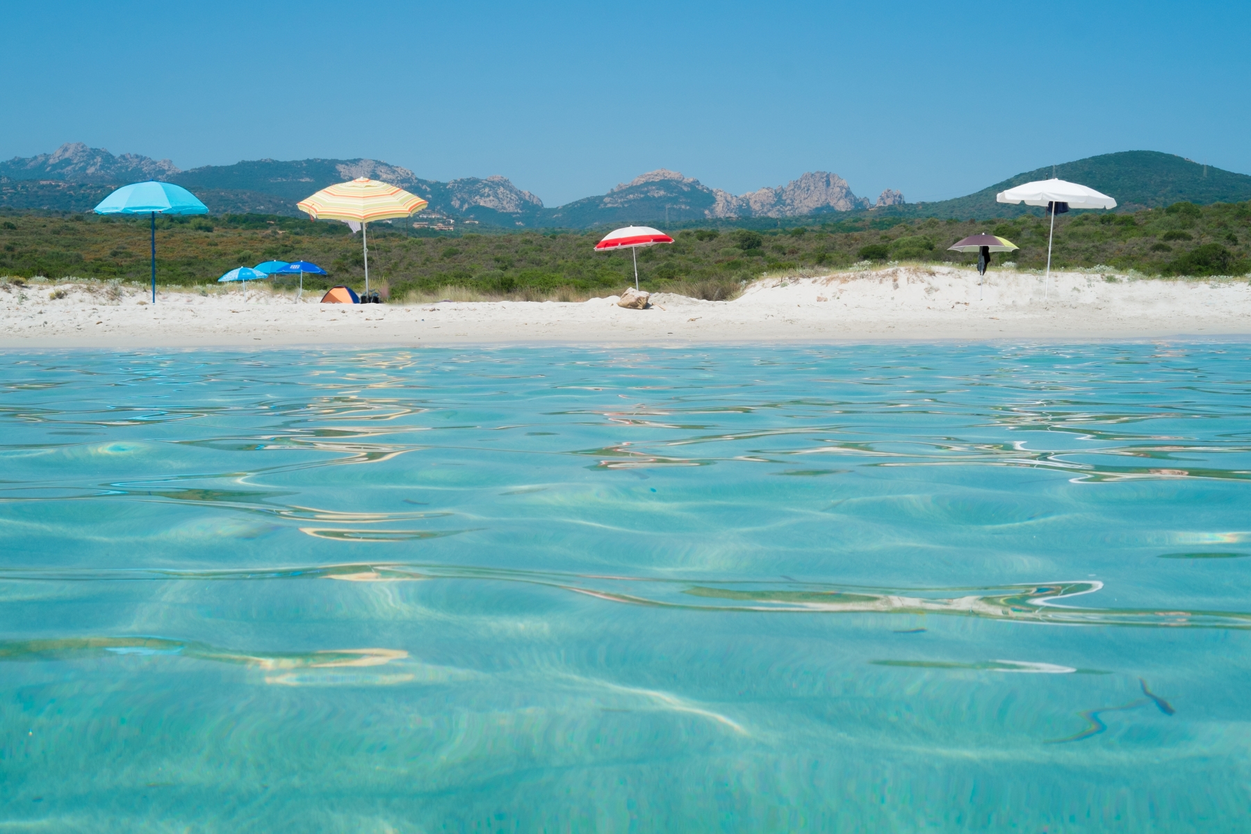
Rena Bianca - Olbia
As soon as your feet touch the sand, you’ll feel like you’re inside a picture postcard. Fine, soft, snow-white, glistening grains of sand, facing a sea reflecting shades of turquoise and emerald green, with reddish granite cliffs to the sides and a crown of fragrant Mediterranean greenery behind it. This is the enchanting setting of Rena Bianca, one of the iconic beaches along the northeastern coast of the Island, 17 kilometres from Olbia and a few steps from the seaside villages of San Pantaleo and Portisco. From the beach, you can admire a breathtaking view of the Gulf of Cugnana, embellished on your left by the islands of Soffi and Mortorio.
Its name refers to the white sand, the beach’s most obvious feature, but when you observe the water’s edge you will notice hints of pink, coming from little grains of quartzite. In Rena Bianca, as well as relaxing on the sand, you can explore the surrounding stretches of coast by canoe, jet ski or pedalo or you can ‘get closer’ to the world of windsurfing, thanks to the school located on the beach. The waters are shallow, with a sandy seabed, suitable for families with children, the area is accessible to disabled people and there is no shortage of refreshment areas and beach equipment rentals.
In Sardinia, the most popular beaches often hide a cosy, private corner, without services but with the possibility of being in closer contact with nature. Rena Bianca confirms this rule: from the car park and from the left side of the beach there are two paths that cross the northern promontory, taking you to a small, wild, sandy arch-shaped area named Lu Stagnu Longu, referring to a small pond behind it.
You can get to Rena Bianca from provincial road SP 94, turning off at the signposted exit heading east, which leads directly to the car park. Coming from Olbia, just over a kilometre before the beach, an inscription on a slab of rock embedded in the ground indicates the entrance to Portisco. Here, a village has developed around the Marina di Portisco, with villas, shops and hotels, while a white sandy beach stretches to the north, plunging into the sea with its light blue and darker blue waters. Near the cliff to the north you will notice a granitic islet, which bears the same name as the locality and is entirely covered in Mediterranean scrub.
Continuing further north, you will come to the ‘pearls’ of the Costa Smeralda, starting from Razza di Giunco, with its pink rocks embellishing a beach dotted with islets and promontories, beyond which lie Petra Ruja, featuring picturesque red rocks, and Liscia Ruja, the most spacious beach of the Costa Smeralda, where grains of pink quartzite once more peep out along the water’s edge.
Spargi
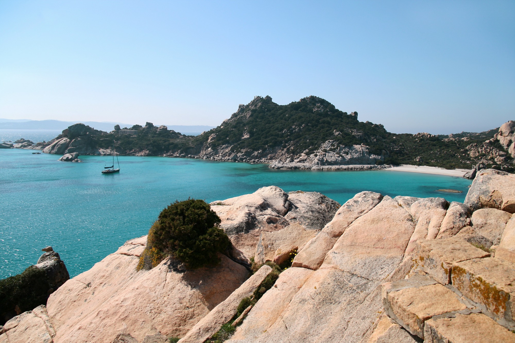
Uninhabited because of its granitic and rugged nature, it has an almost circular shape, with few coves and countless sandy bays. Spargi is located across the western coasts of the Maddalena, and is the third largest island of the Maddalena Archipelago National Park, with a surface of over four square kilometres. It is accompanied by its “smaller sister”, Spargiotto, where rare bird species nest: European shags, Audouin’s gulls and European storm petrels. Not too far west rises the Spartigiotello cliff and its shallows, split in half by a sand channel, a paradise for divers. The seabed is surprising: large underwater attractions include the Washington shallows, Punta Zanotto, coloured red by soft corals, and Spargi wreck, a Roman craft (35 metres long) dated 2nd century BC, discovered in 1939. Part of its load is in exhibition at the Nino Lamboglia Museum in the Maddalena.
To reach the island and islet, take private or rented boats or go on a guided excursion leaving from the Emerald Coast, La Maddalena, Palau and Santa Teresa Gallura. Sgargi is particularly beautiful from its southern and eastern sides, where there are beaches of white sand: the turquoise reflections of Cala Corsara, the crystalline luminosity of Cala Soraya, Cala Conneri (also called Cala dell’Amore) and Cala Granara. Little coves lined with rocks sculpted by time and vegetation that grows all the way down to the shoreline are abundant in the north (Cala Pietranera) and west (Cara Piscioli). The hinterland is almost impossible to access, covered in cistus, giant strawberry trees, juniper trees and mastics. In the early 19th century, a famous episode confirmed this particularity: Natale Berretta hid here to avoid being arrested, and managed to elude inspections. Once he was proved innocent, he decided to continue living there with his family.
In the 20th century, the island was a military base during both world wars. Today its fortified bases are local attractions: in particular, Fort Zanotti is located on its northern part, overhanging the sea, hidden among granite and vegetation. The old military port of Cala Granu and other former military seats are in the northwest of the island.