
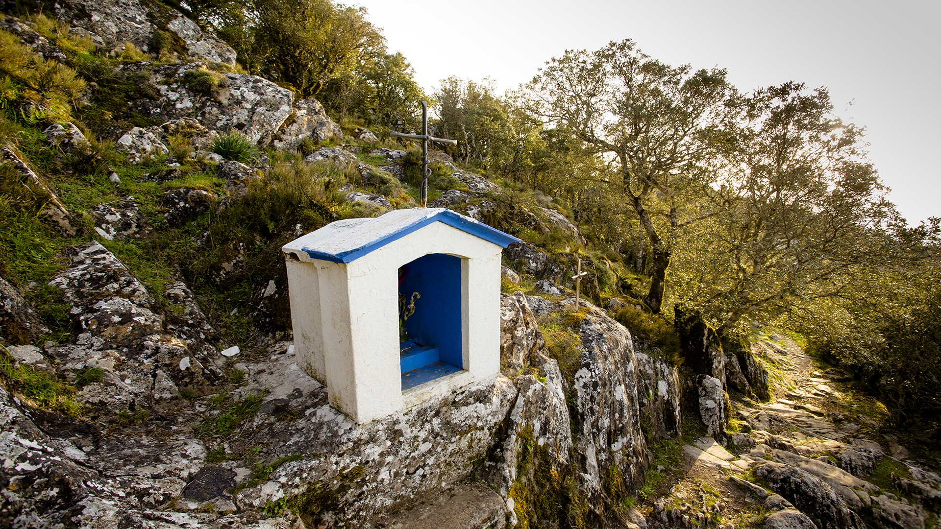
Nostra Signora di Gonare
It is the ‘highest’ church on the island, as well as being the most evocative Marian sanctuary. Nostra Signora di Gonare stands in a marvellous setting at an altitude of 1100 metres. The mountain range, with its three limestone peaks (Gonare, Gonareddu and Punta Lotzori) and surrounded by grey granites, dominates the whole of central Sardinia. From the central peak, where the church stands, you can see the sea to the east and to the west on clear days. A part of the sanctuary walls belongs to the Parish Church of Sant’Andrea di Orani and the other part belongs to that of San Michele Arcangelo in Sarule. The same goes for the property of the cumbessias, ancient dwellings with porticoes for worshippers during celebrations, the most ancient of which were built next to the church, while others were built further downstream.
There is an aura of legend around the origins of Nostra Signora di Gonare. The sanctuary is the work of the judge of Torres, Gonario, who, upon his return from a pilgrimage to the Holy Land, found himself in danger during a violent storm and promised the Virgin Mary that, in exchange for his life, he would build a church dedicated to her on the first site he caught sight of. Mount Gonare lit up, guiding him to safety, and the storm died down. The sanctuary was built on top of it. The first historical evidence of the cult of the Madonna of Gonare, deeply-rooted in central Sardinia, dates back to 1341: a payment of money by the rector of Gonare was discovered. Other evidence was found in the Chorographia Sardiniae (mid-16th century). In addition, the bell of the sanctuary dates back to 1587. A report by the bishop of Alghero (1608) describes the progress of the building taking place, which ended in 1619: the small sanctuary was extended to its current size. It was consecrated in 1912 and 60 years later, before the eyes of 50 thousand worshippers, the solemn coronation of Madonna di Gonare took place.
Many generations have invoked the Virgin Mary and climbed the mountain. The same thing happens today. The steep, captivating path is dug out of the rock, with places of worship along the way: su brazzolu (the cradle), where the infant would have been placed, s’imbaradorgiu, a boulder in the shape of a seat, and a small pit where the Virgin would have lay her hand. There are three celebrations: one on 25 March, the feast of the Annunciation, when a votive bread is distributed to pilgrims, on the last Sunday in May, the coronation anniversary, and on 8 September, the ‘big feast’, celebrated every other year by the respective parish priests of Orani and Sarule and preceded by a novena accompanied by gosos (devotional songs) and via crucis along the sides of the mountain.

Sa Domo 'e Marras
It was built in the 18th century in the historic centre of Galtellì, a village in lower Baronia, and was inhabited until the 1970s. Then, after being restored in 1995, in keeping with the traditional architecture, the ancient manor house of the Marras family became an ethnographic museum and today it contains a collection of 1800 objects including work tools, furniture and grave goods, which enrich the architecture of sa domo ‘e sos Marras.
Casa Marras is a typical 18th-century noble palace that has retained the appearance of a castle with a crenellated turret. From a large portal, passing through a barrel vault above which there is an inhabited floor, you will enter a rectangular courtyard paved with cobblestones. In the centre there is a well, with arcades on the sides that reflect the organisation of family and collective life of a typical community with an agro-pastoral vocation. On the ground floor, the rooms will allow you to relive activities of the past aimed at transforming and preserving agricultural products. The tools tell the story of the work cycles. The first floor, which can be accessed via an external staircase near the entrance to the courtyard, contains the residence. A corridor will lead you to various rooms furnished with eighteenth-century furniture: here, the collection of antique ‘pieces’ embellishes the rooms, also visited by Nobel Prizewinner Grazia Deledda.
After visiting the museum, don't miss a chance to walk along the stone-paved streets of the village, a former bishopric inhabited by extraordinarily devout citizens: you will come across five churches (plus three more in the countryside) in the space of about one square kilometre. Some are architectural jewels, such as the Church of the Santissimo Crocifisso and the former Cathedral of San Pietro. Then you can dive into the nature of the mountain that ‘protects’ the village: from the top of Monte Tuttavista,. as its name suggests, you can observe breathtaking views.
San Pietro - Galtellì
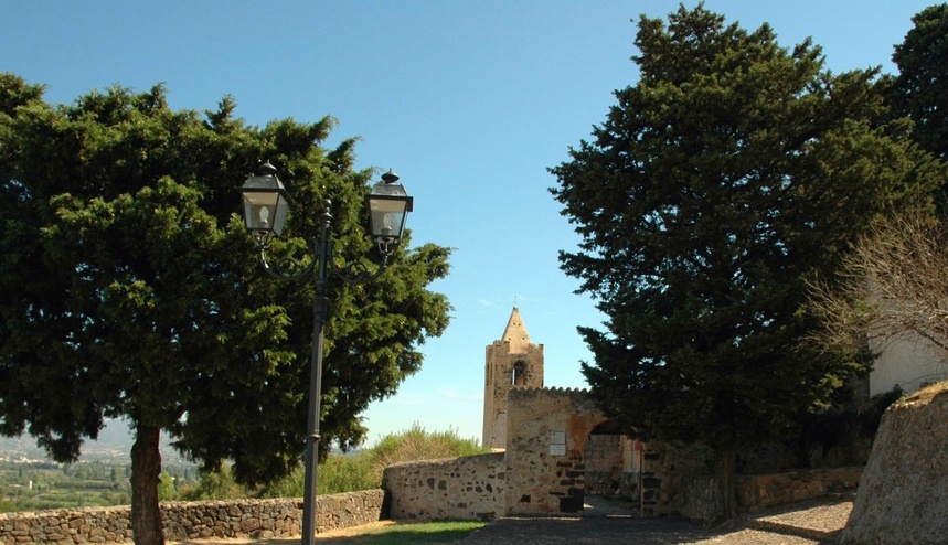
Inside the cemetery walls, at the eastern exit of the residential area of Galtellì, you will see a high bell tower on the right. It is part of the complex of San Pietro, once the bishopric of the small village in Bassa Baronìa, transferred to Nuoro in 1496. Of the three buildings of the medieval diocese, the square-section bell tower may have been built in the late sixteenth century over an older tower and the large Romanesque cathedral remained unfinished, while the other church, perhaps early medieval, smaller and originally with one nave, was then enlarged to include three naves.
Around 1090, construction began on the large Romanesque church, which was to serve as the cathedral of the diocese of Galtellum. The small church may have already existed, but was unsuitable for hosting the bishop’s throne. In 1138, the diocese fell under the control of the archbishopric of Pisa: due to dependence on the Pisans and lack of funds, the works were suspended. The cathedral was to be an imposing building, but only the northern side of the hall, the transept and the oriented apse were built. Two bishop’s tombs were placed in the external walls. Following the abandonment of the construction site, the bishop continued to reside in the smaller church, which was decorated and ennobled along all the walls with frescoes by painters from Umbria and Lazio in the first decades of the 13th century, a series depicting stories from the Old and New Testaments. They have resurfaced thanks to recent restoration work: today you can admire them in all their beauty. To upgrade the church to the ‘episcopal’ rank, the layout was enlarged to three naves and the northern side of the hall, the northern arm of the transept and the eastern end of the southern one were raised, while the apse was rebuilt. The external surfaces are made of local stone. The light spreads through arched single-lancet windows that open into the apse and into an arm of the transept.
From the former cathedral, you can continue your journey along the paved streets of an extraordinarily devout village: in the space of about one square kilometre, you will come across five churches, including several architectural jewels, such as the church of the Santissimo Crocifisso (Holy Crucifix). Then there are three more in the countryside in the direction of Mount Tuttavista, where you can combine a cultural visit with a hike through nature: from the top, you can enjoy breathtaking views.
The hidden world of caves
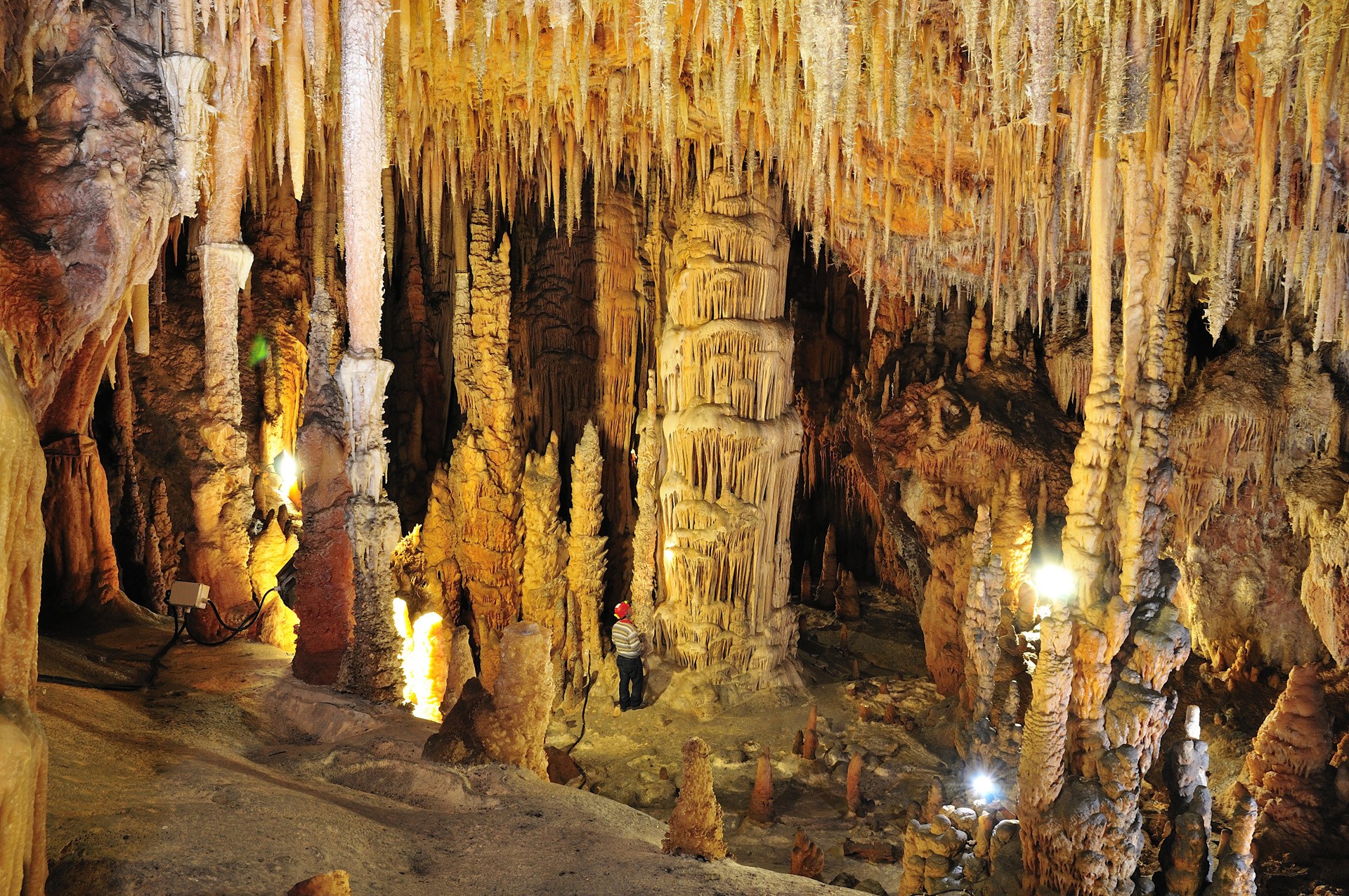
They guard masterpieces of nature, hide secrets, preserve the memory of legendary inhabitants. They still host some of them in their meanders and sometimes they talk. Like sa Oche, ‘the voice’, that howls, ringing out in the valley of Lanaitto in Oliena, generated by the air currents moving in the ‘twin’ cave of su Bentu. A short distance away, the words of Grazia Deledda, from her novel ‘L’edera’ (The Ivy) and from nineteenth-century tales can be heard, halfway between reality and legend, in the setting of the Corbeddu Cave. It was the home of a ‘gentleman bandit’, from whom it got its name and who transformed it into a tribunal of his own. Some of the oldest human remains ever found on a Mediterranean island come from here. Ispinigoli, in Dorgali, and its 38-metre high ‘column’ are also surrounded by original stories. Who knows if the 60-metre-deep hole at the bottom of the cave was really used for human sacrifices, to the point of earning itself the name of ‘abyss of the virgins’. In this area, the passage down from the mountains to the sea is short and there are also legends linked to the sightings of the monk seal: whether or not they still frequent the Gulf of Orosei is a mystery, but they undoubtedly lived around Cala Gonone, in the Grotte del Bue Marino (Sea Oxen Grottoes), named after them. The ‘room of the beaches’ was a safe haven for giving birth and weaning their pups. The Neolithic peoples also gathered here, in the same ‘rooms’, just above the level of the water, where the Cala Gonone Jazz concerts have been held every summer for decades.
Sanctuary of Gremanu
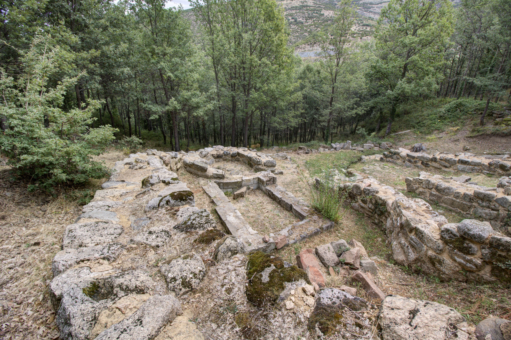
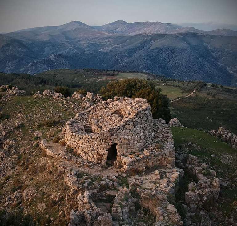
Crossing the threshold of the temenos, the sacred enclosure, you will be able to imagine the amazement of the ancient visitors before the magnificence of the monument, though the most surprising aspect does not catch the eye right away and is hidden further upstream: it is the only (currently known) example of a Nuragic aqueduct that served the village and the sanctuary of Gremanu. The complex is set in a thick oak forest in the valley of Pratobello, about a thousand metres above sea level between the elevations of Gennargentu, in the territory of Fonni, the ‘highest’ village in Sardinia. The site occupies about seven hectares and is divided into two parts: inside the first, there are the wells and water sources, while further downstream are the residential and religious areas. The springs are enclosed within a semicircular curtain wall, next to which you will notice a basin, probably used for ritual purposes. A small channel directed the water from a spring to a well, then from here a system of canals guided it to the sanctuary.
The religious area, delimited by a 70-metre-long fence, contains various buildings: a temple with a circular layout similar to a nuraghe, a small megaron temple, an apsidal room and two circular huts. The entrance, facing south, led into a semicircular courtyard equipped with counter-seats. On the sides of the entrance door to the temples there are the two huts, perhaps a stopping point for the worshippers. The circular temple has a granite and schist paved floor, a niche and a seat. Traces of fires, the remains of a dividing wall decorated with protomes and zig-zag patterns and a granite ‘socle’ lead us to think that metals were melted here to make votive objects. The megaron temple is eleven metres long, consisting of a vestibule and a cell, inside which you can see a pink granite wall running crosswise and leaning against the back wall, which delimits another room, perhaps intended to contain the ritual hearth. The apsidal temple, made of granite ashlars, also consists of a vestibule and a cell, with a paved floor. The buildings date back to the Recent Bronze Age (13th-12th century BC), while the artefacts found between the sanctuary and the wells date back to the Final Bronze Age (11th century BC). Outside the temples, there are stone bases with holes: here the molten bronze was poured to secure votive objects, swords or small bronze statues.
A kilometre and a half separates the sanctuary from a funeral area, which perhaps belonged to the village: it is the necropolis of Madau, made up of four Tombs of Giants similar to each other, positioned in an amphitheatre layout and facing east. Here, you can also admire the stele of Madau, a granite slab set in the ground next to the first tomb, depicting symbols linked to nature or perhaps to the constellation of the Pleiades.
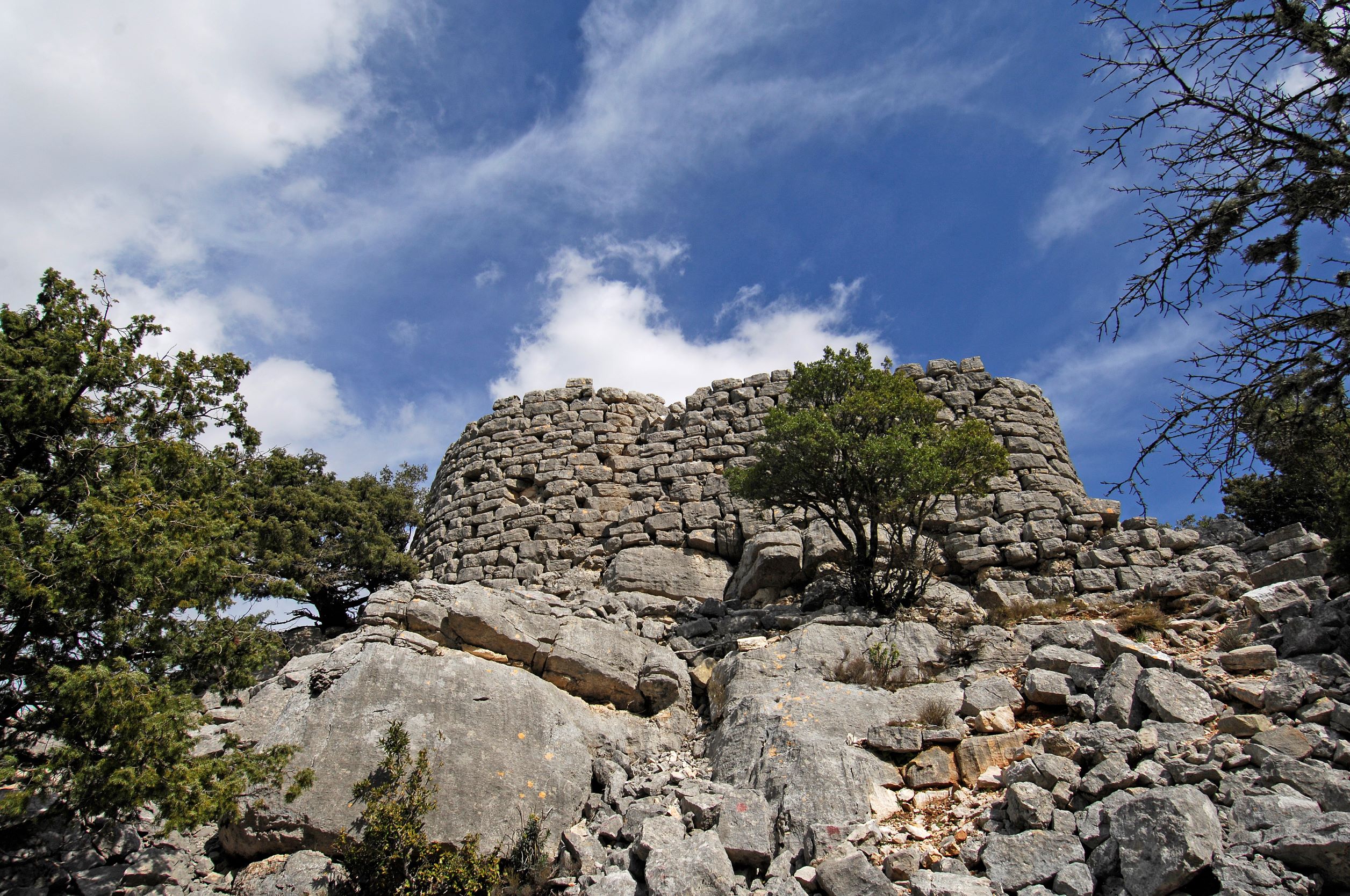
Nuraghe Mereu
It stands on a rocky outcrop overlooking one of the deepest canyons in Europe and, thanks to its light limestone blocks, it stands out in the heart of a dense forest. The nuraghe Mereu stands at a height of 835 metres on the Supramonte of Orgosolo. The inhabitants of this Barbagia village call it nuraghe intro ‘e padente, or ‘the nuraghe inside the wood’. The Mereu is, in fact, difficult to see if observed from below and from a distance, as it is surrounded by the forest of Montes. However, once you reach it, you will be able to admire a breathtaking landscape, especially the walls of the spectacular gorge of Gorropu to the north-east. Then, to the south, you can see the outlines of the Supramonte of Orgosolo and that of Urzulei.
The nuraghe, built entirely from limestone blocks found on site, has a complex structure, with a trilobate layout, a keep and two secondary towers connected by a curtain wall. Still standing are the main tower with a tholos roof, still intact and about five metres high, and the bastion on the west side. The original entrance was on the south side and led into a corridor that is still partly accessible and at the end of which there is a connecting room between the keep and one of the towers, now partially collapsed. The third tower, however, is now a ruin. The stairwell, to the left of the entrance and leading to the upper terrace, is also partially remaining. To the west of the fortress, you will notice several traces of the village huts, while, hidden inside the wood, there are a few Tombs of Giants, linked to the same settlement.
800 metres further on, heading north-east, you will reach the single-tower nuraghe Presethu Tortu, also known as nuraghe Gorropu due to its closeness to the gorge. It is also built in white limestone and is located on the edge of a rock wall, which conditioned its structure. On the east side you will notice a bastion more than three metres high, still in good condition, while the tower is currently six metres high. Like the Mereu, the Presethu Tortu is surrounded by traces of huts. The path between the two nuraghi crosses the dense forest, marked by stones purposely placed along the way. A visit to the two nuraghi ‘guarded’ by the forest of Montes will take you into the thousand-year-old wood of sas Baddes, one of the most ancient expanses of holm oaks in Europe, occupying a thousand hectares. A short distance away, a visit to the most famous natural monument, the gorge of Gorropu, on the border between the Barbagia area of Orgosolo and the Ogliastra area of Urzulei, is a must. The canyon with its majestic walls, a kilometre and a half long, was created by the patient erosion of the river Flumineddu, and it is a destination for trekking enthusiasts from all over the world.

Monte Novo San Giovanni
A limestone ‘tower’ with spiers of up to 70 meters high, surrounded by rare endemic floral species, from which to enjoy a spectacular 360-degree view of both the Supramonte and Gennargentu massifs. That describes the spectacle of Monte Novo San Giovanni, a natural monument that stands at 1306 metres above the Montes forest, in the Orgosolo region, known as the 'village of murals' of the Barbagia of Ollolai. Seen from afar, it looks like an enormous bastion with an almost regular shape, a bit like the 'heels' of Ogliastra, but in reality the upper layer is broken into rocky blocks divided by deep cracks that are home to such endemic species as the ribes sardorum.
The view from here spans from the Gennargentu to the Supramonte of Orgosolo and Urzulei, from monte Corrasi to the gola di Gorropu, then to the Baronia coastline along the sea. You’ll see the full length of the Montes forest and the centuries-old sas Baddes oak woods, one of Europe’s oldest. At the top of Santu Juvanne, as it is known here, are two wooden huts. On the right looking south-east you’ll see Monte Fumai, another tall limestone tower vaguely shaped like a pyramid. The top reaches 1316 metres in height and it shares its geological origins with Santu Juvanne. The trail that leads to the natural panoramic terrace is accessible to all and an easy walk. It starts at the Montes forestry station and goes by the Funtana Bona natural springs, the source of the Cedrino river, and which, as its name suggests, is a source of pure clean water. The trail, which can also be enjoyed on a mountain bike, is shaded by oak woods and majestic holm oaks. Now and then you might even spot a mouflon, a local breed of mountain goat. Other local fauna includes wild boar, wild cats, dormice, martens, hares and foxes, while eagles, ravens and peregrine falcons circle in sky around the peaks of Monte Novo San Giovanni and Monte Fumai. Near the base of the tower the forest thins out, the rugged landscape comes alive with asphodels and rock roses and begins to open up: you may even see grazing herds along the bends before you reach a small section with stone steps that finally lead you to the summit.
The Montes forest bears traces of ancient settlements, like the Mereu and Presethu Tortu nuraghes near the sas Baddes woods, and the two Giants’ tombs at sa Senepida. At the feet of Monte Fumai are the remains of a pastoral village known as Norculanu, the setting of legends and popular tales that you can hear as you stroll along the streets of Orgosolo, decorated with murals.
It cannot be spring without Monumenti Aperti
Artistic magnificence, shared memory, authenticity and a sense of community: this is the most encompassing effort to safeguard, enhance and promote the cultural heritage of Sardinia. In 2023, the 27th edition of Monumenti Aperti (Open Monuments) runs across five weekends, from the 6th of May until the first weekend of June. Hundreds of cultural sites will open their doors during this time, such as museums, archaeological sites, churches and historical buildings, natural monuments and parks. Each town will tell its tale through literary itineraries, architecture routes in cities that have been marked by centuries of powerful rulers. Students and volunteers are warming up to lead you along a travel through the beauty that crosses millennia, all the way to the farthest past. It is not a coincindence that this year's title goes by the name of 'Pratiche di meraviglia' (Practices of wonder').
Nuraghe Ardasai
You will see it almost suddenly, on the top of a rocky spur along a spectacular scenic road with a view of hills and green valleys. Its position and setting will captivate you and you will be intrigued by a mysterious path. The nuraghe Ardasai is located on the slopes of Tonneri, about 13 kilometres from the residential area of Seui. A strategic position, from which the access roads to Barbagia can be controlled. The structure is part of a complex that also includes a village, the remains of a Giants’ Tomb and perhaps a sacred well.
This is a single-tower nuraghe, probably built during the Middle Bronze Age (17th-14th century BC) with large limestone blocks, originally on several levels. Today, the lower floor still remains, with a tholos vault and a spiral staircase that led to the second level. Around the tower, there was a curtain wall with secondary towers, traces of which can still be identified.
The village huts were positioned around the nuraghe and were oval or circular in shape. In some cases, they exploited the natural form of the rock. Further traces of settlements are scattered over the surrounding hills and downstream: the fortified Nuragic village of Serra su Casteddu occupies the top of the mountain that stands in front of the nuraghe Ardasai, on the opposite side of the road, while all around, within a radius of a few hundred metres, there are other nuraghi, tombs, villages and megalithic circles.
The Ardasai is the subject of a legend that links it to the fortress of Monte Baranta in Olmedo, with which it also shares the position on a sheer rocky spike: a paved path starts from the south-west side of the tower and apparently ends in a sort of natural gateway, delimited by two limestone boulders. Beyond, you’ll find the edge of a ravine. At Monte Baranta and in the surroundings of Gairo Vecchio, there seem to be similar paths, which legends and local traditions apparently identify with the places where the ritual sacrifices of the village elders were celebrated in ancient times.
The territory of Seui is ideal for combining archaeology and trekking through nature: on the opposite side of Monte Tonneri, in an easterly direction, you can admire the unmistakable outline of Perda ‘e Liana, a natural monument and the symbol of Ogliastra. Then, a little further south, lies the forest of Montarbu, one of the most captivating in Sardinia thanks to its landscape and wildlife heritage. You can also cross it in an original way, aboard the Trenino Verde tourist train.
Shoes full of footsteps
The climate is mild most of the year and the temperatures are often pleasant even in winter. Intense light floods the paths along the coasts, as they wind through the wildest hinterland landscapes. Many of these are not quite beaten tracks and are pervaded by an impalpable primordial atmosphere that dominates the beauty of the landscapes. These are paths and hiking trails that lead to the discovery of the most exclusive and private Sardinia, to be explored while connected with the spirit of the places, that touches your soul.