

Su Mulinu Vezzu
Its majesty, state of preservation and special construction features make it a unique place in Sardinia. The granite complex of Su Mulinu Vezzu is the only survivor of seven water mills operating on the Bisine river in the early 20th century. ‘The old mill’ is located less than a kilometre from Olzai and is surrounded by holm oaks, oaks, cork oaks and Mediterranean greenery. It is an impressive work of pre-industrial hydraulic engineering, built around the mid-19th century for the grinding of wheat and barley. You can admire a mill with a vertical waterwheel and its structure is divided into two complementary parts: the large wheel is between two high walls and drives the stone necessary for milling. Above it, embedded in the stone, a channel collects the water captured from the river through a stone and rock embankment. Thanks to the slope of the channel, the water falls onto the wheel, making it turn. The actual mill is inside the adjacent room.
Inside it, you will notice the stone floor and the wooden gears that activate the mechanism capable of setting the large grindstone in motion. The room also serves as a small museum, where typical milling objects and tools are on display. Flourishing agricultural activity was the basis of the economy of Olzai, the prosperity of which was also demonstrated by the high percentage of people with degrees between the end of the 19th and beginning of the 20th centuries. In 1921, a devastating flood swept away all the mills except the Vezzu, which nevertheless suffered serious damage and was abandoned. Between 2003 and 2004, the Municipality of Olzai took action to restore it. Today, the mill works and is activated for wheat milling demonstrations. A visit to the museum is also an opportunity to explore the Olzai landscapes. To the south-west of the town, stands Mount Gulana, a destination for trekking and mountain biking excursions, which has stone blocks on its summit: they are evidence of a castle, perhaps of Byzantine origin and the stage of fanciful legends. It is said that a treasure was hidden in the basement.
Olzai is the traditional destination for Autumn in Barbagia, an event during which you can taste the typical products of the area, admire the local artisans and observe su Mulinu Vezzu ‘at work’. The fourteenth-century Church of Santa Barbara is also worth a visit. Inside it, you will find the ‘Retablo della Pestilenza’, a work by an artist known as the Maestro d'Olzai.
Montiferru
It is the largest volcanic complex on the Island and has a fascinating variety of landscapes, from sheer rock faces high up above the sea to slopes that gently descend towards the inland plateaus. In between, there are woods, springs, waterfalls, castles and archaeological treasures, as well as a wealth of wildlife. Montiferru is a massif with a perimeter extending into the territories of five municipalities: Bonarcado, Cuglieri, Santu Lussurgiu, Scano di Montiferro and Seneghe. Its morphology is the result of the volcano’s lava flows that occurred millions of years ago and ‘designed’ basaltic landscapes like the cliffs of the western coast and the eastern plateaus, including that of Abbasanta. The highest peak of the massif is Monte Urtigu, at 1050 metres: from its summit, on clear days, you can see both the island of Asinara to the north and Sella del Diavolo (Devil's Saddle) on the Cagliari coast.
The vegetation is dominated by holm oaks, but you will also see cork oaks, yew trees, holly and downy oaks. The massif is the habitat of wild boars, wild cats, foxes and a few mouflons, which have been reintroduced into the Pabarile area. The red ox is also bred in Montiferru. It is a species belonging to the Sardinian-Modicana breed. A circular route allows you to walk or cycle around the peaks of the complex, admiring breathtaking views, as your eyes move from the sea to the rocky ridges in no time. You can set off from Badde Urbara or from Elighes Uttiosos, walking on phonolites, which are called perdas sonadoras (sounding stones) here, and will emit sounds when you step on them. You will also pass by archaeological evidence, such as the single-tower nuraghe Ruju and the megalithic wall of Straderis or Giolza.
There is no lack of points of interest around its slopes: a few kilometres from Santu Lussurgiu lies San Leonardo di Siete Fuentes, a place where you can visit a village with an ancient church, immersed in a forest with springs of very pure water. On the border of Bonarcado, the spectacular waterfall of sos Molinos flows. It’s a fairy-tale place with a picturesque mill next to it. A real dive into the past awaits you a short distance from Santa Caterina di Pittinuri: here stand the ruins of the ancient city of Cornus, of Punic origin, and the settlement of Columbaris, the ‘heart’ of Christianity in the late Roman era. Along the coast there are ‘natural’ monuments for you to admire: s’Archittu, Cabu a limestone arch overlooking the beach of the same name, and, further north, the spectacular waterfall overlooking the sea of Cabu Nieddu. Among the ruins of Casteddu Ezzu, about 3 kilometres from Cuglieri, you can ‘dive’ into the medieval period of the Judicates, in an atmosphere of great charm and fascination.
Sirilò Archaeological park
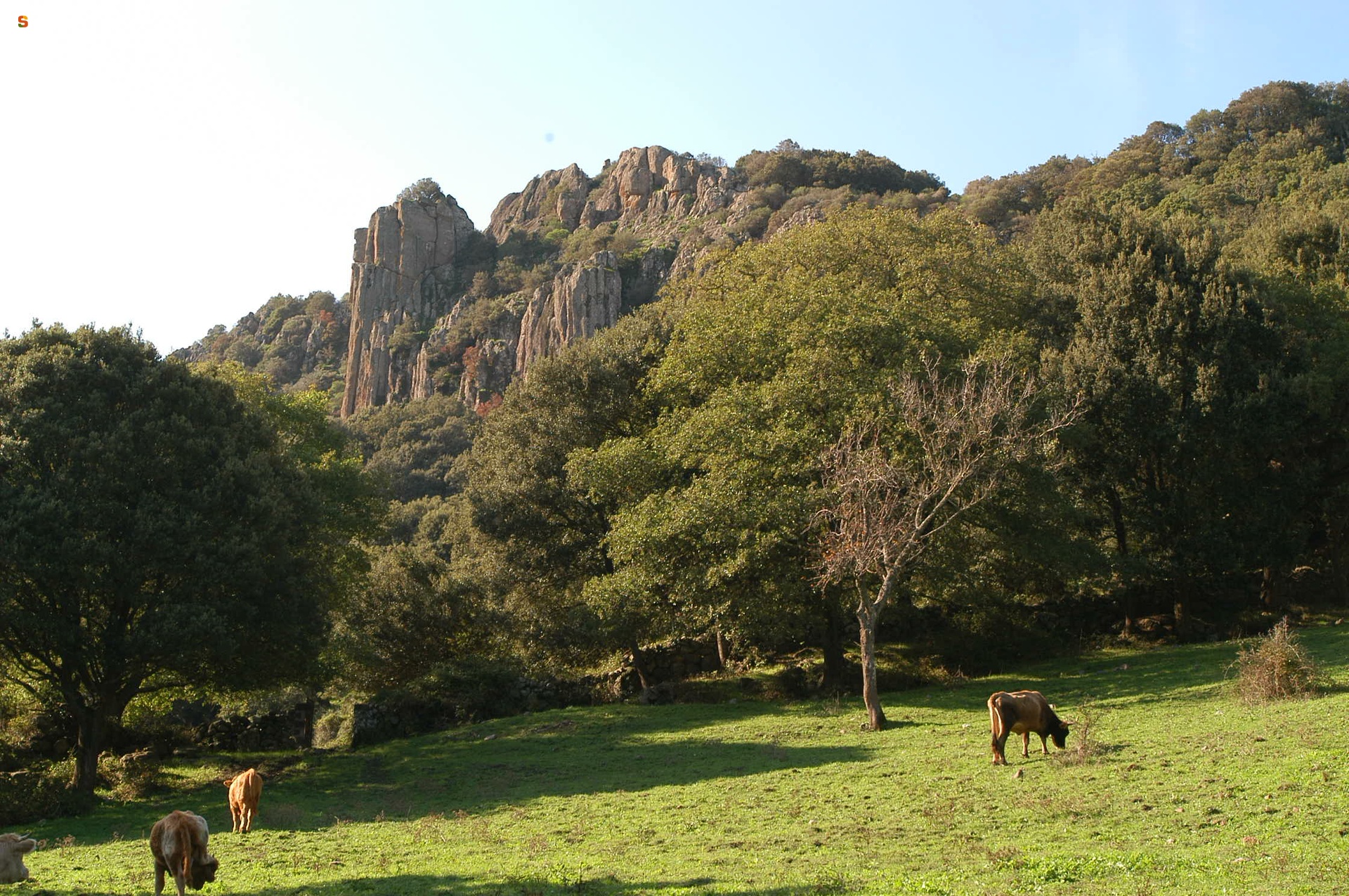
From the Neolithic to the Imperial Age, millennia crossed by eras, cultural phases and periods of encounters (and perhaps clashes) with peoples arriving from the sea. Sirilò is a settlement about four kilometres from Orgosolo, which occupies the peak and the slopes of a thousand-metre-high mountain. On the summit are the remains of a nuraghe, around which there is a village, various Domus de Janas – 13 have been identified so far -, a dolmen and an unusual temple that ‘incorporates’ another Domus. The first three rows of the Nuragic tower still remain: you will spot the trapezoidal entrance with an architrave still in situ. It was built using large granite blocks. From its position, you can enjoy a breathtaking 360-degree view: Supramonte di Oliena to the east, the Gennargentu massif to the south and to the west you can see Fonni, while to the north, beyond Orgosolo, the view opens onto Nuoro.
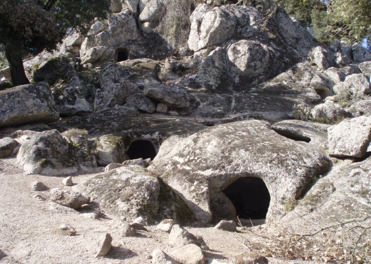
The village has about fifteen huts, already inhabited in the pre-Nuragic age. The necropolis dates back to the same period, with tombs that were dug out of the granite rock and a holm oak forest extending around it. You will see tombs created according to a simple plan and influenced by the shape of the slope, with one or two rooms with varying layouts. Some tombs are more elaborate from an architectural point of view, with funeral alcoves positioned higher than the floor, cornices, grooves in the doors connecting the rooms, small counters and cupules for depositing offerings. No symbolic elements have been identified - for that matter, they are absent in all the ‘fairy houses’ in the area -, but you will notice residual traces of red ochre on some walls.
The temple consists of a cylindrical body and a vestibule, where there are still traces of the benches against the walls. Further south, almost ‘camouflaged’ between the granite rocks and woods, you will find the dolmen. Unlike the religious and funeral buildings, materials that testify to continuity of use have been recovered in the village, including Etruscan and Greek imported objects. Sirilò therefore bears witness to the cultural change taking place at the beginning of the Iron Age, with the abandonment of the ‘old’ symbols. The traces continue as far as Roman times. Some think that the site - like the village of Tiscali, in the nearby Lanaitto valley – was an outpost of ‘resistance’ by the locals against the imperial conquest. The inaccessible position, which was easier to defend than to occupy, along with the absence of temples, memorial stones or Latin inscriptions in the area and the fact that there are no place names of Roman origin in the territory, seem to support this theory.
A few hundred metres separate Sirilò from another Pre-Nuragic necropolis: the Domus de Janas of Oreharva. There are 17 of them, of the single and multi-cell types, located in the forest. One of them is buried and two are unfinished.
Sa Lhopasa
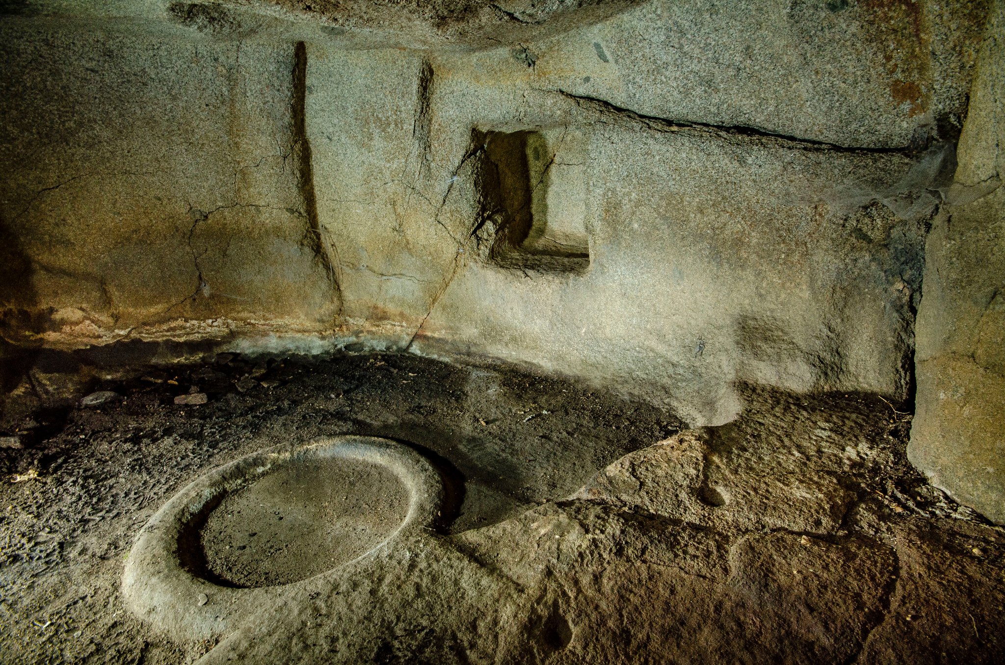
As soon as you come across it, set in the greenery of a holm oak forest, you will really think it seems like a house populated by fairies. The Domus de Janas of sa Lhopasa is located five kilometres from the village of Orgosolo, dug into a spur of granite rock and consisting of two rooms, the anteroom and the main cell. You can go into the tomb through a trapezoidal entrance, which leads to a quadrangular room. Traces of red ochre paint still remain on the side walls, under the ceiling. In the one on the left, there is also a bas-relief, perhaps belonging to a pilaster strip that was later destroyed. The main room, with a rectangular layout and a height greater than its depth, is on the opposite side to the entrance. You will notice that the walls and ceiling seem more finished in some places than in others, where they seem barely rough-hewn: it’s possible that the decoration of the domus was never completed.
The most surprising element of the cell is the circular hearth in the centre of the floor. It has a listel with rounded edges and boasts an unusual feature: it merges with a sort of platform saved on the rock, on which four cupules with a diameter of a few centimetres have been created. On the back wall, along with further traces of red paint, you will see a rectangular niche. A baetylic semi-pillar appears inside it, made as a bas-relief, most likely linked to the sacred and religious function of the room. For some, it represents a male symbol linked to reproduction and rebirth, in contrast with the funereal nature of the place.
The first three and a half kilometres of the route to sa Lhopasa coincides with a stretch of road that has become a devotional path leading to a heartfelt pilgrimage destination over time. In fact, the place of martyrdom of the blessed Antonia Mesina, who defended her chastity to the death and also became a symbol against wickedness and abuse, is located in Ovadduthai. An ever-increasing number of visitors pay homage to the very young martyr, taking the opportunity to admire the famous murals that embellish the village streets and then explore the natural and archaeological beauty of the Supramonte of Orgosolo. The climb to the panoramic Monte Novo San Giovanni is captivating and not excessively tiring. Equally enchanting are the sinkhole of su Suercone, the canyon of Gorropu, one of the deepest in Europe, and the forest of Montes, within which the ‘white’ nuraghe Mereu lies.
San Paolo eremita - Monti
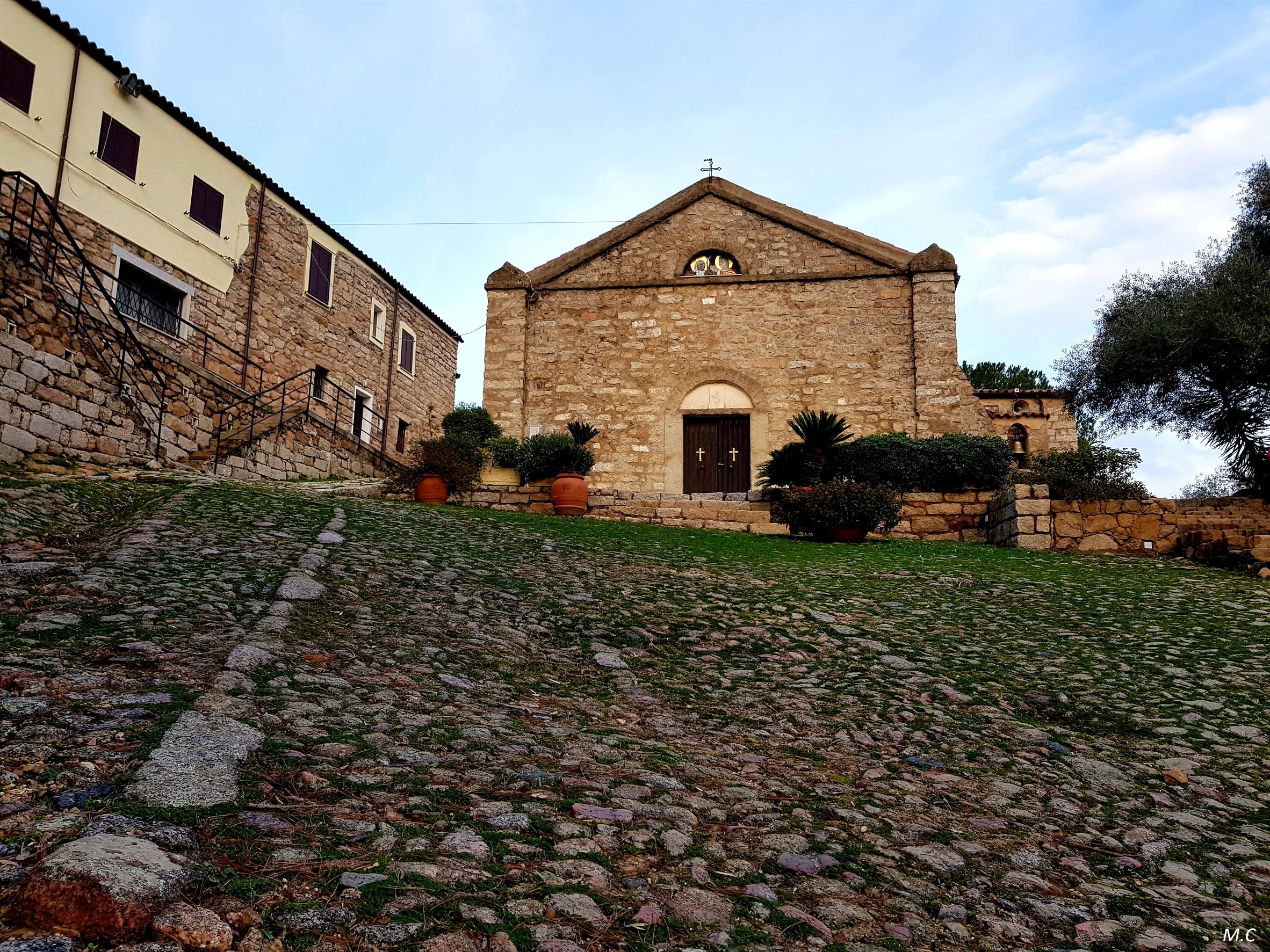
It is one of the most venerated places of worship in the north of the island, visited every year by numerous worshippers from Gallura, Baronia and Barbagia, some of whom are the protagonists of a night-time pilgrimage. The Sanctuary of San Paolo Eremita is located in the territory of Monti, about twelve kilometres from the town centre. Its origins are documented thanks to a parchment found in the altar, indicating the date of its consecration, 31 July, 1348, in the presence of the bishops of Bisarcio and Castro. The present-day building is the result of reconstruction that took place in various phases between the 18th and early 20th centuries. The sources also mention a monastery. It is not known which order it belonged to and there are no traces of it to date. Although the liturgical celebration of Saint Paul of Thebes is in January, local tradition placed the festivities in mid-August, before Cabudannu, that is September - the beginning of the agricultural year - as a good omen for the harvest.
The building stands on top of a granite outcrop, surrounded by Mediterranean greenery. In fact, the exposed ashlars with which it was built are made of granite. The façade is gabled, while it has a single-nave layout, with a barrel vault. Inside, you will see two columns from the Roman era on the sides of the altar and, on the wall behind it, the statue of the saint to whom it is dedicated. Next to the church are the ancient and recently-restored cumbessias, where pilgrims from the surrounding areas could stay and who were also accommodated by artisans, merchants and nougat makers.
Numerous miracles are attributed to Saint Paul and legends linger around the sanctuary: it is said that it was built by a bandit who was seriously injured, following the healing and conversion performed by the saint. It is no coincidence that, during the 19th century, it was frequented by fugitives from the area, who were granted a period of pardon during the celebration, allowing them to meet their families. According to another story, the citizens of Alghero tried several times, during the night, to bring the ancient statue of the saint to their town, as the artefact seems to have been of Catalan origin. In the morning, the statue always magically returned to its niche. The current simulacrum dates back to the 20th century. On Easter Monday it is carried in a procession to the Parish Church of San Gavino and it then returns, eight days later, accompanied by a torchlight procession. One of the most heartfelt pilgrimages sets off from Olbia, in the first half of September, at 3 o’clock in the morning, to reach the sanctuary in the late morning, after having travelled about 20 kilometres. The main celebration, however, takes place around Ferragosto, on 15 August, and it is also an opportunity to taste Vermentino wine, a product of which Monti is one of the ‘capitals’.
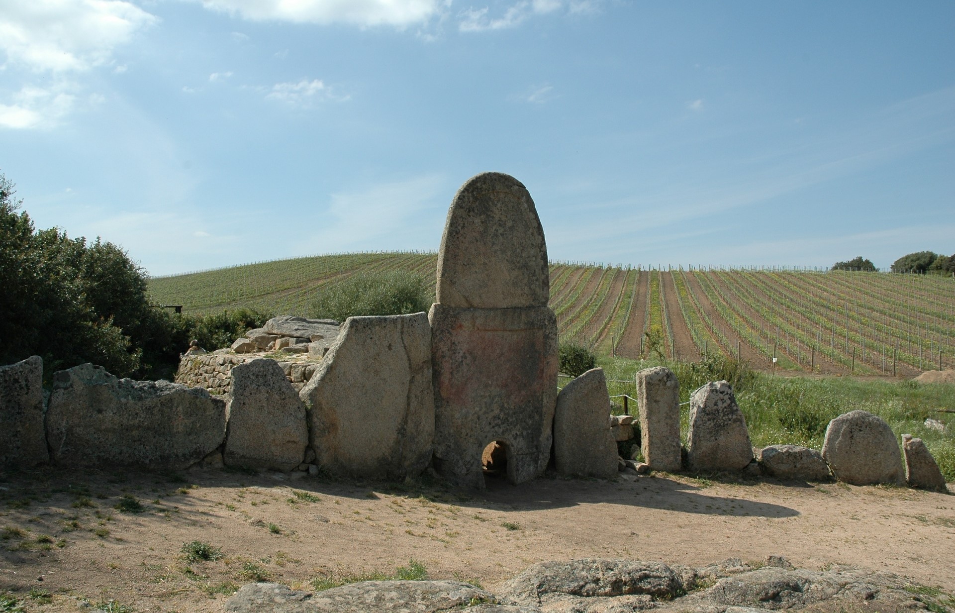
Giants’ Tomb of Coddu Vecchiu
It bears witness to the evolution of the building techniques used on the prehistoric tombs and contains what many consider to be the highest ‘façade’ known to date among the Sardinian megalithic tombs. It is located a short distance from one of the most important Nuragic settlements in Gallura, for which it may have served as a ‘cemetery’. The Giants’ Tomb of Coddu Vecchiu – also known as Coddu Vecchju or ‘Ecchju – is located in the territory of Arzachena, in the locality of Capichera, just 700 metres from the La Prisgiona nuraghe. Built from local granite, it was originally a tunnel tomb, of the allée couverte type. The first construction phase probably dates back to the Early Bronze Age, around the 18th century BC. Later on, during the Middle Bronze Age - that is, between the 16th and 14th centuries BC. -, the tomb was ‘transformed’ into a Giants’ Tomb, with the addition of the front exedra and the curved stele, of an exceptional size: with its four metres, it is considered the tallest on the island.
The front is semicircular and made with orthostatic stone slabs, meaning fixed into the ground. You will notice that their height decreases towards the ends, while the stele stands out in the centre and is made of two overlapping slabs, both decorated with a raised frame. At the base of the lower slab, there is a door that leads to the tomb corridor. The room has a rectangular layout and is about nine metres long, with a paved floor. The internal surface is made up of slabs laid on edge, with rows of stones running above them, the function of which is to support the flat arch slabs that form the roof. The external surface is also made up of rows of medium-sized stones. Everything, during the tomb’s period of ‘activity’, was covered by a mound of earth and stones. During the excavations, grave goods were found, including pans, bowls, pots and rolling dishes with engraved decorations.
About 200 metres from the tomb, a few rows of the Demuro single-tower nuraghe can still be seen. Then, heading south-east, you can visit one of the most fascinating Bronze Age complexes in Sardinia, made up of a nuraghe and the village of La Prisgiona. The main building consists of a keep and two side towers connected by a bastion and surrounded by a wall. Outside, there were about a hundred huts, with living areas, storehouses and artisan ‘workshops’. The archaeological remains in the area are surrounded by hills covered in Mediterranean scrub and vineyards. The area is, in fact, renowned for the production of Vermentino grapes, from which the only DOCG wine in Sardinia is obtained. You can enjoy it as an accompaniment to tasty Gallura cuisine, or as an aperitif after a day in the sun on the enchanting Costa Smeralda beaches.

Nuraghe Ruinas
It stands on the slopes of Gennargentu, at an altitude of about 1200 metres, asserting itself as one of the ‘highest’ Bronze Age settlements in Sardinia. Furthermore, the traces of the village that surrounds it tell a story steeped in legend. The nuraghe Ruinas is ‘immersed’ in a mountainous landscape in Arzana, not far from woods, waterfalls and springs. Orruinas – as it is called by the people of Arzana – must have been a particularly important settlement: in addition to the nuraghe, it also has a Giants’ Tomb, (perhaps) a sacred well and above all a vast village of which around 200 huts can be seen today, although it is assumed that there were originally many more of them. The nuraghe has a trefoil layout, with about 8 and a half metres of the height of the keep still standing and the tholos roof of the main chamber still remains, while to the left of the entrance you will see the staircase that led to the upper room, which later collapsed.
The towers on the sides show signs of renovation work: in one of them, the main room was ‘sacrificed’ to allow the construction of a boundary wall, while a small room was saved, from which there is a staircase that led both to the upper floor and to a walkway on the curtain wall that connected two towers. Between the bastion and the keep you will notice the courtyard, with an irregular layout.
The village extended around the nuraghe, with mainly circular structures and a rectangular building, which some interpret as a meeting hut, given its considerable size of twenty metres by thirty. A few hundred metres north of the nuraghe are the remains of the Giants’ Tomb of reference of the village. The settlement has yielded numerous artefacts, among which a bronze statue, 12 centimetres tall with its arms outstretched in front of it, stands out. Some findings have been dated back to the Imperial age, thereby testifying to continued human presence at least until a historical period that may even have been medieval. In fact, there is a legend linked to the village of Ruinas, according to which it existed until the beginning of the 15th century, only to be abandoned due to an epidemic of the plague. Its inhabitants are said to have been accommodated in Arzana, in the Preda 'e Maore district, and therefore the territory in which the site is located, over 30 kilometres from the inhabited area, was ‘claimed’ by the Ogliastra village.
Visiting Orruinas is an opportunity to combine archaeology and outdoor activities: a trekking trail of about seven kilometres starts from the site and heads north, reaching Punta la Marmora, the top of Gennargentu and the highest peak in Sardinia. During the journey, you will see ancient sheepfolds and animals in the wild, until you find yourself gazing at spectacular landscapes and enjoying a unique view.
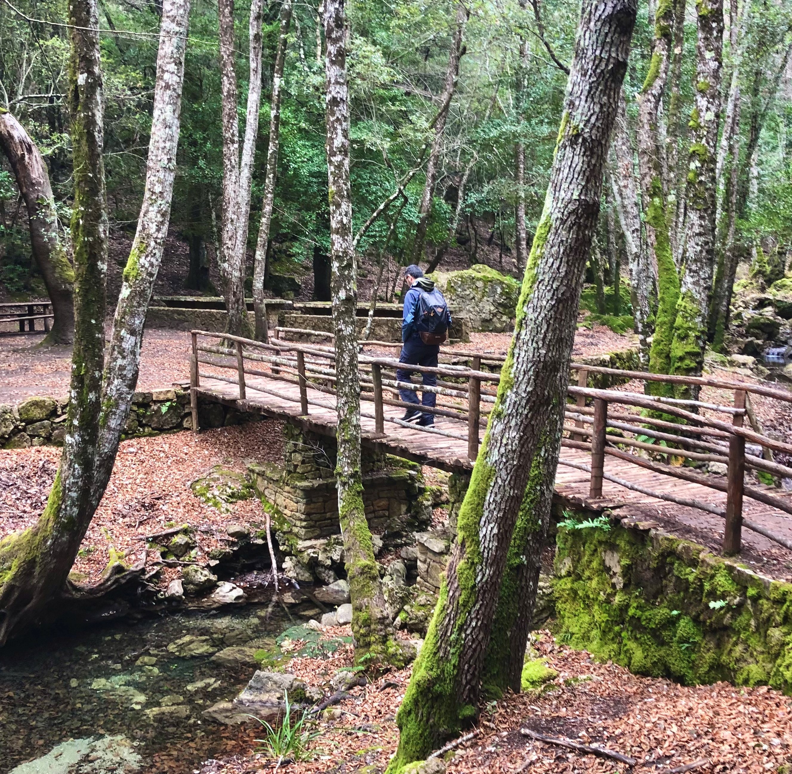
Forest of Niala
Those who visit it, cannot help but describe it with just one adjective: enchanted. The Niala forest, in the territory of Ussassai, next to the state-owned forest of Montarbu, is an oasis set in nature and full of attractions: lush expanses of holm oaks and Mediterranean scrub are crossed by torrents that generate waterfalls. The natural pools of Tuvu Nieddu, stand out and, during the hot season, you can enjoy a refreshing swim here. In springtime, you can admire several paths as they turn pink, thanks to the peonies in bloom.
Niala can be reached via various routes with a view of the distinctive ‘buttes’ of Ogliastra, including the Italia trail, along the Z20 section. Otherwise, you can get there from the Sentiero delle Aquile (Path of the Eagles) - to the west of Gairo Taquisara -, crossing through is Tostoinus, a place where you can admire a picturesque cuile, a small stone bridge and the remains of a Nuragic village. Part of the forest is crossed by railway tracks where, until recently, the Trenino Verde (Green Train) travelled along the Mandas – Arbatax stretch, so coming across a little station is no surprise, after which you can take a look at the fascinating bridge of Irtzioni, also called the San Girolamo bridge, from the name of the place in which it is located. It is an iron structure dating back to the late 19th century, considered by many to be one of the most distinctive features of the entire network that the little ‘trenino’ tourist train travels along.
Not far from the bridge, you’ll find a resting area, embellished by an installation, created by the artist Pinuccio Sciola: it is made up of ‘balls’, rocky spheres lying near a spring and a small lake. Here, there are also some rock arches and a few karstic cavities. One of the caves of Niala is called the ‘cave of the Madonna’, due to the shape of a rocky protrusion inside it, which brings to mind a Madonna with Child.
From the Niala forest you can carry on until you come to the Montarbu forest, through the forestry base of Taccu Mannu. In the most downstream part, the paths run through Mediterranean greenery, surrounded by strawberry trees, junipers and mastic trees. Montarbu is also a wildlife oasis, inhabited by deer, wild boars, foxes, squirrels, fallow deer and mouflons.
The immense natural heritage is the pride of Ussassai and so is the residential area. An excellent opportunity to visit it, is the apple festival in October, when the apple variety typical of the village, the trempa orrubia, or ‘red cheek'’ apple, is celebrated. You will be able to taste typical dishes such as culurgiones cun sa mècuda and is coccois prenas. Last stop is Trebigei, seven kilometres from the town, where the Romanesque sanctuary of San Salvatore stands, surrounded by stone cumbessias (dwellings for pilgrims).
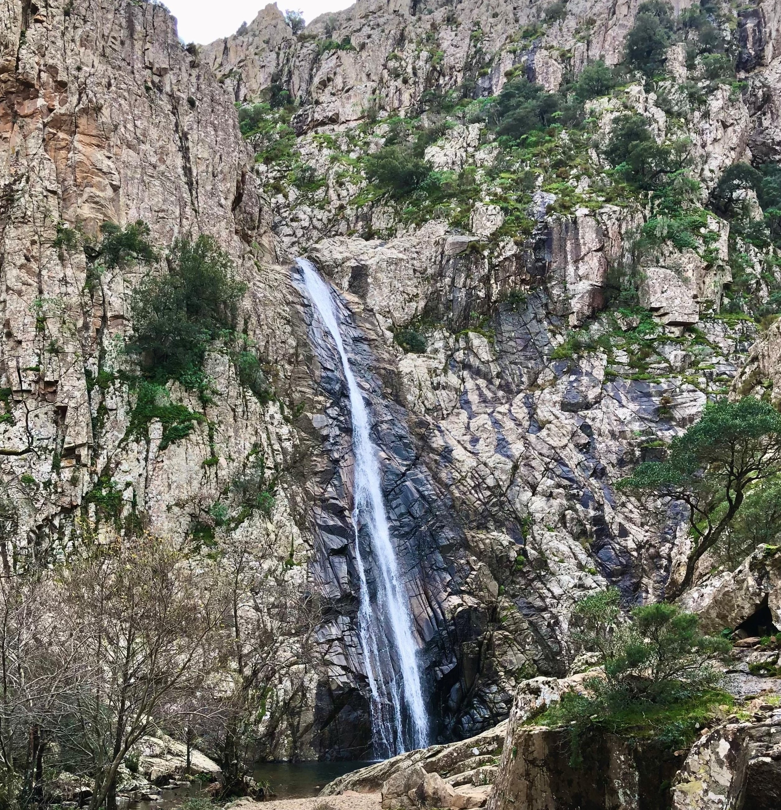
Piscina Irgas
It’s hard to say which is more thrilling: the trail to reach it or actually seeing it once you get there. What is sure, however, is that to ‘conquer’ it you’ll enjoy an experience you’ll not soon forget. Piscina Irgas is one of three majestic waterfalls that furrow the granite rock faces at parco di Monte Linas – Oridda – Marganai, one of which, together with sa Spendula, lies within the borders of Villacidro, while the third, the highest, Muru Mannu, falls within the domain of Gonnosfanadiga. The waterfall is a preferred destination of enthusiasts of a variety of sports: hiking, canyoning and mountain biking, and it can be reached from diverse starting points.
Hikers generally set off at the entrance ‘gate’ of the Montimannu forest, some 15km from Villacidro, or from sa Duchessa, in the area of Domusnovas. The first trail bears the red/white banner marking CAI 113, which you’ll see all along the route. You’ll walk through an oak forest and cross to the other side of the Cannisoni river over a metal bridge, then hike up to the belvedere, at an altitude of some 600 mt. From here you can see Piscina Irgas from above in all its glory, not to mention the mountains of the Marganai massif and, further down, the gorge carved by the Oridda river. The walk continues downhill from here to the base of the waterfall not far away. The 45mt leap of the waterfall splashes into a lovely little emerald-green lake. The second trail passes through abandoned mining areas, towards the Oridda Valley, partly following – in the opposite direction – a section of route 11 of the Cammino minerario di Santa Barbara. An upwards section along the left bank of the Oridda river will take you to the top and another panoramic vista point, from which you can view, and hear, the waterfall from above. The trail, which is also marked with small stone figurines, will lead you down to the base of the fall. You can walk both trails – one going, the other returning – to create a 10km long ring walk.
Piscina Irgas, one of the first of Sardinia’s cascades to be equipped for canyoning, is now a favourite of those practising that sport, nestled in a gorgeous setting and blessed with plenty of fresh water. The route continues beyond the waterfall with fun smaller drops and pools. Mountain bike enthusiasts can set off along a trail which goes westward from the Campu s’Isca forest nursery to Bega Trotta point, and then northwards along the Oridda plains, and from there to the Piscina Irgas belvedere, then downwards along the Leni river back to the trailhead. The initial portion of the 113 CAI trail coincides with the route to get to Muru Mannu, which, with its 70mt drop, is Sardinia’s tallest waterfall! Closer to the village of Villacidro, and easy to reach, is sa Spendula, surrounded by a lovely park.
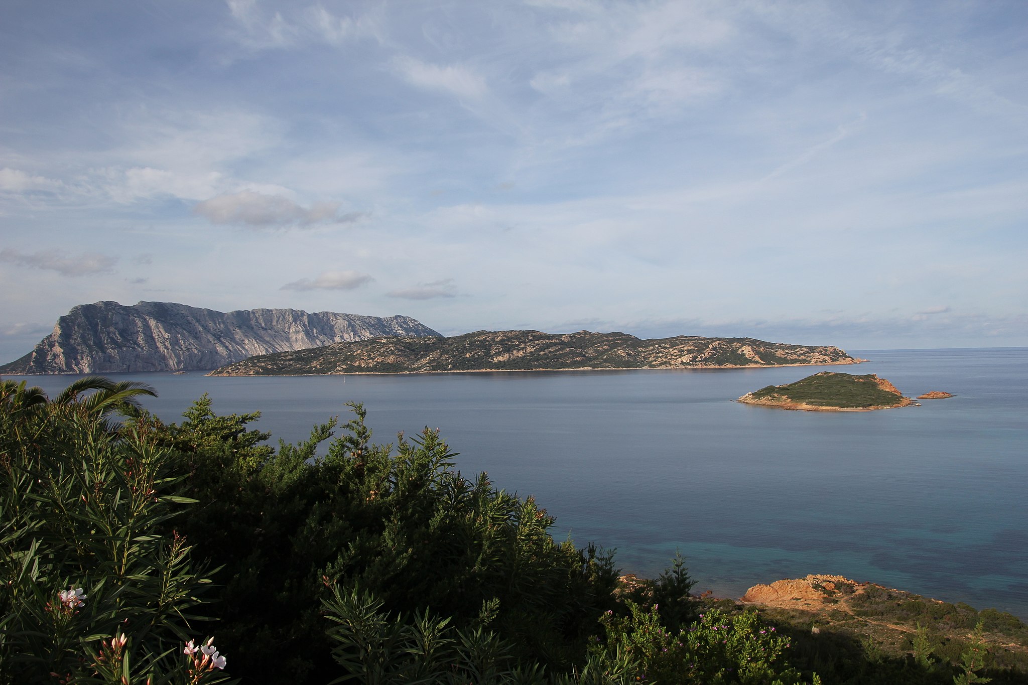
Molara
Here and there, it still contains traces of ancient human presence, but today it is above all an uncontaminated haven made of granite and covered in Mediterranean greenery, immersed in the enchanting Gallura sea. Molara is one of the islands within the perimeter of the protected marine area of Tavolara – Capo Coda Cavallo, the second largest after Tavolara. It differs from its more famous ‘neighbour’ in its composition, as Tavolara is predominantly limestone, its shape and because it is uninhabited. Its name is of medieval origin and probably comes from its rounded and basically even appearance, like that of a millstone. The ruins on the island are surrounded by an aura of legend: the remains of a single-nave church may be traced back to a sanctuary dedicated to Saint Ponziano, who is said to have been exiled here by Maximinus Thrax. Around it, there are traces of a medieval settlement and a castle, while some sources testify to the presence of a convent during the 15th century.
As well as its historical aspects, Molara stands out for its natural heritage. There are examples of cows and goats living here in the wild and the Audouin's gull and peregrine falcon nest here. Among the plant species, along with wild olives and lentisks, native plants thrive here, like the Sardinian Asteroideae and the Limonium Acutifolium. In the southwestern part you can go for a dip in the spectacular Molara pools, ‘mirrors’ of turquoise crystal clear water surrounded by granite rocks, also ideal for snorkelling. The waters around Molara are a destination for diving enthusiasts: about a mile south of the island, at a depth of 40 metres, lies the ‘shipwreck of Molara’, which was recently identified as the French merchant ship Oued Yquem. In 1941, the ship was hit, perhaps by mistake, by a Dutch submarine, while en route to the port of Marseilles. When on board, divers can observe groupers, snappers, amberjacks and sea bream, as well as colourful sponges.
You can reach Molara, without missing a chance to stop at the little Cala Spagnola, from Olbia, Porto San Paolo, Capo Coda Cavallo and from Marina di Puntaldia. The excursions also make it possible to sail around the smaller islands in the protected area: Molarotto, Proratora, the Islands of Piana and Cavalli, as well as the tiny islands of Porri, Topi, Drago and the islet of Rosso. A stop at Tavolara is a must. This limestone and granite mountain emerges from the sea, with an unmistakable profile, and hosts the Una Notte in Italia (A Night in Italy) film festival every year. You’ll find little houses, refreshment areas, several beaches and fabulous diving spots here. Among these, to the east, there is the Secca del Papa.