
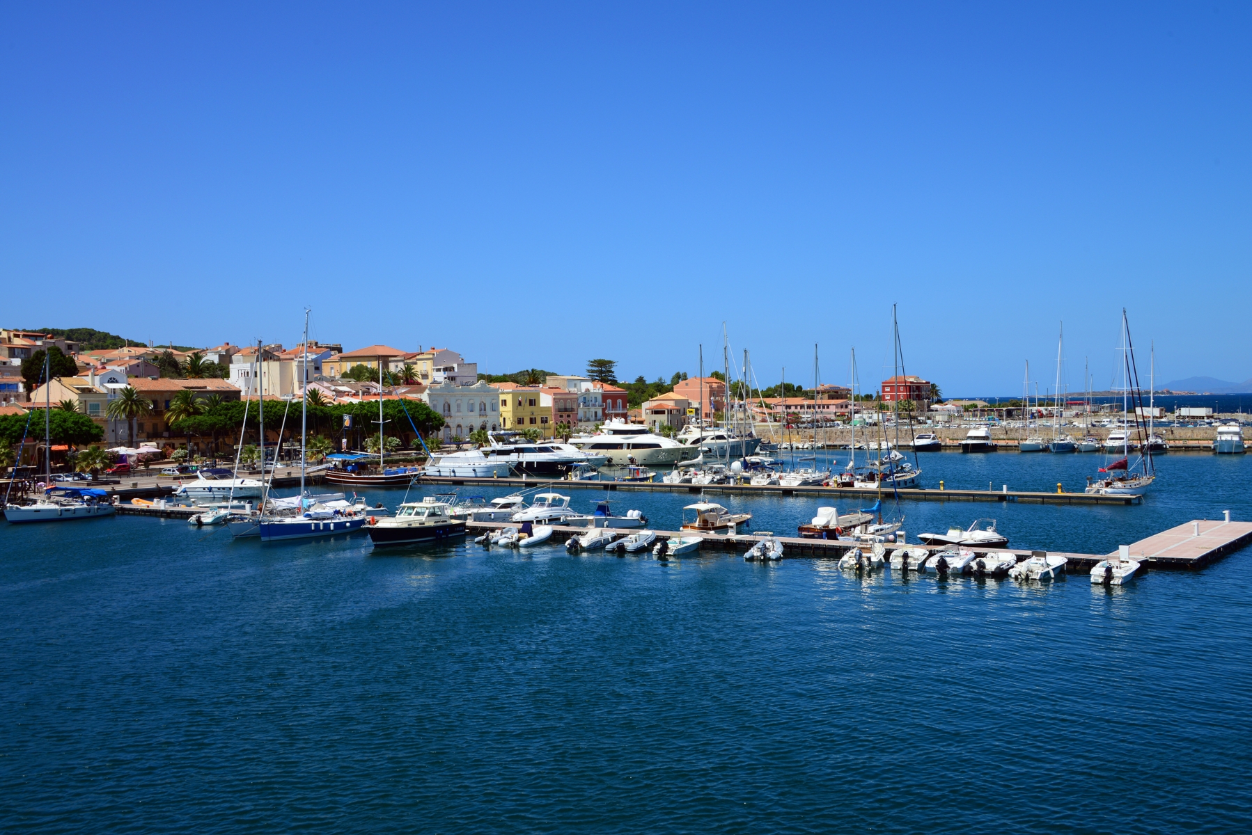
Sea Museum
“King Carlo Emanuele (…) successfully transformed, (…) the inhospitable island into a region of fishing and trade so that it would bring wealth and well-being to the kingdom and abroad”. The inscription stands out on the southern door of the Savoy fortress: it was the first masonry building (1738) of the then-emerging Carloforte, a village built on a natural acropolis. The small fort was built as a guardhouse and meeting site and later became a place of imprisonment. Following its renovation, it currently accommodates the civic museum, known as the Museum of the Sea. Inside it, you will find the story of a Ligurian community that moved from Tabarka (in Tunisia) to the Sulcis island of San Pietro, which can now be reached in 40 minutes by ferry from Calasetta and Portoscuso.
The first of six rooms contains the colonization documents. The second room contains artefacts linked to the fishing, processing and preservation of tuna, an activity that made the island famous all over the world. You can admire the model of a tuna-fishing net, arepresentation of the series of anchors and nets that form the ‘cage’ used for tuna fishing, and a model of the nineteenth-century establishment of Portopaglia. Every year, between the end of May and early June, Carloforte celebrates this tradition with an international culinary event called the Girotonno. The museum continues on with the Malacology room, in which there is a collection of Mediterranean shells. In the Galanzieri room, there are documents about the boatmen who maintained a connection between the island and the mines of Sulcis (in particular in Porto Flavia) for transporting minerals, as well as the tools used in Lateen sailing. The visit ends with the room of rural activities and with one dedicated to the painter, Mario Emanuelli.
After your visit to the museum, don't miss your chance to explore the jagged coastlines and the wonderful coves of San Pietro. To the north, you will find the romantic CalaVinagra; to the north-west, there is a deep fjord that is closed by the enchanting Cala Fico; to the west there is the impressive promontory of Capo Sandalo, dominated by the nineteenth-century lighthouse. There are no other lighthouses in Italy located further west than this one. To the south, there is La Conca, with its sheer cliffs, and Le Colonne, two sea stacks standing up out of the water and the symbol of Carloforte.
Geremeas
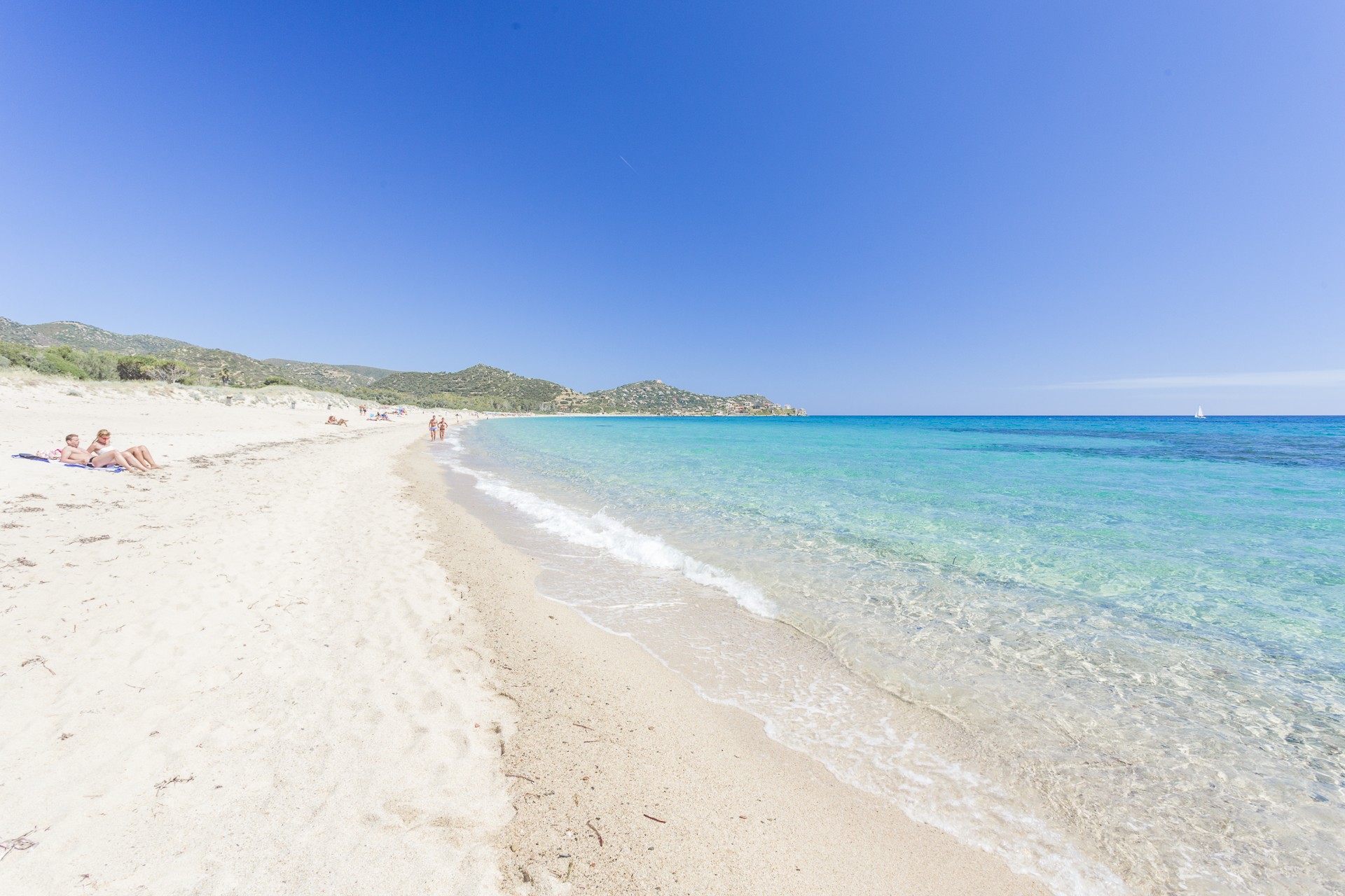
A wonderful bay, three kilometres long on the eastern side of the Golfo degli Angeli, featuring three white sandy beaches, surrounded by promontories covered in Mediterranean scrub and by a sea of endless shades of blue. Geremeas is a tourist locality in southern Sardinia, which is part of the municipality of Quartu Sant'Elena and of Maracalagonis, residential areas less than twenty kilometres away. The two territories are separated by a river of the same name, riu Geremeas, the capacity of which increases considerably during the wintertime and flows into the sea, while during the summer it is reduced, creating a small pond close to the shoreline.
The first beach is Kala 'e Moru (Saracen's landing place), in the territory of Quartu: a sandy shore with tiny golden grains of sand washed by a transparent sea of iridescent colours and a sandy seabed. On the hill overlooking the beach, there is a large tourist village, which is separated from the magnificent cove of Mari Pintau by the promontory of Bruncu de Su Monte Moru. Further east, you will come across the other two beaches, which are separated from each other by the river. The first is Marongiu, with its fine, light sand and the other is Baccu Mandara, in the territory of Maracalagonis, with soft, golden, slightly coarser sand, which is steep next to the shore. It is washed by a crystal clear green and turquoise sea, with waters that become deep very close to the shore. Behind it there are sand dunes surrounded by greenery. Continuing along the coastal road, you will come across another famous locality in the Maracalagonis area, Torre delle Stelle.
The beaches of Geremeas can be accessed by disabled people and are equipped with ample parking and services: beach equipment and boats, places for dining and refreshments and accommodation facilities. When the northwesterly mistral wind blows, the bay becomes a destination for kitesurfing and windsurfing enthusiasts. In the evening, you can enjoy the splendid sunsets in comfort, watching the sun slowly set in the distance, 'hiding' itself behind Cagliari. As well as the sea, you can enjoy nature and archaeology in the nearby hinterland: you will find interesting archaeological sites and the Parco dei Sette Fratelli (Park of the Seven Brothers).
Portixeddu
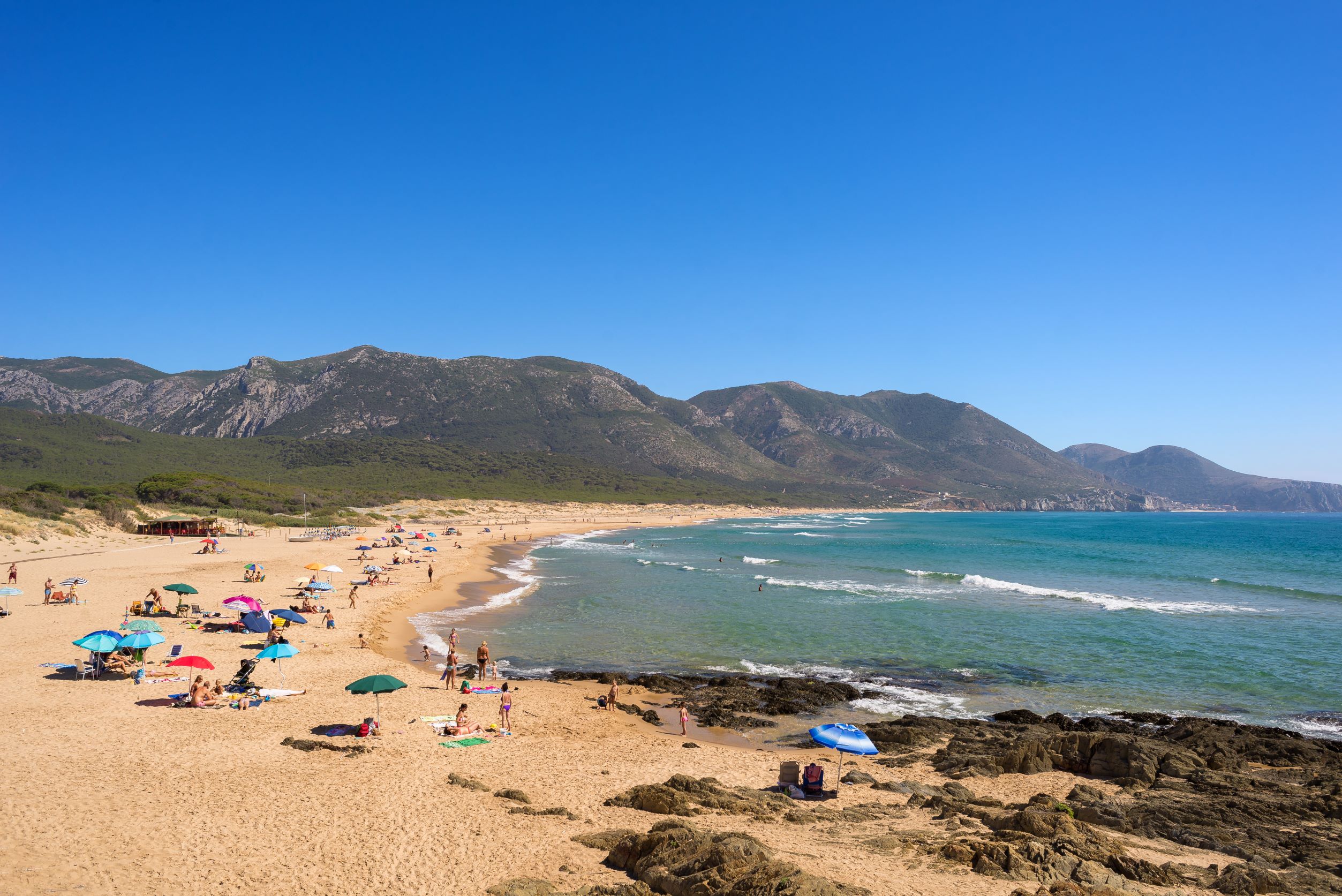
At the foot of the slope, a small cliff opens onto a large, wild expanse of fine, light-coloured sand, more than two kilometres long, embraced by a dense pine forest, where you can enjoy some shade on hot, muggy days. The beach of Portixeddu, also known as rio Mannu because it is cut in half by the mouth of the stream, overlooks a fantastic sea, with a splendid transparent seabed that slopes rapidly and is affected by strong currents that must always be taken into account. The water is crystal clear and, with the complicity of the sun, it creates captivating sky blue colours and wonderful reflections of light.
The length and depth of the beach will always offer you tranquillity and relaxation. When the strong northwesterly wind is blowing, the beach becomes a destination for surfers. From the promontory above it, you can enjoy a spectacular view, especially at sunset. In the evening, you can also go for walks and stop off at the small stone square at the seafront, where numerous outdoor events take place in the summer. You will find restaurants and accommodation nearby, as well as a kiosk-bar on the beach and the possibility to rent beach equipment, canoes and pedaloes.
The small tourist village of Portixeddu (small port), where the beach is located, is found in the territory of Fluminimaggiore, about ten kilometres away, while the nearest town, Buggerru, is six kilometres away. Basically, it is isolated from the rest of the territory, making it even more captivating.
The coast of Fluminimaggiore has other places not to be missed, such as Guardia is Turcus (guard of the Turks) and the two coves of sa Perdixedda (pebble) Manna, the big beach, and sa Perdixedda Pittica, the small beach. Not far from Portixeddu, in the territory of Buggerru, you will find the dunes of San Nicolao, on the coastal stretch of the Golfo del Leone, one of the most picturesque on the west coast of Sardinia.

Art of weaving, able hands and centuries of secrets
Artistic handicraft is an intrinsic and distinctive feature of Sardinia. Weaving represents one of its main components, thanks to the skilful hands that have been able to perfect the art of wicker basket-making over the centuries. Their shapes vary according to the type of material and place in which they are made: in Flussio, Montresta, Ollolai and Sennori, asphodelus is the raw materials par excellence, while in lowland localities, near ponds or by the sea, like Castelsardo, San Vero Milis and Sinnai, rushes, grain or Mediterranean dwarf palm are used for making baskets. All the towns share an ancient and interesting tradition: women have been able to pass down the secrets of weaving, creating different shapes based on the function of the wicker containers, mixing coloured inserts, extraordinary designs and traditional patterns.