
The hidden world of caves
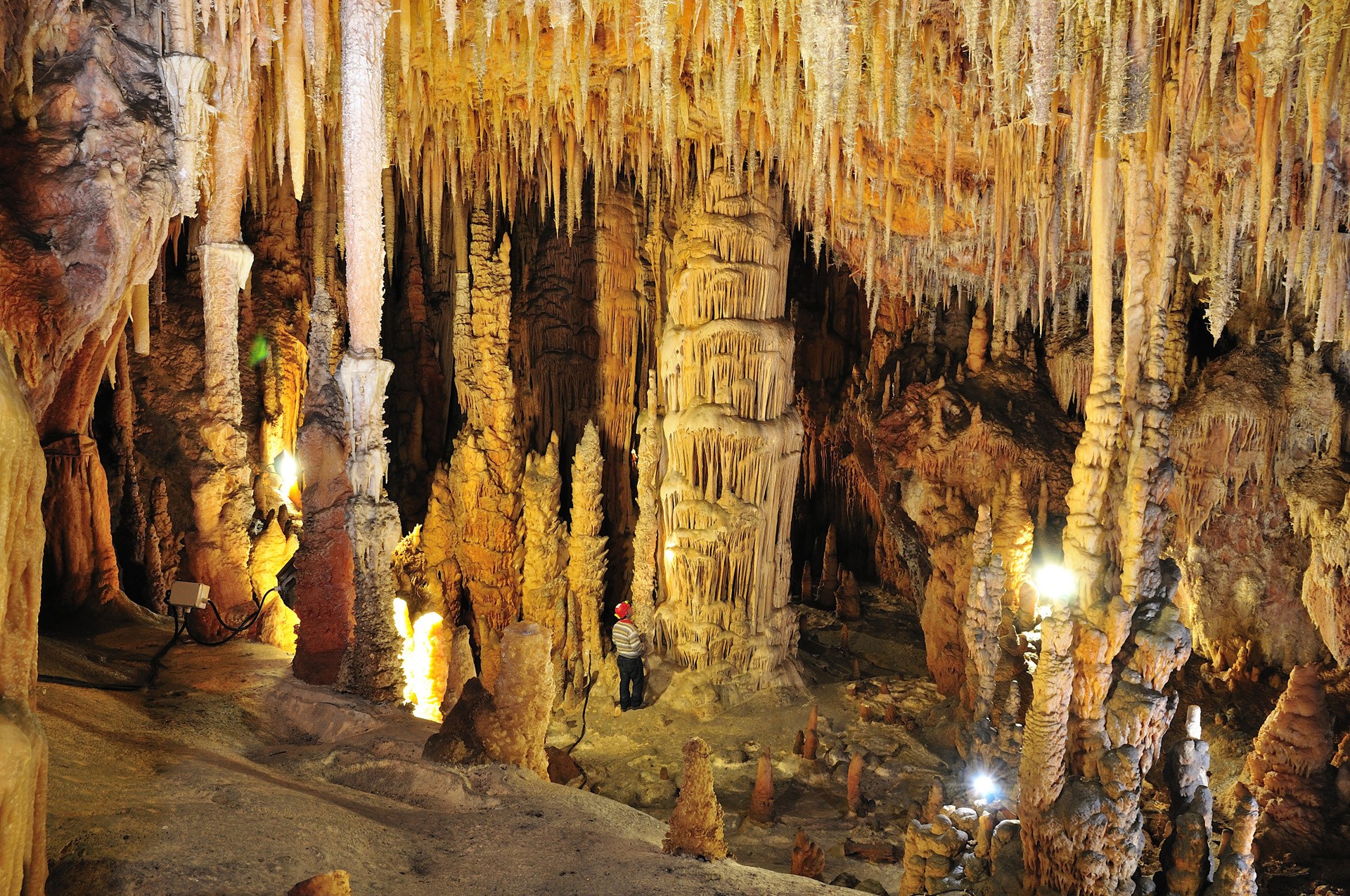
They guard masterpieces of nature, hide secrets, preserve the memory of legendary inhabitants. They still host some of them in their meanders and sometimes they talk. Like sa Oche, ‘the voice’, that howls, ringing out in the valley of Lanaitto in Oliena, generated by the air currents moving in the ‘twin’ cave of su Bentu. A short distance away, the words of Grazia Deledda, from her novel ‘L’edera’ (The Ivy) and from nineteenth-century tales can be heard, halfway between reality and legend, in the setting of the Corbeddu Cave. It was the home of a ‘gentleman bandit’, from whom it got its name and who transformed it into a tribunal of his own. Some of the oldest human remains ever found on a Mediterranean island come from here. Ispinigoli, in Dorgali, and its 38-metre high ‘column’ are also surrounded by original stories. Who knows if the 60-metre-deep hole at the bottom of the cave was really used for human sacrifices, to the point of earning itself the name of ‘abyss of the virgins’. In this area, the passage down from the mountains to the sea is short and there are also legends linked to the sightings of the monk seal: whether or not they still frequent the Gulf of Orosei is a mystery, but they undoubtedly lived around Cala Gonone, in the Grotte del Bue Marino (Sea Oxen Grottoes), named after them. The ‘room of the beaches’ was a safe haven for giving birth and weaning their pups. The Neolithic peoples also gathered here, in the same ‘rooms’, just above the level of the water, where the Cala Gonone Jazz concerts have been held every summer for decades.

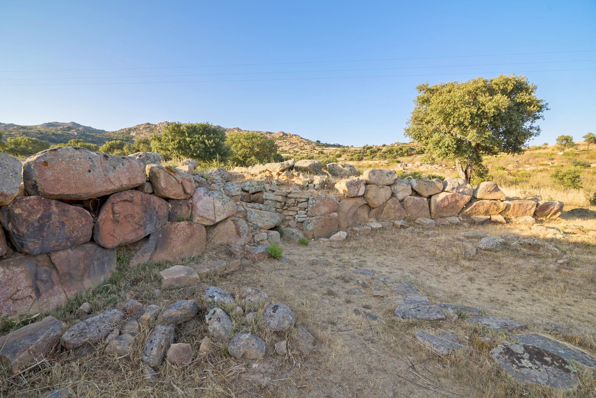
Su Cuaddu de Nixias
It is considered the oldest Giants’ Tomb of all time and is characterised by unusual construction elements in southern Sardinia. Su Cuaddu de Nixias stands in the countryside of Lunamatrona, along the road that leads to nearby Villanovaforru, set in the enchanting hilly landscape of Marmilla, close to the Giara di Siddi. The prehistoric tomb shows distinctive traits that make it fascinating and, at the same time, mysterious. You will first be struck by the arched stele in the centre of the exedra, a central element of the Giants’ Tombs in the centre-north of the Island but rare in southern Sardinia, where the façade generally consists of rows of rock ashlars. The stele, made of a sandstone rock about three metres high with an arched shape at the top, has a front divided into three bands delimited by listels, decorated with a raised border. You will also notice an odd circular hole, created in later periods, which is where the monument gets its name: according to a popular legend, is cuaddus, the horses, used to be tied to the hole. Nixias is the name of the locality. Another unusual element is the positioning of the tomb, pointing in the ‘anomalous’ north-east/south-west direction.
Its origin is in the cultural facies of Monte Claro, around the second half of the third millennium BC. In this period, a lithic cist tomb was built, delimited by four slabs on the sides and a flat arch roof, today corresponding to the final part of the burial chamber. During the Middle Bronze Age (16th-14th century BC), a dolmen corridor chamber was built on it, made from blocks of marl laid ‘on edge’, just over ten metres long and with a monumental exedra on the façade. The slabs of the exedra are set in the ground at decreasing heights starting from the sides of the stele, forming a 14-metre arch.
There are two nuraghi not far from the burial site. For the communities that frequented them, su Cuaddu de Nixias was probably the ‘burial ground’ of reference. The closest is the single-tower nuraghe Trobas, about 500 metres from the tomb. It has an external diameter of thirteen metres and a circular chamber six metres wide, where you will notice two niches. The excavations have revealed traces of a fire, which occurred after the building had already partially collapsed and was probably why it was permanently abandoned. The second nuraghe is in an easterly direction, almost adjacent to the town of Lunamatrona, known as Pitzu Cummu. It stands on a 200-metre-high hill and has a complex structure, consisting of a central tower and four secondary towers, built with basalt blocks. Inside, there is a well with a diameter of one and a half metres; around it, along the slope of the hill, there are traces of other structures, possibly linked to the village.
Sa Domu de Orgia
Not only is it the largest Nuragic megaron temple known to date, but it is the site where a real archaeological ‘treasure’ was discovered, also the protagonist of a popular legend. Sa Domu de Orgia stands at an altitude of about a thousand metres on Monte Cuccureddì, in the territory of Esterzili, a village nestled between the plateaus and valleys of Barbagia di Seulo. The sanctuary, enclosed by an elliptical-shaped fence, is 22 and a half metres long and just under eight metres wide. It consists of a vestibule, obtained by extending the side walls, a cell divided into two spaces and a small opisthodomos on the opposite side to the entrance, probably with the function of making the structure more symmetrical. The construction material is schist, worked in square blocks positioned in horizontal rows.
The most accredited theory regarding its date is that it was built in the Recent Bronze Age, at the end of the 13th century BC, on top of a previous Nuragic village. Inside, you will notice that the vestibule and the rooms of the cell still contain the counter-seat around the perimeter, where votive offerings were placed. It was initially thought that the temple was much more recent, also because of the similarity between its layout and those of Mycenaean temples, but the artefacts found date back to the Nuragic civilisation. The temple would therefore be the result of the influence that people of Greek lineage brought to Sardinia during the Recent Bronze Age. Among these objects, the votive bronzes from the vestibule stand out, representing priestesses, warriors and hunters, similar to those found in the nearby Sanctuary of Santa Vittoria di Serri, suggesting that it was a common ‘workshop’. The sanctuary also revealed another surprise - numerous coins from the Roman era, providing evidence of the continued use of the temple even in later eras, up to more than a thousand years after its construction.
The legend of the priestess Orgia, who was a witch and a fairy at the same time and lived here until the inhabitants of the surrounding villages forced her to leave, lingers within the walls of the temple. The witch decided to take revenge, hiding two baskets, one containing a treasure and the other a swarm of terrible muscas maceddas, killer flies. The fearless people may have dared to go in search of the treasure, but would have caused a massacre by opening the wrong chest, so no one attempted the feat and the ‘booty’ is still hidden within the walls.
Just under three kilometres north of the temple, you will visit the other sacred area of Monte Nuxi-Santa Vittoria, where, in a position of control over nuraghi and villages that had appeared around the course of the Flumendosa river, stands a temple - or perhaps a hut - with a circular layout, a fence and two sacred fountains. On the inner side of the enclosure you will notice traces of a bench, which originally ran around the entire perimeter. Remains from the Roman era have also been found in this site, providing proof of the fact that both areas, Domu de Orgia and Monte Nuxi, have maintained an aura of sacredness for thousands of years, which was respected by the populations who frequented them.
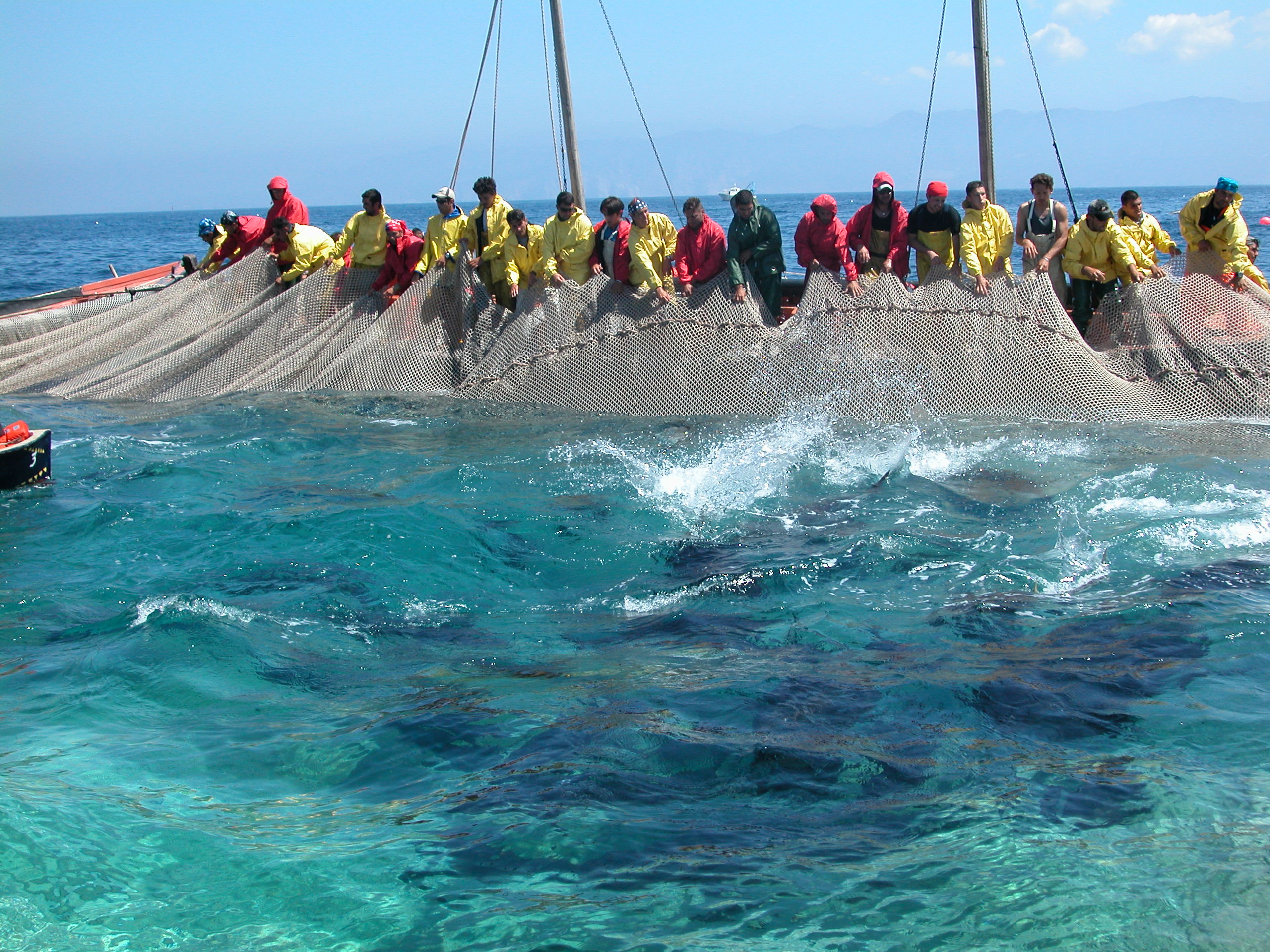
Girotonno, it's Carloforte
Food identifies and narrates the territory. In very few places in the world this statement is as true as it is in Sardinia. Cuisine is one of Sardinia’s most typical and distinctive features, an aspect that goes way beyond the island’s delicacies and creeps into the pages of its history. At San Pietro, an island within the Island, a place with a marvellous sea and a strong personality, culinary tradition represents the identity and the soul of the community. The Girotonno is the symbol of this. Every year, the original food festival tells us about ‘men, stories and flavours on the tuna routes’. Carloforte, the only residential area on the island, shows the world a fishing and cooking tradition at an international event that expresses thousands of years of culture and a tradition based on tuna fishing, rais (fishing master) and ‘tonnaroti’ (tuna fishermen).
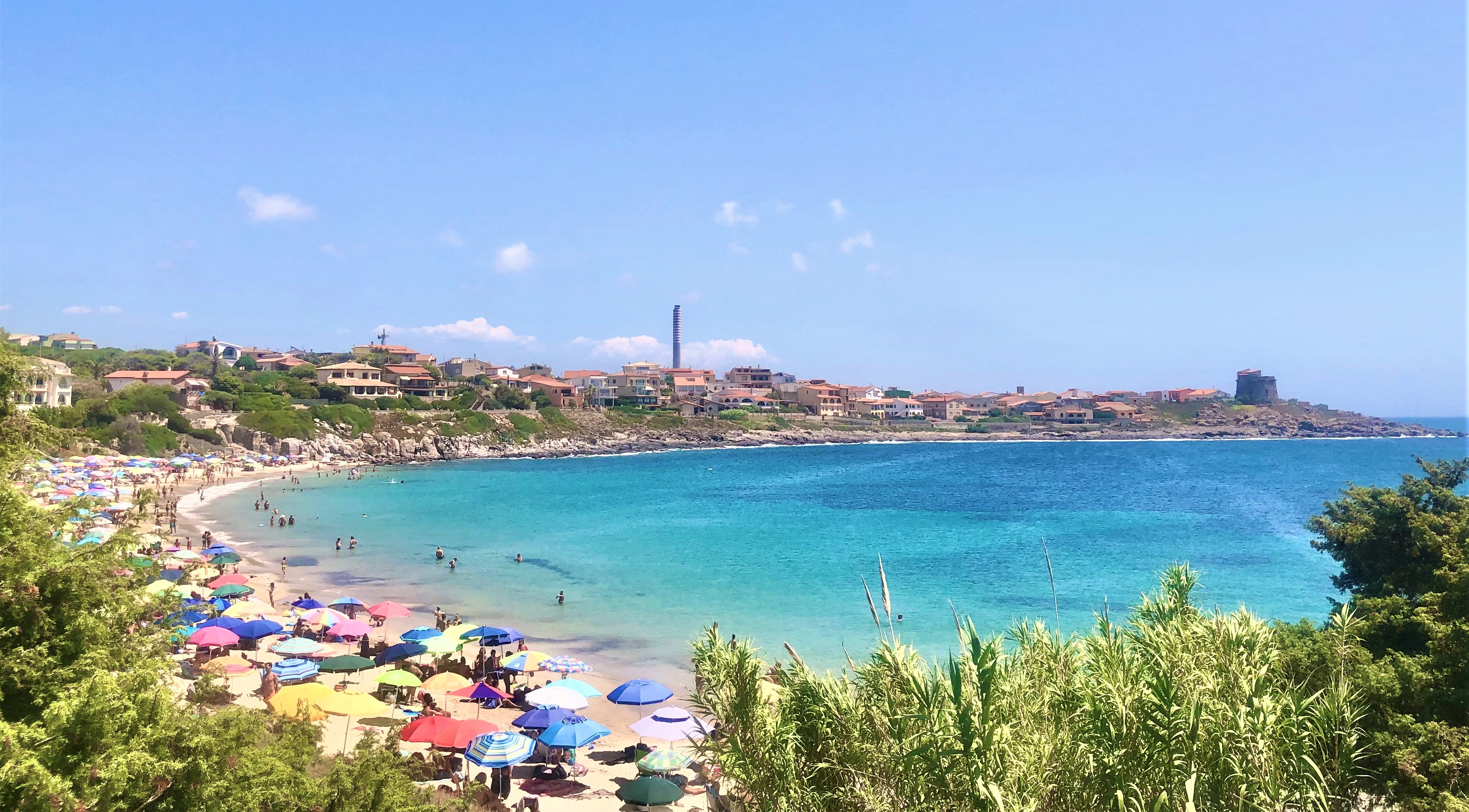
Portopaglietto
It extends in an arched shape, delimited and sheltered by two cliffs, beyond which you will see the greenery of a large, shady pine forest. The beach of Portopaglietto is located in the northern part of the town of Portoscuso, a village of Spanish origin that has always been focused on fishing, especially tuna. The sandy stretch of the beach, about 250 metres long, has golden hues, shining before a crystal clear blue sea. Off the coast, facing the shore, you will see La Ghinghetta, a rock on which there is a picturesque lighthouse coloured with red and black bands. Looking beyond, you will see the coastal outline of the island of San Pietro. The sides of the beach are rocky up to the foot of the trachyte cliffs and above one of them - the southernmost one - stands the tower of Portoscuso, a Spanish fortress built to defend the coast and the fishermen of tuna and coral, which became the symbol of the town over time. It is still in excellent condition today and is used for cultural events. The northern promontory, on the other hand, acts as a shelter from the winds, especially the northwesterly wind, a feature that, along with the shallow waters and sandy seabed, makes Portopaglietto a suitable destination for families with children. An extensive pine forest, less than two hundred metres away, guarantees some shelter during the hottest hours and also contains a playground.
Portopaglietto is surrounded by unmissable landscapes: a path that leads directly from the beach in a southerly direction - through myrtle bushes and prickly pear plants - will take you to the Spanish tower. From here, on your left you will notice the buildings of the historic tuna fishery of su Pranu, dating back to the 17th century. It stretches around a courtyard overlooking the sea, where you will see a marble sundial. The building is still active for the tuna slaughters, between May and June. Inside, there is the church of Sant'Antonio da Padova.
Then, to the north of Portopaglietto, you will reach various panoramic points along the road that runs alongside the pine forest. The first is sa Cala ‘e su Zurfuru, a rocky cove frequented by numerous snorkelling enthusiasts. Moving beyond, you will come across Capo Altano, featuring abandoned military fortifications and a perfect location for admiring the sunset. From the top of the promontory, as well as San Pietro, you will be able to identify Calasetta and the northern limit of the island of Sant’Antioco, while on the right, you can see the Iglesias coast as far as Nebida.
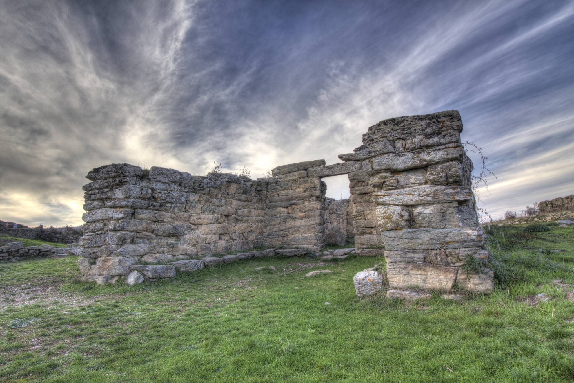
Tomba di Giganti di San Cosimo
It is one of the largest megalithic constructions on the Island, along with a smaller-scale ‘copy’, located not far from other Nuragic ruins - still to be investigated - and it has unearthed an artefact that may be the oldest Mycenaean import found in a Sardinian archaeological site. The Giants’ Tomb of San Cosimo is found in a valley in the territory of Gonnosfanadiga that opens like a natural amphitheatre at the foot of the Terra Maistus mount, in a landscape dominated by the outline of Monte Linas. The area contains a real archaeological park, in which there is also another smaller tomb of the same type, and two nuraghi.
Also known as sa grutta de santu Giuanni, the tomb was considered by the ‘father’ of Sardinian archaeology Giovanni Lilliu - in his work entitled ‘La Civiltà dei Sardi’ (the Sardinian Civilisation) - to be the largest Giants’ Tomb known up until that time: it is thirty metres long and its exedra is 26 metres wide. It was built from granite, obtained in the surrounding area. Based on the artefacts discovered inside and around it, the monument has been dated between the 15th and 14th centuries BC, during the Middle Bronze Age. The façade is typical of Giants’ Tombs in central-southern Sardinia, based on rows and an architraved entrance without a stele. Along the external perimeter you will see some stones against the base, forming a step. This solution served two purposes: to make the structure more solid and to prevent rainwater from seeping in. A small corridor leads to the actual chamber, with a rectangular layout and a truncated-ogival section. The original floor, which has only survived in a few places, consisted of a surface of smooth stones of different sizes and pebbles, placed on a natural bank of granite rock. Among the artefacts unearthed during the excavations – on display at the Archaeological Museum of Villa Abbas in Sardara – you can admire carinated cups, a glass, a few containers and above all beads made of green vitreous paste, which have been considered a Mycenaean product and, therefore, the necklace they were part of could be the oldest jewel found in Sardinia coming from Greece. Three concentric fences surround the tomb. The largest one extends towards the north-west. In the same direction, about seventy metres away, you will notice the second tomb. The same type of construction was used to created it, but it is decidedly smaller in size: the chamber is just under three metres long and the exedra is four meters wide.
A short distance from the necropolis, you’ll find the nuraghe San Cosimo, also known as su Bruncu ‘e s’Orcu, and San Cosimo II, probably single-towered, both still to be excavated. The site of the first nuraghe corresponds to the territory of the medieval village of Serru, which did not survive an attack inflicted by Saracen pirates in the early 17th century. The only traces of the village that still exist are the ruins of the small church, also dedicated to San Cosimo, giving a name to the locality, the tomb and the nuraghe.

Casa Spadaccino
It was originally a railway station, then a manor house, after which it was abandoned for decades. Today it is a cultural centre. These are the four lives lived by Casa Spadaccino, a historic building a stone’s throw from the sea, at su Loi, a locality in the territory of Capoterra. It was constructed in 1873 by the French mining company of Petin et Gaudet, which held a concession in the inland mountains. It was located at the end of the ‘road of the Genoese’, an ancient coal merchants’ road on which a railway was installed. The building served as the terminus station for convoys loaded with iron extracted from the mine. In the 1930s, it became the heart of a thriving farm, surrounded by vineyards, vegetable gardens and orchards. The area was transformed into a large, colourful garden, where cutting-edge cultivation techniques were applied, so much so that it earned itself the nickname of su spantu, ‘the wonder’, which still identifies a small village not far from su Loi.
The urban development of the Capoterra coast led to the sale of much of the land, resulting in the decline and closure of the company. Casa Spadaccino - which owes its name to its last owner - was abandoned for decades, before being acquired and renovated by the Municipality of Capoterra. Today, the Laguna di Santa Gilla environmental and sustainability education centre is located inside it, along with the Laguna Museum (MuLAG), and it also hosts cultural events and shows. The exhibition is a journey through the natural and ecosystem-based aspects of the lagoon, also known as the Stagno di Cagliari. It also looks back at its relationship that evolved over time with the inhabitants of Capoterra. There are plenty of educational workshops and thematic programmes aimed at raising awareness about the lake environment.
The building consists of a single-storey central body, with an attic and an entrance portico with five arches, to which two other buildings, identical to each other, are attached. A large, sheltered garden offers peacefulness and a space for outdoor activities and events. You can combine a visit to the ‘house’ with an experience in close contact with nature on the banks of the lagoon. The lagoon environment extends for 1300 hectares between Cagliari and the territories of Assemini, Capoterra and Elmas. The wildlife that populates it is varied and fascinating for birdwatching enthusiasts, who can count on dedicated stations: you will see herons, hawks, black-winged stilts and above all pink flamingos, which have nested here for decades. You can walk along the paths around the lagoon, or ride on horseback or on a mountain bike.
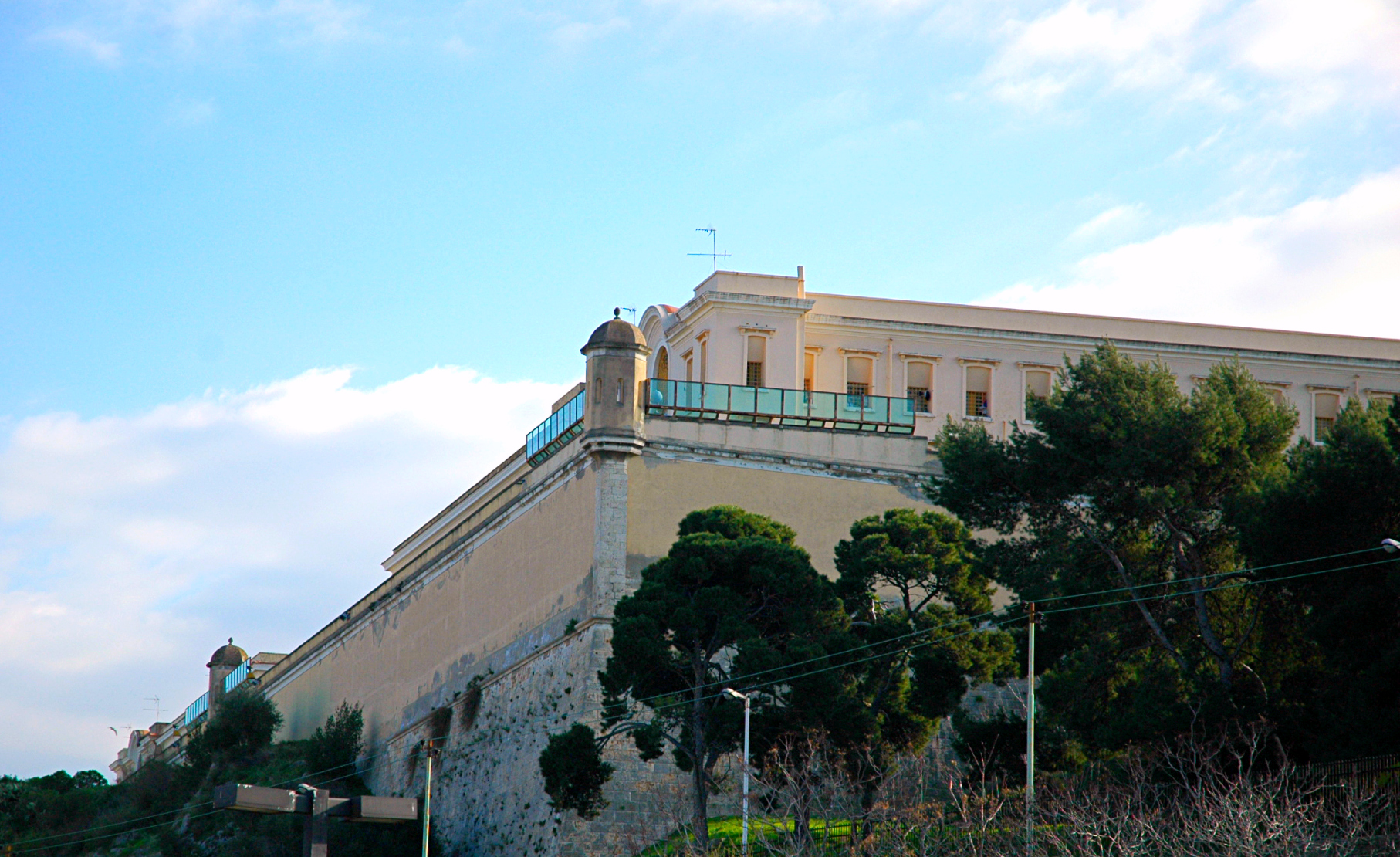
Former prison of Buoncammino
It is the most imposing urban building in Cagliari and it stands on top of a panoramic hill surrounded by tree-lined avenues and ‘terraces’ with a view of the entire city. The prison of Buoncammino, like the surrounding urban area, owes its name to the nearby church of San Lorenzo, originally dedicated to the Virgin of Buoncammino. At the top of a high ground, at an altitude of one hundred metres, it occupies a rectangular surface area of 15 thousand square metres.
The complex, made up of six buildings, was constructed in two phases: the first around 1855 and the second between 1887 and 1897. Before Buoncammino, prisoners were held in the Tower of San Pancrazio, with its entrance in the nearby Castello district, and in annexed and surrounding buildings. The first nucleus emerged to integrate the prison facilities in use at the time, but due to overcrowding and the hazardous conditions they were experiencing, it was decided that the new prison should be extended and transformed into a real ‘citadel’ that could accommodate from 500 to a thousand prisoners, with the consequent permanent closure of the San Pancrazio complex. The current appearance is the result of further additions of buildings, which took place around the 1930s.
At the corners of the perimeter wall, you will notice octagonal bartizans, covered by a small segmented dome. Two more are up against the building at the front of the complex, where the prison entrance archway opens up. Once you cross the threshold, you will see a terreplein that can be reached via two flights of steps opposite each other. Here you will find the management building and an additional porter’s lodge that leads to a courtyard, from which the wings leading to the cells branch off.
In many areas of the prison, you will recognise neoclassical details: rounded arches, cross vaults, decorations and paintings in the cornices and ceilings. Buoncammino stands in a ‘strategic’ position, in the outskirts of the town (at the time of construction), not far from the fortifications of the Castello district and on a high ground with a view of both the east and west sides of Cagliari. During its 120 years of ‘service’, no prisoner ever managed to escape. The prison was closed in 2014, as it no longer complied with the regulations on prison conditions. Since then, it has been opened up to the public, as a stop on cultural tours, particularly on the occasion of the FAI Days (FAI is the Italian National Trust), with a view to turning it into a permanent museum.
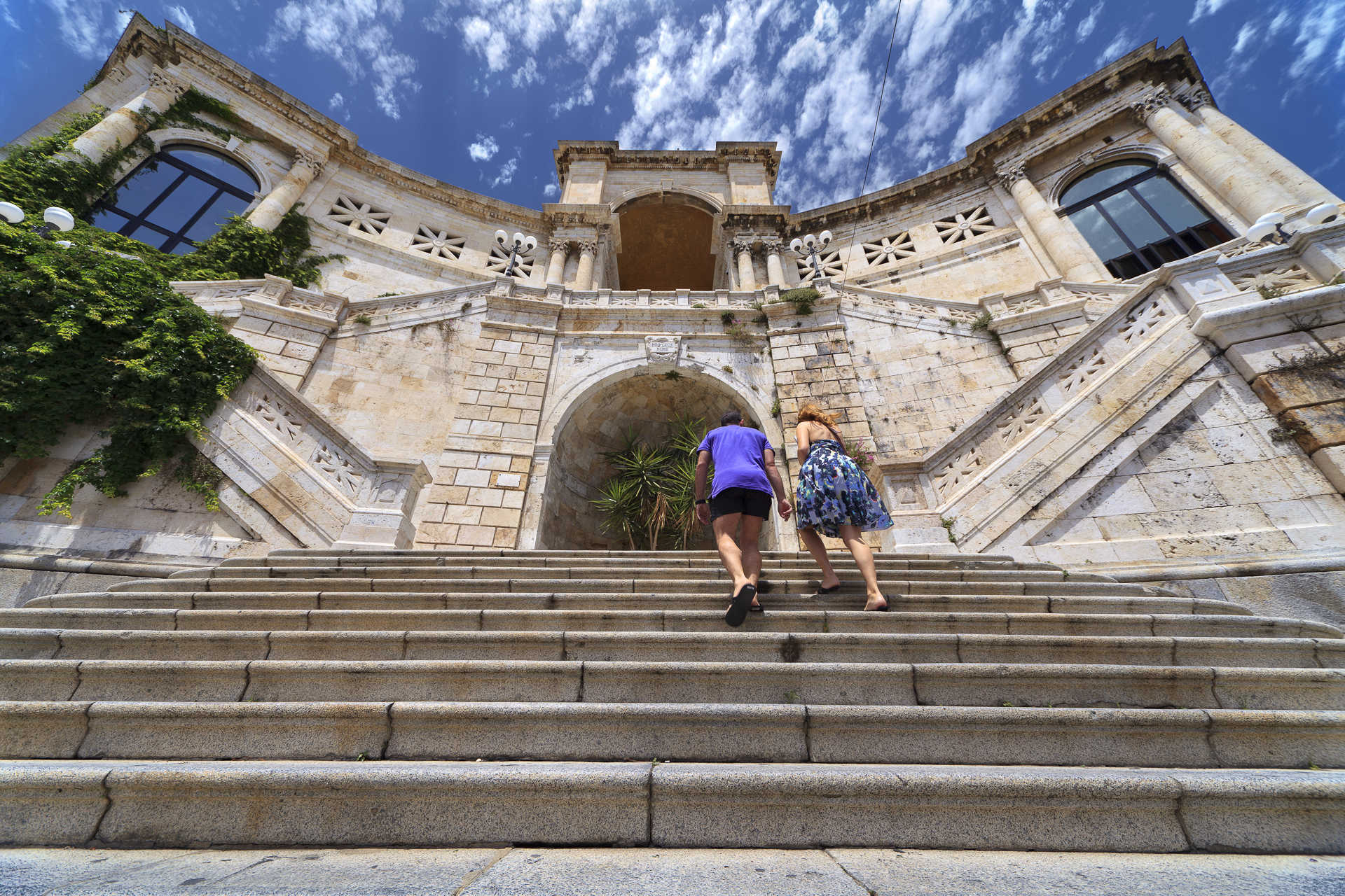
Viale Buoncammino boasts some of the city’s most panoramic viewpoints. While walking along it, you will cross through the nineteenth-century Porta Cristina, dedicated to the wife of King Charles Felix, and you will come to Piazza Arsenale, where the Citadel of Museums is located, and Piazza Indipendenza, where you can venture into the little lanes of the Castello district and visit the Tower of the Elephant, Palazzo Regio (Royal Palace), Palazzo di Città and the Cathedral of Santa Maria.
It cannot be spring without Monumenti Aperti
Artistic magnificence, shared memory, authenticity and a sense of community: this is the most encompassing effort to safeguard, enhance and promote the cultural heritage of Sardinia. In 2023, the 27th edition of Monumenti Aperti (Open Monuments) runs across five weekends, from the 6th of May until the first weekend of June. Hundreds of cultural sites will open their doors during this time, such as museums, archaeological sites, churches and historical buildings, natural monuments and parks. Each town will tell its tale through literary itineraries, architecture routes in cities that have been marked by centuries of powerful rulers. Students and volunteers are warming up to lead you along a travel through the beauty that crosses millennia, all the way to the farthest past. It is not a coincindence that this year's title goes by the name of 'Pratiche di meraviglia' (Practices of wonder').

Castello di Baratuli
It is an important witness to the system of surveillance and defence of the Campidano territory in medieval times and it is also literally surrounded by fascinating legacies from pre-Nuragic and Nuragic times. The castle of Baratuli stands on the top of Olladiri in the territory of Monastir and was built on a previous settlement dating back to the Bronze and Iron Ages. It was built around the middle of the 12th century in the name of the judges of Cagliari, with the aim of monitoring the southern part of the Campidano area. It later passed to the Gherardesca family, who also owned the castles of Acquafredda and Gioiosa Guardia between the current territories of Siliqua and Villamassargia. After the fall of Count Ugolino, one of the most famous and controversial characters of Dante’s Inferno, it ended up in the hands of the Republic of Pisa, which destroyed it in the early 14th century, perhaps to avoid it being conquered by the Aragonese. Along with the castle, the village of the same name located in the valley, near the country church of Santa Lucia, was also destroyed.
By observing the foundations and the wall base of the fortress - a hexagonal layout with a paved courtyard in the centre - you will also see the remains of a barrel-vaulted cistern and other structures, probably used as storehouses and accommodation. On the other side of the courtyard, opposite the entrance, are the foundations of the main tower, which could be reached via a flight of steps. Beyond the courtyard, a furnace and traces of the curtain wall can be seen. From the castle, there is a 360-degree view, allowing you to see Monastir, as well as the towns of Ussana to the north, Serdiana and Dolianova to the east and Sestu to the south.
At the base of Mount Olladiri, next to the path leading to the top, you will notice cavities dug out of the basaltic rock: this is the necropolis of Is Aruttas, consisting of five Domus de Janas, dating back to between 3200 and 2800 BC. Four tombs are made up of an entrance, an anteroom and a burial chamber, while one of them was never completed and only has one room. Not far from the site are the remains of a pre-Nuragic settlement, after which a large Nuragic village was built with numerous huts. The surrounding area reserves other surprises: next to Olladiri, there is another mountain, Zara, on which you can see the ruins of a large settlement frequented between the pre-Nuragic age and the Roman period. There are two funeral areas, including a necropolis with two Domus de Janas, side by side, which, due to their unusual features, have been named is ogus de su monti, ‘the eyes of the mountain’. At the top, you will notice a monumental flight of steps, leading to a sacred area with altars and wells, while on the slopes of the hill there are traces of circular huts. This is where a sandstone artefact was found and some have identified it as a wine press, perhaps the oldest in the Mediterranean and an exceptional piece of evidence of wine production, a widespread activity in the Nuragic age. Today, it is kept in the council chamber of the Monastir town hall.